Avenue Strip

Wood, Forest in Stirlingshire

Scotland

Avenue Strip

Mugdock Hill Much land around big cities is occupied by horses..
Mugdock Hill Credit: Richard Webb

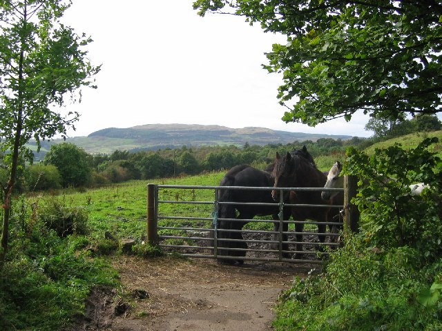
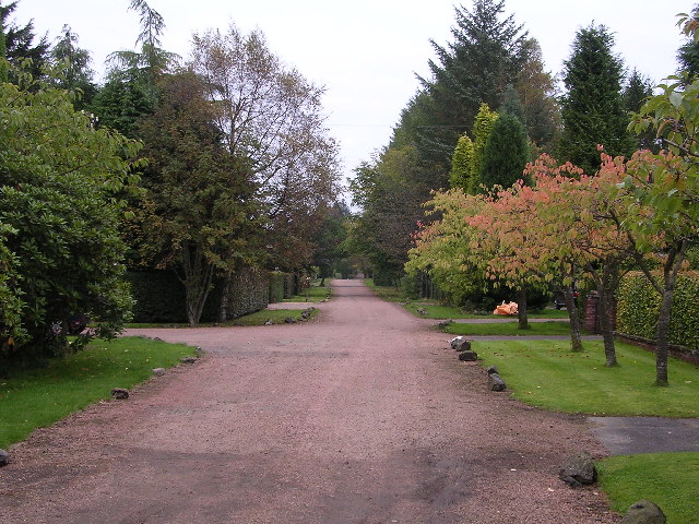
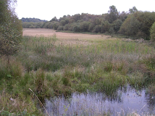
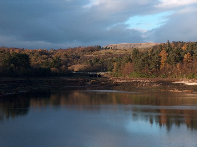
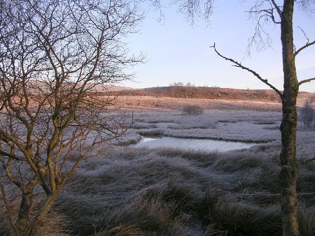
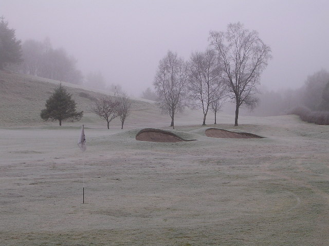
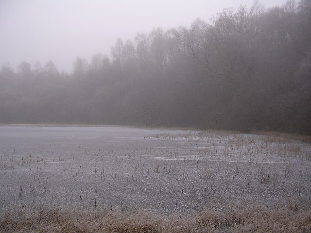
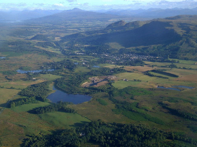
Avenue Strip, located in Stirlingshire, Scotland, is a picturesque woodland area known for its stunning natural beauty. Situated amidst the scenic landscapes of Stirling, this enchanting forest is a haven for nature lovers, hikers, and outdoor enthusiasts.

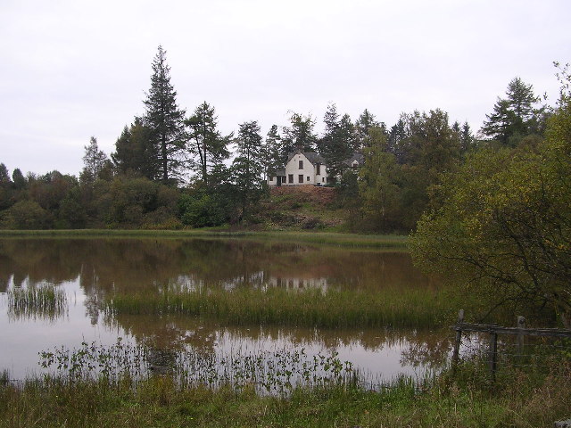
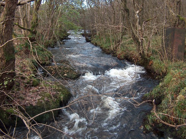
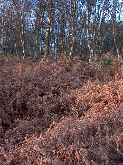
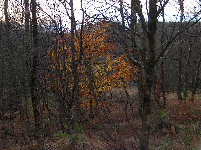
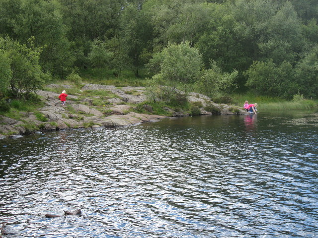
Covering an extensive area of lush greenery, Avenue Strip is home to a diverse range of flora and fauna. The forest is primarily composed of a mixture of deciduous and coniferous trees, including oak, birch, and pine. The towering trees create a dense canopy, providing shade and shelter for a variety of wildlife.

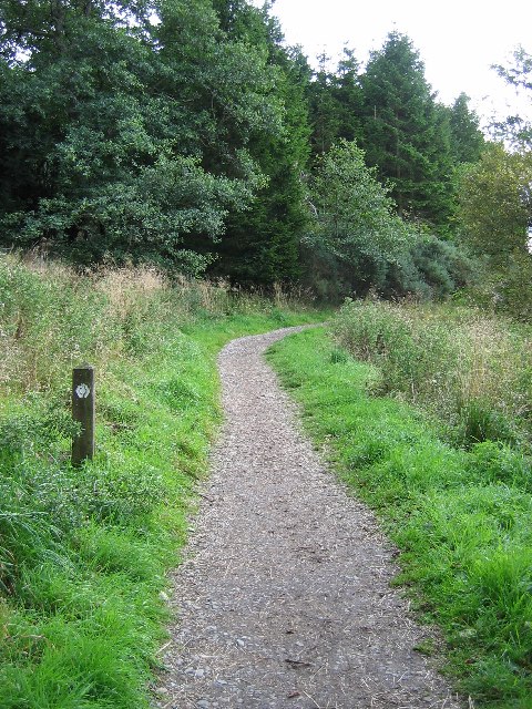
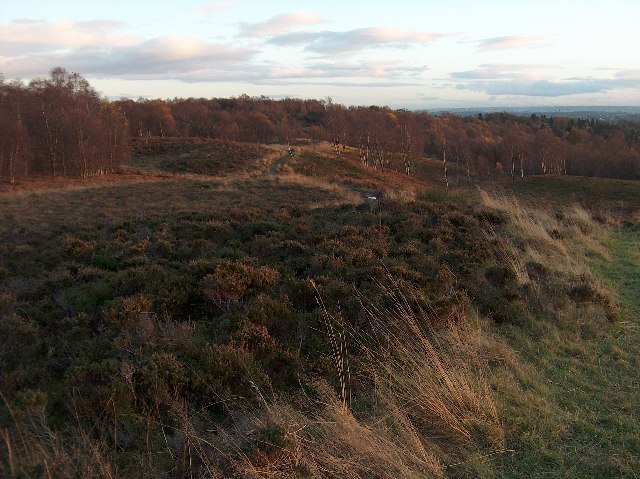
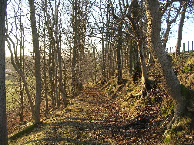
The forest boasts an extensive network of well-maintained trails, making it an ideal destination for hikers and walkers. Visitors can explore the serene surroundings while enjoying the fresh air and tranquil ambiance. The trails cater to all levels of fitness and offer different lengths and difficulties.

For those interested in wildlife spotting, Avenue Strip provides ample opportunities to observe native animals in their natural habitat. Deer, foxes, and a variety of bird species can often be spotted among the trees.

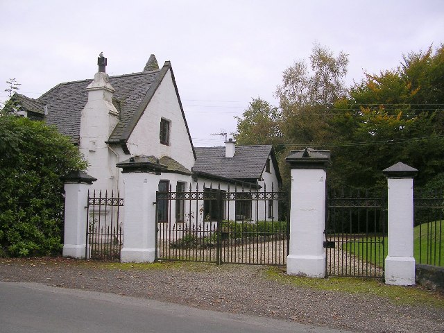
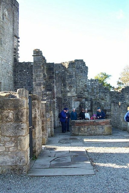
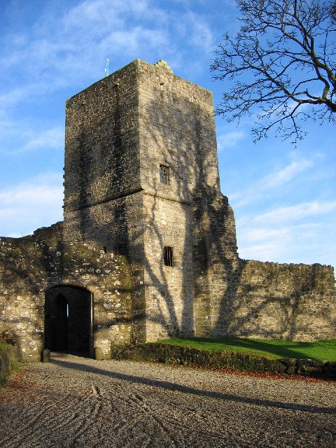
Avenue Strip is also known for its historical significance. The forest has been a part of the local landscape for centuries and has witnessed many historical events. Ruins of ancient settlements and remnants of old structures can still be found within the woodland, adding to its charm and intrigue.

With its breathtaking natural beauty, diverse wildlife, and historical significance, Avenue Strip in Stirlingshire is a must-visit destination for nature enthusiasts and history buffs alike.

If you have any feedback on the listing, please let us know in the comments section below.

Avenue Strip Images

Images are sourced within 2km of 55.967086/-4.3160203 or Grid Reference NS5577. Thanks to Geograph Open Source API. All images are credited.

Mugdock Hill Much land around big cities is occupied by horses..
Mugdock Hill
Much land around big cities is occupied by horses..
Mugdock Castle, Mugdock Country Park, East Dunbartonshire Origins of this Graham Castle date back to late 14th century
Mugdock Castle, Mugdock Country Park, East Dunbartonshire
Origins of this Graham Castle date back to late 14th century
West Highland Way in Craigallian Woods, Stirlingshire The post on the left of the picture has the stylised thistle which is the way-marker for this long-distance footpath.
West Highland Way in Craigallian Woods, Stirlingshire
The post on the left of the picture has the stylised thistle which is the way-marker for this long-distance footpath.
Moor Road, Strathblane Looking east along Moor Road from just before the open ground of Dumbrock Muir
Moor Road, Strathblane
Looking east along Moor Road from just before the open ground of Dumbrock Muir
Mill Dam, Strathblane Looking south across Mill Dam
Mill Dam, Strathblane
Looking south across Mill Dam
Loch Ardinning Wildlife Reserve Managed by Scottish Wildlife Trust
Loch Ardinning Wildlife Reserve
Managed by Scottish Wildlife Trust
Gatehouse to Mugdock Estate Gatehouse at eastern edge of Mugdock Country Park
Gatehouse to Mugdock Estate
Gatehouse at eastern edge of Mugdock Country Park
Allander Water, Mugdock Wood, Nr. Milngavie Late autumn afternoon.
Allander Water, Mugdock Wood, Nr. Milngavie
Late autumn afternoon.
Bracken and Birches, Mugdock Wood Late autumn afternoon light in deiduous woodland near Milngavie.
Bracken and Birches, Mugdock Wood
Late autumn afternoon light in deiduous woodland near Milngavie.
Mugdock Reservoir, Nr Milngavie Late autumn afternoon. Campsie Fells in the distance beyond Mugdock Wood.
Mugdock Reservoir, Nr Milngavie
Late autumn afternoon. Campsie Fells in the distance beyond Mugdock Wood.
Mugdock Wood, Last Leaves
Drumclog Moor, Nr. Milngavie Drumclog Moor and deciduous woodland beyond, near Milngavie, on a late autumn afternoon.
Drumclog Moor, Nr. Milngavie
Drumclog Moor and deciduous woodland beyond, near Milngavie, on a late autumn afternoon.
Woodland track near Easterton Farm
Black Linn, near Craigmaddie Small lochan and marshland. Looking towards Muirhouse Muir on Christmas Day morning.
Black Linn, near Craigmaddie
Small lochan and marshland. Looking towards Muirhouse Muir on Christmas Day morning.
Frosty Green at Mount Zion Part of Hilton Park Golf Course
Frosty Green at Mount Zion
Part of Hilton Park Golf Course
Misty Frozen Dumbrock Loch
Mugdock Country Park. An interior view of the castle.
Mugdock Country Park.
An interior view of the castle.
The SE shore of Dumbrock Loch
Show me another place!

Avenue Strip is located at Grid Ref: NS5577 (Lat: 55.967086, Lng: -4.3160203)

Unitary Authority: Stirling

Police Authority: Forth Valley

What 3 Words

///army.start.regress. Near Strathblane, Stirling

Related Wikis

Mugdock Country Park

Mugdock Country Park is a country park and historical site located partly in East Dunbartonshire and partly in Stirling, in the former county of Stirlingshire...

Mugdock

Mugdock is a hamlet in Stirlingshire, Scotland. It lies to the south of the village of Strathblane, and was in the civil parish. In the past the hamlet...

Mugdock Castle

Mugdock Castle was the stronghold of the Clan Graham from the middle of the 13th century. Its ruins are located in Mugdock Country Park, just west of the...

Loch Ardinning

Loch Ardinning (Scottish Gaelic: Loch Àird Dùnain) is a body of freshwater in the district of Stirling in Scotland, lying to the south of the village of...

Nearby Amenities

Located within 500m of 55.967086,-4.3160203
Mugdock
Place: hamlet
Wikidata: Q16866857
Lat/Long: 55.9650726/-4.3103322
Parking
South Lodge Carpark
Fee: no
Lit: no
Lat/Long: 55.9632641/-4.3171479
Power: tower
Lat/Long: 55.9681984/-4.3086301
Power: tower
Lat/Long: 55.9695001/-4.3131382
Power: tower
Lat/Long: 55.9711604/-4.3187912
Hiking: yes
Information: guidepost
Tourism: information
Lat/Long: 55.9635217/-4.3179054
Hiking: yes
Information: guidepost
Tourism: information
Lat/Long: 55.964461/-4.3185492
Bench
Backrest: no
Colour: brown
Material: wood
Seats: 3
Lat/Long: 55.9650398/-4.320982
Power: pole
Lat/Long: 55.9709806/-4.3147368
Power: pole
Lat/Long: 55.9707637/-4.3147389
Material: wood
Power: pole
Lat/Long: 55.969557/-4.3146488
Power: pole
Lat/Long: 55.9690352/-4.3146592
Power: pole
Lat/Long: 55.9681533/-4.3146236
Power: pole
Lat/Long: 55.9674192/-4.3146236
Power: pole
Lat/Long: 55.9666851/-4.3146131
Power: pole
Lat/Long: 55.9659333/-4.314611
Power: pole
Lat/Long: 55.965137/-4.3146027
Power: pole
Lat/Long: 55.9643606/-4.3145922
Power: pole
Lat/Long: 55.9637976/-4.3146634
Power: pole
Lat/Long: 55.9629966/-4.314785
Power: pole
Lat/Long: 55.9682589/-4.3158306
Power: pole
Lat/Long: 55.9683632/-4.317027
Power: pole
Lat/Long: 55.9684652/-4.3181963
Power: pole
Lat/Long: 55.9684793/-4.3197134
Power: pole
Lat/Long: 55.9684875/-4.3214882
Power: pole
Lat/Long: 55.9685051/-4.3229298
Information: guidepost
Tourism: information
Lat/Long: 55.9673102/-4.3110152
Fountain
Lat/Long: 55.966311/-4.309532
The data included in this document is from www.openstreetmap.org. The data is made available under ODbL.

Have you been to Avenue Strip?

Leave your review of Avenue Strip below (or comments, questions and feedback).