Castle Strip

Wood, Forest in Stirlingshire

Scotland

Castle Strip

Mugdock Hill Much land around big cities is occupied by horses..
Mugdock Hill Credit: Richard Webb

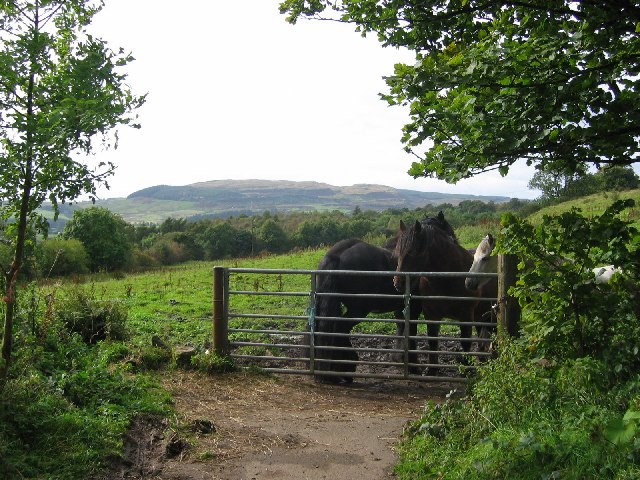
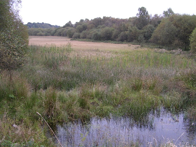
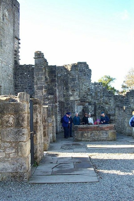
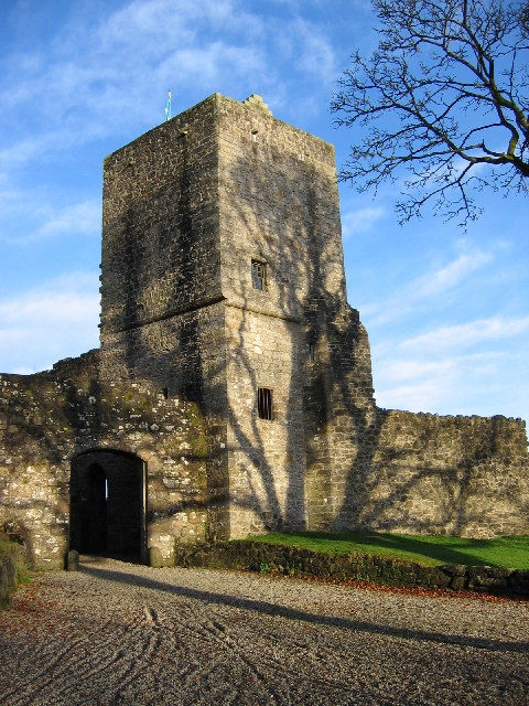
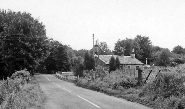
Castle Strip is a historic woodland located in Stirlingshire, Scotland. Situated in the heart of the region, the forest covers an area of approximately 500 acres, providing a picturesque landscape for visitors to explore. The woodland is named after the ruin of Castle Strip, a medieval fortress that once stood proudly within its boundaries.

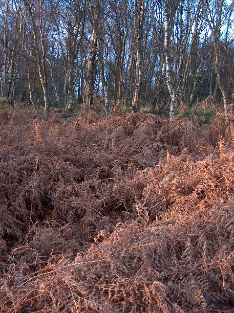
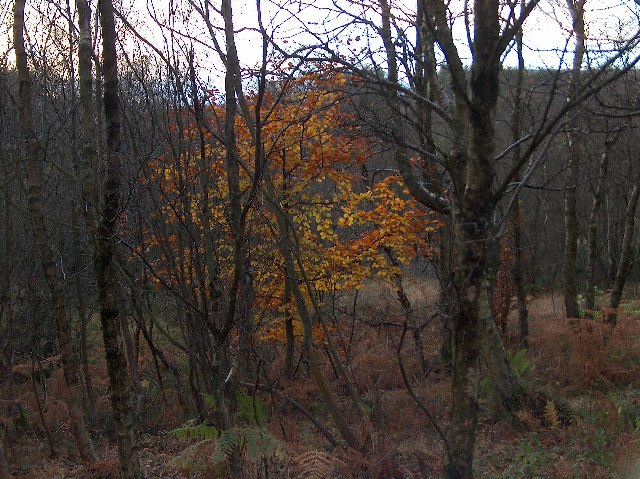
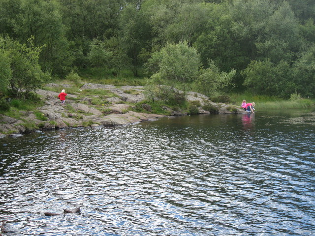
The forest is predominantly composed of native Scottish trees, including oak, birch, and pine, creating a diverse and vibrant ecosystem. The lush greenery of the woodland is home to a wide variety of flora and fauna, making it a haven for nature enthusiasts and wildlife lovers alike. Visitors may have the opportunity to spot red deer, foxes, and a multitude of bird species as they wander through the forest.

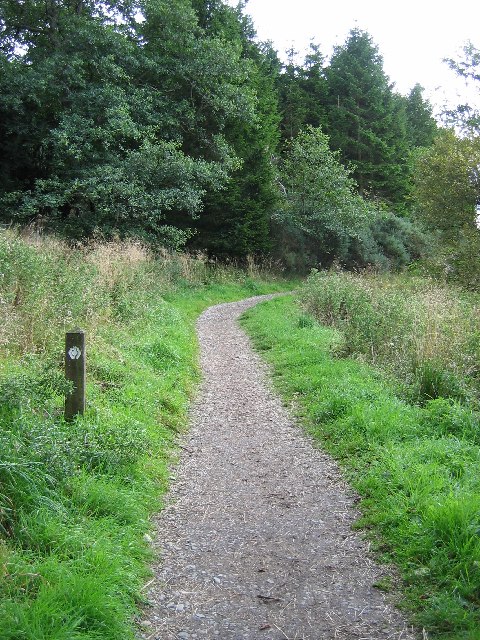
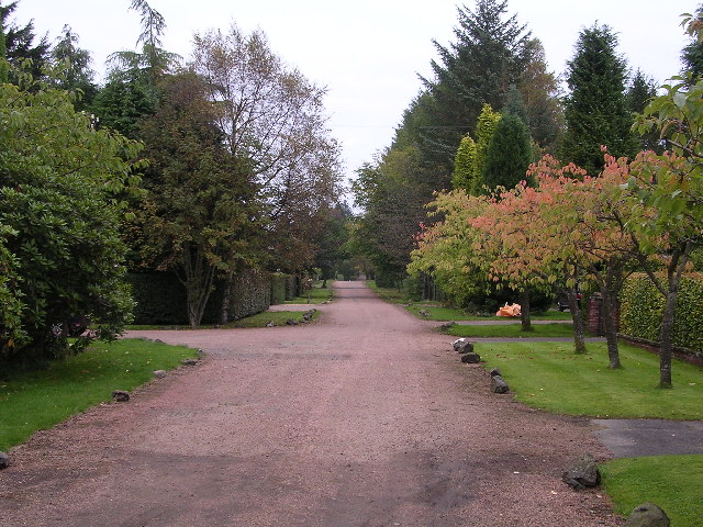
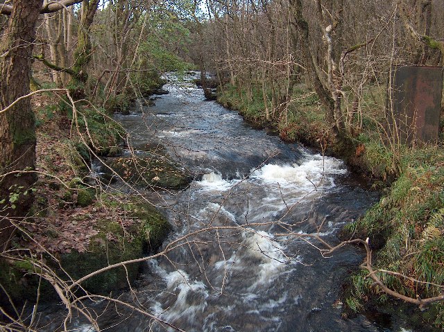
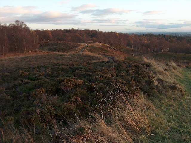
Castle Strip offers numerous walking trails and paths that wind their way through the woodland, allowing visitors to immerse themselves in its natural beauty. These well-maintained paths cater to all levels of fitness, from leisurely strolls to more challenging hikes. Along the way, visitors can admire the ancient trees, listen to the calming sounds of nature, and perhaps stumble upon hidden gems such as tranquil streams or secluded picnic spots.

Whether it's a peaceful escape from the hustle and bustle of daily life, a chance to reconnect with nature, or an opportunity to learn about the rich history of the area, Castle Strip is a destination that offers something for everyone.

If you have any feedback on the listing, please let us know in the comments section below.

Castle Strip Images

Images are sourced within 2km of 55.968781/-4.3338137 or Grid Reference NS5477. Thanks to Geograph Open Source API. All images are credited.

Mugdock Hill Much land around big cities is occupied by horses..
Mugdock Hill
Much land around big cities is occupied by horses..
Mugdock Castle, Mugdock Country Park, East Dunbartonshire Origins of this Graham Castle date back to late 14th century
Mugdock Castle, Mugdock Country Park, East Dunbartonshire
Origins of this Graham Castle date back to late 14th century
Craigallian Loch, near Carbeth, Stirlingshire On the left of the photo can be seen part of the West Highland Way long distance footpath. The separate hill in the background is Dumgoyne
Craigallian Loch, near Carbeth, Stirlingshire
On the left of the photo can be seen part of the West Highland Way long distance footpath. The separate hill in the background is Dumgoyne
West Highland Way in Craigallian Woods, Stirlingshire The post on the left of the picture has the stylised thistle which is the way-marker for this long-distance footpath.
West Highland Way in Craigallian Woods, Stirlingshire
The post on the left of the picture has the stylised thistle which is the way-marker for this long-distance footpath.
Moor Road, Strathblane Looking east along Moor Road from just before the open ground of Dumbrock Muir
Moor Road, Strathblane
Looking east along Moor Road from just before the open ground of Dumbrock Muir
Mill Dam, Strathblane Looking south across Mill Dam
Mill Dam, Strathblane
Looking south across Mill Dam
Loch Ardinning Wildlife Reserve Managed by Scottish Wildlife Trust
Loch Ardinning Wildlife Reserve
Managed by Scottish Wildlife Trust
Gatehouse to Mugdock Estate Gatehouse at eastern edge of Mugdock Country Park
Gatehouse to Mugdock Estate
Gatehouse at eastern edge of Mugdock Country Park
Allander Water, Mugdock Wood, Nr. Milngavie Late autumn afternoon.
Allander Water, Mugdock Wood, Nr. Milngavie
Late autumn afternoon.
Bracken and Birches, Mugdock Wood Late autumn afternoon light in deiduous woodland near Milngavie.
Bracken and Birches, Mugdock Wood
Late autumn afternoon light in deiduous woodland near Milngavie.
Mugdock Wood, Last Leaves
Drumclog Moor, Nr. Milngavie Drumclog Moor and deciduous woodland beyond, near Milngavie, on a late autumn afternoon.
Drumclog Moor, Nr. Milngavie
Drumclog Moor and deciduous woodland beyond, near Milngavie, on a late autumn afternoon.
Hilton Park Golf Club
Frosty Green at Mount Zion Part of Hilton Park Golf Course
Frosty Green at Mount Zion
Part of Hilton Park Golf Course
Misty Frozen Dumbrock Loch
Mugdock Country Park. An interior view of the castle.
Mugdock Country Park.
An interior view of the castle.
The SE shore of Dumbrock Loch
Mugdock Visitor Centre Old agricultural machinery outside the Visitor Centre at Mugdock Country Park
Mugdock Visitor Centre
Old agricultural machinery outside the Visitor Centre at Mugdock Country Park
Show me another place!

Castle Strip is located at Grid Ref: NS5477 (Lat: 55.968781, Lng: -4.3338137)

Unitary Authority: Stirling

Police Authority: Forth Valley

What 3 Words

///bland.exhales.debut. Near Strathblane, Stirling

Related Wikis

Mugdock Castle

Mugdock Castle was the stronghold of the Clan Graham from the middle of the 13th century. Its ruins are located in Mugdock Country Park, just west of the...

Mugdock Country Park

Mugdock Country Park is a country park and historical site located partly in East Dunbartonshire and partly in Stirling, in the former county of Stirlingshire...

Mugdock

Mugdock is a hamlet in Stirlingshire, Scotland. It lies to the south of the village of Strathblane, and was in the civil parish. In the past the hamlet...

Blanefield railway station

Blanefield railway station served the village of Blanefield, Stirling, Scotland from 1867 to 1959 on the Blane Valley Railway. == History == The station...

Nearby Amenities

Located within 500m of 55.968781,-4.3338137
Parking
Khyber Car Park
Lat/Long: 55.9672792/-4.3372599
Gallow Hill
Natural: peak
Source: local_knowledge
Lat/Long: 55.9711901/-4.3323777
Moot Hill
Ele: 177
Natural: peak
Source: old map/ height by gps
Lat/Long: 55.9708821/-4.3278352
Craigallian
Created By: Potlatch 0.9b
Place: hamlet
Lat/Long: 55.9696954/-4.3412435
Barrier: kissing_gate
Lat/Long: 55.9678207/-4.3371483
Leisure: playground
Lat/Long: 55.9718906/-4.3318316
Bench
Lat/Long: 55.9687287/-4.3353206
Power: pole
Lat/Long: 55.969136/-4.3262678
Power: pole
Lat/Long: 55.9694491/-4.3279378
Power: pole
Lat/Long: 55.9697833/-4.3296079
Power: pole
Lat/Long: 55.9700941/-4.3312381
Recycling
Recycling Cans: yes
Recycling Glass Bottles: yes
Recycling Waste: yes
Recycling Type: container
Lat/Long: 55.9726417/-4.3305974
Recycling
Recycling Cans: yes
Recycling Glass Bottles: yes
Recycling Waste: yes
Recycling Type: container
Lat/Long: 55.9724986/-4.3305198
Board Type: history
Direction: 040
Information: board
Tourism: information
Lat/Long: 55.9722093/-4.3310825
Recycling
Recycling Cans: yes
Recycling Glass Bottles: yes
Recycling Waste: yes
Recycling Type: container
Lat/Long: 55.9721733/-4.3307902
Bench
Backrest: yes
Colour: brown
Material: wood
Lat/Long: 55.9718441/-4.330072
Bench
Backrest: yes
Colour: brown
Material: wood
Lat/Long: 55.9710932/-4.3299599
Bench
Backrest: no
Colour: brown
Direction: 5;185
Inscription: Craigend Zoo 1949-1955
Material: wood
Lat/Long: 55.9700581/-4.3316518
Bench
Backrest: no
Colour: brown
Direction: 140;320
Inscription: Craigend Zoo 1949-1955
Material: wood
Lat/Long: 55.9700342/-4.3317073
Board Type: history
Direction: SE
Information: board
Subject Wikidata: Q5181662
Tourism: information
Lat/Long: 55.9700812/-4.3328866
Board Type: history
Direction: SW
Information: board
Tourism: information
Lat/Long: 55.9698755/-4.3336584
Watering Place
Fee: no
Lat/Long: 55.9724024/-4.3304706
Board Type: history
Direction: 185
Information: board
Subject Wikidata: Q5181662
Tourism: information
Lat/Long: 55.9696207/-4.3333146
Bench
Backrest: no
Direction: 90;270
Material: wood
Lat/Long: 55.9696465/-4.3334118
Bench
Backrest: no
Direction: 90;270
Material: wood
Lat/Long: 55.9697246/-4.3334238
Bench
Backrest: no
Direction: 130;310
Material: wood
Lat/Long: 55.9696893/-4.3331932
Bicycle Parking
Covered: yes
Lat/Long: 55.9724632/-4.3309824
Cafe
Spider Monkey Coffee Co
Check Date: 2023-10-08
Phone: +44 141 956 6775
Lat/Long: 55.9725812/-4.330777
Cafe
Caulders
Check Date: 2024-03-30
Cuisine: coffee_shop;sandwich
Opening Hours: 09:00-17:00
Lat/Long: 55.9722022/-4.3290575
Power: pole
Lat/Long: 55.9715385/-4.3391632
Power: pole
Lat/Long: 55.9710333/-4.3376097
Power: pole
Lat/Long: 55.9705478/-4.3361189
Restaurant
Stables Tearoom
Lat/Long: 55.9723572/-4.3306501
Toilets
Lat/Long: 55.9725489/-4.330573
Entrance: main
Lat/Long: 55.9723646/-4.3306875
Entrance: main
Lat/Long: 55.9724356/-4.3305877
Entrance: main
Lat/Long: 55.9725272/-4.330689
Entrance: main
Lat/Long: 55.9724256/-4.3308311
Defibrillator
Emergency: defibrillator
Indoor: no
Lat/Long: 55.9725029/-4.3304637
Theatre
Theatre & Conference Suite
Toilets
Adapted Toilet
Dog: no
Name Gd: Taigh-beag Ciarramach
Wheelchair: designated
Lat/Long: 55.9725412/-4.3307363
Mugdock Visitor Centre & Gift Shop
Information: office
Name Gd: Ionad Luchd-tadhail Agus Bùth Thiodhlaicean
Shop: gift
Tourism: information
Website: https://www.mugdock-country-park.org.uk/about-the-park/visitor-centre
Lat/Long: 55.9724181/-4.3305445
Mugdock Makkers
Addr Postcode: G62 8EL
Check Date: 2023-10-08
Email: mail@mugdockmakkers.co.uk
Opening Hours: 11:00-17:00 open "summer", 11:00-16:00
Phone: +44 141 956 6555
Shop: craft
Website: https://mugdockmakkers.co.uk/
Lat/Long: 55.972441/-4.3308791
Leisure: picnic_table
Material: wood
Lat/Long: 55.9722327/-4.3310548
Leisure: picnic_table
Material: wood
Lat/Long: 55.972259/-4.3311319
Bench
Backrest: yes
Direction: 200
Material: wood
Lat/Long: 55.9722403/-4.3308
Bench
Backrest: yes
Direction: 215
Material: wood
Lat/Long: 55.9722526/-4.3308342
Bench
Backrest: yes
Direction: 220
Material: wood
Lat/Long: 55.9723322/-4.3310078
Bench
Backrest: yes
Direction: 235
Material: wood
Lat/Long: 55.9723509/-4.3310326
Entrance: service
Level: 1
Lat/Long: 55.9724652/-4.3304996
Entrance: main
Lat/Long: 55.9725372/-4.3305926
Entrance: main
Lat/Long: 55.9725751/-4.3307095
Waste Basket
Waste: dog_excrement
Lat/Long: 55.9695305/-4.3333676
The data included in this document is from www.openstreetmap.org. The data is made available under ODbL.

Have you been to Castle Strip?

Leave your review of Castle Strip below (or comments, questions and feedback).