Craigton Wood

Wood, Forest in Stirlingshire

Scotland

Craigton Wood

Mugdock Hill Much land around big cities is occupied by horses..
Mugdock Hill Credit: Richard Webb

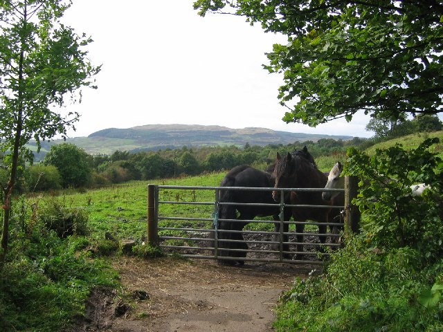
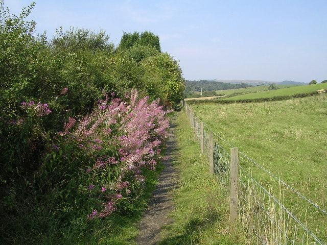
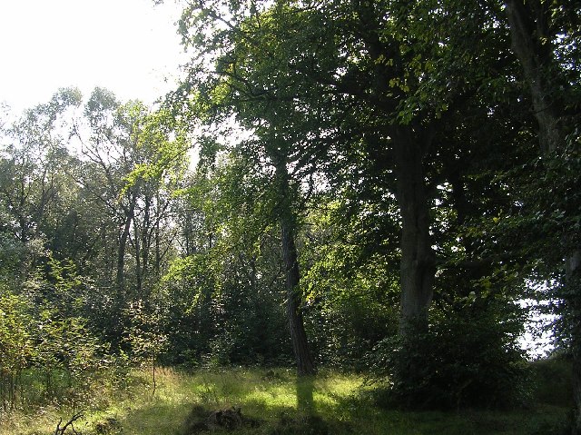
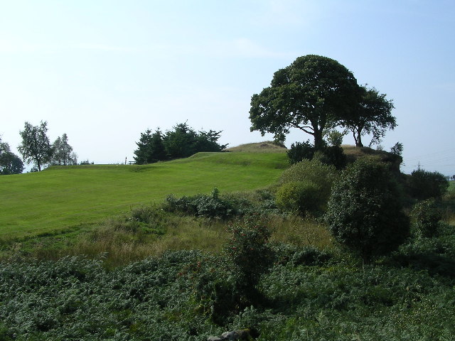
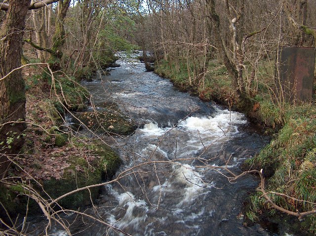
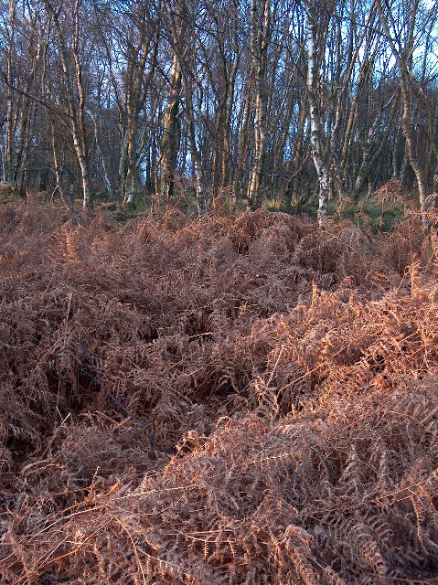
Craigton Wood is a picturesque forest located in Stirlingshire, Scotland. Spanning over a vast area, the wood is known for its rich biodiversity and stunning natural beauty. It is situated in close proximity to the village of Craigton, making it easily accessible to visitors.

The wood is predominantly made up of a mix of native tree species, including oak, birch, and rowan, which create a dense and lush canopy. These trees provide a habitat for a wide variety of flora and fauna, making it a popular destination for nature enthusiasts and birdwatchers.

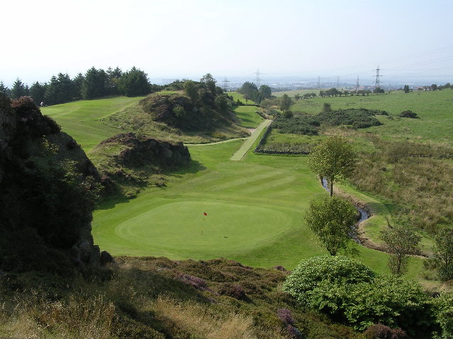
Tranquil walking trails wind their way through the wood, allowing visitors to explore and immerse themselves in the serene surroundings. The paths are well-maintained, making it suitable for all ages and abilities. Along the trails, there are several viewpoints that offer breathtaking vistas of the surrounding countryside.

Craigton Wood is also home to an abundance of wildlife. Visitors may spot red squirrels, roe deer, and a variety of bird species such as woodpeckers and thrushes. The wood is particularly known for its vibrant birdlife, and it is not uncommon to see birdwatchers armed with binoculars and cameras, patiently waiting for sightings of rare species.

In addition to its natural beauty, Craigton Wood holds historical significance. It is said to have been an important timber resource in the past, supplying wood for the local industries. Today, it remains a valuable resource for the local community, offering a tranquil retreat and a chance to connect with nature.

If you have any feedback on the listing, please let us know in the comments section below.

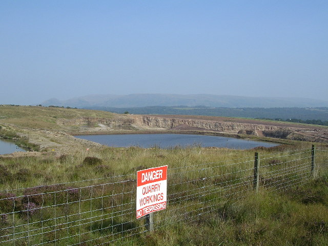
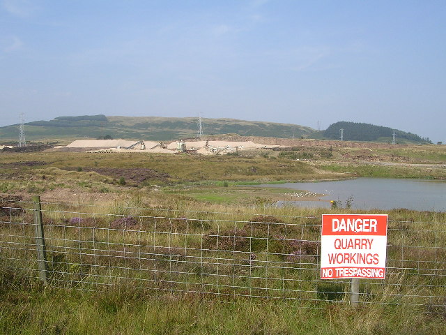
Craigton Wood Images

Images are sourced within 2km of 55.948218/-4.3375733 or Grid Reference NS5475. Thanks to Geograph Open Source API. All images are credited.

Mugdock Hill Much land around big cities is occupied by horses..
Mugdock Hill
Much land around big cities is occupied by horses..
Milngavie town centre Start of the West Highland Way.
Milngavie town centre
Start of the West Highland Way.
Baljaffray roundabout Heading away from Milngavie
Baljaffray roundabout
Heading away from Milngavie
Mosshead Primary School, Bearsden A non-denominational, co-ed school built in 1973. The turreted building on the skyline is the Lynedoch nursing home.
Mosshead Primary School, Bearsden
A non-denominational, co-ed school built in 1973. The turreted building on the skyline is the Lynedoch nursing home.
Footpath along boundary of Bearsden A footpath through common ground along the northern boundary of Bearsden.
Footpath along boundary of Bearsden
A footpath through common ground along the northern boundary of Bearsden.
Douglas Muir Quarry Sand and gravel quarry north of Windyhill golf course. A major blot on the landscape.
Douglas Muir Quarry
Sand and gravel quarry north of Windyhill golf course. A major blot on the landscape.
Mains Plantation Mains Plantation is a SINC - a site of importance for nature conservation.
Mains Plantation
Mains Plantation is a SINC - a site of importance for nature conservation.
Douglas Muir Quarry A massive area of despolation.
Douglas Muir Quarry
A massive area of despolation.
Craighead Knowe The summit of Windyhill golf course.
Craighead Knowe
The summit of Windyhill golf course.
View from Craighead Knowe Looking down onto Windyhill golf course
View from Craighead Knowe
Looking down onto Windyhill golf course
Grazing Land at Tambowie Campsie Fells in the background
Grazing Land at Tambowie
Campsie Fells in the background
Mains housing estate North west corner of Mains housing estate
Mains housing estate
North west corner of Mains housing estate
Milngavie Fire Station
Access Road to Douglas Muir Quarry Douglas Muir Quarry is a major blot on the landscape north west of Milngavie. Photo of the sand and gravel quarry here <a href="https://www.geograph.org.uk/photo/49124">NS5274 : Douglas Muir Quarry</a>
Access Road to Douglas Muir Quarry
Douglas Muir Quarry is a major blot on the landscape north west of Milngavie. Photo of the sand and gravel quarry here NS5274 : Douglas Muir Quarry
Baljaffray Primary School, South Baljaffray, Bearsden Primary school in South Baljaffray Housing estate, Bearsden, East Dunbartonshire, Campsie Fells in the distance. Early afternoon.
Baljaffray Primary School, South Baljaffray, Bearsden
Primary school in South Baljaffray Housing estate, Bearsden, East Dunbartonshire, Campsie Fells in the distance. Early afternoon.
Tannoch Loch, Milngavie A small loch in a residential area, much loved by wildfowl and locals. Campsie Fells in the distance beyond the woodland.
Tannoch Loch, Milngavie
A small loch in a residential area, much loved by wildfowl and locals. Campsie Fells in the distance beyond the woodland.
Allander Water, Mugdock Wood, Nr. Milngavie Late autumn afternoon.
Allander Water, Mugdock Wood, Nr. Milngavie
Late autumn afternoon.
Bracken and Birches, Mugdock Wood Late autumn afternoon light in deiduous woodland near Milngavie.
Bracken and Birches, Mugdock Wood
Late autumn afternoon light in deiduous woodland near Milngavie.
Show me another place!

Craigton Wood is located at Grid Ref: NS5475 (Lat: 55.948218, Lng: -4.3375733)

Unitary Authority: East Dunbartonshire

Police Authority: Greater Glasgow

What 3 Words

///tooth.jets.deny. Near Milngavie, East Dunbartonshire

Nearby Locations

Craigton Wood

Related Wikis

Douglas Academy

Douglas Academy is a non-denominational, co-educational, comprehensive secondary school in the town of Milngavie, East Dunbartonshire, serving the Milngavie...

Heatherbank House

Heatherbank House is an early 19th century private house located in Milngavie, Scotland and is one of the oldest buildings in the town. It is the former...

Bearsden and Milngavie

Bearsden and Milngavie (Scottish Gaelic: Cille Phàdraig Ùr agus Muileann Dhaibhidh) was, from 1975 to 1996, one of nineteen local government districts...

Milngavie

Milngavie ( mul-GHY; Scottish Gaelic: Muileann-Ghaidh) is a town in East Dunbartonshire, Scotland and a suburb of Glasgow. It is on the Allander Water...

Milngavie railway station

Milngavie railway station serves the town of Milngavie, East Dunbartonshire, near Glasgow in Scotland. The station is sited 9 miles 35 chains (15.2 km...

St Paul's Church (Milngavie)

St Paul's Church is a church building of the Presbyterian Church of Scotland in the Scottish town of Milngavie in East Dunbartonshire, near Glasgow. It...

Mugdock Castle

Mugdock Castle was the stronghold of the Clan Graham from the middle of the 13th century. Its ruins are located in Mugdock Country Park, just west of the...

West of Scotland F.C.

West of Scotland Football Club is a rugby union club based in Milngavie, Scotland. Founded in 1865, West of Scotland are one of the oldest rugby clubs...

Nearby Amenities

Located within 500m of 55.948218,-4.3375733
Noexit: yes
Lat/Long: 55.9468105/-4.3382737
Noexit: yes
Lat/Long: 55.9447055/-4.3366747
Post Office
Craigash Road Post Office
Addr Country: GB
Addr Postcode: G62 7BP
Brand: Post Office
Brand Wikidata: Q1783168
Contact Website: https://www.postoffice.co.uk/branch-finder/1048325/craigash-road
Ref Pol Id: 1383
Lat/Long: 55.9466032/-4.3325
Londis
Addr Street: Craigash Road
Brand: Londis
Brand Wikidata: Q21008564
Brand Wikipedia: en:Londis (United Kingdom)
Shop: convenience
Source: Local_knowledge
Lat/Long: 55.9466647/-4.3326472
Keystore
Addr Street: Craigash Road
Shop: convenience
Source: Local_knowledge
Lat/Long: 55.9469404/-4.332389
Crossing
Crossing: uncontrolled
Crossing Island: no
Crossing Markings: zebra
Kerb: lowered
Tactile Paving: no
Lat/Long: 55.9470497/-4.3442796
Crossing
Crossing: uncontrolled
Crossing Island: no
Crossing Markings: surface
Lat/Long: 55.9444228/-4.3353716
Crossing
Crossing Island: no
Tactile Paving: no
Lat/Long: 55.9486552/-4.3418049
Bus Stop
Bench: yes
Naptan AtcoCode: 611098
Naptan NaptanCode: 65423953
Public Transport: platform
Shelter: yes
Lat/Long: 55.947303/-4.3325872
Generator Method: photovoltaic
Generator Output Electricity: yes
Generator Source: solar
Generator Type: solar_photovoltaic_panel
Location: roof
Power: generator
Lat/Long: 55.9458896/-4.3311158
Generator Method: photovoltaic
Generator Output Electricity: yes
Generator Source: solar
Generator Type: solar_photovoltaic_panel
Location: roof
Power: generator
Lat/Long: 55.9469996/-4.3397284
Generator Method: photovoltaic
Generator Output Electricity: yes
Generator Source: solar
Generator Type: solar_photovoltaic_panel
Location: roof
Power: generator
Lat/Long: 55.9470927/-4.3408066
Generator Method: photovoltaic
Generator Output Electricity: yes
Generator Source: solar
Generator Type: solar_photovoltaic_panel
Location: roof
Power: generator
Lat/Long: 55.9474727/-4.3405357
Generator Method: photovoltaic
Generator Output Electricity: yes
Generator Source: solar
Generator Type: solar_photovoltaic_panel
Location: roof
Power: generator
Lat/Long: 55.9461915/-4.3355387
Generator Method: photovoltaic
Generator Output Electricity: yes
Generator Source: solar
Generator Type: solar_photovoltaic_panel
Location: roof
Power: generator
Lat/Long: 55.9453699/-4.3373559
Generator Method: photovoltaic
Generator Output Electricity: yes
Generator Source: solar
Generator Type: solar_photovoltaic_panel
Location: roof
Power: generator
Lat/Long: 55.9453617/-4.3373171
Entrance: main
Level: 0
Lat/Long: 55.9473256/-4.3453711
Traffic Calming: bump
Lat/Long: 55.9480215/-4.3424012
Crossing
Crossing: uncontrolled
Crossing Island: no
Crossing Markings: zebra
Tactile Paving: yes
Lat/Long: 55.9478381/-4.3425154
Post Box
Lat/Long: 55.9459349/-4.3372229
Post Box
Lat/Long: 55.9466253/-4.3326871
Noexit: yes
Lat/Long: 55.9473241/-4.3392644
The data included in this document is from www.openstreetmap.org. The data is made available under ODbL.

Have you been to Craigton Wood?

Leave your review of Craigton Wood below (or comments, questions and feedback).