Capland

Settlement in Somerset Somerset West and Taunton

England

Capland

Direction Sign – Signpost on Station Road in Hatch Beauchamp Located on the east side of the junction of Station Road and Higher Street in Hatch Beauchamp parish. 2 arms, 1 worboys, and pyramid finial. An arm pointing to Parish Church was added above the existing arm between 2007 and 2012.

Milestone Society National ID: SO_ST3020C
Direction Sign – Signpost on Station Road in Hatch Beauchamp Credit: John V Nicholls

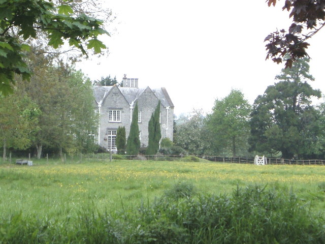
Capland is a small village located in the county of Somerset, England. Situated in the beautiful countryside, it is surrounded by rolling hills, lush green fields, and picturesque landscapes. The village is nestled within the larger parish of Somerset, adding to its charm and tranquility.

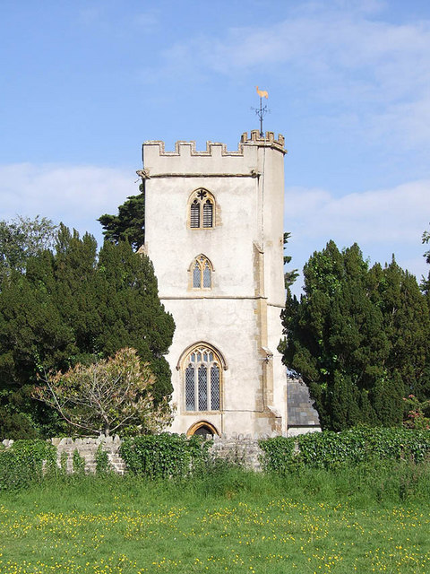
Capland is known for its rich history, dating back to the medieval period. The village boasts several historical landmarks, including St. Mary's Church, a beautiful 12th-century building with stunning architectural features. This church is a prominent focal point in the village, attracting both locals and visitors alike.

The village itself is relatively small, with a tight-knit community of friendly and welcoming residents. It exudes a strong sense of community spirit, with various events and activities organized throughout the year, such as village fairs and carnivals. These occasions provide an opportunity for locals to come together and celebrate their heritage.

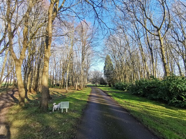
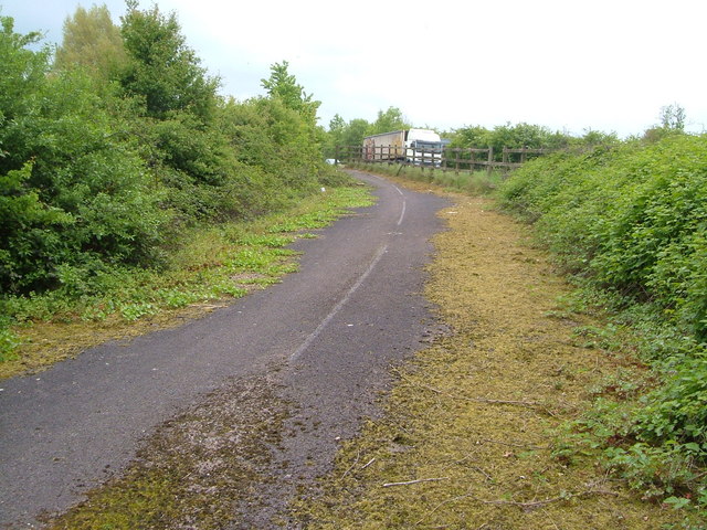
Surrounded by stunning natural beauty, Capland offers ample opportunities for outdoor activities. There are numerous walking trails and hiking routes in the vicinity, allowing visitors to explore the countryside and enjoy breathtaking views. The village is also conveniently located near several nature reserves and national parks, perfect for nature enthusiasts and wildlife lovers.

While Capland may be a tranquil and secluded village, it is within close proximity to larger towns and cities, making it a desirable place to live for those seeking a balance between peaceful rural living and access to urban amenities.

If you have any feedback on the listing, please let us know in the comments section below.
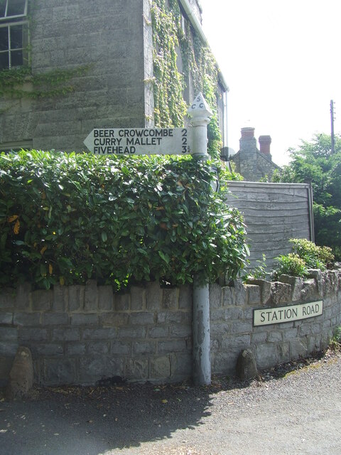
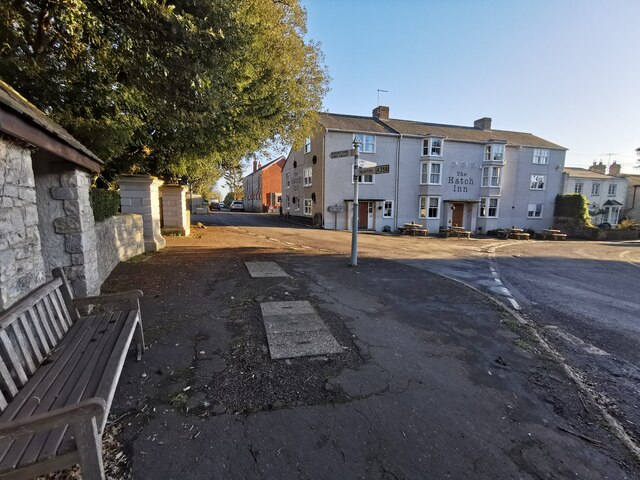
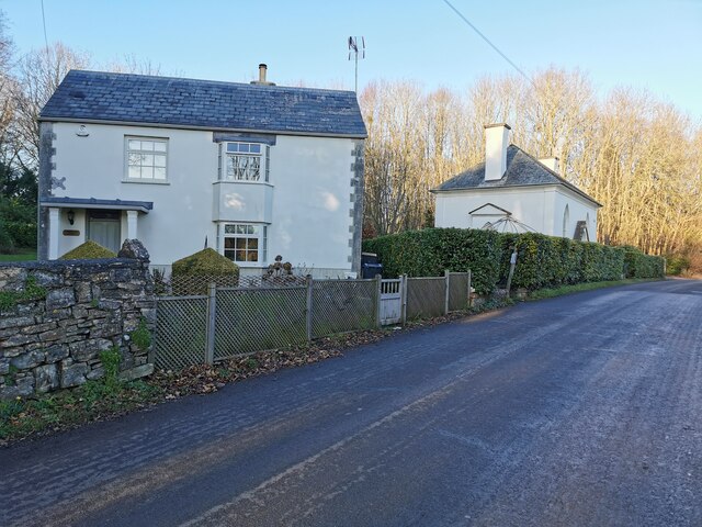
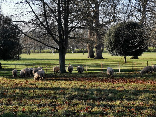
Capland Images

Images are sourced within 2km of 50.965324/-2.99325 or Grid Reference ST3018. Thanks to Geograph Open Source API. All images are credited.

Direction Sign – Signpost on Station Road in Hatch Beauchamp Located on the east side of the junction of Station Road and Higher Street in Hatch Beauchamp parish. 2 arms, 1 worboys, and pyramid finial. An arm pointing to Parish Church was added above the existing arm between 2007 and 2012.

Milestone Society National ID: SO_ST3020C
Direction Sign – Signpost on Station Road in Hatch Beauchamp
Located on the east side of the junction of Station Road and Higher Street in Hatch Beauchamp parish. 2 arms, 1 worboys, and pyramid finial. An arm pointing to Parish Church was added above the existing arm between 2007 and 2012. Milestone Society National ID: SO_ST3020C
Hatch Beauchamp : Village Road A road junction in the centre of the village with The Hatch Inn in the scene.
Hatch Beauchamp : Village Road
A road junction in the centre of the village with The Hatch Inn in the scene.
Hatch Beauchamp : Higher Road Looking along Higher Road and alongside Labumum Cottage.
Hatch Beauchamp : Higher Road
Looking along Higher Road and alongside Labumum Cottage.
Hatch Beauchamp : Hatch Court Park A track leads to the church.
Hatch Beauchamp : Hatch Court Park
A track leads to the church.
Hatch Beauchamp : Hatch Court Park Sheep in a field at Hatch Court Park.
Hatch Beauchamp : Hatch Court Park
Sheep in a field at Hatch Court Park.
Hatch Beauchamp : Grassy Field Looking across a field.
Hatch Beauchamp : Grassy Field
Looking across a field.
Hatch Beauchamp : Footpath A footpath through Hatch Court Park.
Hatch Beauchamp : Footpath
A footpath through Hatch Court Park.
Hatch Beauchamp : Hatch Court A driveway heading up to the house.
Hatch Beauchamp : Hatch Court
A driveway heading up to the house.
Hatch Beauchamp : Footpath A footpath heading to Hatch Court.
Hatch Beauchamp : Footpath
A footpath heading to Hatch Court.
Hatch Beauchamp : Station Road Looking along the road by the Hatch Inn.
Hatch Beauchamp : Station Road
Looking along the road by the Hatch Inn.
Hatch Beauchamp Garage This old wooden framed building is on village Rd which runs south out of the village towards Hatch Green
Hatch Beauchamp Garage
This old wooden framed building is on village Rd which runs south out of the village towards Hatch Green
Gateway to Hatch Beauchamp Village Hall The village hall is set well back from the road and its entrance is on Village Road.
Gateway to Hatch Beauchamp Village Hall
The village hall is set well back from the road and its entrance is on Village Road.
Broadmead Rd. Broadmead Rd runs west out of the village of Beercrocombe towards Frog Street Farm.
Broadmead Rd.
Broadmead Rd runs west out of the village of Beercrocombe towards Frog Street Farm.
Weir near Hatch Beauchamp On the Fivehead River, seen from the south bank.
Weir near Hatch Beauchamp
On the Fivehead River, seen from the south bank.
Old A358 at Capland Traffic beginning the Hatch Beauchamp bypass on the A358 passes tarmac still bearing white lines where the former main road rounded a bend at Capland.
Old A358 at Capland
Traffic beginning the Hatch Beauchamp bypass on the A358 passes tarmac still bearing white lines where the former main road rounded a bend at Capland.
Railway sleepers near Hatch Beauchamp You never know when they might come in useful. Presumably sourced from the disused railway line that runs past Hatch Beauchamp some 500 metres away.
Railway sleepers near Hatch Beauchamp
You never know when they might come in useful. Presumably sourced from the disused railway line that runs past Hatch Beauchamp some 500 metres away.
Fowler's Farm, Hatch Beauchamp Seen across a field from the footpath past Higher Mill.
Fowler's Farm, Hatch Beauchamp
Seen across a field from the footpath past Higher Mill.
Close House, Hatch Beauchamp Home of Colonel John Chard, hero of Rorke's Drift - then a rectory, now somewhere you can stay. Seen from a footpath across the Fivehead River.
Close House, Hatch Beauchamp
Home of Colonel John Chard, hero of Rorke's Drift - then a rectory, now somewhere you can stay. Seen from a footpath across the Fivehead River.
Show me another place!

Capland is located at Grid Ref: ST3018 (Lat: 50.965324, Lng: -2.99325)

Administrative County: Somerset

District: Somerset West and Taunton

Police Authority: Avon and Somerset

What 3 Words

///dribble.fetching.compress. Near Creech St Michael, Somerset

Nearby Locations

Capland

Related Wikis

Hatch Beauchamp

Hatch Beauchamp is a village and civil parish in Somerset, England, situated 5 miles (8.0 km) south east of Taunton. The village has a population of 620...

Barrington Hill Meadows

Barrington Hill Meadows (grid reference ST300170) is a 16.1 hectare (39.5 acre) biological Site of Special Scientific Interest in Somerset, England, notified...

Bickenhall

Bickenhall is a hamlet and parish in Somerset, England, situated 5 miles (8.0 km) south east of Taunton. The parish, which includes the hamlet of Batten...

Church of the Blessed Virgin Mary, Ashill

The Anglican Church of the Blessed Virgin Mary in Ashill, Somerset, England was built in the 12th century. It is a Grade II* listed building. == History... ==

Beercrocombe

Beercrocombe (also known as Beer Crocombe) is a village and civil parish in Somerset, England, 1 mile (1.6 km) south of Curry Mallet and 7 miles (11.3...

West Hatch

West Hatch is a hamlet and civil parish in Somerset, England, situated 5 miles (8.0 km) south east of Taunton. It has a population of 306. == History... ==

Church of St James, Beercrocombe

The Church of St James in Beercrocombe, Somerset, England, dates from the 13th century but the current building is predominantly from the 15th. It was...

Curland

Curland is a village and civil parish in Somerset, England, situated 6 miles (9.7 km) south of Taunton. The village has a population of 225. The parish...

Nearby Amenities

Located within 500m of 50.965324,-2.99325
Give Way
Lat/Long: 50.9634508/-2.9930637
Give Way
Lat/Long: 50.9647269/-2.9960717
Give Way
Direction: forward
Lat/Long: 50.9649229/-2.9968892
Rest Area
Opening Hours: 24/7
Lat/Long: 50.9643141/-2.9950448
Rest Area
Opening Hours: 24/7
Lat/Long: 50.9642161/-2.9951789
Capland
Place: hamlet
Lat/Long: 50.9655711/-2.9938868
Bus Stop
Hatch Beauchamp Road
Bus: yes
Naptan AtcoCode: 3600SOB20363
Naptan Bearing: S
Naptan CommonName: Hatch Beauchamp Road
Naptan Indicator: S-bound
Naptan NaptanCode: sotampwm
Naptan Verified: no
Public Transport: platform
Shelter: yes
Lat/Long: 50.9653608/-2.9954973
Power: pole
Source: bing
Lat/Long: 50.96925/-2.9912129
Power: pole
Source: bing
Lat/Long: 50.9673404/-2.9953904
Power: pole
Source: bing
Lat/Long: 50.9674097/-2.9946958
Power: pole
Source: bing
Lat/Long: 50.9674527/-2.993993
Power: pole
Source: bing
Lat/Long: 50.9675288/-2.9927994
Power: pole
Source: bing
Lat/Long: 50.9676141/-2.9915603
Power: pole
Source: bing
Lat/Long: 50.9685017/-2.9907462
Power: pole
Source: bing
Lat/Long: 50.9676875/-2.9902647
Power: pole
Source: bing
Lat/Long: 50.9666943/-2.9884905
Power: pole
Source: bing
Lat/Long: 50.9668933/-2.9897964
Power: pole
Source: bing
Lat/Long: 50.9659975/-2.9902862
Power: pole
Source: bing
Lat/Long: 50.9650777/-2.9907891
Power: pole
Source: bing
Transformer: distribution
Lat/Long: 50.9643015/-2.9912116
Power: pole
Source: bing
Lat/Long: 50.9636486/-2.9913349
Power: pole
Source: bing
Lat/Long: 50.9629332/-2.991465
Power: pole
Source: bing
Lat/Long: 50.9615699/-2.9917225
Power: pole
Source: bing
Transformer: distribution
Lat/Long: 50.9621519/-2.9916179
The data included in this document is from www.openstreetmap.org. The data is made available under ODbL.

Have you been to Capland?

Leave your review of Capland below (or comments, questions and feedback).