Haltriggs Strip

Wood, Forest in Ayrshire

Scotland

Haltriggs Strip

End-terrace on Maxwood Road
End-terrace on Maxwood Road Credit: Alan Reid

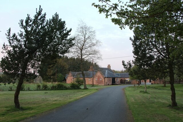
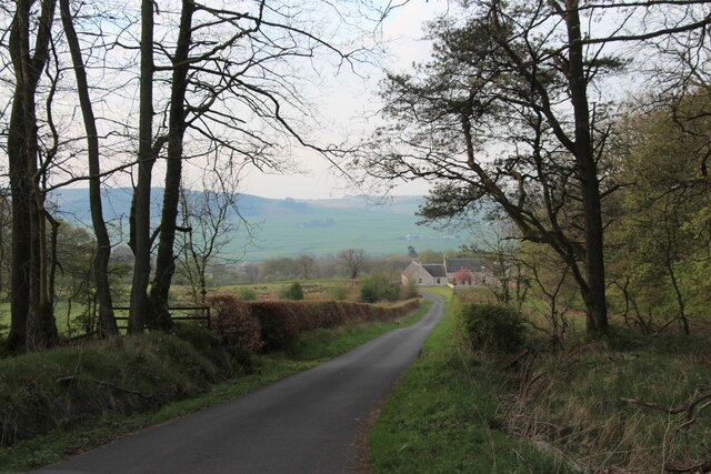
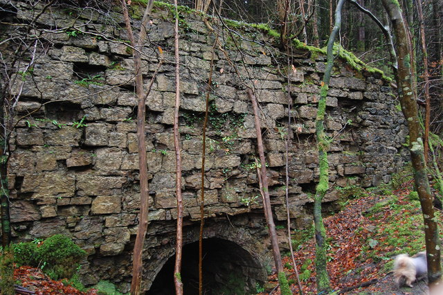
Haltriggs Strip is a picturesque woodland located in Ayrshire, Scotland. Covering an area of approximately 200 acres, it is renowned for its natural beauty and diverse ecosystem. The strip is situated near the town of Ayr and is easily accessible for both locals and tourists.

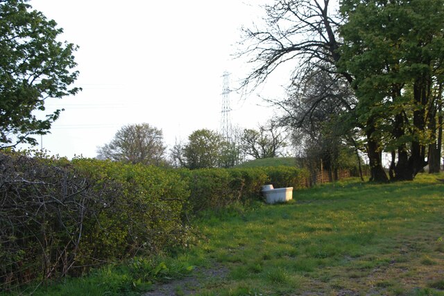
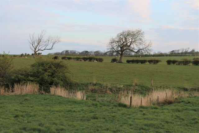
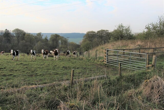
The woodland is primarily composed of various species of trees, including oak, birch, and pine, which create a dense forest canopy. This dense vegetation provides a sanctuary for a wide range of wildlife, such as red squirrels, roe deer, and numerous bird species. Nature enthusiasts often visit the area to observe and photograph these animals in their natural habitat.

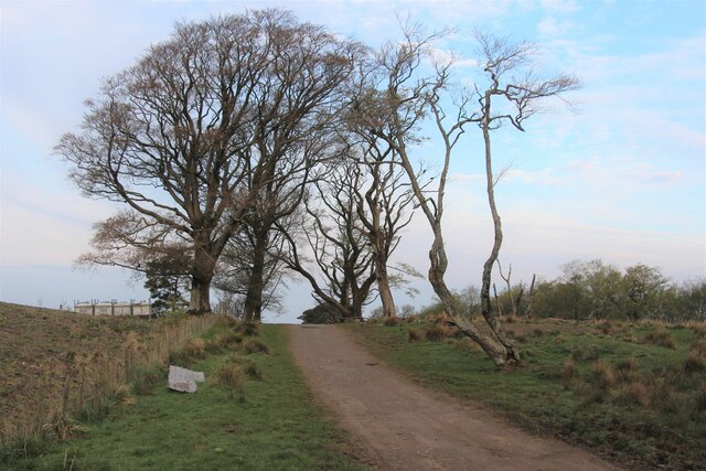
Haltriggs Strip offers several walking trails that wind through the forest, allowing visitors to explore its hidden gems. The paths are well-maintained, making it suitable for all ages and fitness levels. Along the trails, visitors can enjoy the peaceful ambiance, listen to the soothing sounds of nature, and breathe in the fresh, crisp air.

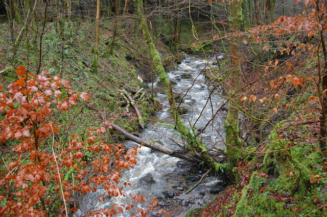
The woodland also features a small river that runs through it, adding to its charm. The river provides a habitat for various aquatic creatures, and its tranquil presence enhances the overall serenity of the environment. It also offers an opportunity for visitors to engage in activities such as fishing or simply sitting by the water's edge and enjoying the calming ambiance.

Haltriggs Strip is a true haven for nature lovers, offering a tranquil escape from the hustle and bustle of everyday life. Its natural beauty, diverse wildlife, and well-maintained trails make it a must-visit destination for anyone seeking a peaceful retreat in the heart of Ayrshire.

If you have any feedback on the listing, please let us know in the comments section below.

Haltriggs Strip Images

Images are sourced within 2km of 55.615294/-4.3810159 or Grid Reference NS5038. Thanks to Geograph Open Source API. All images are credited.

End-terrace on Maxwood Road
Waterside, Galston
Waterside, Galston
Sheltered corner at Castle Hill
Alton Burn Running to the left through the rushes.
Alton Burn
Running to the left through the rushes.
Downhill to East Newton
Cattle grazing on Judge's Hill
Barr Castle - Galston, East Ayrshire The present tower dates from the 16th century and was the family seat of the Lockhart family until 1670. It passed to the Campbell's of Cessnock and was used as a domicile. It has been used as a barn, a grain store, a town jail, a cholera hospital, a wool store, a school and a religious meeting house.
It was acquired by the Duke of Portland for the local Masonic  Lodge, St Peter 331 in 1894, who have maintained it until the present day.
Barr Castle used to be known as Lockhart’s Tower. One of the Lockharts of Barr is reputed to have been one of the men associated with returning Robert the Bruce's heart to Scotland after it had been lost in a battle abroad by James Douglas who carried it to the Crusades as a dying wish of the famous King.
The Scottish Reformers William Wishart and John Knox preached in this place A.D. 1545 and 1556 respectively.
Barr Castle - Galston, East Ayrshire
The present tower dates from the 16th century and was the family seat of the Lockhart family until 1670. It passed to the Campbell's of Cessnock and was used as a domicile. It has been used as a barn, a grain store, a town jail, a cholera hospital, a wool store, a school and a religious meeting house. It was acquired by the Duke of Portland for the local Masonic Lodge, St Peter 331 in 1894, who have maintained it until the present day. Barr Castle used to be known as Lockhart’s Tower. One of the Lockharts of Barr is reputed to have been one of the men associated with returning Robert the Bruce's heart to Scotland after it had been lost in a battle abroad by James Douglas who carried it to the Crusades as a dying wish of the famous King. The Scottish Reformers William Wishart and John Knox preached in this place A.D. 1545 and 1556 respectively.
St Sophia's Church - Galston, East Ayrshire St Sophia's church was constructed 1885-6 and designed by architect Sir Robert Rowand Anderson. The third Marquess of Bute commissioned Anderson to bring to Galston this echo of the Byzantine Empire.
 The church is a distinctive building based on Hagia Sophia in Istanbul, which the Marquess had visited and in memory of his mother Lady Sophia Hastings of Loudoun Castle.
 Built in red brick the church is cruciform in shape with a central round tower topped with a conical roof of red tiles.
St Sophia's Church - Galston, East Ayrshire
St Sophia's church was constructed 1885-6 and designed by architect Sir Robert Rowand Anderson. The third Marquess of Bute commissioned Anderson to bring to Galston this echo of the Byzantine Empire. The church is a distinctive building based on Hagia Sophia in Istanbul, which the Marquess had visited and in memory of his mother Lady Sophia Hastings of Loudoun Castle. Built in red brick the church is cruciform in shape with a central round tower topped with a conical roof of red tiles.
Barr Castle - Galston, East Ayrshire The present tower dates from the 16th century and was the family seat of the Lockhart family until 1670. It passed to the Campbell's of Cessnock and was used as a domicile. It has been used as a barn, a grain store, a town jail, a cholera hospital, a wool store, a school and a religious meeting house.
It was acquired in 1894 by the Duke of Portland for the local Masonic Lodge, St Peter 331, who have maintained it until the present day.
Barr Castle used to be known as Lockhart’s Tower. One of the Lockharts of Barr is reputed to have been one of the men associated with returning Robert the Bruce's heart to Scotland after it had been lost in a battle abroad by James Douglas who carried it to the Crusades as a dying wish of the famous King.
The Scottish Reformers William Wishart and John Knox preached in this place A.D. 1545 and 1556 respectively.
Barr Castle - Galston, East Ayrshire
The present tower dates from the 16th century and was the family seat of the Lockhart family until 1670. It passed to the Campbell's of Cessnock and was used as a domicile. It has been used as a barn, a grain store, a town jail, a cholera hospital, a wool store, a school and a religious meeting house. It was acquired in 1894 by the Duke of Portland for the local Masonic Lodge, St Peter 331, who have maintained it until the present day. Barr Castle used to be known as Lockhart’s Tower. One of the Lockharts of Barr is reputed to have been one of the men associated with returning Robert the Bruce's heart to Scotland after it had been lost in a battle abroad by James Douglas who carried it to the Crusades as a dying wish of the famous King. The Scottish Reformers William Wishart and John Knox preached in this place A.D. 1545 and 1556 respectively.
Trees in Dark Wood
Trees in Dark Wood
Ruined building, not on map Remains of a lime kiln, or similar, not sure.
Ruined building, not on map
Remains of a lime kiln, or similar, not sure.
Remains of Loudoun Castle   c 2003 This view used to greet visitors to the now closed Loudoun Castle Theme Park.
Image shows the castle as it was in 2003.
Remains of Loudoun Castle c 2003
This view used to greet visitors to the now closed Loudoun Castle Theme Park. Image shows the castle as it was in 2003.
Small Burn Small burn in Big Wood.
Small Burn
Small burn in Big Wood.
Church Lane at Cross Street, Galston
Portland Arms Hotel, Galston On the corner of Brewland Street and Cross Street
Portland Arms Hotel, Galston
On the corner of Brewland Street and Cross Street
Buck's Head, Bridge Street, Galston
Bridge Street, Galston
Polwarth Street, Galston
Show me another place!

Haltriggs Strip is located at Grid Ref: NS5038 (Lat: 55.615294, Lng: -4.3810159)

Unitary Authority: East Ayrshire

Police Authority: Ayrshire

What 3 Words

///desiring.create.student. Near Galston, East Ayrshire

Related Wikis

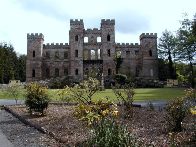
Loudoun Castle (theme park)

Loudoun Castle was a theme park set around the ruins of the 19th century Loudoun Castle near Galston, in the Loudoun area of Ayrshire, Scotland, United...

Loudoun Castle

Loudoun Castle is a ruined 19th-century country house near Galston, in the Loudoun area of Ayrshire, Scotland. The ruins are protected as a category A...

Loudoun Academy, Galston

Loudoun Academy is a secondary school in the outskirts of Galston, East Ayrshire, in Scotland serving the Loudoun district which includes the Irvine Valley...

Twist n' Shout

Twist n' Shout is a steel looping roller coaster located at Loudoun Castle Theme Park in Galston, south-west Scotland. It opened in 2003 as a part of the...

Loudoun Kirk

Loudoun Kirk is a disused church located about one mile west of Loudoun Castle, East Ayrshire. It served as Loudoun's parish church until some point after...

Portland Park, Galston

Portland Park was a football ground in Galston, Scotland. It was the home ground of Galston F.C. == History == Galston were playing at Portland Park when...

Galston parish

Galston Parish is situated in East Ayrshire, Scotland, some five to ten miles east of Kilmarnock and roughly encompasses the southern half of the Upper...

Galston, East Ayrshire

Galston (Lowland Scots: Gauston, Scottish Gaelic: Baile nan Gall) is a municipality in East Ayrshire, Scotland, which has a population of 5,001 (2001)...

Nearby Amenities

Located within 500m of 55.615294,-4.3810159
Barrier: block
Lat/Long: 55.6153261/-4.3776983
Turning Circle
Lat/Long: 55.6135998/-4.3828712
Ford: yes
Lat/Long: 55.6159251/-4.3841496
Barrier: cattle_grid
Lat/Long: 55.6171246/-4.3841403
Barrier: cattle_grid
Lat/Long: 55.6139514/-4.3814513
Power: pole
Lat/Long: 55.6147844/-4.3889155
Power: pole
Lat/Long: 55.6151186/-4.3879133
Power: pole
Lat/Long: 55.6139842/-4.3810371
Power: pole
Lat/Long: 55.6141442/-4.380412
Power: pole
Lat/Long: 55.6143196/-4.379714
Power: pole
Lat/Long: 55.6144843/-4.3790431
The data included in this document is from www.openstreetmap.org. The data is made available under ODbL.

Have you been to Haltriggs Strip?

Leave your review of Haltriggs Strip below (or comments, questions and feedback).