Braid Wood
Wood, Forest in Ayrshire
Scotland
Braid Wood

Braid Wood is a picturesque forest located in the county of Ayrshire, Scotland. Nestled between the towns of Dalry and Kilbirnie, this woodland spans approximately 100 hectares and offers a tranquil escape from the bustling urban areas nearby.
Braid Wood is known for its diverse range of tree species, including oak, beech, and birch, which create a stunning tapestry of colors throughout the seasons. The forest is home to a variety of wildlife, including roe deer, red squirrels, and numerous bird species, making it a popular destination for nature enthusiasts and wildlife photographers.
The woodland is crisscrossed with a network of well-maintained footpaths, allowing visitors to explore its beauty at their own pace. These paths lead to several viewpoints, providing breathtaking vistas of the surrounding countryside, including the rolling hills and nearby Lochwinnoch Nature Reserve.
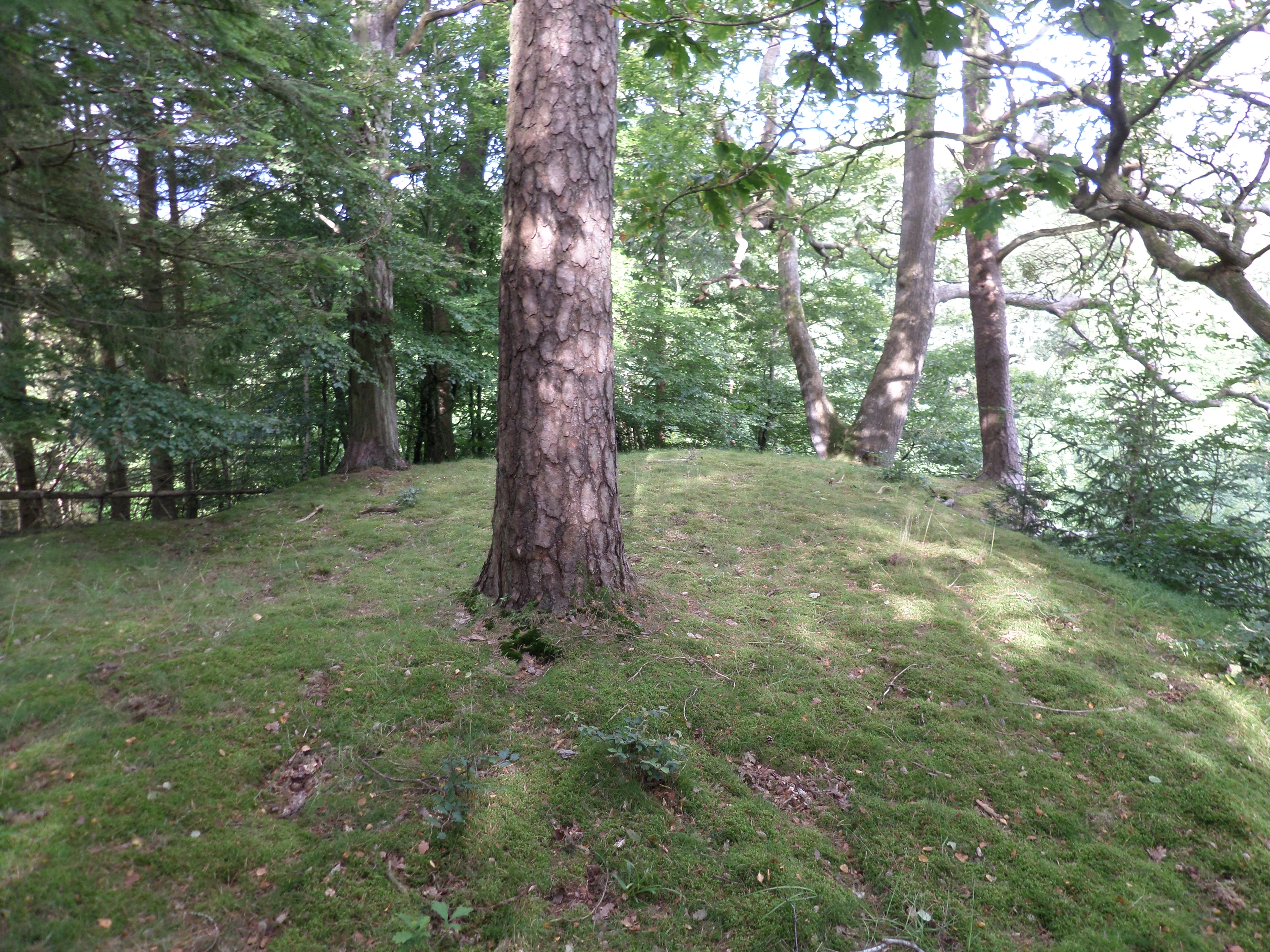
In addition to its natural beauty, Braid Wood also holds historical significance. The remains of a medieval motte-and-bailey castle can be found within the forest, serving as a reminder of the area's rich past.
Braid Wood is a haven for outdoor activities such as walking, cycling, and birdwatching. The forest is also a popular spot for picnicking and family outings, with designated areas equipped with picnic tables and benches.
Overall, Braid Wood offers a peaceful retreat where visitors can immerse themselves in the beauty of nature, explore its rich history, and enjoy a range of outdoor activities.
If you have any feedback on the listing, please let us know in the comments section below.
Braid Wood Images
Images are sourced within 2km of 55.47917/-4.3739997 or Grid Reference NS5023. Thanks to Geograph Open Source API. All images are credited.


Braid Wood is located at Grid Ref: NS5023 (Lat: 55.47917, Lng: -4.3739997)
Unitary Authority: East Ayrshire
Police Authority: Ayrshire
What 3 Words
///anchors.email.rationed. Near Ochiltree, East Ayrshire
Nearby Locations
Related Wikis

Auchinleck Castle, East Ayrshire
Auchinleck Castle was a castle built on a rocky promontory on the eastern bank of the Lugar Water, East Ayrshire, Scotland across the river from Ochiltree...
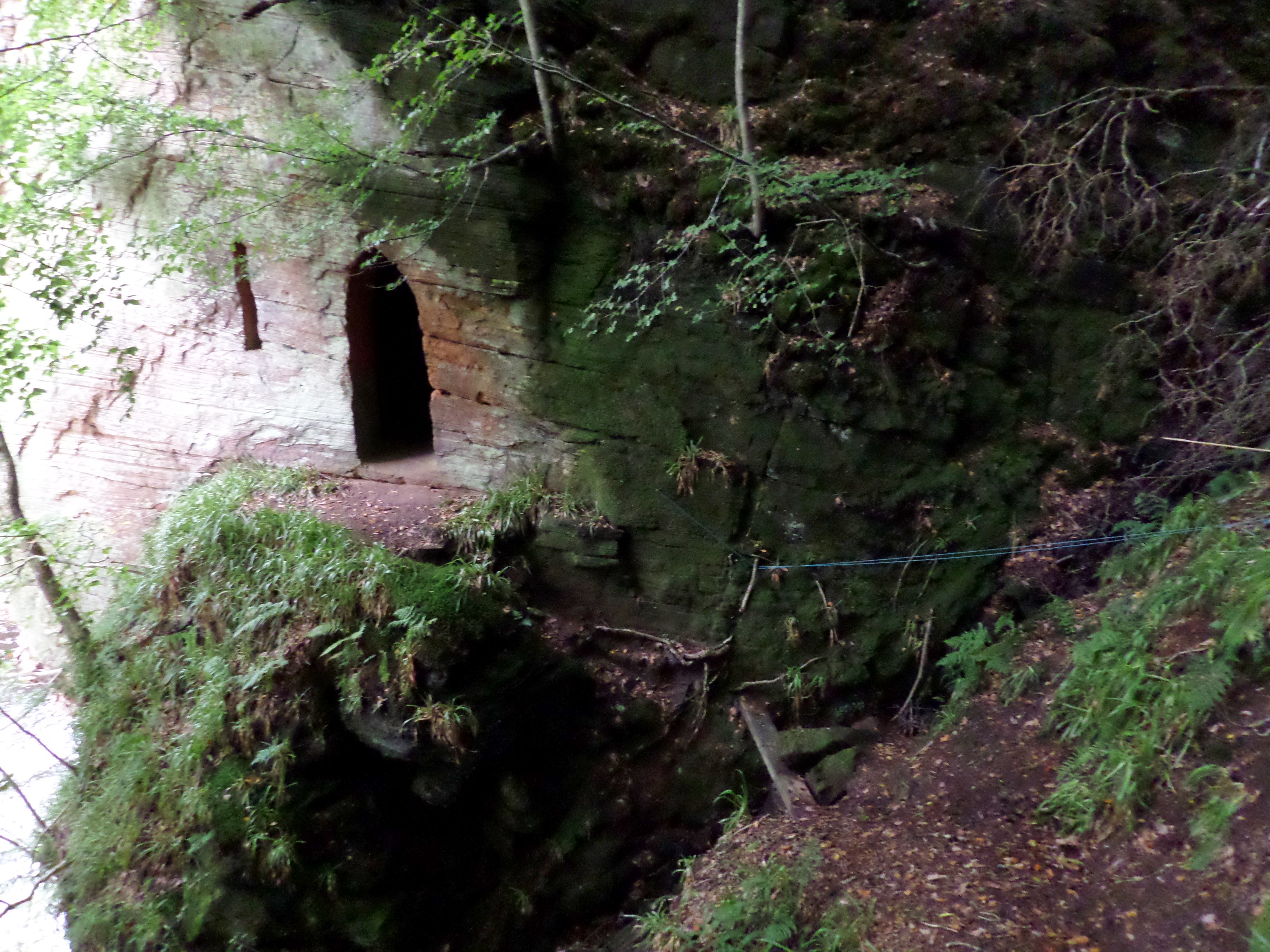
Wallace's Cave, Auchinleck
Wallace's Cave in the Lugar Gorge at Auchinleck in the Parish of Auchinleck is an 18th-century grotto contemporary with Dr Johnson's Summerhouse, also...
Ochiltree Castle, East Ayrshire
Ochiltree Castle (meaning: "the lofty dwelling-place") was a castle built on a promontory by the Lugar Water, East Ayrshire, Scotland across from Auchinleck...
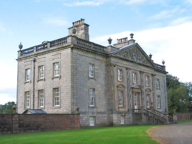
Auchinleck House
Auchinleck House is an 18th-century mansion in Scotland. It is situated near the town of Auchinleck near Cumnock and Ayr in East Ayrshire. The Auchinleck...
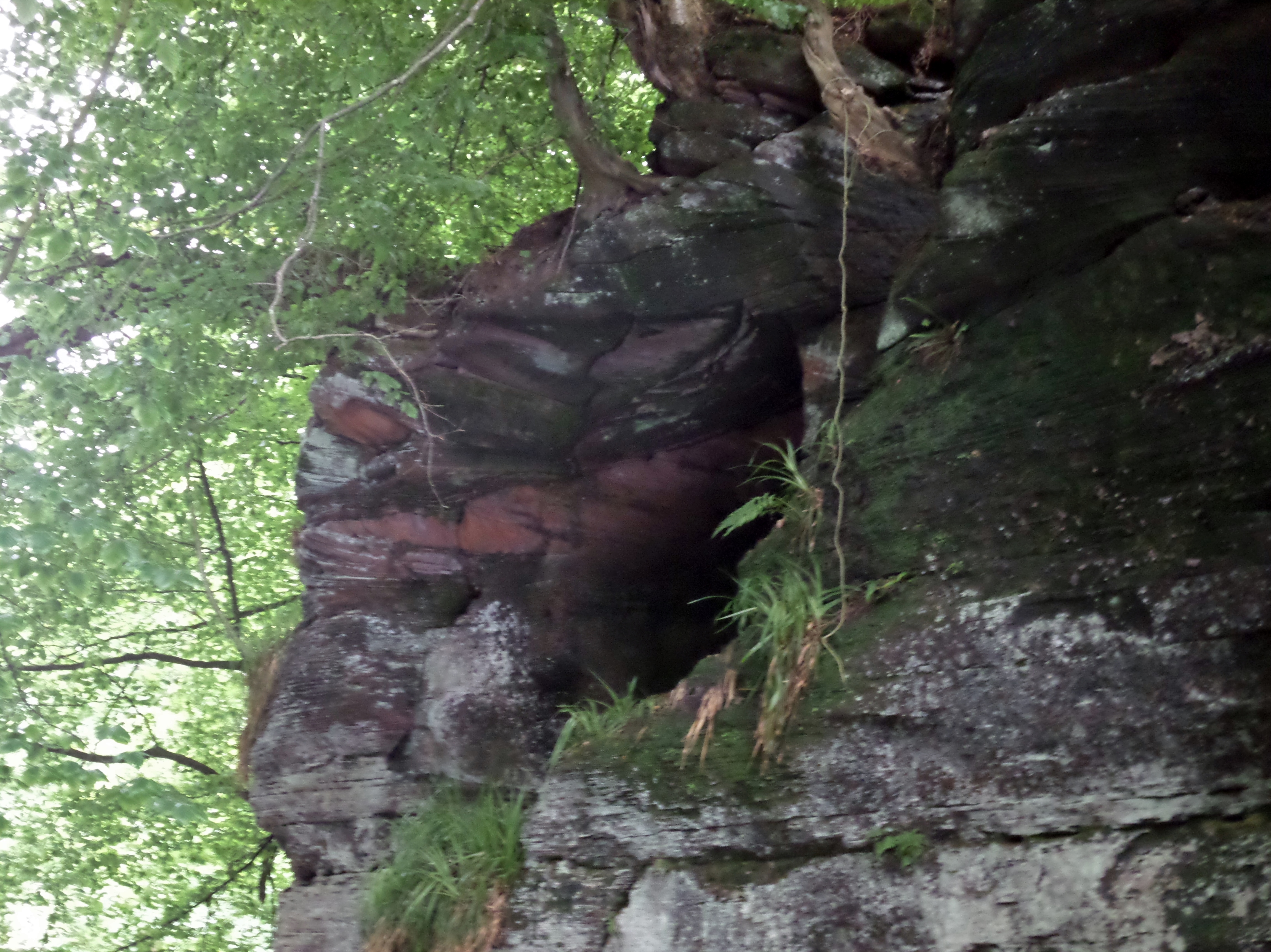
Peden's Cave (Auchinbay)
Peden's Cave is at least partly artificial and is set into a craggy outcrop of red sandstone rocks overlooking the River Lugar just below the farm of Auchinbay...

Ochiltree
Ochiltree is a conservation village in East Ayrshire, Scotland, near Auchinleck and Cumnock. It is one of the oldest villages in East Ayrshire, with archaeological...

Haugh, East Ayrshire
Haugh or The Haugh is a small village or hamlet in East Ayrshire, Parish of Mauchline, Scotland. The habitation is situated about two and a half miles...

Lugar Water
The Lugar Water, or River Lugar, is created by the confluence of the Bellow Water and the Glenmuir Water, just north of Lugar, both of which flow from...
Related Videos

Catrine to Failford on the RIVER AYR WAY
A walk on the River Ayr Way from Catrine to Failford. Along the way we pass under the awesome Ballochmyle Viaduct, which ...

GET THE FERRY AND AN OLD CASTLE
00:00 Opening sequence 00:20 Recap and Site revue 03:05 Chinese 04:11 Night pics 04:19 TentBox 04:40 Ellie 05:50 Was it ...

The remarkable Peden's Cove (4K)
Peden's Cove was named after Alexander Peden, where his remarkable history comes into this area. A look at the cove where he ...

Drone CRASH Into Britain's Tallest Viaduct | The Ballochmyle Viaduct
A day out EXPLORING a country walk that leads to Britain's Highest Viaduct. The Ballochmyle Viaduct overlooks the Scottish ...
Nearby Amenities
Located within 500m of 55.47917,-4.3739997Have you been to Braid Wood?
Leave your review of Braid Wood below (or comments, questions and feedback).