Broomhouse Braes

Wood, Forest in Ayrshire

Scotland

Broomhouse Braes

Auchinleck Estate Unnamed ruin beside the Lugar Water.
This photo was taken on the 25th June 2022.
Auchinleck Estate Credit: Rab McMurdo

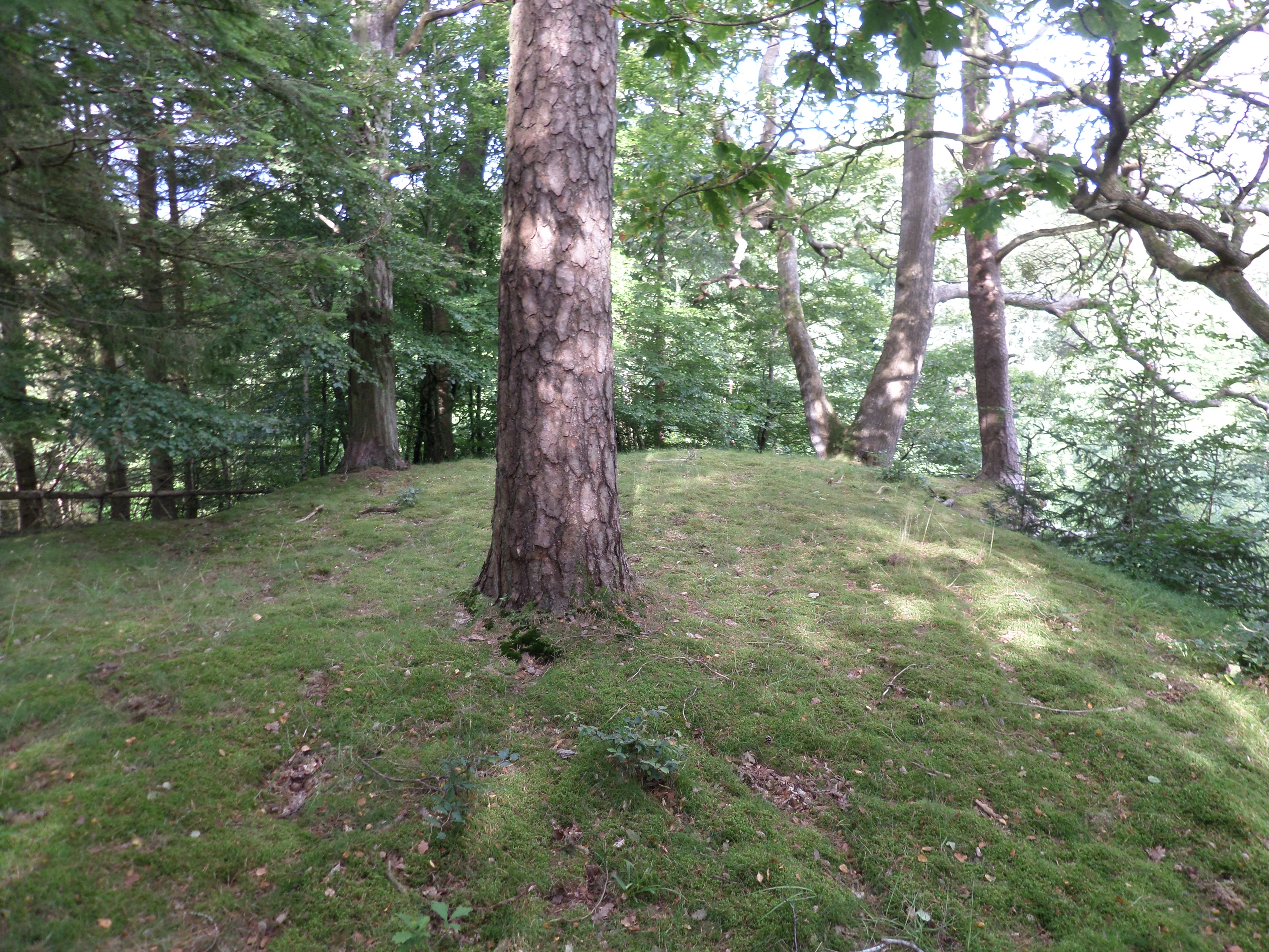
Broomhouse Braes is a picturesque wood located in Ayrshire, Scotland. Nestled in the hills, this enchanting forest covers an area of approximately 100 hectares and is surrounded by breathtaking scenery. It is recognized as a Site of Special Scientific Interest due to its rich biodiversity and historical significance.

The wood is predominantly composed of native broadleaved trees, including oak, birch, and rowan, which provide a habitat for a wide variety of wildlife. Visitors to Broomhouse Braes may catch a glimpse of red squirrels, badgers, and various species of birds such as the great spotted woodpecker and tawny owl. The forest floor is adorned with an array of wildflowers, including bluebells, primroses, and wood sorrel, creating a vibrant and colorful landscape during the spring and summer months.

Broomhouse Braes holds a significant place in Scottish history. The woodland has remnants of ancient settlements, with evidence of Iron Age and medieval farming activities. There are also traces of old boundary walls, indicating the historical use of the land for agriculture and grazing.

The wood offers several well-maintained walking trails, allowing visitors to explore its natural beauty at their own pace. These paths meander through the forest, offering breathtaking views of the surrounding countryside and providing opportunities for peaceful solitude or family picnics.

Broomhouse Braes is a true gem in Ayrshire, offering a haven for nature enthusiasts, history buffs, and those simply seeking tranquility in a stunning woodland setting.

If you have any feedback on the listing, please let us know in the comments section below.

Broomhouse Braes Images

Images are sourced within 2km of 55.473762/-4.3743548 or Grid Reference NS5022. Thanks to Geograph Open Source API. All images are credited.

Auchinleck Estate Unnamed ruin beside the Lugar Water.
This photo was taken on the 25th June 2022.
Auchinleck Estate
Unnamed ruin beside the Lugar Water. This photo was taken on the 25th June 2022.
Auchinleck Castle A wee alcove, or shelf, cut in the solid rock inside Auchinleck Castle.
This photo was taken on the 25th June 2022.
Auchinleck Castle
A wee alcove, or shelf, cut in the solid rock inside Auchinleck Castle. This photo was taken on the 25th June 2022.
Wallace's Cave Inside Wallace's Cave.
This photo was taken on the 25th June 2022.
Wallace's Cave
Inside Wallace's Cave. This photo was taken on the 25th June 2022.
Snowdrop Walk Snowdrop Walk between the two Auchinleck castles.
Snowdrop Walk
Snowdrop Walk between the two Auchinleck castles.
Auchinleck House, Ayrshire Built in the late 1750's for Alexander Boswell, Lord Auchinleck, a Scottish judge and father of James Boswell, the biographer of Dr Samuel Johnson.
See <span class="nowrap"><a title="http://canmore.rcahms.gov.uk/en/site/43613/details/auchinleck+house/" rel="nofollow ugc noopener" href="http://canmore.rcahms.gov.uk/en/site/43613/details/auchinleck+house/">Link</a><img style="margin-left:2px;" alt="External link" title="External link - shift click to open in new window" src="https://s1.geograph.org.uk/img/external.png" width="10" height="10"/></span>
Auchinleck House, Ayrshire
Built in the late 1750's for Alexander Boswell, Lord Auchinleck, a Scottish judge and father of James Boswell, the biographer of Dr Samuel Johnson. See LinkExternal link
Ochiltree, Ayrshire The Junction of Main Street and Mauchline Road in the conservation village of Ochiltree, Ayrshire.  The building on the right is the cosy Commercial Inn, where you will find friendly locals.  Worth a visit for a game of pool and a guid blether!
Ochiltree, Ayrshire
The Junction of Main Street and Mauchline Road in the conservation village of Ochiltree, Ayrshire. The building on the right is the cosy Commercial Inn, where you will find friendly locals. Worth a visit for a game of pool and a guid blether!
Ochiltree in the Snow This view shows the old brig over the River Lugar, next to the Old Cemetery. On the horizon can be seen the winding gear from the disused Barony Colliery. The winding gear has been left as a kind of memorial to those who died whilst working there.
Ochiltree in the Snow
This view shows the old brig over the River Lugar, next to the Old Cemetery. On the horizon can be seen the winding gear from the disused Barony Colliery. The winding gear has been left as a kind of memorial to those who died whilst working there.
The Auld Cemetery, Ochiltree The snow on the gravestones made this scene all the more poignant.
The Auld Cemetery, Ochiltree
The snow on the gravestones made this scene all the more poignant.
Auchinleck House
Auchinleck House
Netherton Farm, Ochiltree
New Houses at Ochiltree
Cattle grazing
Cattle grazing
Farm building on hill near Syke
Right Angle on B7036
Derelict Farm Steading. Beautiful buildings in need of repair.
Derelict Farm Steading.
Beautiful buildings in need of repair.
Ochiltree Dam A major obstacle to the upward migration of Salmon. In the past it was not uncommon to see poachers gaffing fish as they came up the dam.
Ochiltree Dam
A major obstacle to the upward migration of Salmon. In the past it was not uncommon to see poachers gaffing fish as they came up the dam.
Over Fork Over Unusual sign on the side of a building.  Apparently the motto of the Cunningham clan <span class="nowrap"><a title="http://cunninghamhouse.org/default.aspx" rel="nofollow ugc noopener" href="http://cunninghamhouse.org/default.aspx">Link</a><img style="margin-left:2px;" alt="External link" title="External link - shift click to open in new window" src="https://s1.geograph.org.uk/img/external.png" width="10" height="10"/></span>. The crest on the building features a rabbit each side of the 'Y'.  Follow the link for the story.
Over Fork Over
Unusual sign on the side of a building. Apparently the motto of the Cunningham clan LinkExternal link. The crest on the building features a rabbit each side of the 'Y'. Follow the link for the story.
Old road bridge over the Lugar Water at Ochiltree
Show me another place!

Broomhouse Braes is located at Grid Ref: NS5022 (Lat: 55.473762, Lng: -4.3743548)

Unitary Authority: East Ayrshire

Police Authority: Ayrshire

What 3 Words

///spends.shirtless.custodial. Near Ochiltree, East Ayrshire

Related Wikis

Auchinleck Castle, East Ayrshire

Auchinleck Castle was a castle built on a rocky promontory on the eastern bank of the Lugar Water, East Ayrshire, Scotland across the river from Ochiltree...

Ochiltree Castle, East Ayrshire

Ochiltree Castle (meaning: "the lofty dwelling-place") was a castle built on a promontory by the Lugar Water, East Ayrshire, Scotland across from Auchinleck...

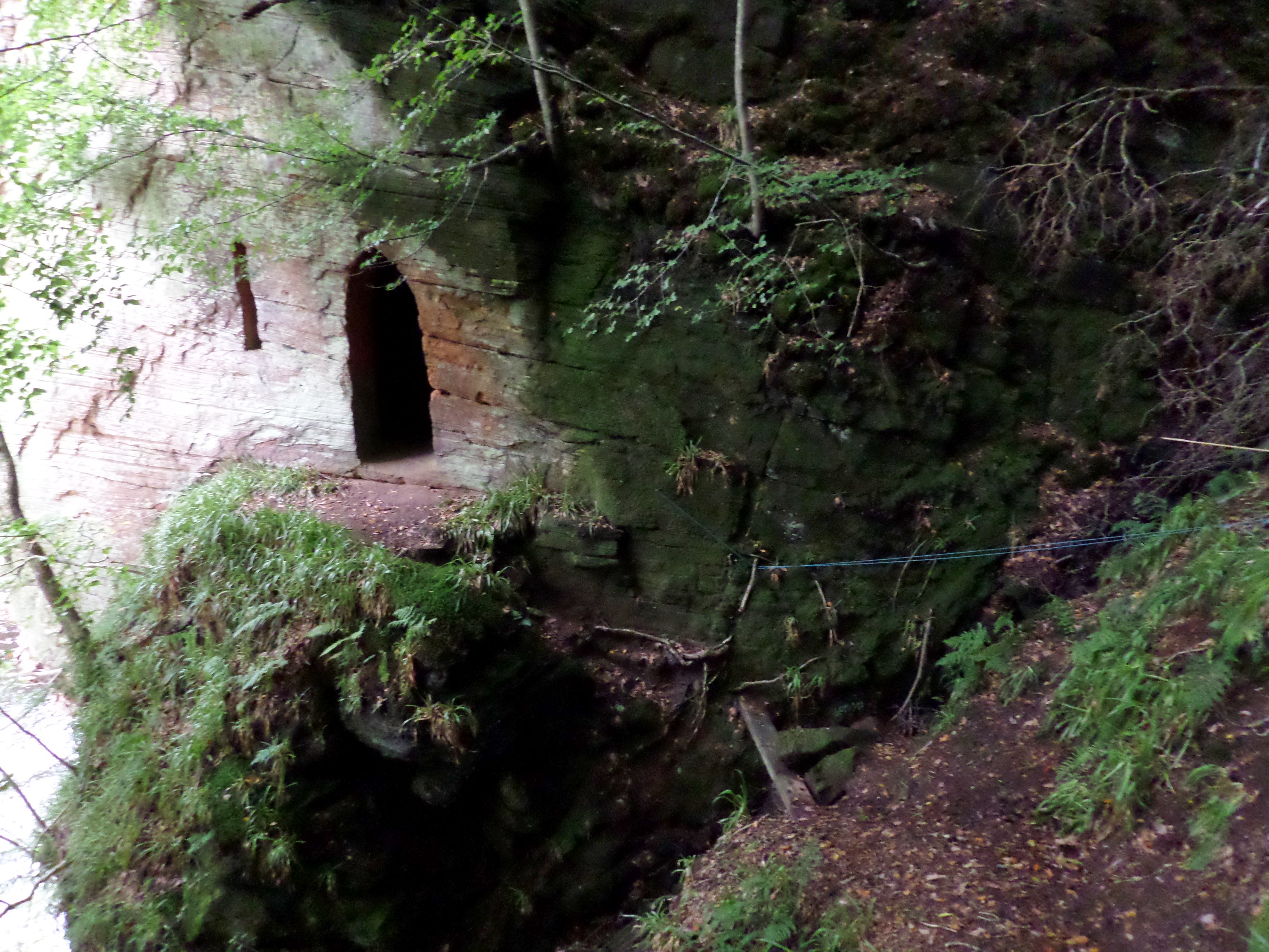
Wallace's Cave, Auchinleck

Wallace's Cave in the Lugar Gorge at Auchinleck in the Parish of Auchinleck is an 18th-century grotto contemporary with Dr Johnson's Summerhouse, also...
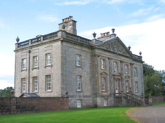
Auchinleck House

Auchinleck House is an 18th-century mansion in Scotland. It is situated near the town of Auchinleck near Cumnock and Ayr in East Ayrshire. The Auchinleck...

Ochiltree

Ochiltree is a conservation village in East Ayrshire, Scotland, near Auchinleck and Cumnock. It is one of the oldest villages in East Ayrshire, with archaeological...

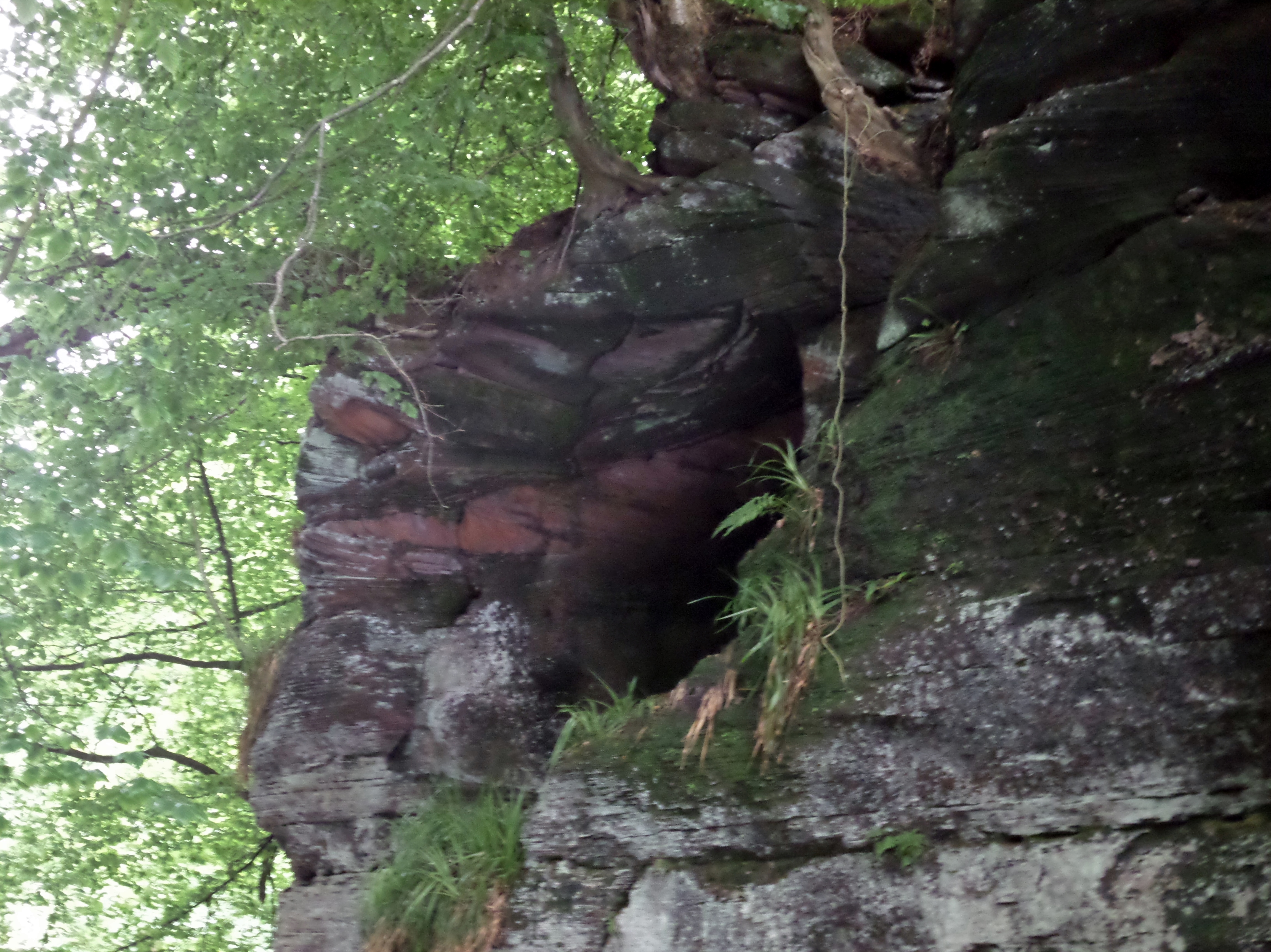
Peden's Cave (Auchinbay)

Peden's Cave is at least partly artificial and is set into a craggy outcrop of red sandstone rocks overlooking the River Lugar just below the farm of Auchinbay...
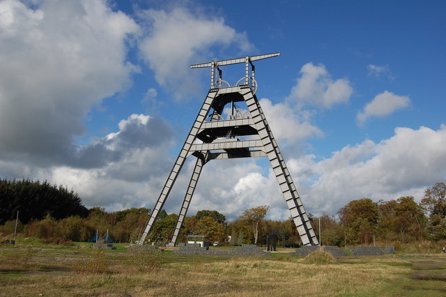
Barony A Frame

The Barony A Frame is a preserved headgear in East Ayrshire, Scotland, located 2 kilometres (1.2 mi) west of Auchinleck. One hundred and eighty feet high...

Lugar Water

The Lugar Water, or River Lugar, is created by the confluence of the Bellow Water and the Glenmuir Water, just north of Lugar, both of which flow from...

Nearby Amenities

Located within 500m of 55.473762,-4.3743548
Power: pole
Lat/Long: 55.4760826/-4.3679378
Power: pole
Lat/Long: 55.4765723/-4.3693131
Power: pole
Lat/Long: 55.4770582/-4.3706749
Power: pole
Lat/Long: 55.4775569/-4.3720524
Power: pole
Lat/Long: 55.4780286/-4.3733735
Broomhouse Braes
Natural: peak
Lat/Long: 55.4725711/-4.374386
Norris Well (river pool)
Historic: archaeological_site
Lat/Long: 55.4726447/-4.3754839
Braid Wood
Historic: monument
Lat/Long: 55.4767841/-4.3684843
Site of Broomhouse
Historic: ruins
Lat/Long: 55.4708283/-4.3715613
Former target range
Leisure: pitch
Sport: shooting
Lat/Long: 55.4701989/-4.3714995
Site of Well
Man Made: water_well
Lat/Long: 55.475088/-4.3694407
The data included in this document is from www.openstreetmap.org. The data is made available under ODbL.

Have you been to Broomhouse Braes?

Leave your review of Broomhouse Braes below (or comments, questions and feedback).