Boblainy Forest

Wood, Forest in Inverness-shire

Scotland

Boblainy Forest

Log stacks, Boblainy Forest Stacks of timber alongside the track, on a grey evening.
Log stacks, Boblainy Forest Credit: Craig Wallace

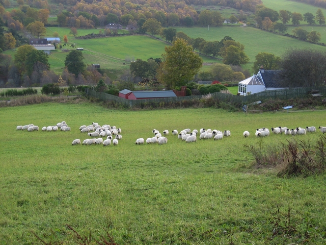
Boblainy Forest is a picturesque woodland located in Inverness-shire, Scotland. Covering an area of approximately 2,500 hectares, it is situated on the northern slopes of the Cairngorm Mountains, near the village of Carrbridge. The forest is part of the larger Forest Park area, which also includes Glenmore and Abernethy Forests, forming an extensive network of woodlands.

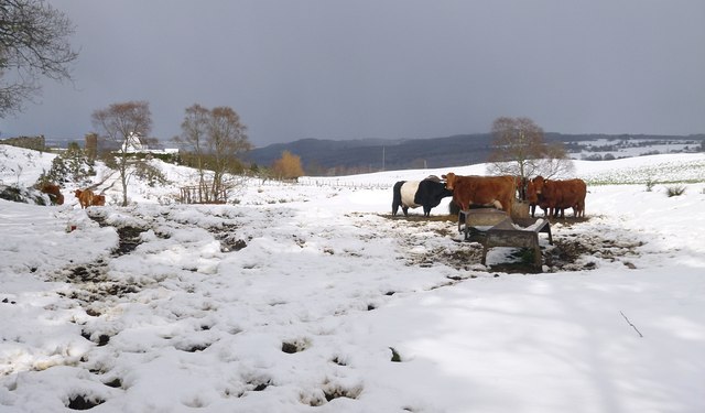
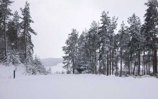
Boblainy Forest is characterized by its diverse range of tree species, including Scots pine, birch, rowan, and oak. The forest boasts a rich biodiversity, providing a habitat for numerous wildlife species such as red squirrels, roe deer, and a variety of bird species.

The forest offers a range of recreational activities for visitors to enjoy. There are several well-marked trails that meander through the woodland, providing opportunities for hiking, walking, and cycling. The trails offer stunning views of the surrounding mountains and the River Dulnain flowing through the forest.

For those interested in history, Boblainy Forest is home to the ruins of an old hunting lodge, which adds a touch of intrigue to the area. The lodge, dating back to the 18th century, is a reminder of the forest's long-standing connection to hunting and its historical significance.

Overall, Boblainy Forest is a natural haven for outdoor enthusiasts, nature lovers, and history buffs alike. Its tranquil atmosphere, diverse flora and fauna, and captivating scenery make it a must-visit destination for anyone seeking a peaceful retreat in the heart of the Scottish Highlands.

If you have any feedback on the listing, please let us know in the comments section below.

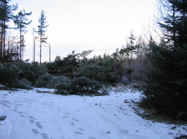
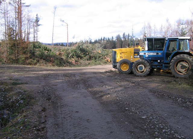
Boblainy Forest Images

Images are sourced within 2km of 57.409427/-4.5167277 or Grid Reference NH4838. Thanks to Geograph Open Source API. All images are credited.

Log stacks, Boblainy Forest Stacks of timber alongside the track, on a grey evening.
Log stacks, Boblainy Forest
Stacks of timber alongside the track, on a grey evening.
Minor track, Boblainy Forest Much of the surrounding area has been felled recently, but the smaller trees alongside the track have been left.
Minor track, Boblainy Forest
Much of the surrounding area has been felled recently, but the smaller trees alongside the track have been left.
Bench with a view, Boblainy Forest A view north towards Ben Wyvis. The cleared area in the foreground is now getting covered by bracken and gorse.

A similar view last year. <a href="https://www.geograph.org.uk/photo/6419555">NH4937 : Bench with a view, Boblainy Forest</a>
Bench with a view, Boblainy Forest
A view north towards Ben Wyvis. The cleared area in the foreground is now getting covered by bracken and gorse. A similar view last year. NH4937 : Bench with a view, Boblainy Forest
Track, Boblainy Forest Looking back down the hill. Conifer trees alongside the track, including spruce and pine.
Track, Boblainy Forest
Looking back down the hill. Conifer trees alongside the track, including spruce and pine.
Track, Boblainy Forest Looking down the hill. Some tall pine trees alongside the track.
Track, Boblainy Forest
Looking down the hill. Some tall pine trees alongside the track.
Cleared forest, by Boblainy Looks like this area was felled a few years ago. A few birch trees left standing.
Cleared forest, by Boblainy
Looks like this area was felled a few years ago. A few birch trees left standing.
Cleared forest, by Clunevackie The edge of a large area of cleared forest. The ground is covered by brash.
Cleared forest, by Clunevackie
The edge of a large area of cleared forest. The ground is covered by brash.
Cleared forest, by Clunevackie A large area of cleared forest, the ground is covered by brash.
Cleared forest, by Clunevackie
A large area of cleared forest, the ground is covered by brash.
Fallen trees across the track Trees blocking the main track through Boblainy Forest, probably felled in the recent strong winds. A Forestry Commission marker post is visible in the centre, behind a fallen tree.

It is possible to avoid this obstruction by following the track off to the left, which goes the long way around this triangular junction. The footprints show a few people have done this recently.
Fallen trees across the track
Trees blocking the main track through Boblainy Forest, probably felled in the recent strong winds. A Forestry Commission marker post is visible in the centre, behind a fallen tree. It is possible to avoid this obstruction by following the track off to the left, which goes the long way around this triangular junction. The footprints show a few people have done this recently.
Forest track down the hill This track was upgraded last year, with this gate added. The gate is usually locked, but there is space around the sides for pedestrians or cyclists. There is a sign warning of "Timber Operations Ahead", but there didn't seem to be much happening today.
Some houses and fields near Femnock and Boblainy are visible in the distance.
Forest track down the hill
This track was upgraded last year, with this gate added. The gate is usually locked, but there is space around the sides for pedestrians or cyclists. There is a sign warning of "Timber Operations Ahead", but there didn't seem to be much happening today. Some houses and fields near Femnock and Boblainy are visible in the distance.
Valley of the Bruiach Burn Much of the forest on the slopes either side of the burn was felled a few years ago. It looks like not much has been replanted - instead the area is becoming covered with bushes, heather, and a few small trees.
Valley of the Bruiach Burn
Much of the forest on the slopes either side of the burn was felled a few years ago. It looks like not much has been replanted - instead the area is becoming covered with bushes, heather, and a few small trees.
Footbridge over the Bruiach Burn This bridge was built here fairly recently, probably sometime last year. 
I'm not sure why it is here, as it doesn't seem to lead to anywhere on the west side. Though you could cut across fields to the road or houses at Femnock.
Footbridge over the Bruiach Burn
This bridge was built here fairly recently, probably sometime last year. I'm not sure why it is here, as it doesn't seem to lead to anywhere on the west side. Though you could cut across fields to the road or houses at Femnock.
Abandoned van, in Boblainy forest It looks like this van has been pushed off the forest track and down the hill. It has been here for quite a few years now, and is now rather rusty.
The van is a Ford Escort Mk3 or Mk4, dating from the 1980s.

The fence on the right is the boundary of the Forestry Commission land.
Abandoned van, in Boblainy forest
It looks like this van has been pushed off the forest track and down the hill. It has been here for quite a few years now, and is now rather rusty. The van is a Ford Escort Mk3 or Mk4, dating from the 1980s. The fence on the right is the boundary of the Forestry Commission land.
View across Loch a' Bhròn I think this loch was once surrounded by forest, but much of it was cleared a number of years ago. This area doesn't seem to have been replanted, and it has now become moorland, with some boggy bits beside the loch.
It is still shown as forest on the OS maps.
View across Loch a' Bhròn
I think this loch was once surrounded by forest, but much of it was cleared a number of years ago. This area doesn't seem to have been replanted, and it has now become moorland, with some boggy bits beside the loch. It is still shown as forest on the OS maps.
Track junction, in Boblainy Forest This is the main track through Boblainy Forest, with a minor track branching off to the left. 
Parked on the right is a Komatsu grader, and a tractor with a roller behind it. It looks like they have been repairing the track.

For this junction last December, see <a href="https://www.geograph.org.uk/photo/2733012">NH4739 : Fallen trees across the track</a>
Track junction, in Boblainy Forest
This is the main track through Boblainy Forest, with a minor track branching off to the left. Parked on the right is a Komatsu grader, and a tractor with a roller behind it. It looks like they have been repairing the track. For this junction last December, see NH4739 : Fallen trees across the track
Minor track through the forest I don't think this track is used very often. It is very muddy in places, and there are several fallen trees across it.
It seems it is not marked on the OS 1:50K map, but is on the larger scales.
Minor track through the forest
I don't think this track is used very often. It is very muddy in places, and there are several fallen trees across it. It seems it is not marked on the OS 1:50K map, but is on the larger scales.
Cattle in the snow, by Achnacloich A group of cattle gathered around a feeder.
The track along the side of the field is often rather muddy, today it is also covered by snow. The house and farm buildings at Achnacloich are in the distance on the left of the photo.
Cattle in the snow, by Achnacloich
A group of cattle gathered around a feeder. The track along the side of the field is often rather muddy, today it is also covered by snow. The house and farm buildings at Achnacloich are in the distance on the left of the photo.
Track junction in the snow The main track through Boblainy Forest - between Ardendrain and Culburnie - is on the left of the photo. This route is marked by a red Forestry Commission marker post. Another track branches off to the right.
Track junction in the snow
The main track through Boblainy Forest - between Ardendrain and Culburnie - is on the left of the photo. This route is marked by a red Forestry Commission marker post. Another track branches off to the right.
Show me another place!

Boblainy Forest is located at Grid Ref: NH4838 (Lat: 57.409427, Lng: -4.5167277)

Unitary Authority: Highland

Police Authority: Highlands and Islands

What 3 Words

///games.mixers.bandaged. Near Drumnadrochit, Highland

Nearby Locations

Boblainy Forest

Related Wikis

Culnaskiach Falls

Culnaskiach Falls is a waterfall in Boblainy Forest, to the south of the village of Kiltarlity, in the Highland council area of Scotland. It is on a small...

Ardendrain

Ardendrain (Scottish Gaelic: Àirde an Droigheann, meaning "Height of the Blackthorn) is a scattered hamlet in the Highland council area of Scotland. It...
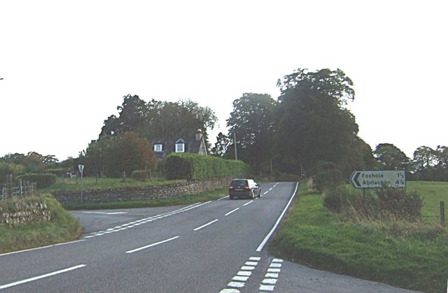
Foxhole, Scotland

Foxhole (Scottish Gaelic: A 'Bhog solla) is a small hamlet in the Highland council area of Scotland. It is 2 miles (3.2 km) south of the village of Kiltarlity...

Glaichbea

Glaichbea is a small hamlet in the Highland council area, located directly south of Camault Muir in the Highlands of Scotland. It is located 3.8 miles...

Nearby Amenities

Located within 500m of 57.409427,-4.5167277
Barrier: cattle_grid
Lat/Long: 57.4133029/-4.5146917
Turning Circle
Lat/Long: 57.4064152/-4.5170382
Clunevackie
Place: hamlet
Lat/Long: 57.4065226/-4.5175368
Power: pole
Lat/Long: 57.4063493/-4.5175509
Power: pole
Lat/Long: 57.4068815/-4.517161
Power: pole
Lat/Long: 57.4073929/-4.5167746
Power: pole
Lat/Long: 57.4079179/-4.5163343
Power: pole
Lat/Long: 57.4085994/-4.5158688
Power: pole
Lat/Long: 57.4091841/-4.5155008
Power: pole
Lat/Long: 57.4097906/-4.515195
Power: pole
Lat/Long: 57.4104295/-4.514901
Power: pole
Lat/Long: 57.4111056/-4.5145985
Power: pole
Lat/Long: 57.4117012/-4.514333
Power: pole
Lat/Long: 57.412284/-4.5143582
Power: pole
Lat/Long: 57.4128451/-4.5144019
Power: pole
Lat/Long: 57.4134071/-4.5144641
The data included in this document is from www.openstreetmap.org. The data is made available under ODbL.

Have you been to Boblainy Forest?

Leave your review of Boblainy Forest below (or comments, questions and feedback).