Capel Tygwydd

Settlement in Cardiganshire

Wales

Capel Tygwydd

Bridge At Cenarth Falls Looking towards a little cafe which may once have been an inn
Bridge At Cenarth Falls Credit: Deborah Tilley

Capel Tygwydd is a small village located in the county of Cardiganshire, Wales. Situated in the picturesque countryside, it is nestled among rolling hills and verdant valleys, offering breathtaking views of the surrounding natural beauty. The village is positioned at an elevation of 200 meters above sea level, providing a refreshing and tranquil atmosphere.

Capel Tygwydd is known for its rich historical heritage. The village's name translates to "Chapel of Good Weather" in English, and it is believed to have been named after the local chapel that once stood in the area. Although the chapel no longer exists, its legacy remains an integral part of the village's identity.

The community in Capel Tygwydd is close-knit and friendly, with a population of around 300 residents. The village is primarily residential, with traditional stone houses and cottages adding to its charm. The local economy is largely based on agriculture, with many residents engaged in farming activities.

In terms of amenities, Capel Tygwydd has a primary school, which serves the educational needs of the village and surrounding areas. The village also has a community center that hosts various social events and gatherings throughout the year, fostering a sense of community spirit.

For outdoor enthusiasts, Capel Tygwydd offers plenty of opportunities for exploration and recreation. The surrounding countryside is crisscrossed with footpaths and hiking trails, allowing residents and visitors to immerse themselves in nature.

Overall, Capel Tygwydd is a picturesque village with a rich history, a friendly community, and stunning natural surroundings, making it an ideal place for those seeking a peaceful and idyllic lifestyle.

If you have any feedback on the listing, please let us know in the comments section below.

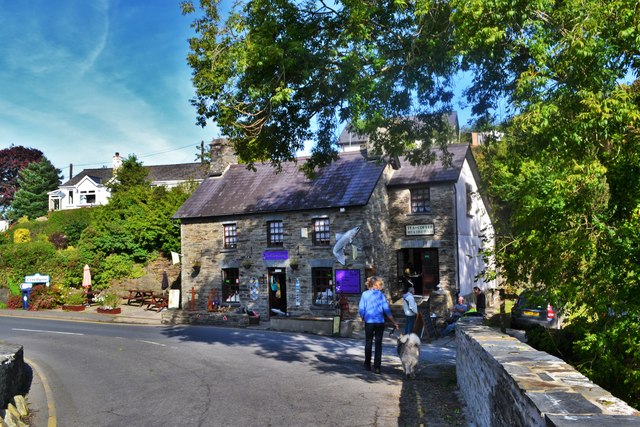
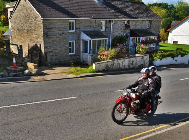
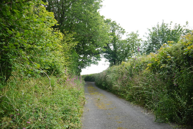
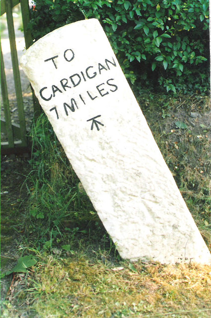
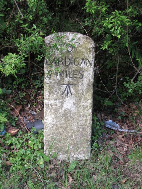
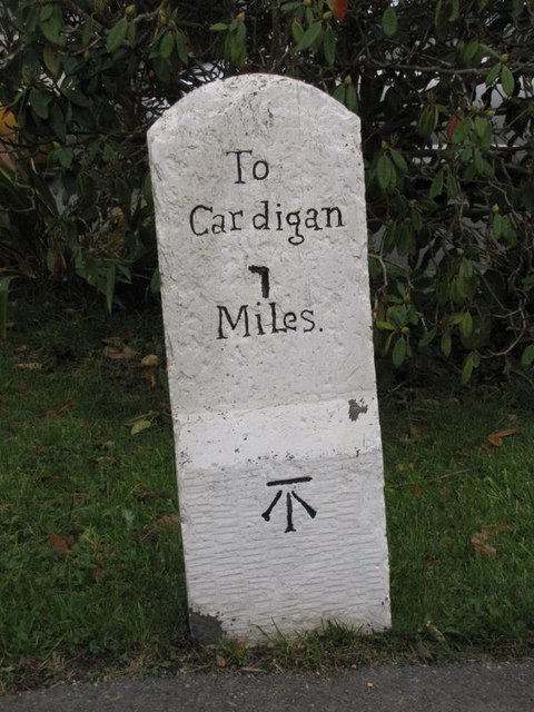
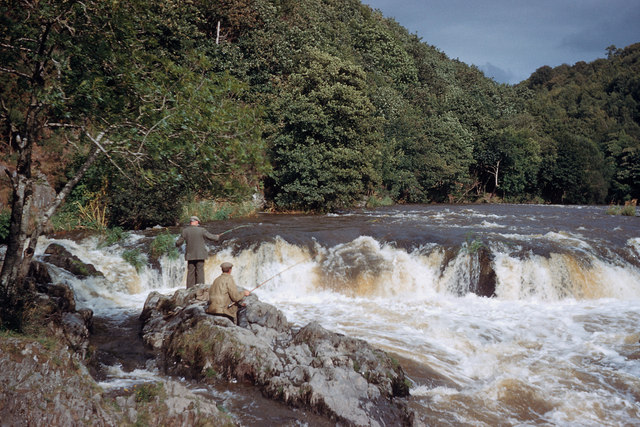
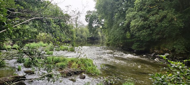
Capel Tygwydd Images

Images are sourced within 2km of 52.063715/-4.523607 or Grid Reference SN2743. Thanks to Geograph Open Source API. All images are credited.

Bridge At Cenarth Falls Looking towards a little cafe which may once have been an inn
Bridge At Cenarth Falls
Looking towards a little cafe which may once have been an inn
Classic Motorbike At Cenarth Heading through the village towards Newcastle Emlyn
Classic Motorbike At Cenarth
Heading through the village towards Newcastle Emlyn
The road up to Brongwyn This steep narrow lane almost overgrown with vegetation in places leads from the B4570 to the B4333.
The road up to Brongwyn
This steep narrow lane almost overgrown with vegetation in places leads from the B4570 to the B4333.
Old Milestone by the B4570, south east of Capel Tygwydd Cardigan tombstone by the B4570, in parish of Beulah (Ceredigion District), by "Milestone", South East of Capel Tygwydd, in front of domestic hedge.

Inscription reads:-
TO
CARDIGAN
7 MILES
Carved bench mark below inscription.

Grade II listed by Cadw. Reference Number: 16822
<span class="nowrap"><a title="https://cadwpublic-api.azurewebsites.net/reports/listedbuilding/FullReport?lang=&id=16822" rel="nofollow ugc noopener" href="https://cadwpublic-api.azurewebsites.net/reports/listedbuilding/FullReport?lang=&id=16822">Link</a><img style="margin-left:2px;" alt="External link" title="External link - shift click to open in new window" src="https://s1.geograph.org.uk/img/external.png" width="10" height="10"/></span>

Surveyed

Milestone Society National ID: CRD_CALA07.
Old Milestone by the B4570, south east of Capel Tygwydd
Cardigan tombstone by the B4570, in parish of Beulah (Ceredigion District), by "Milestone", South East of Capel Tygwydd, in front of domestic hedge. Inscription reads:- TO CARDIGAN 7 MILES Carved bench mark below inscription. Grade II listed by Cadw. Reference Number: 16822 LinkExternal link Surveyed Milestone Society National ID: CRD_CALA07.
Old Milestone by the B4570, Nantgwgan, Beulah parish Cardigan tombstone by the B4570, in parish of Beulah (Ceredigion District), Nantgwgan, South of Ponthirwaun, on verge.

Inscription reads:-
TO
CARDIGAN
6 MILES
Carved bench mark middle face.

Grade II listed by Cadw.
Reference Number: 17974 <span class="nowrap"><a title="https://cadwpublic-api.azurewebsites.net/reports/listedbuilding/FullReport?lang=&id=17974" rel="nofollow ugc noopener" href="https://cadwpublic-api.azurewebsites.net/reports/listedbuilding/FullReport?lang=&id=17974">Link</a><img style="margin-left:2px;" alt="External link" title="External link - shift click to open in new window" src="https://s1.geograph.org.uk/img/external.png" width="10" height="10"/></span>

Surveyed

Milestone Society National ID: CRD_CALA06
Old Milestone by the B4570, Nantgwgan, Beulah parish
Cardigan tombstone by the B4570, in parish of Beulah (Ceredigion District), Nantgwgan, South of Ponthirwaun, on verge. Inscription reads:- TO CARDIGAN 6 MILES Carved bench mark middle face. Grade II listed by Cadw. Reference Number: 17974 LinkExternal link Surveyed Milestone Society National ID: CRD_CALA06
Old Milestone by the B4570, Troed-y-rhiw-Siôn Cardigan tombstone by the B4570, in parish of Beulah (Ceredigion District), Troed-y-rhiw-siôn, Northwest of Cwm Cou, on verge, South side of road.

Inscription reads:-
TO
CARDIGAN
8
MILES
Carved benchmark on middle face.

Grade II listed by Cadw.
Reference Number: 17950 <span class="nowrap"><a title="https://cadwpublic-api.azurewebsites.net/reports/listedbuilding/FullReport?lang=&id=17950" rel="nofollow ugc noopener" href="https://cadwpublic-api.azurewebsites.net/reports/listedbuilding/FullReport?lang=&id=17950">Link</a><img style="margin-left:2px;" alt="External link" title="External link - shift click to open in new window" src="https://s1.geograph.org.uk/img/external.png" width="10" height="10"/></span>

Surveyed

Milestone Society National ID: CRD_CALA08
Old Milestone by the B4570, Troed-y-rhiw-Siôn
Cardigan tombstone by the B4570, in parish of Beulah (Ceredigion District), Troed-y-rhiw-siôn, Northwest of Cwm Cou, on verge, South side of road. Inscription reads:- TO CARDIGAN 8 MILES Carved benchmark on middle face. Grade II listed by Cadw. Reference Number: 17950 LinkExternal link Surveyed Milestone Society National ID: CRD_CALA08
Old Milestone by the A484, Cenarth, Beulah parish Cardigan tombstone by the A484, in parish of Beulah (Ceredigion District), Cenarth, beside footpath, Northeast side of road.

Inscription reads:-
To
Cardigan
7
Miles
Carved bench mark on lower face.

Grade II listed by Cadw.
Reference Number: 17947 <span class="nowrap"><a title="https://cadwpublic-api.azurewebsites.net/reports/listedbuilding/FullReport?lang=&id=17947" rel="nofollow ugc noopener" href="https://cadwpublic-api.azurewebsites.net/reports/listedbuilding/FullReport?lang=&id=17947">Link</a><img style="margin-left:2px;" alt="External link" title="External link - shift click to open in new window" src="https://s1.geograph.org.uk/img/external.png" width="10" height="10"/></span>

Surveyed

Milestone Society National ID: CRD_CACM07
Old Milestone by the A484, Cenarth, Beulah parish
Cardigan tombstone by the A484, in parish of Beulah (Ceredigion District), Cenarth, beside footpath, Northeast side of road. Inscription reads:- To Cardigan 7 Miles Carved bench mark on lower face. Grade II listed by Cadw. Reference Number: 17947 LinkExternal link Surveyed Milestone Society National ID: CRD_CACM07
Fishermen on Afon Teifi at Cenarth Falls Great to see fishermen at the falls, and there was also a coracle (but not photographed).
Fishermen on Afon Teifi at Cenarth Falls
Great to see fishermen at the falls, and there was also a coracle (but not photographed).
Ordnance Survey Cut Mark This OS cut mark can be found on the wall at the gate leading to St Mary's Church. It marks a point 89.555m above mean sea level.
Ordnance Survey Cut Mark
This OS cut mark can be found on the wall at the gate leading to St Mary's Church. It marks a point 89.555m above mean sea level.
Ordnance Survey 1GL Bolt This OS Bolt can be found on the SE angle of St Mary's Church. It marks a point 88.9135m above mean sea level.
Ordnance Survey 1GL Bolt
This OS Bolt can be found on the SE angle of St Mary's Church. It marks a point 88.9135m above mean sea level.
Ordnance Survey Cut Mark This OS cut mark can be found on the stone NE side of the road. It marks a point 127.373m above mean sea level.
Ordnance Survey Cut Mark
This OS cut mark can be found on the stone NE side of the road. It marks a point 127.373m above mean sea level.
Milestone - Cardigan 8 The OS cut mark on the stone marks a point 72.149m above mean sea level.
Milestone - Cardigan 8
The OS cut mark on the stone marks a point 72.149m above mean sea level.
Milestone - Cardigan 7 The OS cut mark on the stone marks a point 17.593m above mean sea level.
Milestone - Cardigan 7
The OS cut mark on the stone marks a point 17.593m above mean sea level.
Ordnance Survey Cut Mark This OS cut mark can be found on the water tap at the road junction. It marks a point 118.909m above mean sea level.
Ordnance Survey Cut Mark
This OS cut mark can be found on the water tap at the road junction. It marks a point 118.909m above mean sea level.
Ordnance Survey Cut Mark This hidden and damaged OS cut mark can be found on the gatepost east side of the road. It marks a point 101.517m above mean sea level.
Ordnance Survey Cut Mark
This hidden and damaged OS cut mark can be found on the gatepost east side of the road. It marks a point 101.517m above mean sea level.
Ordnance Survey Cut Mark This OS cut mark can be found on Pant Glas Cottage. It marks a point 68.753m above mean sea level.
Ordnance Survey Cut Mark
This OS cut mark can be found on Pant Glas Cottage. It marks a point 68.753m above mean sea level.
Ordnance Survey 1GL Bolt This OS bolt can be found on the SW angle of the chapel. It marks a point 56.6178m above mean sea level.
Ordnance Survey 1GL Bolt
This OS bolt can be found on the SW angle of the chapel. It marks a point 56.6178m above mean sea level.
Afon Teifi upstream from Cenarth
Show me another place!

Capel Tygwydd is located at Grid Ref: SN2743 (Lat: 52.063715, Lng: -4.523607)

Unitary Authority: Ceredigion

Police Authority: Dyfed Powys

What 3 Words

///vitals.sports.guideline. Near Newcastle Emlyn, Ceredigion

Nearby Locations

Capel Tygwydd

Related Wikis

Capel Tygwydd

Capel Tygwydd is a hamlet in the community of Beulah, Ceredigion, Wales, which is 70.3 miles (113.1 km) from Cardiff and 191.7 miles (308.5 km) from London...

Troed-y-rhiw-Sion

Troed-y-rhiw-Sion is a hamlet in the community of Beulah, Ceredigion, Wales, which is 69.3 miles (111.6 km) from Cardiff and 190.9 miles (307.2 km) from...

Rhipinllwyd

Rhipinllwyd (or Rhippinllwyd) is a hamlet in the community of Beulah, Ceredigion, Wales, which is 69.3 miles (111.5 km) from Cardiff and 190.7 miles...

Brongwyn

Brongwyn is a hamlet in the community of Beulah, Ceredigion, Wales, which is 69.5 miles (111.9 km) from Cardiff and 190.7 miles (306.9 km) from London...

Related Videos

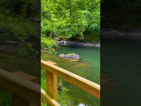
1st trip in our new Concorde Motorhome | Argoed Meadow Camping & Caravan Park | Cenarth Falls

This trip was our first trip out in our 'new to us' motorhome, Charlie the Concorde. A lovely little village, with beautiful scenery, two ...

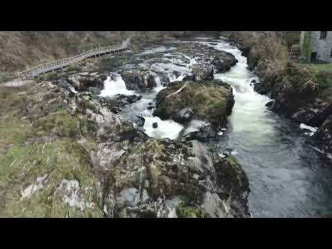
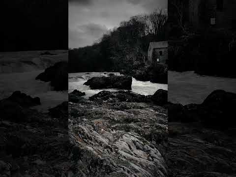
𝐶𝑒𝑛𝑎𝑟𝑡ℎ 𝐹𝑎𝑙𝑙𝑠 ~ 𝑃𝑎𝑟𝑡 𝑇𝑤𝑜

I really hope you enjoy the video! And if you really enjoyed it, hit the subscribe, like button and comment down below for more ...

Nearby Amenities

Located within 500m of 52.063715,-4.523607
Direction: 235
Generator Method: photovoltaic
Generator Output Electricity: yes
Generator Solar Modules: 6
Generator Source: solar
Generator Type: solar_photovoltaic_panel
Location: roof
Power: generator
Lat/Long: 52.0659558/-4.5240712
Direction: 235
Generator Method: photovoltaic
Generator Output Electricity: yes
Generator Solar Modules: 6
Generator Source: solar
Generator Type: solar_photovoltaic_panel
Location: roof
Power: generator
Lat/Long: 52.0660205/-4.5241457
Direction: SSW
Generator Method: photovoltaic
Generator Output Electricity: yes
Generator Solar Modules: 12
Generator Source: solar
Generator Type: solar_photovoltaic_panel
Location: roof
Power: generator
Lat/Long: 52.0621108/-4.5194813
The data included in this document is from www.openstreetmap.org. The data is made available under ODbL.

Have you been to Capel Tygwydd?

Leave your review of Capel Tygwydd below (or comments, questions and feedback).