Black Wood

Wood, Forest in Stirlingshire

Scotland

Black Wood

Aucheneck trig pillar
Aucheneck trig pillar Credit: John Ferguson

Black Wood, located in Stirlingshire, Scotland, is a mesmerizing forest that offers a unique and enchanting experience for nature lovers and outdoor enthusiasts. Covering an area of approximately 840 hectares, this ancient woodland is a significant part of the larger Trossachs National Park.

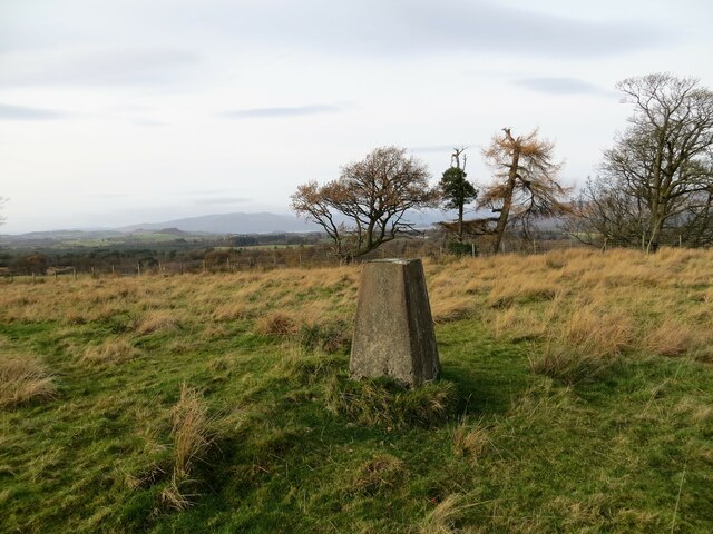
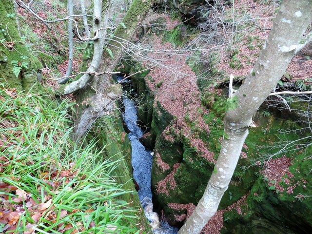
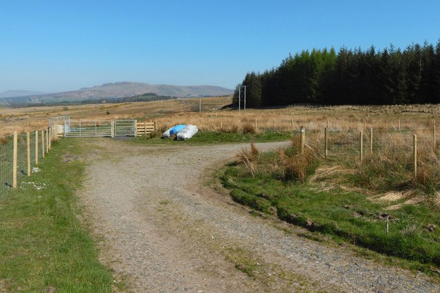
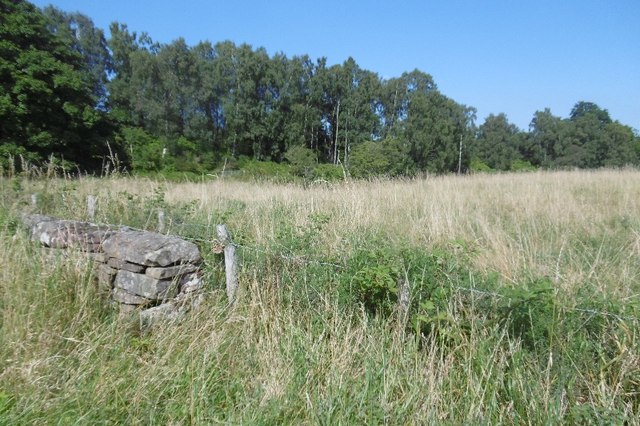
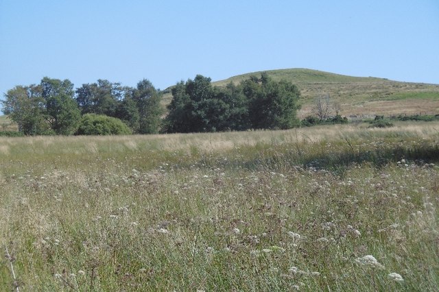
Black Wood is predominantly composed of native Scottish trees, including oak, birch, rowan, and Scots pine. These towering trees create a dense canopy, allowing only fragments of sunlight to penetrate the forest floor. The resulting environment is rich in biodiversity, supporting a wide range of flora and fauna.

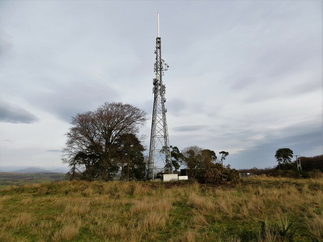
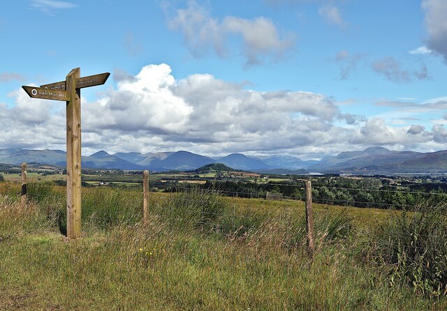
The woodland is crisscrossed by a network of well-maintained trails, providing visitors with the opportunity to explore the forest's wonders. The main path, known as the Black Wood of Rannoch Trail, winds through the heart of the forest, offering breathtaking views of towering trees, delicate wildflowers, and a diverse array of wildlife. Birdwatchers can spot species such as woodpeckers, crossbills, and red kites, while lucky visitors may even catch a glimpse of red squirrels or elusive pine martens.

Black Wood is not only a haven for nature enthusiasts but also plays an important role in local history and culture. The forest is believed to have inspired the renowned Scottish author Sir Walter Scott, who spent time in the area and drew inspiration from its mystical beauty. Today, the wood remains a favorite destination for artists, writers, and those seeking tranquility and inspiration.

Overall, Black Wood in Stirlingshire is a captivating and immersive forest where visitors can explore Scotland's natural beauty, discover its rich biodiversity, and connect with its storied past.

If you have any feedback on the listing, please let us know in the comments section below.

Black Wood Images

Images are sourced within 2km of 56.021167/-4.4425182 or Grid Reference NS4783. Thanks to Geograph Open Source API. All images are credited.

Aucheneck trig pillar
T. V. relay mast for the Killearn area
Carnock Burn flowing through the gorge in Finnoch Glen
Signpost on the John Muir Way Looking towards Ben Lomond from John Muir Way signpost on Cameron Muir.
Signpost on the John Muir Way
Looking towards Ben Lomond from John Muir Way signpost on Cameron Muir.
Loch Lomond and Stockie Muir from the air Stockie Muir is in the foreground, Drymen is on the right, the 39km long loch spreads far into the distant mountains.
Loch Lomond and Stockie Muir from the air
Stockie Muir is in the foreground, Drymen is on the right, the 39km long loch spreads far into the distant mountains.
No overtaking for 300 yards A section of the A809 just outside Croftamie leading up to a sharp corner.
No overtaking for 300 yards
A section of the A809 just outside Croftamie leading up to a sharp corner.
Entrance to Loch Lomond and the Trossachs National Park On the A809 just south east of Croftamie.
Entrance to Loch Lomond and the Trossachs National Park
On the A809 just south east of Croftamie.
The John Muir Way approaching Cameron Muir Less than 50 metres of this track, which is marked on the 1:25000 map, passes through this grid square. The picture was taken from roughly the point where the track enters the square from the south, and is a view towards the point where it leaves on the east.
The John Muir Way approaching Cameron Muir
Less than 50 metres of this track, which is marked on the 1:25000 map, passes through this grid square. The picture was taken from roughly the point where the track enters the square from the south, and is a view towards the point where it leaves on the east.
Gate on the John Muir Way The John Muir Way leaves the woods here, and reaches Cameron Muir. There is a marker for that route on the gate; it turns left here, to head west.

A different route heads right (east) at this point: a <a href="https://www.geograph.org.uk/photo/1713408">NS4683 : Track across Cameron Muir</a>.

The peak at the centre of the skyline, obscured a little by haze, is Uamh Bheag ("little cave", <a href="https://www.geograph.org.uk/gridref/NN6911">NN6911</a>). A telecoms mast is on a nearer hill on the right, almost directly behind the rightmost gatepost in the picture: <a href="https://www.geograph.org.uk/photo/2050032">NS4884 : Aucheneck trig point, and telecoms mast</a>.

The bend in the path behind the gate is shown, from the other side of that turning, in <a href="https://www.geograph.org.uk/photo/4981448">NS4683 : The John Muir Way at Cameron Muir</a>.
Gate on the John Muir Way
The John Muir Way leaves the woods here, and reaches Cameron Muir. There is a marker for that route on the gate; it turns left here, to head west. A different route heads right (east) at this point: a NS4683 : Track across Cameron Muir. The peak at the centre of the skyline, obscured a little by haze, is Uamh Bheag ("little cave", NN6911). A telecoms mast is on a nearer hill on the right, almost directly behind the rightmost gatepost in the picture: NS4884 : Aucheneck trig point, and telecoms mast. The bend in the path behind the gate is shown, from the other side of that turning, in NS4683 : The John Muir Way at Cameron Muir.
The John Muir Way at Cameron Muir A marker on a gatepost beside the path shows that the John Muir Way makes a right turn here, to head south, passing through a gate that is out of shot to the right, but which is shown, from the other side, in <a href="https://www.geograph.org.uk/photo/4981444">NS4683 : Gate on the John Muir Way</a>, where the same turning in the path can be seen.

The route that carries on straight ahead (east) is a <a href="https://www.geograph.org.uk/photo/1713408">NS4683 : Track across Cameron Muir</a>; the end-note refers to that route, which is distinct from the John Muir Way.

The Campsie Hills are in the background, left of centre, and the more distant Fintry Hills are at the far left.

Sometime after this picture was taken, a signpost was put up here at the turning: see <a href="https://www.geograph.org.uk/photo/6639139">NS4683 : Signpost on the John Muir Way</a>, taken in 2020.
The John Muir Way at Cameron Muir
A marker on a gatepost beside the path shows that the John Muir Way makes a right turn here, to head south, passing through a gate that is out of shot to the right, but which is shown, from the other side, in NS4683 : Gate on the John Muir Way, where the same turning in the path can be seen. The route that carries on straight ahead (east) is a NS4683 : Track across Cameron Muir; the end-note refers to that route, which is distinct from the John Muir Way. The Campsie Hills are in the background, left of centre, and the more distant Fintry Hills are at the far left. Sometime after this picture was taken, a signpost was put up here at the turning: see NS4683 : Signpost on the John Muir Way, taken in 2020.
Carnock Burn From here the burn flows NE, beneath the bridge carrying the A809, into Finnich Glen.  The picturesque glen is 70 feet deep in places and is visited by thousands of people every year and contains a rock feature known as the Devil's Pulpit.  The pulpit is accessible via a set of very steep and slippery stone steps on the South side of the glen.
Carnock Burn
From here the burn flows NE, beneath the bridge carrying the A809, into Finnich Glen. The picturesque glen is 70 feet deep in places and is visited by thousands of people every year and contains a rock feature known as the Devil's Pulpit. The pulpit is accessible via a set of very steep and slippery stone steps on the South side of the glen.
Roadworks, A809 Today's road closure - there always seems to be one in the Balfron/Drymen area.  I was able to negotiate passage.
Roadworks, A809
Today's road closure - there always seems to be one in the Balfron/Drymen area. I was able to negotiate passage.
Woodland, Craighat
Woodland, Craighat
Long grass, Finnich A field which seems to have been left alone this year.
Long grass, Finnich
A field which seems to have been left alone this year.
A809 Quiet, due a resurfacing closure nearer Croftamie.
A809
Quiet, due a resurfacing closure nearer Croftamie.
High Finnich A field of long grass which has been left for a while.
High Finnich
A field of long grass which has been left for a while.
Footpath Finnich Glen The footpath in autumn approaching the Devils Pulpit located in Finnich Glen.
Footpath Finnich Glen
The footpath in autumn approaching the Devils Pulpit located in Finnich Glen.
Old Milepost by the A809, Craighat Wood, Killearn Parish Glasgow curved by the A809, in parish of Killearn (Stirling District), Craighat, on grass verge.

Inscription reads:- : GLASGOW / ROYAL EXCHANGE / 14 / {pointing hand} / DRYMEN / {pointing hand} / 3 : 

Surveyed

Milestone Society National ID: ST_GWDR14.
Old Milepost by the A809, Craighat Wood, Killearn Parish
Glasgow curved by the A809, in parish of Killearn (Stirling District), Craighat, on grass verge. Inscription reads:- : GLASGOW / ROYAL EXCHANGE / 14 / {pointing hand} / DRYMEN / {pointing hand} / 3 : Surveyed Milestone Society National ID: ST_GWDR14.
Show me another place!

Black Wood is located at Grid Ref: NS4783 (Lat: 56.021167, Lng: -4.4425182)

Unitary Authority: Stirling

Police Authority: Forth Valley

What 3 Words

///date.insisting.reports. Near Killearn, Stirling

Nearby Locations

Black Wood

Related Wikis

Finnich Glen

Finnich Glen in Stirlingshire, is a short, steep glen up to 70 ft deep which runs east from Finnich Bridge on the A809. It was carved from the red sandstone...

Croftamie

Croftamie (Scottish Gaelic Croit Sheumaidh) is a small village and community council area in the Stirling council area in Scotland. It lies to the south...

Dalnair Castle

Dalnair Castle, also known as Dalnair House, is a Scottish baronial castle dating from around 1884. It is located outside the village of Croftamie in Stirling...

Drymen railway station

Drymen railway station served the village of Croftamie, Stirling, Scotland, from 1856 to 1934 on the Forth and Clyde Junction Railway. == History == The...

Nearby Amenities

Located within 500m of 56.021167,-4.4425182
Power: pole
Lat/Long: 56.0245763/-4.4393346
Power: pole
Lat/Long: 56.0247513/-4.4389532
Power: pole
Lat/Long: 56.0237271/-4.4412011
Power: pole
Lat/Long: 56.0250018/-4.4384073
Power: pole
Lat/Long: 56.0241503/-4.4402658
Power: pole
Lat/Long: 56.0199826/-4.4502482
Power: pole
Lat/Long: 56.0203882/-4.4490643
Power: pole
Lat/Long: 56.0207518/-4.4479787
Power: pole
Lat/Long: 56.0211434/-4.4468345
Power: pole
Lat/Long: 56.0215701/-4.4458806
Power: pole
Lat/Long: 56.0220109/-4.4449226
Power: pole
Lat/Long: 56.0224516/-4.4439562
Power: pole
Lat/Long: 56.0228724/-4.4430463
Power: pole
Lat/Long: 56.0232921/-4.4421071
The data included in this document is from www.openstreetmap.org. The data is made available under ODbL.

Have you been to Black Wood?

Leave your review of Black Wood below (or comments, questions and feedback).