Barholm Wood

Wood, Forest in Kirkcudbrightshire

Scotland

Barholm Wood

River Cree at Spittal Wood The piles of rocks going out into the river are breakwaters.
River Cree at Spittal Wood Credit: Russel Wills

Barholm Wood is a picturesque forest located in the county of Kirkcudbrightshire, Scotland. Covering an area of approximately 100 hectares, this ancient woodland is renowned for its natural beauty and rich biodiversity. It is situated near the small village of Ringford, offering a tranquil and peaceful retreat for nature enthusiasts and outdoor adventurers alike.

The forest is predominantly composed of native tree species such as oak, birch, and ash, creating a diverse and vibrant ecosystem. The dense canopy provides shelter to a wide array of wildlife, including red squirrels, roe deer, and various species of birds. It is also home to a number of rare and protected species, such as the pearl-bordered fritillary butterfly and the lesser horseshoe bat.

Barholm Wood is crisscrossed by a network of well-maintained trails, allowing visitors to explore the area on foot. These paths wind through the enchanting woodland, offering stunning views of the surrounding countryside and the nearby River Dee. The forest also boasts a beautiful waterfall known as Barholm Cascade, which cascades down a series of rocky steps, adding to the area's natural splendor.

The wood is a popular destination for outdoor activities, including hiking, birdwatching, and photography. Its tranquil atmosphere and abundant wildlife make it an ideal spot for nature lovers seeking a peaceful escape. Whether you are looking to immerse yourself in the wonders of nature or simply enjoy a leisurely stroll, Barholm Wood is a must-visit destination for anyone visiting Kirkcudbrightshire.

If you have any feedback on the listing, please let us know in the comments section below.
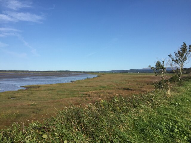
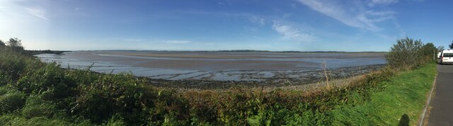
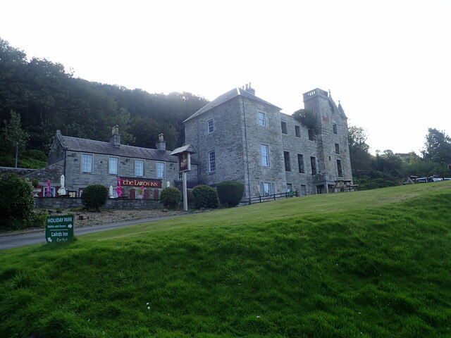
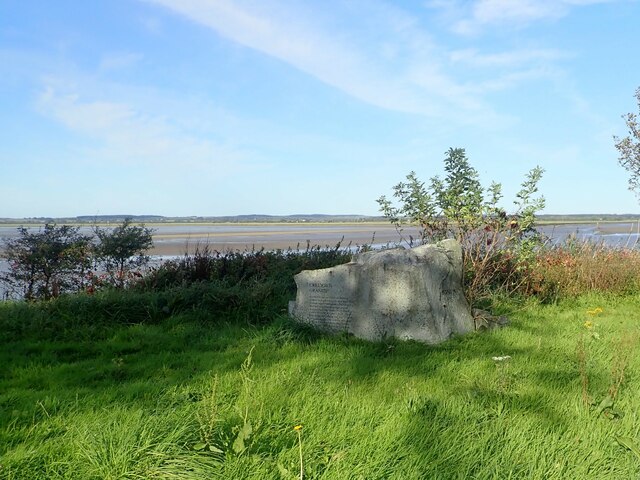
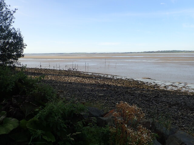
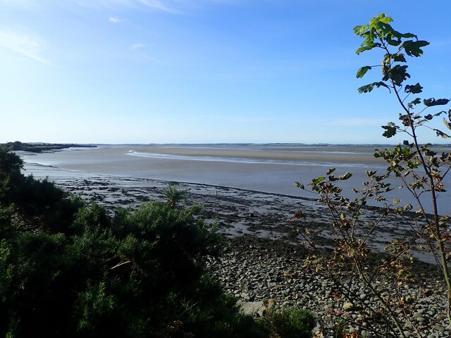
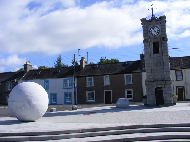
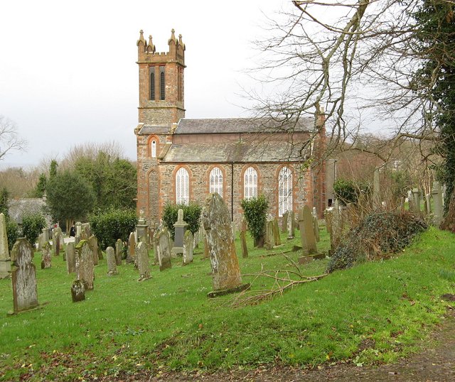
Barholm Wood Images

Images are sourced within 2km of 54.902745/-4.3862741 or Grid Reference NX4759. Thanks to Geograph Open Source API. All images are credited.

River Cree at Spittal Wood The piles of rocks going out into the river are breakwaters.
River Cree at Spittal Wood
The piles of rocks going out into the river are breakwaters.
Spittal Wood the hard way Brutal haul up to the railway trackbed from the old A75. Signposted 30% and feels like it.
Spittal Wood the hard way
Brutal haul up to the railway trackbed from the old A75. Signposted 30% and feels like it.
River Cree Upstream from Creetown
River Cree
Upstream from Creetown
Cycle path, Spittal An all too short section on the Port Road.
Cycle path, Spittal
An all too short section on the Port Road.
Cycle path Steep climb over, soon onto the railway trackbed.
Cycle path
Steep climb over, soon onto the railway trackbed.
Cree Trig Point Flush Bracket S8191
Marshland at the River Cree estuary
Panorama of the Cree estuary
The Lairds Inn and Castle Cary The castle, dating from about 1580, is now in ruins but a part has been converted to the Lairds Inn and serves the caravan park in the grounds of the old castle.
The Lairds Inn and Castle Cary
The castle, dating from about 1580, is now in ruins but a part has been converted to the Lairds Inn and serves the caravan park in the grounds of the old castle.
Creetown Granite Commemorating a local industry, this granite stone is placed at the northern end of a layby on the A75.
Creetown Granite
Commemorating a local industry, this granite stone is placed at the northern end of a layby on the A75.
Stake nets on the River Cree Once used for salmon fishing
Stake nets on the River Cree
Once used for salmon fishing
Looking south down the River Cree
Teepee with a smoking chimney At Castle Cary Holiday Park
Teepee with a smoking chimney
At Castle Cary Holiday Park
Castle Cary C16 Scottish baronial castle, now derelict. The grounds of the estate is now a holiday park.
Castle Cary
C16 Scottish baronial castle, now derelict. The grounds of the estate is now a holiday park.
Woodland footpath from Castle Cary to Creetown
Former mill at Creetown Ivy-clad ruin of an old cotton mill in Creetown
Former mill at Creetown
Ivy-clad ruin of an old cotton mill in Creetown
Kirkmabreck Parish Church <span class="nowrap"><a title="https://scotlandschurchestrust.org.uk/church/kirkmabreck-parish-church/" rel="nofollow ugc noopener" href="https://scotlandschurchestrust.org.uk/church/kirkmabreck-parish-church/">Link</a><img style="margin-left:2px;" alt="External link" title="External link - shift click to open in new window" src="https://s1.geograph.org.uk/img/external.png" width="10" height="10"/></span>
Kirkmabreck Parish Church
Kirkmabreck Parish Church The front of the church with its square bell tower
Kirkmabreck Parish Church
The front of the church with its square bell tower
Show me another place!

Barholm Wood is located at Grid Ref: NX4759 (Lat: 54.902745, Lng: -4.3862741)

Unitary Authority: Dumfries and Galloway

Police Authority: Dumfries and Galloway

What 3 Words

///traps.diplomat.erupt. Near Newton Stewart, Dumfries & Galloway

Nearby Locations

Barholm Wood

Related Wikis

Creetown

Creetown (/ˈkri:tən/, sometimes /'kri:taʊn/) is a small seaside town in the Stewartry of Kirkcudbright, in Galloway in the Dumfries and Galloway council...

Kirkmabreck

Kirkmabreck is a civil parish in the historic county of Kirkcudbrightshire in the Dumfries and Galloway council area, Scotland. Situated in the historic...

Creetown F.C.

Creetown Football Club are a football club based in Creetown in the Dumfries and Galloway area of Scotland. Formed in 1905 as Creetown Rifle Volunteers...

Creetown railway station

Creetown railway station served the town of Creetown, Dumfries and Galloway, Scotland from 1861 to 1965 on the Portpatrick and Wigtownshire Joint Railway...

Nearby Amenities

Located within 500m of 54.902745,-4.3862741
Source: PGS
Lat/Long: 54.8993131/-4.3912276
Source: PGS
Lat/Long: 54.8993169/-4.3905436
Source: PGS
Lat/Long: 54.8992258/-4.3901671
Source: PGS
Lat/Long: 54.8989035/-4.3894001
Source: PGS
Lat/Long: 54.8993627/-4.387685
Source: PGS
Lat/Long: 54.8990484/-4.3873754
Source: PGS
Lat/Long: 54.8988988/-4.3871646
Source: PGS
Lat/Long: 54.8987044/-4.3876753
Source: PGS
Lat/Long: 54.899055/-4.3884042
Source: PGS
Lat/Long: 54.8989477/-4.3885383
Source: PGS
Lat/Long: 54.8985011/-4.3882599
Creetown
Name En: Creetown
Name Gd: Port Aiseig a' Chrìch
Name Sco: Ferrytoon o Cree
Old Name: Ferrytown of Cree
Place: village
Lat/Long: 54.9015058/-4.379229
Adamson Square
Naptan AtcoCode: 680000040503
Naptan Bearing: N
Naptan BusStopType: CUS
Naptan CommonName: Adamson Square
Naptan Indicator: Clock Tower
Naptan Landmark: Adamson Square
Naptan NaptanCode: 34236738
Naptan Notes: none
Naptan Street: Main Street
Naptan Verified: no
Source: naptan_import
Lat/Long: 54.9015193/-4.3793586
Adamson Square
Naptan AtcoCode: 680000040504
Naptan Bearing: S
Naptan BusStopType: CUS
Naptan CommonName: Adamson Square
Naptan Indicator: opp Clock Tower
Naptan Landmark: Adamson Square
Naptan NaptanCode: 34236739
Naptan Notes: none
Naptan Street: Main Street
Naptan Verified: no
Source: naptan_import
Lat/Long: 54.9014994/-4.3789987
Telephone
Booth: KX100
Covered: booth
Lat/Long: 54.9017482/-4.3791167
Post Box
Collection Times: Mo-Fr 16:00; Sa 12:30
Operator: Royal Mail
Post Box Type: pillar
Ref: DG8 55
Royal Cypher: scottish_crown
Lat/Long: 54.9017205/-4.3791435
Barrier: block
Fixme: please clarify the type of barrier
Lat/Long: 54.9046805/-4.3813151
Power: pole
Lat/Long: 54.9063371/-4.3827351
Power: pole
Lat/Long: 54.9057419/-4.383349
Power: pole
Lat/Long: 54.9051167/-4.3845807
Power: pole
Lat/Long: 54.9046697/-4.3854584
Power: pole
Lat/Long: 54.904133/-4.3865053
Power: pole
Lat/Long: 54.9045159/-4.3863552
Power: pole
Lat/Long: 54.904933/-4.3861685
Power: pole
Lat/Long: 54.9060107/-4.3841035
Power: pole
Lat/Long: 54.9058824/-4.3840611
Power: pole
Lat/Long: 54.9051012/-4.3825061
Power: pole
Lat/Long: 54.9044959/-4.381717
Power: pole
Lat/Long: 54.9039449/-4.3810241
Power: pole
Lat/Long: 54.9033872/-4.3802928
Generator Method: photovoltaic
Generator Output Electricity: yes
Generator Source: solar
Generator Type: solar_photovoltaic_panel
Power: generator
Lat/Long: 54.9005716/-4.3799582
The data included in this document is from www.openstreetmap.org. The data is made available under ODbL.

Have you been to Barholm Wood?

Leave your review of Barholm Wood below (or comments, questions and feedback).