Crow Wood

Wood, Forest in Kirkcudbrightshire

Scotland

Crow Wood

Pumpkins for sale at Strathmaddie Strathmaddie has pumpkins for sale 'for Halloween carving'. The minor road passing by must see little traffic whether motorised or pedestrian, so sales cannot be high.
Pumpkins for sale at Strathmaddie Credit: Trevor Littlewood

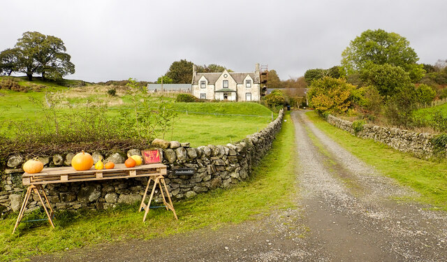
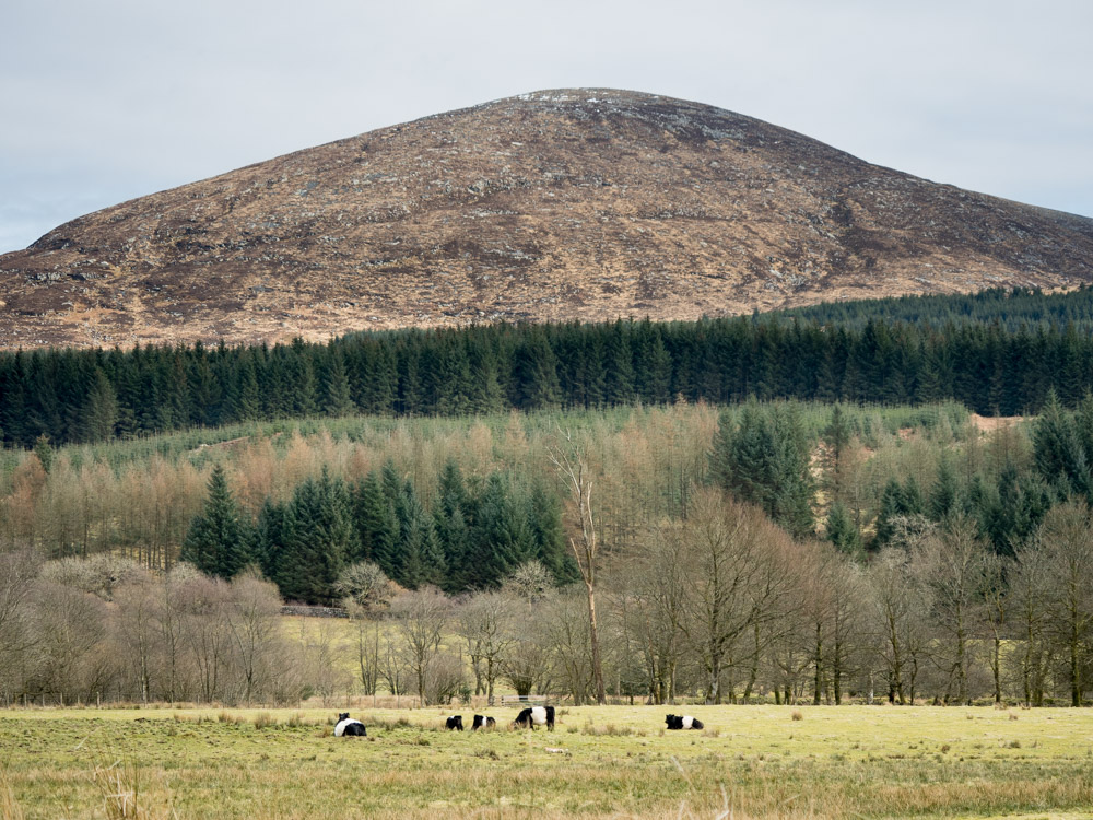
Crow Wood is a picturesque forest located in the region of Kirkcudbrightshire, Scotland. Covering an area of approximately 500 acres, this dense woodland is renowned for its natural beauty and diverse range of flora and fauna. It is situated on the outskirts of the charming town of Kirkcudbright, providing locals and visitors with easy access to its tranquil surroundings.

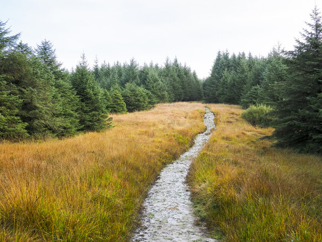
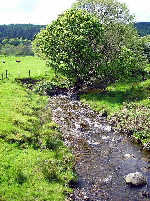
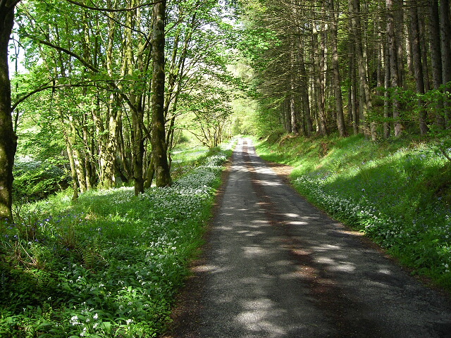
The wood is predominantly composed of native tree species, including oak, beech, and birch, which form a dense canopy that filters sunlight and creates a cool and peaceful atmosphere. Walking trails wind their way through the forest, offering visitors the opportunity to explore its hidden corners and discover the enchanting wildlife that calls it home.

Birdwatchers are particularly drawn to Crow Wood, as it is a haven for various species such as woodpeckers, owls, and songbirds. Lucky observers may even catch a glimpse of the elusive red squirrel or the occasional roe deer that roam the forest.

Throughout the year, Crow Wood displays a rich tapestry of colors, with vibrant spring blossoms, lush green foliage in the summer, and the stunning autumnal hues that paint the landscape in shades of gold and crimson. This makes it a popular destination for nature lovers, photographers, and those seeking a peaceful retreat.

Crow Wood is managed by a local conservation organization, ensuring the preservation of its natural beauty and the protection of its ecosystem. It is open to the public, providing a welcoming space for outdoor activities such as walking, picnicking, and wildlife spotting.

If you have any feedback on the listing, please let us know in the comments section below.

Crow Wood Images

Images are sourced within 2km of 54.944726/-4.390245 or Grid Reference NX4663. Thanks to Geograph Open Source API. All images are credited.

Pumpkins for sale at Strathmaddie Strathmaddie has pumpkins for sale 'for Halloween carving'. The minor road passing by must see little traffic whether motorised or pedestrian, so sales cannot be high.
Pumpkins for sale at Strathmaddie
Strathmaddie has pumpkins for sale 'for Halloween carving'. The minor road passing by must see little traffic whether motorised or pedestrian, so sales cannot be high.
Road heading south on the Cairnsmore estate The estate road heading towards Crow Wood.
Road heading south on the Cairnsmore estate
The estate road heading towards Crow Wood.
Path for Cairnsmore of Fleet passing through woodland The main path for Cairnsmore of Fleet beginning to climb north-east of the buildings at Cairnsmore Farm.
Path for Cairnsmore of Fleet passing through woodland
The main path for Cairnsmore of Fleet beginning to climb north-east of the buildings at Cairnsmore Farm.
Walkers on forest road on slope of Ardwell Hill Ardwell Hill is part of a western spur of the hill Cairnsmore of Fleet, it rises to the right out of the image.
Walkers on forest road on slope of Ardwell Hill
Ardwell Hill is part of a western spur of the hill Cairnsmore of Fleet, it rises to the right out of the image.
Minor road close to Palnure Burn The road is heading south towards Graddoch Bridge. The burn is out of view to the right, meandering through fields.
Minor road close to Palnure Burn
The road is heading south towards Graddoch Bridge. The burn is out of view to the right, meandering through fields.
Trees alongside the Palnure Burn The burn can just be detected beside the middle distance trees.
Trees alongside the Palnure Burn
The burn can just be detected beside the middle distance trees.
Bungalow beside Mill Burn The burn flows just below the slope to the right, it then passes beneath the Woodend Bridge from which the image was made.
Bungalow beside Mill Burn
The burn flows just below the slope to the right, it then passes beneath the Woodend Bridge from which the image was made.
Road heading north in valley of Palnure Burn The road is on the eastern side of the burn approaching Bardrochwood and other properties at Bargaly where it terminates, at least for public, motorised use.
Road heading north in valley of Palnure Burn
The road is on the eastern side of the burn approaching Bardrochwood and other properties at Bargaly where it terminates, at least for public, motorised use.
Path over Bardrochwood Moor Bardrochwood Moor is on the western side of Crammery Hill, part of the extensive hill, Cairnsmore of Fleet. The path is the main route used by people climbing the hill.
Path over Bardrochwood Moor
Bardrochwood Moor is on the western side of Crammery Hill, part of the extensive hill, Cairnsmore of Fleet. The path is the main route used by people climbing the hill.
Spur between two streams The left side valley, fully in view, is that of the Graddoch Burn. The Torr Burn passes in the foreground to make its confluence with the other.
The hill is known as Knee of Cairnsmore.
Spur between two streams
The left side valley, fully in view, is that of the Graddoch Burn. The Torr Burn passes in the foreground to make its confluence with the other. The hill is known as Knee of Cairnsmore.
Silage bales, Cuil
Silage bales, Cuil
A75, Muirfad
A75, Muirfad
Between road and river, Muirfad
Old milestone On this visit we passed this milestone near the Palnure Burn twice before finally spotting it hidden in long, dry grass and brambles which were cleared away.  It used to stand upright but as the years go by it is leaning more and more.   Although several of this style are still by the roadside, this is one of the few complete with its 3 metal plates made at the Affleck foundry.   It is 36 miles from Port Patrick and another 378 to London!
Old milestone
On this visit we passed this milestone near the Palnure Burn twice before finally spotting it hidden in long, dry grass and brambles which were cleared away. It used to stand upright but as the years go by it is leaning more and more. Although several of this style are still by the roadside, this is one of the few complete with its 3 metal plates made at the Affleck foundry. It is 36 miles from Port Patrick and another 378 to London!
Outdoor Centre Stronord Outdoor Centre.  Owned by Dumfries and Galloway Council.
Outdoor Centre
Stronord Outdoor Centre. Owned by Dumfries and Galloway Council.
Viaduct - remains of the "Port Line" Not much left of the viaduct near Muirfad, which once carried trains on the Dumfries - Stranraer line
Viaduct - remains of the "Port Line"
Not much left of the viaduct near Muirfad, which once carried trains on the Dumfries - Stranraer line
Burn at Woodend Bridge
Minor Road Flanked by Wild Garlic and Bluebells
Show me another place!

Crow Wood is located at Grid Ref: NX4663 (Lat: 54.944726, Lng: -4.390245)

Unitary Authority: Dumfries and Galloway

Police Authority: Dumfries and Galloway

What 3 Words

///presumes.puzzled.crusted. Near Newton Stewart, Dumfries & Galloway

Nearby Locations

Crow Wood

Related Wikis

Palnure railway station

Palnure railway station (NX450634) was a railway station on the Portpatrick and Wigtownshire Joint Railway close to Newton Stewart and the junction for...

Palnure

Palnure (Scottish Gaelic: Poll an Iùbhair) is a small village in the historical county of Kirkcudbrightshire in Dumfries and Galloway, Scotland, on the...

Kirroughtree

Kirroughtree Forest is located near Newton Stewart in Dumfries and Galloway, southwest Scotland and overlooks the Irish Sea. It is managed by Forestry...

Creetown railway station

Creetown railway station served the town of Creetown, Dumfries and Galloway, Scotland from 1861 to 1965 on the Portpatrick and Wigtownshire Joint Railway...

Cairnsmore of Fleet

Cairnsmore of Fleet is an isolated mountain in the Southern Uplands of Scotland. The mountain forms an unafforested granite massif, whose highest point...

Creetown

Creetown (/ˈkri:tən/, sometimes /'kri:taʊn/) is a small seaside town in the Stewartry of Kirkcudbright, in Galloway in the Dumfries and Galloway council...

Kirkmabreck

Kirkmabreck is a civil parish in the historic county of Kirkcudbrightshire in the Dumfries and Galloway council area, Scotland. Situated in the historic...

Kirroughtree House

Kirroughtree House is the heritage-listed mansion house (Category B listing.) of the Kirroughtree estate. It occupies a prominent position 1 mile (1.6...

Nearby Amenities

Located within 500m of 54.944726,-4.390245
Cairnsmore
Place: hamlet
Lat/Long: 54.9458389/-4.3897098
Fixme: continue
Lat/Long: 54.9472963/-4.3911088
Fixme: continue
Lat/Long: 54.9469682/-4.3915942
Power: pole
Lat/Long: 54.9439819/-4.3970722
Power: pole
Lat/Long: 54.9441201/-4.3961426
Power: pole
Lat/Long: 54.944255/-4.3951515
Power: pole
Lat/Long: 54.9445689/-4.3944144
Power: pole
Lat/Long: 54.9449624/-4.3934829
Power: pole
Lat/Long: 54.9452731/-4.3927342
Power: pole
Lat/Long: 54.9456798/-4.3918143
Power: pole
Lat/Long: 54.9459462/-4.3911022
The data included in this document is from www.openstreetmap.org. The data is made available under ODbL.

Have you been to Crow Wood?

Leave your review of Crow Wood below (or comments, questions and feedback).