Craigintier Wood

Wood, Forest in Dunbartonshire

Scotland

Craigintier Wood

Route of the old railway line The overgrown route of the Forth and Clyde Junction Railway, which ran from Stirling to Balloch.
Route of the old railway line Credit: Richard Sutcliffe

Craigintier Wood is a picturesque forest located in Dunbartonshire, Scotland. Spanning an area of approximately 100 hectares, this woodland is known for its natural beauty and diverse range of plant and animal species. Situated on the slopes of the Kilpatrick Hills, the wood offers stunning panoramic views of the surrounding countryside and the nearby Clyde Estuary.

The woodland is predominantly composed of native broadleaf trees, such as oak, birch, and rowan. These trees provide a rich habitat for wildlife, attracting a variety of bird species including woodpeckers, chaffinches, and tree creepers. In addition, the forest floor is carpeted with an array of wildflowers, ferns, and mosses, creating an enchanting and tranquil environment.

Craigintier Wood is a popular destination for outdoor enthusiasts, offering a network of well-maintained trails for walking, jogging, and cycling. The trails vary in length and difficulty, catering to both experienced hikers and families seeking a leisurely stroll. Along the paths, visitors can discover hidden gems such as a charming waterfall and a small pond teeming with amphibians and insects.

The wood is also home to an abundance of wildlife, including roe deer, foxes, and squirrels. Nature lovers can enjoy spotting these creatures from one of the designated wildlife viewing areas or simply by observing their natural behaviors as they roam freely throughout the woodland.

Overall, Craigintier Wood is a haven of natural beauty and tranquility, providing a serene escape from the bustling urban life of Dunbartonshire. Whether it's for a leisurely walk, a family picnic, or birdwatching, this woodland offers something for everyone to enjoy.

If you have any feedback on the listing, please let us know in the comments section below.

Craigintier Wood Images

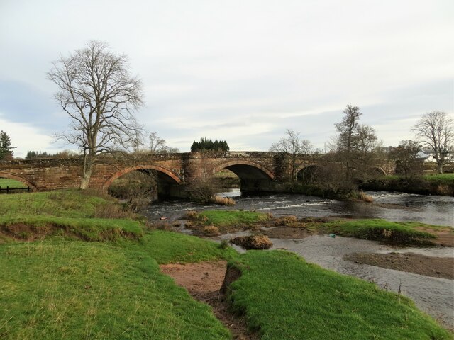
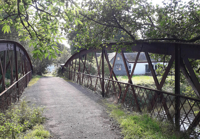
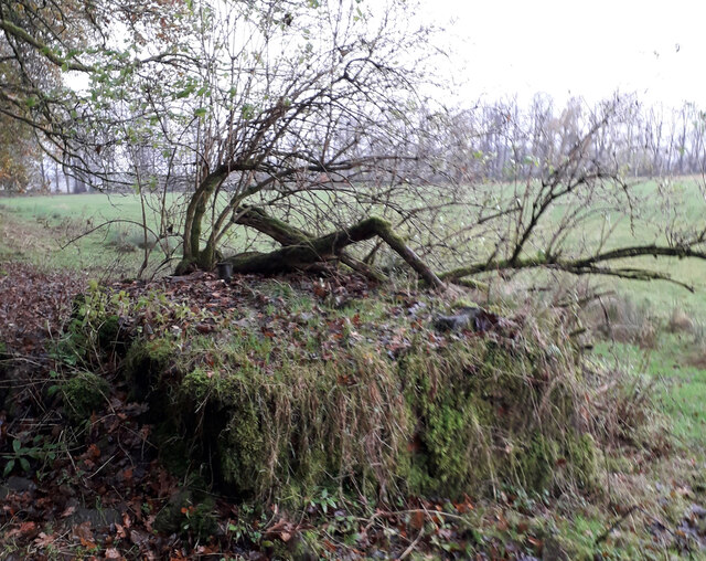
Images are sourced within 2km of 56.048991/-4.4803947 or Grid Reference NS4586. Thanks to Geograph Open Source API. All images are credited.

Route of the old railway line The overgrown route of the Forth and Clyde Junction Railway, which ran from Stirling to Balloch.
Route of the old railway line
The overgrown route of the Forth and Clyde Junction Railway, which ran from Stirling to Balloch.
Minor road passing Kilderran The road runs from Croftamie to Shandon Farm and beyond.
Minor road passing Kilderran
The road runs from Croftamie to Shandon Farm and beyond.
Drymen Bridge over Endrick Water
Truss Bridge over River Endrick Metal truss bridge over the River Endrick. 
September 2022 gates were open and bridge looked safe for pedestrians.
Part of the South Drive of the Buchanan Estate.
Private bridge built by Duke of Montrose, shown on OS Map Stirlingshire Sheet XX. Survey Date 1861. Adjacent to and north of Woodend Lodge which appears in the background.
Truss Bridge over River Endrick
Metal truss bridge over the River Endrick. September 2022 gates were open and bridge looked safe for pedestrians. Part of the South Drive of the Buchanan Estate. Private bridge built by Duke of Montrose, shown on OS Map Stirlingshire Sheet XX. Survey Date 1861. Adjacent to and north of Woodend Lodge which appears in the background.
Early 20th Century Water Tank Brick built water tank. Approximately 3 metres x 2 metres x 1 metre high. It is no longer in use and overgrown with vegetation. The construction and associated broken metal pipework indicate that it was probably built in the 1920s. The foundation of the south wall appears to have been built on top of the remains of the north wall of the earlier St. Ronan's Well. It is situated approximately one metre north of the boundary fence which surrounds Mains Farm's grass fields.
Early 20th Century Water Tank
Brick built water tank. Approximately 3 metres x 2 metres x 1 metre high. It is no longer in use and overgrown with vegetation. The construction and associated broken metal pipework indicate that it was probably built in the 1920s. The foundation of the south wall appears to have been built on top of the remains of the north wall of the earlier St. Ronan's Well. It is situated approximately one metre north of the boundary fence which surrounds Mains Farm's grass fields.
St Ronan's Well These are the remnants of St Ronan's Well. A depression approximately 700mm in dia and 200mm deep. It is filled with mud, leaves and discarded pieces of masonry. It is adjacent to and south of, the brick built water tank which apparently replaced the original well. Were it not for presence of the water tank, the position of St Ronan's well would be almost impossible to locate. It is located beneath the existing barbed wire fence. St Ronan would be disappointed.
St Ronan's Well
These are the remnants of St Ronan's Well. A depression approximately 700mm in dia and 200mm deep. It is filled with mud, leaves and discarded pieces of masonry. It is adjacent to and south of, the brick built water tank which apparently replaced the original well. Were it not for presence of the water tank, the position of St Ronan's well would be almost impossible to locate. It is located beneath the existing barbed wire fence. St Ronan would be disappointed.
Woodend Lodge This Lodge is positioned on South Avenue on the bank of the River Endrick at the south side of the metal truss bridge. Several windows have been boarded up; it is no longer occupied, but not yet derelict.
A derelict white van is permanently parked on South Avenue and performs the useful task of preventing four wheeled vehicles from attempting to cross the ageing bridge.
Woodend Lodge
This Lodge is positioned on South Avenue on the bank of the River Endrick at the south side of the metal truss bridge. Several windows have been boarded up; it is no longer occupied, but not yet derelict. A derelict white van is permanently parked on South Avenue and performs the useful task of preventing four wheeled vehicles from attempting to cross the ageing bridge.
Endrick Water, Drymen Bridge
Endrick Water Downstream view from near Drymen Bridge.
Endrick Water
Downstream view from near Drymen Bridge.
Endrick Water and A811 Below Catter House with the Drymen Show Field on the right.
Endrick Water and A811
Below Catter House with the Drymen Show Field on the right.
Endrick Water Bend below Drymen Bridge. The last appreciable current in the river soon quietens down and the water is slow and still all the way to Loch Lomond.
Endrick Water
Bend below Drymen Bridge. The last appreciable current in the river soon quietens down and the water is slow and still all the way to Loch Lomond.
Endrick Water passing the Show Field Near Drymen.
Endrick Water passing the Show Field
Near Drymen.
Endrick Water The river passes through a large field with cattle moving freely from Dunbartonshire to Stirlingshire.
Endrick Water
The river passes through a large field with cattle moving freely from Dunbartonshire to Stirlingshire.
Cattle crossing the Endrick Water Rather a skittish herd and a lot of noise as calves found themselves on the opposite side from their mothers.  On arrival many were cooling off in the river, they are free to cross, none of the nightmare we used to have in low water of unauthorised crossings by our or our none too friendly neighbour's cattle and having to repatriate them.  I have a fair bit of experience of herding by kayak.
Cattle crossing the Endrick Water
Rather a skittish herd and a lot of noise as calves found themselves on the opposite side from their mothers. On arrival many were cooling off in the river, they are free to cross, none of the nightmare we used to have in low water of unauthorised crossings by our or our none too friendly neighbour's cattle and having to repatriate them. I have a fair bit of experience of herding by kayak.
Endrick Water Anticyclonic calm.
Endrick Water
Anticyclonic calm.
Banks of the Endrick A curious confluence with Nannies Burn which is mapped as joining the Endrick downstream on the other side of a meander.  The movement of the river has cut into path of the burn which now joins here, cutting off the lower course. Looking at older maps shows that the Endrick Water is quite dynamic with its course changing.
Banks of the Endrick
A curious confluence with Nannies Burn which is mapped as joining the Endrick downstream on the other side of a meander. The movement of the river has cut into path of the burn which now joins here, cutting off the lower course. Looking at older maps shows that the Endrick Water is quite dynamic with its course changing.
Endrick Water The bank beside the golf course is mostly dense willow. Every now and then a kingfisher would emerge from under the trees.  There was at least one otter about as well.
Endrick Water
The bank beside the golf course is mostly dense willow. Every now and then a kingfisher would emerge from under the trees. There was at least one otter about as well.
Outside of a meander The very twisty course of the Endrick at Kilmaronock.
Outside of a meander
The very twisty course of the Endrick at Kilmaronock.
Show me another place!

Craigintier Wood is located at Grid Ref: NS4586 (Lat: 56.048991, Lng: -4.4803947)

Unitary Authority: Stirling

Police Authority: Forth Valley

What 3 Words

///elephant.innovate.smiles. Near Killearn, Stirling

Nearby Locations

Craigintier Wood

Related Wikis

Buchanan Castle

Buchanan Castle is a ruined castle in Stirlingshire, Scotland, located 1 mile (1.6 km) west of the village of Drymen. The house was commissioned by The...

Buchanan Auld House

Buchanan Auld House (or Buchanan Old House) is a ruined house in Stirlingshire, Scotland, located 1.5 miles (2.4 km) west of the village of Drymen. Historic...

Croftamie

Croftamie (Scottish Gaelic Croit Sheumaidh) is a small village and community council area in the Stirling council area in Scotland. It lies to the south...

Drymen railway station

Drymen railway station served the village of Croftamie, Stirling, Scotland, from 1856 to 1934 on the Forth and Clyde Junction Railway. == History == The...

Nearby Amenities

Located within 500m of 56.048991,-4.4803947
Power: pole
Lat/Long: 56.0524413/-4.4835163
The data included in this document is from www.openstreetmap.org. The data is made available under ODbL.

Have you been to Craigintier Wood?

Leave your review of Craigintier Wood below (or comments, questions and feedback).