Coille na Creige Tarsuinn
Wood, Forest in Inverness-shire
Scotland
Coille na Creige Tarsuinn

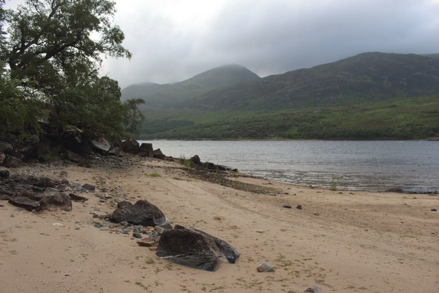
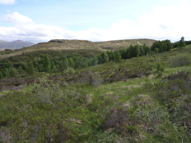
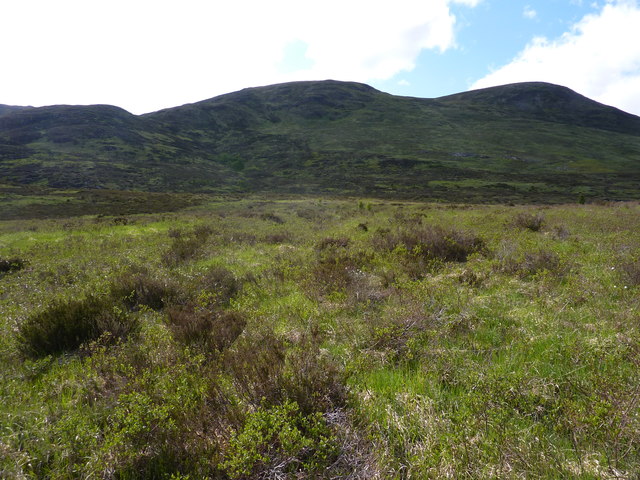
Coille na Creige Tarsuinn, located in Inverness-shire, Scotland, is a picturesque wood and forest that offers visitors a unique and captivating natural experience. Spread over a vast expanse of land, this enchanting woodland is a haven of tranquility and beauty.
The woodland is characterized by its dense and diverse vegetation, comprising a mix of native trees such as oak, birch, and pine. The towering trees create a lush canopy that filters sunlight, creating a dappled effect on the forest floor, while also providing a habitat for a wide array of wildlife.
Wandering through Coille na Creige Tarsuinn, visitors can discover a network of winding trails that meander through the woodland, offering the perfect opportunity for a refreshing walk or invigorating hike. The trails lead to breathtaking viewpoints, where visitors can admire panoramic vistas of the surrounding landscapes, including rolling hills, meandering rivers, and distant mountains.
For nature enthusiasts, Coille na Creige Tarsuinn is a treasure trove of wildlife. The forest is home to numerous species of birds, including the majestic golden eagle and the elusive capercaillie. Lucky visitors may also spot red deer roaming freely through the woodland, as well as smaller mammals such as red squirrels and badgers.
Coille na Creige Tarsuinn is not only a haven for nature lovers but also a place of cultural significance. It is steeped in history, with ancient ruins and archaeological sites scattered throughout the woodland, providing a glimpse into the past.
In summary, Coille na Creige Tarsuinn is a captivating natural paradise, where visitors can immerse themselves in the beauty of the Scottish countryside, explore diverse ecosystems, and connect with both nature and history.
If you have any feedback on the listing, please let us know in the comments section below.
Coille na Creige Tarsuinn Images
Images are sourced within 2km of 56.9378/-4.5448963 or Grid Reference NN4585. Thanks to Geograph Open Source API. All images are credited.


Coille na Creige Tarsuinn is located at Grid Ref: NN4585 (Lat: 56.9378, Lng: -4.5448963)
Unitary Authority: Highland
Police Authority: Highlands and Islands
What 3 Words
///remix.munched.arose. Near Gairlochy, Highland
Nearby Locations
Related Wikis

Binnein Shuas
Binnein Shuas (747 m) is a mountain in the Grampian Mountains of Scotland. It lies between Loch Laggan and Lochan na h-Earba in Inverness-shire. A steep...

Loch Laggan
Loch Laggan is a freshwater loch situated approximately 6+1⁄2 mi (10.5 km) west of Dalwhinnie in the Scottish Highlands. The loch has an irregular shape...

Creag Meagaidh
Creag Meagaidh (Scottish Gaelic: Creag Mèagaidh) is a mountain on the northern side of Glen Spean in the Highlands of Scotland. It is a complex mountain...

Lochan na h-Earba
The single name Lochan na h-Earba is applied to two lochs to the south of Loch Laggan in Highland, Scotland, close to the historic boundary between Lochaber...
Have you been to Coille na Creige Tarsuinn?
Leave your review of Coille na Creige Tarsuinn below (or comments, questions and feedback).