Daltamie Wood

Wood, Forest in Kirkcudbrightshire

Scotland

Daltamie Wood

Pumpkins for sale at Strathmaddie Strathmaddie has pumpkins for sale 'for Halloween carving'. The minor road passing by must see little traffic whether motorised or pedestrian, so sales cannot be high.
Pumpkins for sale at Strathmaddie Credit: Trevor Littlewood

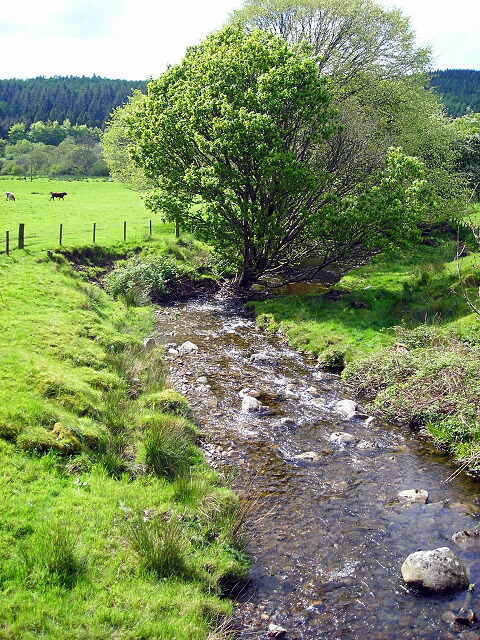
Daltamie Wood is a picturesque forest located in the region of Kirkcudbrightshire in Scotland. It covers an area of approximately 200 hectares and is renowned for its diverse flora and fauna, making it a popular destination for nature enthusiasts and outdoor lovers.

The wood is predominantly composed of native broadleaf trees such as oak, birch, and beech, which create a rich and vibrant canopy throughout the forest. These trees provide a habitat for a wide variety of wildlife, including red squirrels, roe deer, and numerous bird species, making it an ideal spot for birdwatching and wildlife spotting.

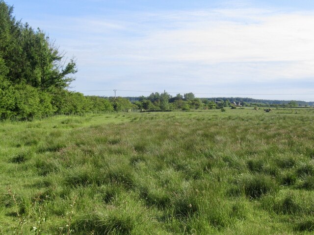
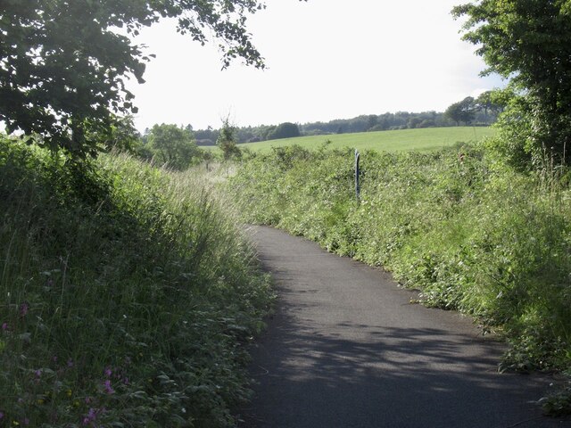
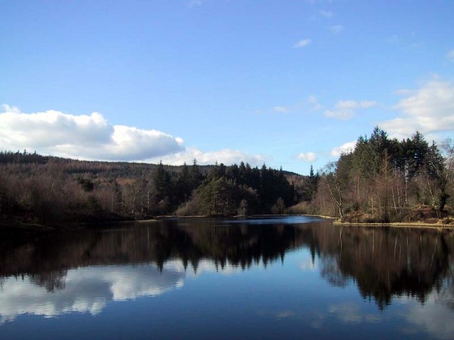
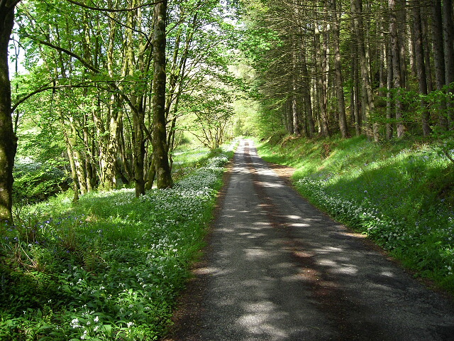
Several walking trails and paths crisscross the forest, allowing visitors to explore its natural beauty at their own pace. These trails range from easy strolls to more challenging hikes, catering to all levels of fitness and experience. Along the way, visitors can enjoy breathtaking views of the surrounding countryside, including rolling hills and the nearby Loch Ken.

Daltamie Wood also holds historical significance, with the remains of an ancient fort known as Daltamie Castle located within its boundaries. The castle dates back to the 13th century and offers a glimpse into the area's rich heritage.

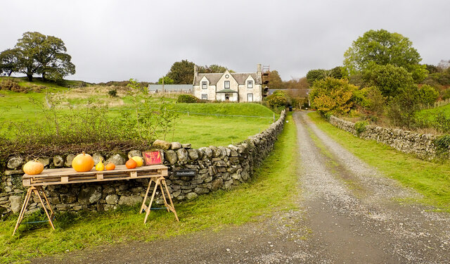
The forest is easily accessible by car, with parking available at designated areas. It is also well-maintained, with picnic spots and benches scattered throughout, providing the perfect setting for a leisurely lunch amidst nature.

Overall, Daltamie Wood is a charming and tranquil forest that offers a wonderful escape from the hustle and bustle of everyday life, providing visitors with a chance to immerse themselves in the beauty of Scotland's natural landscape.

If you have any feedback on the listing, please let us know in the comments section below.

Daltamie Wood Images

Images are sourced within 2km of 54.951241/-4.4216804 or Grid Reference NX4564. Thanks to Geograph Open Source API. All images are credited.

Pumpkins for sale at Strathmaddie Strathmaddie has pumpkins for sale 'for Halloween carving'. The minor road passing by must see little traffic whether motorised or pedestrian, so sales cannot be high.
Pumpkins for sale at Strathmaddie
Strathmaddie has pumpkins for sale 'for Halloween carving'. The minor road passing by must see little traffic whether motorised or pedestrian, so sales cannot be high.
Minor road close to Palnure Burn The road is heading south towards Graddoch Bridge. The burn is out of view to the right, meandering through fields.
Minor road close to Palnure Burn
The road is heading south towards Graddoch Bridge. The burn is out of view to the right, meandering through fields.
Trees alongside the Palnure Burn The burn can just be detected beside the middle distance trees.
Trees alongside the Palnure Burn
The burn can just be detected beside the middle distance trees.
Bungalow beside Mill Burn The burn flows just below the slope to the right, it then passes beneath the Woodend Bridge from which the image was made.
Bungalow beside Mill Burn
The burn flows just below the slope to the right, it then passes beneath the Woodend Bridge from which the image was made.
Sunlit field east of Little Park Shadowed trees beyond and shadowed bracken before but a luminously-lit grassed field in between.
Sunlit field east of Little Park
Shadowed trees beyond and shadowed bracken before but a luminously-lit grassed field in between.
Road heading north in valley of Palnure Burn The road is on the eastern side of the burn approaching Bardrochwood and other properties at Bargaly where it terminates, at least for public, motorised use.
Road heading north in valley of Palnure Burn
The road is on the eastern side of the burn approaching Bardrochwood and other properties at Bargaly where it terminates, at least for public, motorised use.
A75, Muirfad
A75, Muirfad
Between road and river, Muirfad
Carse land near Palnure Cree flood plain.
Carse land near Palnure
Cree flood plain.
Cycle path near Calgow Using an old alignment of the A75.
Cycle path near Calgow
Using an old alignment of the A75.
Old milestone On this visit we passed this milestone near the Palnure Burn twice before finally spotting it hidden in long, dry grass and brambles which were cleared away.  It used to stand upright but as the years go by it is leaning more and more.   Although several of this style are still by the roadside, this is one of the few complete with its 3 metal plates made at the Affleck foundry.   It is 36 miles from Port Patrick and another 378 to London!
Old milestone
On this visit we passed this milestone near the Palnure Burn twice before finally spotting it hidden in long, dry grass and brambles which were cleared away. It used to stand upright but as the years go by it is leaning more and more. Although several of this style are still by the roadside, this is one of the few complete with its 3 metal plates made at the Affleck foundry. It is 36 miles from Port Patrick and another 378 to London!
Bend in the River Cree and the Carse of Barr taken from the entrance to Parkmaclurg at high tide
Bend in the River Cree and the Carse of Barr
taken from the entrance to Parkmaclurg at high tide
Galloway Forest Park monument Monument and view point at the start of the Kirroughtree Mountain bike black trail.
Galloway Forest Park monument
Monument and view point at the start of the Kirroughtree Mountain bike black trail.
Outdoor Centre Stronord Outdoor Centre.  Owned by Dumfries and Galloway Council.
Outdoor Centre
Stronord Outdoor Centre. Owned by Dumfries and Galloway Council.
Viaduct - remains of the "Port Line" Not much left of the viaduct near Muirfad, which once carried trains on the Dumfries - Stranraer line
Viaduct - remains of the "Port Line"
Not much left of the viaduct near Muirfad, which once carried trains on the Dumfries - Stranraer line
Bruntis Loch
Bruntis Loch
Burn at Woodend Bridge
Minor Road Flanked by Wild Garlic and Bluebells
Show me another place!

Daltamie Wood is located at Grid Ref: NX4564 (Lat: 54.951241, Lng: -4.4216804)

Unitary Authority: Dumfries and Galloway

Police Authority: Dumfries and Galloway

What 3 Words

///taxi.invoices.retract. Near Newton Stewart, Dumfries & Galloway

Related Wikis

Kirroughtree

Kirroughtree Forest is located near Newton Stewart in Dumfries and Galloway, southwest Scotland and overlooks the Irish Sea. It is managed by Forestry...

Palnure railway station

Palnure railway station (NX450634) was a railway station on the Portpatrick and Wigtownshire Joint Railway close to Newton Stewart and the junction for...

Palnure

Palnure (Scottish Gaelic: Poll an Iùbhair) is a small village in the historical county of Kirkcudbrightshire in Dumfries and Galloway, Scotland, on the...

Kirroughtree House

Kirroughtree House is the heritage-listed mansion house (Category B listing.) of the Kirroughtree estate. It occupies a prominent position 1 mile (1.6...

McMillan Hall, Newton Stewart

The McMillan Hall is a municipal building in Dashwood Square in Newton Stewart, Dumfries and Galloway, Scotland. The structure, which is used as a community...

Penninghame

Penninghame in Wigtownshire, Dumfries and Galloway, Scotland, is a civil parish area, 8 miles (N. W.) from Wigtown. The area is approx 16 miles in length...

Minnigaff

Minnigaff is a village and civil parish in the historic county of Kirkcudbrightshire in Dumfries and Galloway, Scotland. Lead was discovered there in...

Newton Stewart railway station

Newton Stewart railway station served the town of Newton Stewart, Dumfries and Galloway, Scotland from 1861 to 1965 on the Portpatrick and Wigtownshire...

Nearby Amenities

Located within 500m of 54.951241,-4.4216804
7 Stanes Kirroughtree Trailhead
Bicycle: yes
Information: map
Tourism: information
Lat/Long: 54.9541488/-4.4193098
Bicycle Rental
The Breakpad Bike Shop
Shop: bicycle
Lat/Long: 54.9544852/-4.4193572
Traffic Calming: hump
Lat/Long: 54.9535996/-4.4172786
Kirroughtree Visitor Centre
Information: office
Tourism: information
Lat/Long: 54.9542686/-4.4194704
Cafe
Lat/Long: 54.9543734/-4.4194128
Toilets
Access: yes
Fee: no
Female: yes
Male: yes
Toilets Handwashing: yes
Toilets Position: seated;urinal
Lat/Long: 54.9545867/-4.4193041
Covered: no
Leisure: picnic_table
Lat/Long: 54.9546883/-4.4177739
Bench
Lat/Long: 54.9541262/-4.4172207
Bench
Lat/Long: 54.9521392/-4.4189943
Bench
Lat/Long: 54.9522001/-4.4189139
Bench
Lat/Long: 54.9506975/-4.4187865
Bench
Lat/Long: 54.9514646/-4.4185585
Power: pole
Lat/Long: 54.9487873/-4.4158107
Power: pole
Lat/Long: 54.9491879/-4.4167018
Power: pole
Lat/Long: 54.9489588/-4.4178449
Power: pole
Lat/Long: 54.9488208/-4.4185774
Power: pole
Lat/Long: 54.9486493/-4.4194382
Power: pole
Lat/Long: 54.9484845/-4.420278
Power: pole
Lat/Long: 54.9482246/-4.4212858
Power: pole
Lat/Long: 54.9479352/-4.4227578
Power: pole
Lat/Long: 54.9480625/-4.4244118
Power: pole
Lat/Long: 54.9482089/-4.4258051
Power: pole
Lat/Long: 54.9482796/-4.4262497
Power: pole
Lat/Long: 54.9489925/-4.4271985
Power: pole
Lat/Long: 54.9494534/-4.4278278
Power: pole
Lat/Long: 54.9497618/-4.428257
Power: pole
Lat/Long: 54.9503576/-4.4291673
Vending Machine
Vending: parking_tickets
Lat/Long: 54.9535239/-4.4191776
Vending Machine
Vending: parking_tickets
Lat/Long: 54.9534891/-4.4201116
Leisure: picnic_table
Lat/Long: 54.9550341/-4.4179732
The Breakpad Bike Shop
Shop: bicycle
Source: local knowledge
Lat/Long: 54.95452/-4.4193609
Bench: yes
Leisure: picnic_table
Lit: no
Material: wood
Lat/Long: 54.9543678/-4.4191024
Bench: yes
Leisure: picnic_table
Lit: no
Material: wood
Lat/Long: 54.9543269/-4.4191054
Bench: yes
Leisure: picnic_table
Lit: no
Material: wood
Lat/Long: 54.9542802/-4.4191214
Bench: yes
Leisure: picnic_table
Lit: no
Material: wood
Lat/Long: 54.9542384/-4.4191381
Bench: yes
Leisure: picnic_table
Lit: no
Material: wood
Lat/Long: 54.9541983/-4.4191464
Crossing
Crossing: unmarked
Crossing Markings: no
Lat/Long: 54.9536673/-4.4194145
Crossing
Crossing: unmarked
Crossing Markings: no
Lat/Long: 54.9536046/-4.4197608
Crossing
Crossing: unmarked
Crossing Markings: no
Lat/Long: 54.9536589/-4.4190995
The data included in this document is from www.openstreetmap.org. The data is made available under ODbL.

Have you been to Daltamie Wood?

Leave your review of Daltamie Wood below (or comments, questions and feedback).