Torrachilty Forest

Wood, Forest in Ross-shire

Scotland

Torrachilty Forest

The A835 approaching Contin
The A835 approaching Contin Credit: Douglas Nelson

The requested URL returned error: 429 Too Many Requests

If you have any feedback on the listing, please let us know in the comments section below.

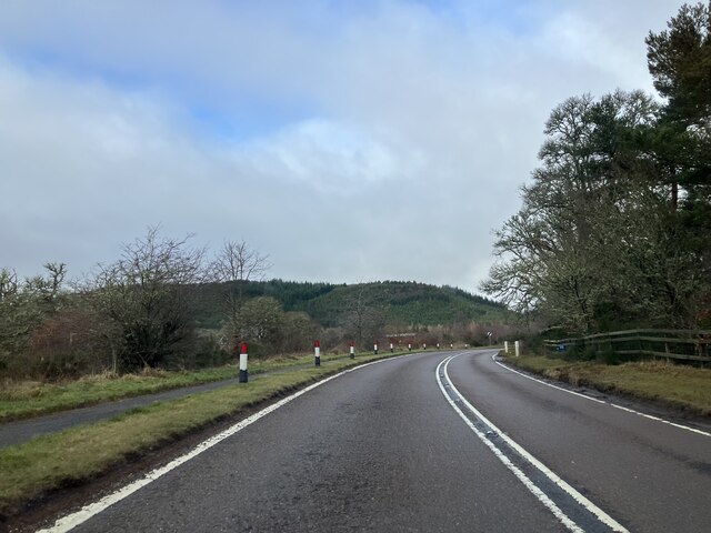
Torrachilty Forest Images

Images are sourced within 2km of 57.564651/-4.6167978 or Grid Reference NH4355. Thanks to Geograph Open Source API. All images are credited.

The A835 approaching Contin
Fairburn windfarm track
Loch Achilty Forestry Commission Car Park
A835 towards Contin The A835 is a primary road in the Scottish Highlands linking Inverness to Ullapool and the Far North of Scotland. It runs for just over 66 miles, between Tore Roundabout and Ledmore (north of Ullapool)/ The road can be particularly busy before and after ferry crossings arrive at and depart from Ullapool, and sees a great deal of goods traffic travelling to and from the Western Isles (<span class="nowrap"><a title="https://www.sabre-roads.org.uk/wiki/index.php?title=A835" rel="nofollow ugc noopener" href="https://www.sabre-roads.org.uk/wiki/index.php?title=A835">Link</a><img style="margin-left:2px;" alt="External link" title="External link - shift click to open in new window" src="https://s1.geograph.org.uk/img/external.png" width="10" height="10"/></span> SABRE).
A835 towards Contin
The A835 is a primary road in the Scottish Highlands linking Inverness to Ullapool and the Far North of Scotland. It runs for just over 66 miles, between Tore Roundabout and Ledmore (north of Ullapool)/ The road can be particularly busy before and after ferry crossings arrive at and depart from Ullapool, and sees a great deal of goods traffic travelling to and from the Western Isles (LinkExternal link SABRE).
A835 approaching Contin
A835 northbound
A835 northbound
A835 northbound
A835 northbound
Small cairn on Torr Achilty
Farm road towards Torachilty Farm
Loch Achonachie and its power station Loch Achonachie sits astride the River Conon and is impounded by a dam and power station. It's seen here from the north, nearing the summit of Torr Achilty.
(Note: Torr Achilty was reached by motoring over the dam and parking in a convenient niche on its north side; recent information is that such an approach to the hill is no longer possible and that the dam may no longer be crossed by the public, even on foot.)
Loch Achonachie and its power station
Loch Achonachie sits astride the River Conon and is impounded by a dam and power station. It's seen here from the north, nearing the summit of Torr Achilty. (Note: Torr Achilty was reached by motoring over the dam and parking in a convenient niche on its north side; recent information is that such an approach to the hill is no longer possible and that the dam may no longer be crossed by the public, even on foot.)
Moorland with pine trees north of Torr Achilty Torr Achilty is a low but rough hill on the north side of Loch Achonachie. The view is to the north-west over scattered pine trees on heather moorland.
Moorland with pine trees north of Torr Achilty
Torr Achilty is a low but rough hill on the north side of Loch Achonachie. The view is to the north-west over scattered pine trees on heather moorland.
Single track road by Loch Achonachie
Loch Achilty
Loch Achilty
Caution ahead for 13 miles
Loch Achonachie Loch Achonachie in Strath Conon seen in fading afternoon light.
Loch Achonachie
Loch Achonachie in Strath Conon seen in fading afternoon light.
Achilty Hotel The Achilty Hotel at the time of writing operates only on a B & B basis; it lies on the north side of the A835 at the west end of the village of Contin.
Achilty Hotel
The Achilty Hotel at the time of writing operates only on a B & B basis; it lies on the north side of the A835 at the west end of the village of Contin.
Autumn colours, in Achilty Oakwood A clearing in this mixed woodland above Loch Achilty. As well as oak, it includes birch, bracken and some conifers.
Autumn colours, in Achilty Oakwood
A clearing in this mixed woodland above Loch Achilty. As well as oak, it includes birch, bracken and some conifers.
Loch Achilty
Loch Achilty
Show me another place!

Torrachilty Forest is located at Grid Ref: NH4355 (Lat: 57.564651, Lng: -4.6167978)

Unitary Authority: Highland

Police Authority: Highlands and Islands

What 3 Words

///even.third.trickled. Near Strathpeffer, Highland

Related Wikis

Loch Achonachie

Loch Achonachie is a freshwater loch in Ross-Shire, Scotland, 1.9 kilometres (1.2 mi) south-west of Contin. Situated on the River Conon, the loch is a...

Loch Achilty

Loch Achilty is a large deep picturesque lowland freshwater loch set within a sloping birch and oakwood forest, located near Contin in Easter Ross in the...

Contin Island

Contin Island is an inhabited riverine islet in Ross and Cromarty within the Highland council area of Scotland. Located in the Black Water, a tributary...

Contin

Contin (Gaelic: Cunndainn) is a Ross-shire village, and a civil parish and community council area between Strathpeffer and Garve in the Highland council...

Nearby Amenities

Located within 500m of 57.564651,-4.6167978
The data included in this document is from www.openstreetmap.org. The data is made available under ODbL.

Have you been to Torrachilty Forest?

Leave your review of Torrachilty Forest below (or comments, questions and feedback).