Burn Park Plantation

Wood, Forest in Wigtownshire

Scotland

Burn Park Plantation

Car park at Kidsdale The car park at Kidsdale is used as a starting point for the descent to the shore at Port Castle Bay via the Physgill Glen. St Ninian's Cave is a niche into the cliffs at the shore there.
Car park at Kidsdale Credit: Trevor Littlewood

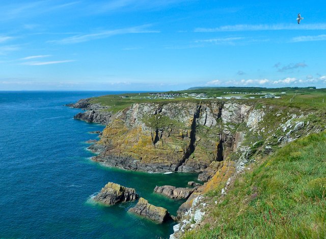
Burn Park Plantation is a picturesque woodland area located in Wigtownshire, Scotland. Covering an area of approximately 100 hectares, it is nestled in the heart of the countryside, offering visitors a tranquil and serene environment to explore.

The plantation is predominantly composed of native deciduous trees, such as oak, birch, and beech, which form a dense canopy providing shade and shelter for a variety of wildlife. The rich biodiversity of the area makes it an ideal habitat for numerous bird species, including woodpeckers, owls, and various songbirds.

A network of well-maintained trails and paths wind their way through the plantation, allowing visitors to immerse themselves in the natural beauty of the surroundings. These trails offer stunning views of the surrounding countryside and provide opportunities for leisurely walks or more adventurous hikes.

The Burn Park Plantation also features a small stream that meanders through its grounds, adding to the overall charm and tranquility of the area. This stream not only enhances the natural beauty of the woodland but also supports a diverse range of aquatic life.

The plantation is a popular destination for nature enthusiasts, birdwatchers, and families looking to enjoy a day out in nature. It offers ample parking facilities, picnic areas, and benches strategically placed to allow visitors to rest and take in the peaceful ambiance.

Overall, Burn Park Plantation is a haven of natural beauty and tranquility, providing visitors with an opportunity to immerse themselves in the stunning woodland scenery and observe the diverse wildlife that calls this area home.

If you have any feedback on the listing, please let us know in the comments section below.

Burn Park Plantation Images

Images are sourced within 2km of 54.695576/-4.4367611 or Grid Reference NX4336. Thanks to Geograph Open Source API. All images are credited.

Car park at Kidsdale The car park at Kidsdale is used as a starting point for the descent to the shore at Port Castle Bay via the Physgill Glen. St Ninian's Cave is a niche into the cliffs at the shore there.
Car park at Kidsdale
The car park at Kidsdale is used as a starting point for the descent to the shore at Port Castle Bay via the Physgill Glen. St Ninian's Cave is a niche into the cliffs at the shore there.
Path heading north-west through Physgill Glen The Physgill Glen descends from Kidsdale to the sea at Port Castle Bay.
Path heading north-west through Physgill Glen
The Physgill Glen descends from Kidsdale to the sea at Port Castle Bay.
Beach at Port Castle Bay The stony beach at the bay on a wet and windy October day. St Ninian's Cave is among the rocks in the distance and the  Physgill Glen comes down to the bay just to the right of the people at the centre of the image.
Beach at Port Castle Bay
The stony beach at the bay on a wet and windy October day. St Ninian's Cave is among the rocks in the distance and the Physgill Glen comes down to the bay just to the right of the people at the centre of the image.
Old Boundary Marker near Burrow Head, Dumfries and Galloway War Department Boundary Marker on the cliff top northwest of Burrow Head Holiday Farm and 1000 metres south of Tonderghie. Formerly in Whithorn parish, Wigtownshire, now Dumfries and Galloway. It marks the boundary of Burrow Head heavy anti-aircraft practice battery and domestic site, see <span class="nowrap"><a title="https://canmore.org.uk/site/146537/burrow-head-heavy-anti-aircraft-practice-battery-and-domestic-site" rel="nofollow ugc noopener" href="https://canmore.org.uk/site/146537/burrow-head-heavy-anti-aircraft-practice-battery-and-domestic-site">Link</a><img style="margin-left:2px;" alt="External link" title="External link - shift click to open in new window" src="https://s1.geograph.org.uk/img/external.png" width="10" height="10"/></span>.

Milestone Society National ID: WT_WDWHIT01em
Old Boundary Marker near Burrow Head, Dumfries and Galloway
War Department Boundary Marker on the cliff top northwest of Burrow Head Holiday Farm and 1000 metres south of Tonderghie. Formerly in Whithorn parish, Wigtownshire, now Dumfries and Galloway. It marks the boundary of Burrow Head heavy anti-aircraft practice battery and domestic site, see LinkExternal link. Milestone Society National ID: WT_WDWHIT01em
Road over Ersock Hill
Rose Hips A potential food source for overwintering birds.
Rose Hips
A potential food source for overwintering birds.
Robin's Pincushion or Bedeguar Gall Robin's Pincushion, or Bedeguar Gall, is a gall that appears almost exclusively on Dog Rose stems. It is caused by a gall wasp (Diplolepis rosae) which lays its eggs in either the leaves or stem of the dog rose, and one gall may contain several grubs with each one in an individual chamber. Other insects may invade the gall, some of which may be innocent tenants simply taking advantage of the gall causing an enlargement of the structure. But others may be parasites of these inhabitants and others may be hyperparasites preying on the parasites. It has been estimated that as many as 14 different species may be found within Diplolepis rosae galls. All the gall grubs will overwinter inside the 'apparently' dead gall, to emerge next Spring.
Robin's Pincushion or Bedeguar Gall
Robin's Pincushion, or Bedeguar Gall, is a gall that appears almost exclusively on Dog Rose stems. It is caused by a gall wasp (Diplolepis rosae) which lays its eggs in either the leaves or stem of the dog rose, and one gall may contain several grubs with each one in an individual chamber. Other insects may invade the gall, some of which may be innocent tenants simply taking advantage of the gall causing an enlargement of the structure. But others may be parasites of these inhabitants and others may be hyperparasites preying on the parasites. It has been estimated that as many as 14 different species may be found within Diplolepis rosae galls. All the gall grubs will overwinter inside the 'apparently' dead gall, to emerge next Spring.
Port Castle Bay, Whithorn This is the view down the beach from St. Ninian's Cave.
Port Castle Bay, Whithorn
This is the view down the beach from St. Ninian's Cave.
St. Ninian's Cave, Whithorn This is the cave St Ninian, Bishop of Whithorn, used to sit in to meditate. It overlooks Port Castle Bay. The cave is full of little hand-made crosses, made by pilgrims.
St. Ninian's Cave, Whithorn
This is the cave St Ninian, Bishop of Whithorn, used to sit in to meditate. It overlooks Port Castle Bay. The cave is full of little hand-made crosses, made by pilgrims.
Valley of Bluebells This is the valley that takes the footpath down to the beach to St Ninian's Cave. Very stout footwear needed as is a muddy path and the beach to the cave is large round stones and difficult to walk
Valley of Bluebells
This is the valley that takes the footpath down to the beach to St Ninian's Cave. Very stout footwear needed as is a muddy path and the beach to the cave is large round stones and difficult to walk
The view of St Ninian's Cave from half way down the beach Shows the sort of large stones that make up the beach and the need for stout footwear.
The view of St Ninian's Cave from half way down the beach
Shows the sort of large stones that make up the beach and the need for stout footwear.
St Ninian's Cave
St Ninian's Cave
Path to Port Castle Bay Track leading from Kidsdale to Port Castle Bay and St Ninian's Cave.
Path to Port Castle Bay
Track leading from Kidsdale to Port Castle Bay and St Ninian's Cave.
Hill of Glasserton
Hill of Glasserton
Ducker Craig Cleft on the left of scene is worked-out seam of Tonderghie copper mine (Mary Mine)
Ducker Craig
Cleft on the left of scene is worked-out seam of Tonderghie copper mine (Mary Mine)
Physgill Lodge
Physgill Lodge
Hill of Glasserton and track to Port of Counan Taken on RSPB Beached Bird Survey
Hill of Glasserton and track to Port of Counan
Taken on RSPB Beached Bird Survey
View from St Ninian's cave
Show me another place!

Burn Park Plantation is located at Grid Ref: NX4336 (Lat: 54.695576, Lng: -4.4367611)

Unitary Authority: Dumfries and Galloway

Police Authority: Dumfries and Galloway

What 3 Words

///sage.shrubbery.collapsed. Near Whithorn, Dumfries & Galloway

Related Wikis

St Ninian's Cave

St Ninian's Cave is a cave in Physgill Glen, Whithorn, Dumfries and Galloway, Scotland. It features in the climax of the acclaimed 1973 horror film The...

Glasserton

Glasserton is a civil parish in Dumfries and Galloway, south-west Scotland. It is on the Machars peninsula, in the traditional county of Wigtownshire....

Burrow Head

Burrow Head is a headland located approximately two miles south-west of Isle of Whithorn, Wigtownshire, Scotland, and is the second southernmost point...

Rispain Camp

Rispain Camp is the remains of a fortified farmstead 1 mile west of Whithorn, Dumfries and Galloway, Scotland. It is one of the major Iron Age archaeological...

Candida Casa

Candida Casa was the name given to the church established by St Ninian in Whithorn, Galloway, southern Scotland, in the mid fifth century AD. The name...

Whithorn Priory

Whithorn Priory was a medieval Scottish monastery that also served as a cathedral, located at 6 Bruce Street in Whithorn, Wigtownshire, Dumfries and Galloway...

Whithorn

Whithorn (Scots pronunciation: [ˈʍɪthorn], Taigh Mhàrtainn in modern Gaelic), is a royal burgh in the historic county of Wigtownshire in Dumfries and Galloway...

Isle of Whithorn

Isle of Whithorn (Port Rosnait in Gaelic) is one of the most southerly villages and seaports in Scotland, lying on the coast north east of Burrow Head...

Nearby Amenities

Located within 500m of 54.695576,-4.4367611
Kidsdale Farm
Place: farm
Lat/Long: 54.6998634/-4.4344105
The data included in this document is from www.openstreetmap.org. The data is made available under ODbL.

Have you been to Burn Park Plantation?

Leave your review of Burn Park Plantation below (or comments, questions and feedback).