Highcraig Wood
Wood, Forest in Renfrewshire
Scotland
Highcraig Wood
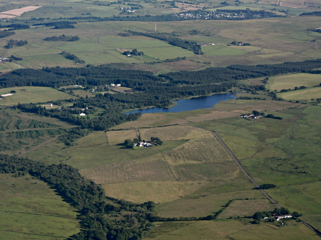
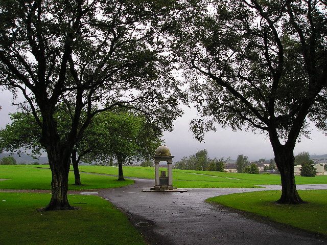
Highcraig Wood is a picturesque forest located in the region of Renfrewshire, Scotland. Situated just outside the village of Kilmacolm, this woodland covers a sprawling area of approximately 60 acres. It is a popular destination for nature enthusiasts, hikers, and families seeking outdoor recreation.
The wood is predominantly made up of broadleaf trees such as oak, beech, and birch, which provide a stunning backdrop throughout the year. In spring, the forest comes alive with vibrant colors as the trees burst into blossom and the woodland floor is carpeted with wildflowers. During the summer months, the dense canopy provides a cool and shaded environment, perfect for escaping the heat. Autumn transforms the wood into a captivating display of fiery hues as the leaves change color, creating a truly enchanting atmosphere.
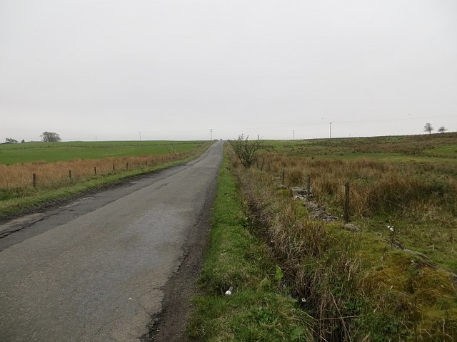
Highcraig Wood offers a network of well-maintained trails that wind through the forest, allowing visitors to explore its beauty at their own pace. These paths cater to all levels of fitness and are suitable for walkers, joggers, and cyclists. Along the way, visitors may encounter a variety of wildlife, including birds, squirrels, and deer, further enhancing the experience.
In addition to its natural charm, Highcraig Wood also boasts several picnic areas and benches, providing a tranquil setting for visitors to relax and enjoy a meal amidst the peaceful surroundings. It is a favorite spot for families to spend quality time together, with children often delighting in the freedom to run and play in a safe and natural environment.
Overall, Highcraig Wood is a captivating woodland that offers a diverse range of experiences for nature lovers. Its stunning scenery, well-maintained trails, and abundant wildlife make it an ideal destination for anyone seeking solace in nature or a peaceful day out in the countryside.
If you have any feedback on the listing, please let us know in the comments section below.
Highcraig Wood Images
Images are sourced within 2km of 55.819018/-4.5073864 or Grid Reference NS4361. Thanks to Geograph Open Source API. All images are credited.


Highcraig Wood is located at Grid Ref: NS4361 (Lat: 55.819018, Lng: -4.5073864)
Unitary Authority: Renfrewshire
Police Authority: Renfrewshire and Inverclyde
What 3 Words
///replying.fearfully.wishing. Near Johnstone, Renfrewshire
Nearby Locations
Related Wikis

Johnstone Castle
Johnstone Castle (Scots: Johnstoun Castle) is a structure and former mansion in the town of Johnstone in Renfrewshire, Scotland. It belonged to the Houstons...

Cochrane Castle
Cochrane Castle was a castle, 1 mile (1.6 km) west of Johnstone, Renfrewshire, Scotland, near the Black Cart Water. == History == The property was owned...
Johnstone Burgh F.C.
Johnstone Burgh Football Club is a Scottish football club based in Johnstone, Renfrewshire, and play in West of Scotland League First Division. == Current... ==

Paisley and Renfrewshire South (UK Parliament constituency)
Paisley and Renfrewshire South is a constituency of the House of Commons, located in Renfrewshire, Scotland to the southwest of Glasgow. It elects one...
Gleniffer Braes
Gleniffer Braes ("brae" being the Scots language word for the slope or brow of a hill) is a short range of hills and park area to the south of Paisley...

Renfrew (district)
Renfrew District (Scottish Gaelic: Sgìre Rinn Friù) was, between 1975 and 1996, one of nineteen local government districts in the Strathclyde region of...

Renfrewshire (historic)
Renfrewshire or the County of Renfrew is a historic county, registration county and lieutenancy area in the west central Lowlands of Scotland. The lieutenancy...

Johnstone railway station
Johnstone railway station serves the town of Johnstone, Renfrewshire, Scotland. The station is managed by ScotRail and is on the Ayrshire Coast Line 10...
Related Videos

Hiking Gleniffer Braes and I Eventually Find a Beautiful Waterfall
I have been told many times that a good walk/hike, pretty close to me is Gleniffer Braes, which is situated between Paisley and ...

Waterfall Wander at Gleniffer Braes | Paisley
When you can't travel far to scratch the hiking itch we looked a bit closer to home for somewhere we could stretch the legs but still ...

4K Virtual Walk - Gleniffer Braes Country Park - Paisley, Scotland
With outstanding views, a serene atmosphere and amazing spaces for walks, runs and cycles, 'the Braes' is a great day out for ...

Nearby Amenities
Located within 500m of 55.819018,-4.5073864Have you been to Highcraig Wood?
Leave your review of Highcraig Wood below (or comments, questions and feedback).