Capel Cynon

Settlement in Cardiganshire

Wales

Capel Cynon

Farmland to the east of Capel Cynon
Farmland to the east of Capel Cynon Credit: Philip Halling

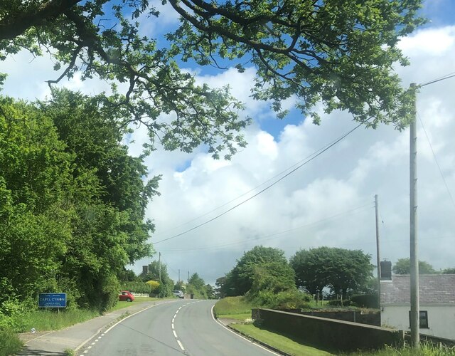
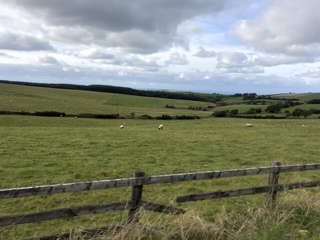
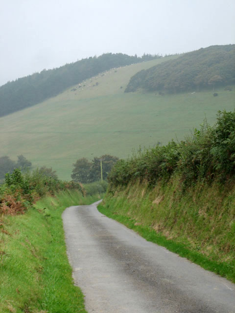
Capel Cynon is a small village located in the county of Cardiganshire, Wales. Situated in the picturesque Ceredigion region, it is surrounded by rolling hills and lush green countryside. The village is nestled in a valley, with the River Cynon meandering through its heart.

With a population of approximately 300 residents, Capel Cynon exudes a quaint and peaceful atmosphere. The village is characterized by its traditional Welsh architecture, with many stone-built houses and cottages dotting the landscape. The local chapel, after which the village is named, stands prominently in the center, acting as a focal point for community gatherings and events.

The economy of Capel Cynon primarily revolves around agriculture, with farming being the main occupation of the villagers. The fertile land surrounding the village is ideal for rearing livestock and cultivating crops. This agricultural heritage is deeply rooted in the community, and farming traditions are still practiced with pride.

Despite its small size, Capel Cynon boasts a strong sense of community spirit. The villagers actively engage in various social and cultural activities, organizing events such as fairs and festivals. These gatherings provide opportunities for locals and visitors alike to celebrate the rich Welsh heritage, with traditional music, dancing, and storytelling taking center stage.

For nature enthusiasts, Capel Cynon offers ample opportunities to explore the stunning Welsh countryside. The village is a perfect starting point for scenic walks along the riverbank or hikes up the nearby hills, providing breathtaking views of the surrounding landscape.

In summary, Capel Cynon is a charming village in Cardiganshire, known for its tranquil setting, traditional architecture, and strong community bonds. It offers a glimpse into the idyllic beauty and cultural richness of rural Wales.

If you have any feedback on the listing, please let us know in the comments section below.

Capel Cynon Images

Images are sourced within 2km of 52.120893/-4.362617 or Grid Reference SN3849. Thanks to Geograph Open Source API. All images are credited.

Farmland to the east of Capel Cynon
View to Pant Bach View across farmland to the east of Capel Cynon to Pant Bach.
View to Pant Bach
View across farmland to the east of Capel Cynon to Pant Bach.
Entering Capel Cynon on the A486
Churn Stand There is an Ordnance Survey rivet on the step of the stand. <a title="https://www.geograph.org.uk/photo/7446177" href="https://www.geograph.org.uk/photo/7446177">Link</a>
Churn Stand
There is an Ordnance Survey rivet on the step of the stand. Link
Ordnance Survey Rivet This OS rivet can be found on the step of the churn stand. It marks a point 259.389m above mean sea level. <a title="https://www.geograph.org.uk/photo/7446176" href="https://www.geograph.org.uk/photo/7446176">Link</a>
Ordnance Survey Rivet
This OS rivet can be found on the step of the churn stand. It marks a point 259.389m above mean sea level. Link
Churn Stand There is an Ordnance Survey cut mark on the front of the stand. <a title="https://www.geograph.org.uk/photo/7446179" href="https://www.geograph.org.uk/photo/7446179">Link</a>
Churn Stand
There is an Ordnance Survey cut mark on the front of the stand. Link
Ordnance Survey Cut Mark This OS cut mark can be found on the front of the Churn Stand. It marks a point 255.144m above mean sea level. <a title="https://www.geograph.org.uk/photo/7446178" href="https://www.geograph.org.uk/photo/7446178">Link</a>
Ordnance Survey Cut Mark
This OS cut mark can be found on the front of the Churn Stand. It marks a point 255.144m above mean sea level. Link
Churn Stand
Churn Stand
Gabrielle's Galley Art gallery with workshops off the A486 between Ffostrasol and Capel Cynon
Gabrielle's Galley
Art gallery with workshops off the A486 between Ffostrasol and Capel Cynon
Farmland near Blaencwrt Farmland near Blaencwrt, Capel Cynon.  Morning mist is hanging in the low-lying valley in the distance.
Farmland near Blaencwrt
Farmland near Blaencwrt, Capel Cynon. Morning mist is hanging in the low-lying valley in the distance.
Farm land north of Capel Cynon
Fields dotted with sheep near Capel Cynon
From near Alltmaen towards Pant-bach View down the slope across an autumn meadow, with fine trees towards the valley bottom.
From near Alltmaen towards Pant-bach
View down the slope across an autumn meadow, with fine trees towards the valley bottom.
Plwmp Radio Tower This radio tower stands high near Plwmp just off the Welsh coast road. It used to belong to Swalec or South Wales Electric till it was acquired by Surf Telecoms.
Plwmp Radio Tower
This radio tower stands high near Plwmp just off the Welsh coast road. It used to belong to Swalec or South Wales Electric till it was acquired by Surf Telecoms.
You get the bends An empty square and a misty morning: what do you get?
You get the bends
An empty square and a misty morning: what do you get?
With high banks and higher The high bank in the misty distance reaches 300 metres above sea level at its crest; the high bank in the foreground rises not much more than three metres from the road.
With high banks and higher
The high bank in the misty distance reaches 300 metres above sea level at its crest; the high bank in the foreground rises not much more than three metres from the road.
Level road, falling land For the time being the road stays level while the land to the left (south) falls away.  Soon, however, the road too descends - to Capel Cynon.
Level road, falling land
For the time being the road stays level while the land to the left (south) falls away. Soon, however, the road too descends - to Capel Cynon.
Heading south to Ffostrasol or head west instead: turn right!
Heading south to Ffostrasol
or head west instead: turn right!
Show me another place!

Capel Cynon is located at Grid Ref: SN3849 (Lat: 52.120893, Lng: -4.362617)

Unitary Authority: Ceredigion

Police Authority: Dyfed Powys

What 3 Words

///mystified.change.kicks. Near Llanllwchaiarn, Ceredigion

Nearby Locations

Capel Cynon

Related Wikis

A486 road

The A486 is an A road in Wales linking New Quay, Ceredigion, with the A484 in Saron (Llangeler), Carmarthenshire. == Route == The road begins in New Quay...

Ffostrasol

Ffostrasol is a small village in the south of Ceredigion, Wales. It is located on the A486 between Synod Inn and Llandysul, and it forms part of the parish...

Blaenbedw Fawr

Blaenbedw Fawr is a small village in the community of Llandysiliogogo, Ceredigion, Wales, which is 68.9 miles (110.8 km) from Cardiff and 187 miles (300...

Rhos Llawr Cwrt National Nature Reserve

Rhos Llawr Cwrt National Nature Reserve nestles in the base of the Clettwr valley, some 10 kilometres from the Ceredigion coast, between Ffostrasol and...

Nearby Amenities

Located within 500m of 52.120893,-4.362617
Capel Cynon
Place: hamlet
Wikidata: Q11054093
Wikipedia: cy:Capel Cynon
Lat/Long: 52.1204385/-4.3637328
The data included in this document is from www.openstreetmap.org. The data is made available under ODbL.

Have you been to Capel Cynon?

Leave your review of Capel Cynon below (or comments, questions and feedback).