Glen Plantation

Wood, Forest in Wigtownshire

Scotland

Glen Plantation

Car park at Kidsdale The car park at Kidsdale is used as a starting point for the descent to the shore at Port Castle Bay via the Physgill Glen. St Ninian's Cave is a niche into the cliffs at the shore there.
Car park at Kidsdale Credit: Trevor Littlewood

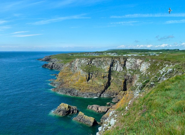
Glen Plantation is a majestic woodland area located in Wigtownshire, Scotland. Encompassing a vast expanse of lush greenery and towering trees, the plantation is a true haven for nature enthusiasts and those seeking tranquility amidst the beauty of the Scottish countryside.

The plantation is renowned for its diverse range of tree species, including oak, beech, and pine, which create a captivating and ever-changing landscape throughout the seasons. The trees stand tall and proud, forming a dense canopy that filters sunlight and casts enchanting shadows on the forest floor below.

Wandering through Glen Plantation, visitors are greeted by a network of well-maintained trails, allowing for exploration and a deeper connection with nature. These paths wind their way through the woodland, revealing hidden treasures such as natural springs, small streams, and wildlife habitats.

A rich variety of flora and fauna call Glen Plantation their home. From delicate wildflowers that carpet the forest floor in spring to the chirping of birds and the occasional sighting of deer, the plantation offers a captivating glimpse into the wonders of the natural world.

Glen Plantation is not only a sanctuary for wildlife but also a place of historical significance. It is believed that the plantation has been in existence for centuries, with ancient ruins and remnants of past settlements scattered throughout the woodland. These remnants serve as a reminder of the plantation's deep-rooted history and the human connection to the land.

In conclusion, Glen Plantation is a captivating woodlands area in Wigtownshire, Scotland, offering a serene escape into nature's embrace. With its diverse range of trees, well-maintained trails, and rich wildlife, the plantation is a must-visit destination for those seeking solace and a deeper appreciation for the natural world.

If you have any feedback on the listing, please let us know in the comments section below.

Glen Plantation Images

Images are sourced within 2km of 54.694784/-4.4417263 or Grid Reference NX4236. Thanks to Geograph Open Source API. All images are credited.

Car park at Kidsdale The car park at Kidsdale is used as a starting point for the descent to the shore at Port Castle Bay via the Physgill Glen. St Ninian's Cave is a niche into the cliffs at the shore there.
Car park at Kidsdale
The car park at Kidsdale is used as a starting point for the descent to the shore at Port Castle Bay via the Physgill Glen. St Ninian's Cave is a niche into the cliffs at the shore there.
Path heading north-west through Physgill Glen The Physgill Glen descends from Kidsdale to the sea at Port Castle Bay.
Path heading north-west through Physgill Glen
The Physgill Glen descends from Kidsdale to the sea at Port Castle Bay.
Beach at Port Castle Bay The stony beach at the bay on a wet and windy October day. St Ninian's Cave is among the rocks in the distance and the  Physgill Glen comes down to the bay just to the right of the people at the centre of the image.
Beach at Port Castle Bay
The stony beach at the bay on a wet and windy October day. St Ninian's Cave is among the rocks in the distance and the Physgill Glen comes down to the bay just to the right of the people at the centre of the image.
Looking Back Looking down the new footpath towards the new bridge over the stream, the high wall in the background is the walled garden belonging to Woodfall.
Looking Back
Looking down the new footpath towards the new bridge over the stream, the high wall in the background is the walled garden belonging to Woodfall.
Rose Hips A potential food source for overwintering birds.
Rose Hips
A potential food source for overwintering birds.
Robin's Pincushion or Bedeguar Gall Robin's Pincushion, or Bedeguar Gall, is a gall that appears almost exclusively on Dog Rose stems. It is caused by a gall wasp (Diplolepis rosae) which lays its eggs in either the leaves or stem of the dog rose, and one gall may contain several grubs with each one in an individual chamber. Other insects may invade the gall, some of which may be innocent tenants simply taking advantage of the gall causing an enlargement of the structure. But others may be parasites of these inhabitants and others may be hyperparasites preying on the parasites. It has been estimated that as many as 14 different species may be found within Diplolepis rosae galls. All the gall grubs will overwinter inside the 'apparently' dead gall, to emerge next Spring.
Robin's Pincushion or Bedeguar Gall
Robin's Pincushion, or Bedeguar Gall, is a gall that appears almost exclusively on Dog Rose stems. It is caused by a gall wasp (Diplolepis rosae) which lays its eggs in either the leaves or stem of the dog rose, and one gall may contain several grubs with each one in an individual chamber. Other insects may invade the gall, some of which may be innocent tenants simply taking advantage of the gall causing an enlargement of the structure. But others may be parasites of these inhabitants and others may be hyperparasites preying on the parasites. It has been estimated that as many as 14 different species may be found within Diplolepis rosae galls. All the gall grubs will overwinter inside the 'apparently' dead gall, to emerge next Spring.
Port Castle Bay, Whithorn This is the view down the beach from St. Ninian's Cave.
Port Castle Bay, Whithorn
This is the view down the beach from St. Ninian's Cave.
St. Ninian's Cave, Whithorn This is the cave St Ninian, Bishop of Whithorn, used to sit in to meditate. It overlooks Port Castle Bay. The cave is full of little hand-made crosses, made by pilgrims.
St. Ninian's Cave, Whithorn
This is the cave St Ninian, Bishop of Whithorn, used to sit in to meditate. It overlooks Port Castle Bay. The cave is full of little hand-made crosses, made by pilgrims.
Valley of Bluebells This is the valley that takes the footpath down to the beach to St Ninian's Cave. Very stout footwear needed as is a muddy path and the beach to the cave is large round stones and difficult to walk
Valley of Bluebells
This is the valley that takes the footpath down to the beach to St Ninian's Cave. Very stout footwear needed as is a muddy path and the beach to the cave is large round stones and difficult to walk
The view of St Ninian's Cave from half way down the beach Shows the sort of large stones that make up the beach and the need for stout footwear.
The view of St Ninian's Cave from half way down the beach
Shows the sort of large stones that make up the beach and the need for stout footwear.
St Ninian's Cave
St Ninian's Cave
Path to Port Castle Bay Track leading from Kidsdale to Port Castle Bay and St Ninian's Cave.
Path to Port Castle Bay
Track leading from Kidsdale to Port Castle Bay and St Ninian's Cave.
Hill of Glasserton
Hill of Glasserton
Ducker Craig Cleft on the left of scene is worked-out seam of Tonderghie copper mine (Mary Mine)
Ducker Craig
Cleft on the left of scene is worked-out seam of Tonderghie copper mine (Mary Mine)
Physgill Lodge
Physgill Lodge
Hill of Glasserton and track to Port of Counan Taken on RSPB Beached Bird Survey
Hill of Glasserton and track to Port of Counan
Taken on RSPB Beached Bird Survey
Desolate plastic-strewn raised beach Beached Bird Survey walk
Desolate plastic-strewn raised beach
Beached Bird Survey walk
View from St Ninian's cave
Show me another place!

Glen Plantation is located at Grid Ref: NX4236 (Lat: 54.694784, Lng: -4.4417263)

Unitary Authority: Dumfries and Galloway

Police Authority: Dumfries and Galloway

What 3 Words

///turntable.legs.hurricane. Near Whithorn, Dumfries & Galloway

Related Wikis

St Ninian's Cave

St Ninian's Cave is a cave in Physgill Glen, Whithorn, Dumfries and Galloway, Scotland. It features in the climax of the acclaimed 1973 horror film The...

Glasserton

Glasserton is a civil parish in Dumfries and Galloway, south-west Scotland. It is on the Machars peninsula, in the traditional county of Wigtownshire....

Burrow Head

Burrow Head is a headland located approximately two miles south-west of Isle of Whithorn, Wigtownshire, Scotland, and is the second southernmost point...

Rispain Camp

Rispain Camp is the remains of a fortified farmstead 1 mile west of Whithorn, Dumfries and Galloway, Scotland. It is one of the major Iron Age archaeological...

Nearby Amenities

Located within 500m of 54.694784,-4.4417263
Source: PGS
Lat/Long: 54.6935706/-4.4491825
Source: PGS
Lat/Long: 54.6935954/-4.4487748
Source: PGS
Lat/Long: 54.693645/-4.4484744
Source: PGS
Lat/Long: 54.6936822/-4.4480023
Source: PGS
Lat/Long: 54.6935706/-4.447659
Source: PGS
Lat/Long: 54.6935085/-4.4472298
Source: PGS
Lat/Long: 54.693411/-4.446978
Source: PGS
Lat/Long: 54.6931117/-4.4457063
Source: PGS
Lat/Long: 54.6928141/-4.4447837
Source: PGS
Lat/Long: 54.6926032/-4.4439039
Source: PGS
Lat/Long: 54.6922436/-4.4430027
Source: PGS
Lat/Long: 54.6920327/-4.443346
Source: PGS
Lat/Long: 54.6916607/-4.4431314
Source: PGS
Lat/Long: 54.6913754/-4.4426808
Source: PGS
Lat/Long: 54.6912638/-4.4423589
Source: PGS
Lat/Long: 54.691165/-4.442034
Source: PGS
Lat/Long: 54.69117/-4.441592
Source: PGS
Lat/Long: 54.691045/-4.441367
Source: PGS
Lat/Long: 54.6909786/-4.4409427
Source: PGS
Lat/Long: 54.6906933/-4.4406852
St. Ninian's Cave
Natural: cave_entrance
Tourism: attraction
Wikidata: Q2315818
Lat/Long: 54.6938497/-4.4491264
The data included in this document is from www.openstreetmap.org. The data is made available under ODbL.

Have you been to Glen Plantation?

Leave your review of Glen Plantation below (or comments, questions and feedback).