Bloody Neuk

Coastal Feature, Headland, Point in Wigtownshire

Scotland

Bloody Neuk

Glasserton Churchyard
Glasserton Churchyard Credit: Billy McCrorie

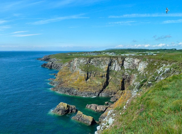
Bloody Neuk is a prominent coastal feature located in Wigtownshire, a historic county in southwestern Scotland. It is a headland that juts out into the North Channel, separating the Irish Sea from the North Atlantic Ocean. This rugged point offers breathtaking views of the surrounding coastline and is a popular destination for tourists and outdoor enthusiasts.

The name "Bloody Neuk" originates from the area's violent past, with tales of brutal battles and bloodshed. It is believed that the headland witnessed numerous conflicts between warring clans and rival factions during ancient times. The name serves as a reminder of the region's turbulent history.

Geologically, Bloody Neuk is composed of rugged cliffs and rocky outcrops, making it an ideal spot for birdwatching and wildlife observation. The headland is home to a diverse range of seabirds, including guillemots, kittiwakes, and puffins, which nest in the cliffs during the breeding season. Visitors can often spot seals basking on nearby rocks or dolphins swimming in the crystal-clear waters.

The area surrounding Bloody Neuk is also known for its picturesque coastal walks and hiking trails. Adventurous trekkers can explore the headland and enjoy panoramic views of the sea and the distant horizon. Additionally, the nearby village of Portpatrick offers amenities such as cafes, restaurants, and accommodations for those seeking a more relaxed experience.

In summary, Bloody Neuk is a captivating headland in Wigtownshire, Scotland, renowned for its dramatic cliffs, rich wildlife, and historical significance. Whether it's the rugged beauty, the abundant birdlife, or the echoes of a turbulent past, this coastal feature continues to captivate visitors from near and far.

If you have any feedback on the listing, please let us know in the comments section below.
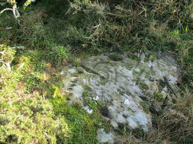
Bloody Neuk Images

Images are sourced within 2km of 54.69487/-4.4512449 or Grid Reference NX4236. Thanks to Geograph Open Source API. All images are credited.

Glasserton Churchyard
Black Cow at Glasserton Viewed from the back of the churchyard.
Black Cow at Glasserton
Viewed from the back of the churchyard.
Glasserton Churchyard
Graveyard, Glasserton
Graveyard at Glasserton
Car park at Kidsdale The car park at Kidsdale is used as a starting point for the descent to the shore at Port Castle Bay via the Physgill Glen. St Ninian's Cave is a niche into the cliffs at the shore there.
Car park at Kidsdale
The car park at Kidsdale is used as a starting point for the descent to the shore at Port Castle Bay via the Physgill Glen. St Ninian's Cave is a niche into the cliffs at the shore there.
Path heading north-west through Physgill Glen The Physgill Glen descends from Kidsdale to the sea at Port Castle Bay.
Path heading north-west through Physgill Glen
The Physgill Glen descends from Kidsdale to the sea at Port Castle Bay.
Beach at Port Castle Bay The stony beach at the bay on a wet and windy October day. St Ninian's Cave is among the rocks in the distance and the  Physgill Glen comes down to the bay just to the right of the people at the centre of the image.
Beach at Port Castle Bay
The stony beach at the bay on a wet and windy October day. St Ninian's Cave is among the rocks in the distance and the Physgill Glen comes down to the bay just to the right of the people at the centre of the image.
Glasserton Cup and Ring Marks (1) Cup and ring marks on rocks appear all over the world and there are many theories as to their uses and who created them.
Glasserton Cup and Ring Marks (1)
Cup and ring marks on rocks appear all over the world and there are many theories as to their uses and who created them.
Glasserton Cup and Ring Marks (2) Cup and ring marks on rocks appear all over the world and there are many theories as to their uses and who created them.
Glasserton Cup and Ring Marks (2)
Cup and ring marks on rocks appear all over the world and there are many theories as to their uses and who created them.
Glasserton Cup and Ring Marks (3) Cup and ring marks on rocks appear all over the world and there are many theories as to their uses and who created them.
Glasserton Cup and Ring Marks (3)
Cup and ring marks on rocks appear all over the world and there are many theories as to their uses and who created them.
Glasserton Cup and Ring Marks (4) Cup and ring marks on rocks appear all over the world and there are many theories as to their uses and who created them.
Glasserton Cup and Ring Marks (4)
Cup and ring marks on rocks appear all over the world and there are many theories as to their uses and who created them.
Glasserton Cup and Ring Marks (5) Cup and ring marks on rocks appear all over the world and there are many theories as to their uses and who created them.
Glasserton Cup and Ring Marks (5)
Cup and ring marks on rocks appear all over the world and there are many theories as to their uses and who created them.
Glasserton Cup and Ring Marks (6) Cup and ring marks on rocks appear all over the world and there are many theories as to their uses and who created them.
Glasserton Cup and Ring Marks (6)
Cup and ring marks on rocks appear all over the world and there are many theories as to their uses and who created them.
Leaving the Churchyard The start of a 'new' footpath that borders Shrubbery Park and ends at Claymoddie. This is part of a project carried out by "All Roads Lead to Whithorn" over the Summer of 2023 to provide an 18km network of paths that eventually take walkers to St Ninian's cave.
Leaving the Churchyard
The start of a 'new' footpath that borders Shrubbery Park and ends at Claymoddie. This is part of a project carried out by "All Roads Lead to Whithorn" over the Summer of 2023 to provide an 18km network of paths that eventually take walkers to St Ninian's cave.
Looking Back Looking down the new footpath towards the new bridge over the stream, the high wall in the background is the walled garden belonging to Woodfall.
Looking Back
Looking down the new footpath towards the new bridge over the stream, the high wall in the background is the walled garden belonging to Woodfall.
Show me another place!

Bloody Neuk is located at Grid Ref: NX4236 (Lat: 54.69487, Lng: -4.4512449)

Unitary Authority: Dumfries and Galloway

Police Authority: Dumfries and Galloway

What 3 Words

///routs.deeply.react. Near Whithorn, Dumfries & Galloway

Related Wikis

St Ninian's Cave

St Ninian's Cave is a cave in Physgill Glen, Whithorn, Dumfries and Galloway, Scotland. It features in the climax of the acclaimed 1973 horror film The...

Glasserton

Glasserton is a civil parish in Dumfries and Galloway, south-west Scotland. It is on the Machars peninsula, in the traditional county of Wigtownshire....

Rispain Camp

Rispain Camp is the remains of a fortified farmstead 1 mile west of Whithorn, Dumfries and Galloway, Scotland. It is one of the major Iron Age archaeological...

Burrow Head

Burrow Head is a headland located approximately two miles south-west of Isle of Whithorn, Wigtownshire, Scotland, and is the second southernmost point...

Nearby Amenities

Located within 500m of 54.69487,-4.4512449
Source: PGS
Lat/Long: 54.696088/-4.4583449
Source: PGS
Lat/Long: 54.6961872/-4.4576154
Source: PGS
Lat/Long: 54.6961996/-4.4570789
Source: PGS
Lat/Long: 54.69615/-4.4567141
Source: PGS
Lat/Long: 54.6960508/-4.4559631
Source: PGS
Lat/Long: 54.6958276/-4.4554696
Source: PGS
Lat/Long: 54.695498/-4.45457
Source: PGS
Lat/Long: 54.6951579/-4.4541178
Source: PGS
Lat/Long: 54.695002/-4.453226
Source: PGS
Lat/Long: 54.6947115/-4.4528947
Source: PGS
Lat/Long: 54.6946867/-4.4516072
Source: PGS
Lat/Long: 54.694389/-4.4508776
Source: PGS
Lat/Long: 54.6938558/-4.4509206
Source: PGS
Lat/Long: 54.693769/-4.4504699
Source: PGS
Lat/Long: 54.6936946/-4.4500837
Source: PGS
Lat/Long: 54.6935582/-4.4497833
Source: PGS
Lat/Long: 54.6935582/-4.44944
Source: PGS
Lat/Long: 54.6935706/-4.4491825
Source: PGS
Lat/Long: 54.6935954/-4.4487748
Source: PGS
Lat/Long: 54.693645/-4.4484744
Source: PGS
Lat/Long: 54.6936822/-4.4480023
Source: PGS
Lat/Long: 54.6935706/-4.447659
Source: PGS
Lat/Long: 54.6935085/-4.4472298
Source: PGS
Lat/Long: 54.693411/-4.446978
Source: PGS
Lat/Long: 54.6931117/-4.4457063
Source: PGS
Lat/Long: 54.6928141/-4.4447837
St. Ninian's Cave
Natural: cave_entrance
Tourism: attraction
Wikidata: Q2315818
Lat/Long: 54.6938497/-4.4491264
The data included in this document is from www.openstreetmap.org. The data is made available under ODbL.

Have you been to Bloody Neuk?

Leave your review of Bloody Neuk below (or comments, questions and feedback).