Blackhill Plantation

Wood, Forest in Dunbartonshire

Scotland

Blackhill Plantation

Old milestone & old milepost On the A811 north from Alexandria and Dumbarton and opposite the Gowk Inn, now a house, are these two mile markers.  The upper red sandstone set in the wall bordering Auchenlinnhe House is like the stone in Drymen opposite the Buchanan Arms at <a href="https://www.geograph.org.uk/gridref/NS47438834">NS47438834</a>.  The metal plate is one of the posts erected at the turn of the 19/20C.   The Dunbarton 6 and 8 plates were still in place a few years ago.
Old milestone & old milepost Credit: Willy Findlay

Blackhill Plantation is a picturesque woodland located in Dunbartonshire, Scotland. Covering an expansive area, the plantation offers a serene and tranquil setting for nature enthusiasts and outdoor lovers.

The woodland is primarily composed of mature trees, including a variety of coniferous and deciduous species, creating a diverse and vibrant ecosystem. These trees provide a dense canopy, offering shade and shelter for a wide range of flora and fauna. The forest floor is adorned with a rich carpet of mosses, ferns, and wildflowers, enhancing the enchanting atmosphere.

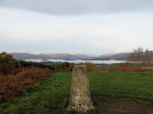
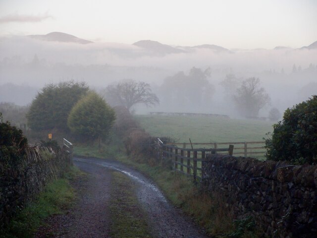
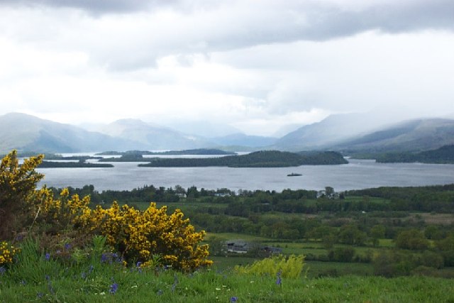
Blackhill Plantation offers an extensive network of well-maintained pathways, making it a popular destination for walkers, hikers, and joggers. The trails meander through the plantation, allowing visitors to explore the natural beauty at their own pace. Along the way, there are several viewpoints that provide breathtaking vistas of the surrounding countryside and neighboring lochs.

The woodland is also home to a variety of wildlife, including deer, foxes, and numerous bird species. Birdwatchers will delight in the chance to spot species such as woodpeckers, owls, and various songbirds in their natural habitat. The tranquil ambiance of the woodland makes it an excellent spot for birdwatching and wildlife photography.

Blackhill Plantation is easily accessible, with ample parking and well-signposted entrances. The woodland is open to the public year-round, offering visitors the opportunity to enjoy its beauty in every season. Whether one is seeking a peaceful stroll, a challenging hike, or a chance to immerse themselves in nature, Blackhill Plantation in Dunbartonshire is a must-visit destination.

If you have any feedback on the listing, please let us know in the comments section below.

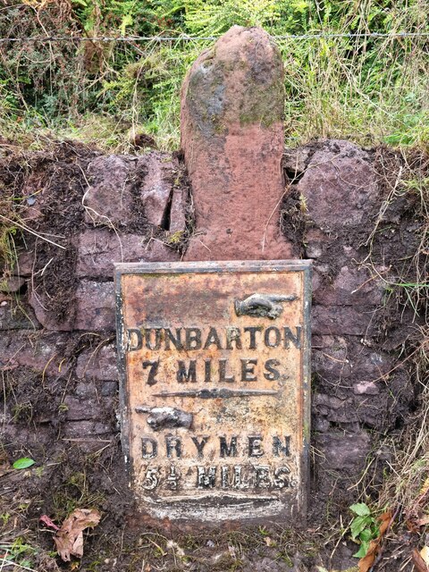
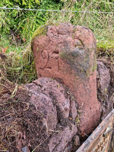
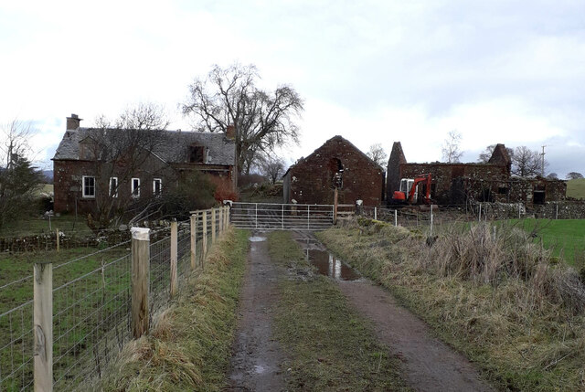
Blackhill Plantation Images

Images are sourced within 2km of 56.029037/-4.5308955 or Grid Reference NS4284. Thanks to Geograph Open Source API. All images are credited.

Old milestone & old milepost On the A811 north from Alexandria and Dumbarton and opposite the Gowk Inn, now a house, are these two mile markers.  The upper red sandstone set in the wall bordering Auchenlinnhe House is like the stone in Drymen opposite the Buchanan Arms at <a href="https://www.geograph.org.uk/gridref/NS47438834">NS47438834</a>.  The metal plate is one of the posts erected at the turn of the 19/20C.   The Dunbarton 6 and 8 plates were still in place a few years ago.
Old milestone & old milepost
On the A811 north from Alexandria and Dumbarton and opposite the Gowk Inn, now a house, are these two mile markers. The upper red sandstone set in the wall bordering Auchenlinnhe House is like the stone in Drymen opposite the Buchanan Arms at NS47438834. The metal plate is one of the posts erected at the turn of the 19/20C. The Dunbarton 6 and 8 plates were still in place a few years ago.
Old milestone This shows the left-hand side of the red sandstone milestone set in the wall surrounding Auchenlinnhe House.  The top of the newer metal milepost can just be seen.  27 is the mileage from Stirling.  MS is shown on the 1776 Taylor & Skinner map and this is the route of the Old Military Road built between 1765-97 by Major William Caufeild.
Old milestone
This shows the left-hand side of the red sandstone milestone set in the wall surrounding Auchenlinnhe House. The top of the newer metal milepost can just be seen. 27 is the mileage from Stirling. MS is shown on the 1776 Taylor & Skinner map and this is the route of the Old Military Road built between 1765-97 by Major William Caufeild.
Old milestone The right-hand face of the red sandstone milestone in the wall surrounding Auchenlinnhe House.   The inscribed 7 is the mileage to Dumbarton.
Old milestone
The right-hand face of the red sandstone milestone in the wall surrounding Auchenlinnhe House. The inscribed 7 is the mileage to Dumbarton.
East Cambusmoon Farm
Trig pillar on Duncryne Hill Great views over Loch Lomond
Trig pillar on Duncryne Hill
Great views over Loch Lomond
Track in Duncryne Wood, leading to Duncryne Hill
A811, Gartocharn
A811, Gartocharn
A811 entering Gartocharn
Old Kirk About a mile north east of Balloch, an old black and white signpost indicates “BALLAGAN AND OLD KIRK”. It is now a struggle to reach Old Kirk even on foot. It is the site of a now derelict farm. Nearby, old maps show “Site of Chapel” where burial remains were once found.
Old Kirk
About a mile north east of Balloch, an old black and white signpost indicates “BALLAGAN AND OLD KIRK”. It is now a struggle to reach Old Kirk even on foot. It is the site of a now derelict farm. Nearby, old maps show “Site of Chapel” where burial remains were once found.
Millennium Hall, Gartocharn Community hall.
Millennium Hall, Gartocharn
Community hall.
The Aber Path On a misty morning. No helpful signs to tell me that the bridge at the far end was lifted and that I would be expected to return to here when I got there.
The Aber Path
On a misty morning. No helpful signs to tell me that the bridge at the far end was lifted and that I would be expected to return to here when I got there.
Loch Lomond from Duncryne Hill Duncryne is a volcanic plug near to Gartocharn south of Loch Lomond and offers fantastic views of Loch Lomond
Loch Lomond from Duncryne Hill
Duncryne is a volcanic plug near to Gartocharn south of Loch Lomond and offers fantastic views of Loch Lomond
Scattered woodland on Duncryne. Getting to That View is part of the fun on Duncryne.  The modest climb through scattered woodland is a delight, especially as spring turns to summer.
Scattered woodland on Duncryne.
Getting to That View is part of the fun on Duncryne. The modest climb through scattered woodland is a delight, especially as spring turns to summer.
Gartocharn A dark winter's morning outside the shop and garage in Gartocharn.
Gartocharn
A dark winter's morning outside the shop and garage in Gartocharn.
Duncryne Hill Taken from Loch Lomond Nature Reserve
Duncryne Hill
Taken from Loch Lomond Nature Reserve
Approaching Gartocharn A view looking northeast along the A811 Old Military Road on the approach to Gartocharn. The buildings of Burnbrae Farm are on the right.
Approaching Gartocharn
A view looking northeast along the A811 Old Military Road on the approach to Gartocharn. The buildings of Burnbrae Farm are on the right.
Scrapyard off the A811 A view looking to the northeast at the entrance to a scrapyard adjacent to the A811 old Military road.
Scrapyard off the A811
A view looking to the northeast at the entrance to a scrapyard adjacent to the A811 old Military road.
Derelict farm buildings Blairquhannan.
Show me another place!

Blackhill Plantation is located at Grid Ref: NS4284 (Lat: 56.029037, Lng: -4.5308955)

Unitary Authority: West Dunbartonshire

Police Authority: Argyll and West Dunbartonshire

What 3 Words

///commoners.propelled.apple. Near Balloch, West Dunbartonshire

Related Wikis

Gartocharn

Gartocharn (; Scottish Gaelic: Gart a’ Chàirn [ˈkarˠʃt̪ ə ˈxaːrˠɲ]) is a village in West Dunbartonshire in Scotland, United Kingdom. It is the only village...

Caldarvan railway station

Caldarvan railway station served the estate of Caldarvan, in the historical county of Dunbartonshire, Scotland, from 1856 to 1934 on the Forth and Clyde...

Ross Priory

Ross Priory is an early 19th-century country house located west of Gartocharn, West Dunbartonshire, on the south shore of Loch Lomond, Scotland. From the...

Balloch Castle

Balloch Castle is an early 19th-century country house situated at the southern tip of Loch Lomond, in West Dunbartonshire, Scotland. Balloch was a property...

Nearby Amenities

Located within 500m of 56.029037,-4.5308955
Power: pole
Lat/Long: 56.0254722/-4.5276426
Power: pole
Lat/Long: 56.0258462/-4.5286655
Power: pole
Lat/Long: 56.0262612/-4.5298013
Power: pole
Lat/Long: 56.0267358/-4.5310584
Power: pole
Lat/Long: 56.0271507/-4.5322005
Power: pole
Lat/Long: 56.0276218/-4.5335162
Power: pole
Lat/Long: 56.0280741/-4.5347587
Power: pole
Lat/Long: 56.0286854/-4.5352356
Power: pole
Lat/Long: 56.0293119/-4.5357188
Power: pole
Lat/Long: 56.0299594/-4.5362292
Power: pole
Lat/Long: 56.0306338/-4.5370596
Power: pole
Lat/Long: 56.0312532/-4.5378126
Power: pole
Lat/Long: 56.0313929/-4.5240856
Power: pole
Lat/Long: 56.031681/-4.5249641
The data included in this document is from www.openstreetmap.org. The data is made available under ODbL.

Have you been to Blackhill Plantation?

Leave your review of Blackhill Plantation below (or comments, questions and feedback).