Crow Wood

Wood, Forest in Ayrshire

Scotland

Crow Wood

Site of Caldwell - later Uplawmoor, station This is the former Glasgow, Barrhead & Kilmarnock (later Glasgow & South-Western) line from Glasgow St Enoch, later from Glasgow Central - and by 1986 single-track, to Kilmarnock and Carlisle. Until 2/4/62 Caldwell was named 'Uplawmoor'; it was closed on 7/11/66 - after having been portrayed on TV as 'Tannochbrae' in 'Dr Finlay's Casebook'. The water ahead is Loch Libo.
Site of Caldwell - later Uplawmoor, station Credit: Ben Brooksbank

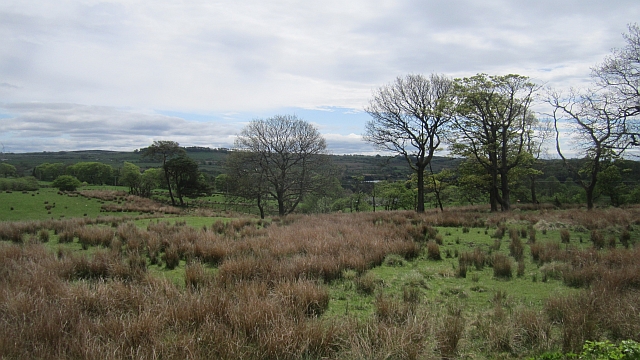
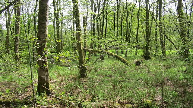
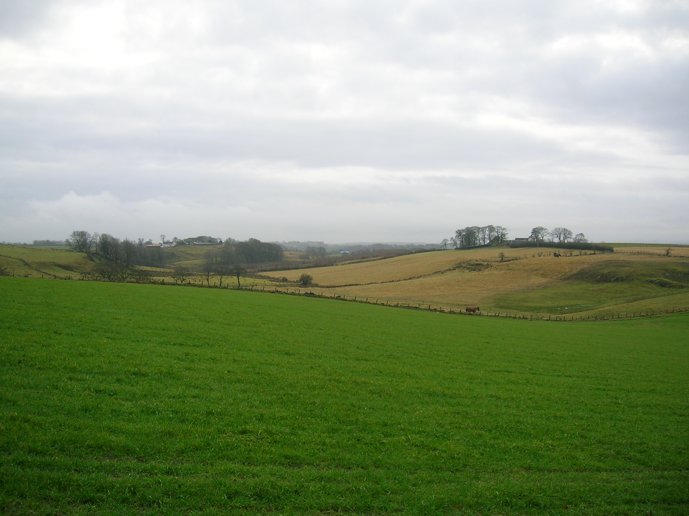
Crow Wood is a picturesque woodland located in Ayrshire, Scotland. Spanning over a vast area, it is considered one of the most prominent woodlands in the region. The wood is primarily composed of a mixture of native Scottish trees such as oak, birch, and pine, creating a diverse and vibrant ecosystem.

The wood boasts a rich history, with evidence of human activity dating back centuries. It is believed that Crow Wood was once used as a hunting ground by ancient civilizations, as remains of tools and artifacts have been discovered in the area. Today, the wood is a popular destination for nature enthusiasts, hikers, and birdwatchers.

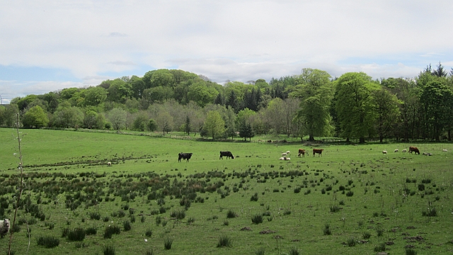
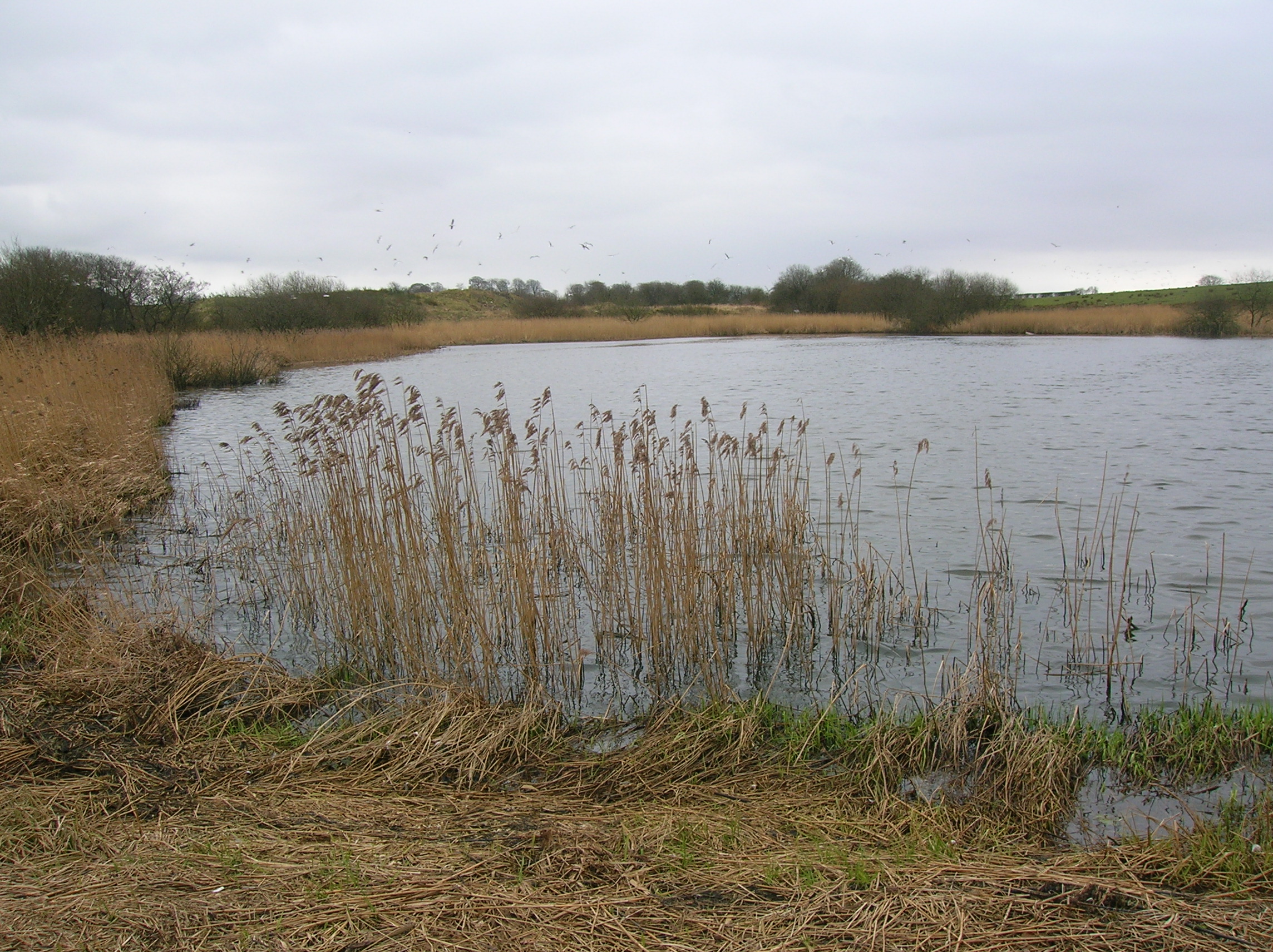
The tranquil atmosphere of Crow Wood is accentuated by the presence of various wildlife species. It is home to a wide range of bird species, including the elusive crow, after which the wood is named. Other common sightings include woodpeckers, owls, and a variety of songbirds.

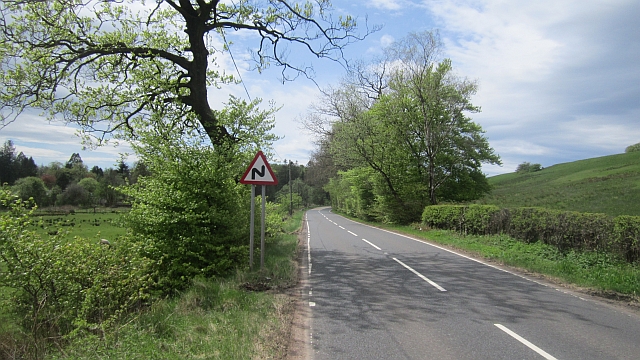
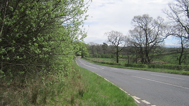
Visitors to Crow Wood can explore a network of well-maintained trails that wind through the forest, offering stunning views of the surrounding landscape. The wood is also equipped with picnic areas, making it an ideal spot for a day out with family and friends. Additionally, there is an educational center where visitors can learn about the flora and fauna of the wood, as well as its cultural and historical significance.

Overall, Crow Wood is a natural gem, offering a peaceful retreat from the hustle and bustle of everyday life. Its lush greenery, diverse wildlife, and recreational facilities make it a must-visit destination for nature enthusiasts and those seeking solace in the beauty of the Scottish countryside.

If you have any feedback on the listing, please let us know in the comments section below.
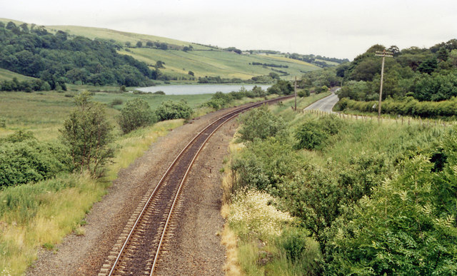
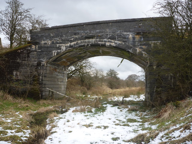
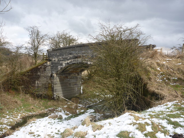
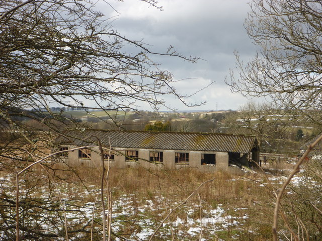
Crow Wood Images

Images are sourced within 2km of 55.750811/-4.5269595 or Grid Reference NS4153. Thanks to Geograph Open Source API. All images are credited.

Site of Caldwell - later Uplawmoor, station This is the former Glasgow, Barrhead & Kilmarnock (later Glasgow & South-Western) line from Glasgow St Enoch, later from Glasgow Central - and by 1986 single-track, to Kilmarnock and Carlisle. Until 2/4/62 Caldwell was named 'Uplawmoor'; it was closed on 7/11/66 - after having been portrayed on TV as 'Tannochbrae' in 'Dr Finlay's Casebook'. The water ahead is Loch Libo.
Site of Caldwell - later Uplawmoor, station
This is the former Glasgow, Barrhead & Kilmarnock (later Glasgow & South-Western) line from Glasgow St Enoch, later from Glasgow Central - and by 1986 single-track, to Kilmarnock and Carlisle. Until 2/4/62 Caldwell was named 'Uplawmoor'; it was closed on 7/11/66 - after having been portrayed on TV as 'Tannochbrae' in 'Dr Finlay's Casebook'. The water ahead is Loch Libo.
Northern East Ayrshire : Pollick Farm Bridge (looking NE) On the Caledonian Railway line from Ardrossan to Lanarkshire.
Northern East Ayrshire : Pollick Farm Bridge (looking NE)
On the Caledonian Railway line from Ardrossan to Lanarkshire.
Northern East Ayrshire : Pollick Farm Bridge (looking north) This bridge carries a farm track over the former Caledonian Railway line from Ardrossan to Lanarkshire.
Northern East Ayrshire : Pollick Farm Bridge (looking north)
This bridge carries a farm track over the former Caledonian Railway line from Ardrossan to Lanarkshire.
Northern East Ayrshire : Derelict Building At Pollick Viewed from the old railway bridge.
Northern East Ayrshire : Derelict Building At Pollick
Viewed from the old railway bridge.
Mclaren's Nurseries from the air The large Mclaren's Nurseries <span class="nowrap"><a title="http://www.mclarensnurseries.co.uk/" rel="nofollow ugc noopener" href="http://www.mclarensnurseries.co.uk/">Link</a><img style="margin-left:2px;" alt="External link" title="External link - shift click to open in new window" src="https://s1.geograph.org.uk/img/external.png" width="10" height="10"/></span> complex on Lochlibo Road, near Uplawmoor which can also be seen.
Mclaren's Nurseries from the air
The large Mclaren's Nurseries LinkExternal link complex on Lochlibo Road, near Uplawmoor which can also be seen.
Rashy ground, Caldwell Poorly drained soils with a grown out woodland.
Rashy ground, Caldwell
Poorly drained soils with a grown out woodland.
Power line, Braco Braco, Renfrewshire: a bend in a power line that runs from Hunterston power station to Neilston substation on Gleniffer Braes.
Power line, Braco
Braco, Renfrewshire: a bend in a power line that runs from Hunterston power station to Neilston substation on Gleniffer Braes.
Pasture, Caldwell There was a steady improvement in the grazing as height was lost from the boggy plateau south of Gleniffer Braes.
Pasture, Caldwell
There was a steady improvement in the grazing as height was lost from the boggy plateau south of Gleniffer Braes.
B775 Passing Caldwell.
B775
Passing Caldwell.
Woodland, Caldwell The woods between the road and glasshouses.
Woodland, Caldwell
The woods between the road and glasshouses.
Ayrshire - Renfrewshire march The B777 runs beside the boundary and the woods of Caldwell.
Ayrshire - Renfrewshire march
The B777 runs beside the boundary and the woods of Caldwell.
Ayrshire - Renfrewshire march Roadsigns at the southern end of the B775 where it meets the B777. Ayrshire seems to be one of those places which thinks of itself as a mere gateway to something better.  You can also get to Arran from Argyll.

There was no Ayrshire Council at this time.
Ayrshire - Renfrewshire march
Roadsigns at the southern end of the B775 where it meets the B777. Ayrshire seems to be one of those places which thinks of itself as a mere gateway to something better. You can also get to Arran from Argyll. There was no Ayrshire Council at this time.
Edge of William Covert Looking into Renfrewshire at a field surrounded by woodland.  A winter view: <a href="https://www.geograph.org.uk/photo/1150170">NS4153 : William  Covert</a>
Edge of William Covert
Looking into Renfrewshire at a field surrounded by woodland. A winter view: NS4153 : William Covert
Woodland, Caldwell A field surrounded by woodland near Lugton. The field is marked as William Covert and is shown on 1890s mapping as woodland.
Woodland, Caldwell
A field surrounded by woodland near Lugton. The field is marked as William Covert and is shown on 1890s mapping as woodland.
The Canny Man Bar and restaurant, Lugton.  Previously The Paraffin Lamp: see <a href="https://www.geograph.org.uk/photo/30292">NS4153 : Paraffin Lamp, Lugton</a>
The Canny Man
Bar and restaurant, Lugton. Previously The Paraffin Lamp: see NS4153 : Paraffin Lamp, Lugton
Industry, Lugton Looking across the Kilmarnock to Glasgow railway line towards the Lockton Lime Works.
Industry, Lugton
Looking across the Kilmarnock to Glasgow railway line towards the Lockton Lime Works.
Railway bridge, Lugton The A735 passes under the Glasgow to Kilmarnock railway.
Railway bridge, Lugton
The A735 passes under the Glasgow to Kilmarnock railway.
Former railway bridge, Lugton The Lanarkshire and Ayrshire Railway crossed the road here, one of two rival lines that passed through Lugton. The duplication was removed in 1964 when this railway closed.

The line connected Glasgow and Ardrossan.
Former railway bridge, Lugton
The Lanarkshire and Ayrshire Railway crossed the road here, one of two rival lines that passed through Lugton. The duplication was removed in 1964 when this railway closed. The line connected Glasgow and Ardrossan.
Show me another place!

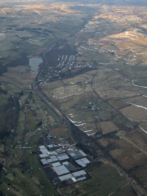
Crow Wood is located at Grid Ref: NS4153 (Lat: 55.750811, Lng: -4.5269595)

Unitary Authority: East Renfrewshire

Police Authority: Greater Glasgow

What 3 Words

///ranged.unloads.bounding. Near Dunlop, East Ayrshire

Nearby Locations

William Covert Crow Wood

Related Wikis

Caldwell, East Renfrewshire

Caldwell is a mansion and old estate with the remains of a castle nearby. These lands lie close to the Lugton Water and the villages of Uplawmoor in East...

Lugton

Lugton is a small village or hamlet in East Ayrshire, Scotland with a population of 80 people. The A736 road runs through on its way from Glasgow, 15 miles...

Lugton railway station

Lugton railway station was a railway station serving the hamlet of Lugton, East Ayrshire, Scotland. The station was originally part of the Glasgow, Barrhead...

Lugton High railway station

Lugton High railway station was a railway station serving the hamlet of Lugton, East Ayrshire, Scotland as part of the Lanarkshire and Ayrshire Railway...

Halket Loch

Halket Loch' also known as Halkhead or Halketh, was situated in the mid-Ayrshire clayland near Lugton. It is visible as a surface depression in pastureland...

Blae Loch (Beith)

The Blae Loch is a small freshwater loch situated in a hollow in a low-lying area beneath Blaelochhead Hill in the Parish of Beith, North Ayrshire, Scotland...

Uplawmoor (GB&K) railway station

Uplawmoor railway station was a railway station near the village of Uplawmoor, East Renfrewshire, Scotland. The station was originally part of the Glasgow...

Uplawmoor

Uplawmoor is a village in East Renfrewshire, Scotland. Its population was 700 as of 2016. Historic Uplawmoor, associated for centuries with the Barony...

Have you been to Crow Wood?

Leave your review of Crow Wood below (or comments, questions and feedback).