Corvisel Wood

Wood, Forest in Wigtownshire

Scotland

Corvisel Wood

East Knockbrex Large farm with prominent slurry tank!
East Knockbrex Credit: Russel Wills

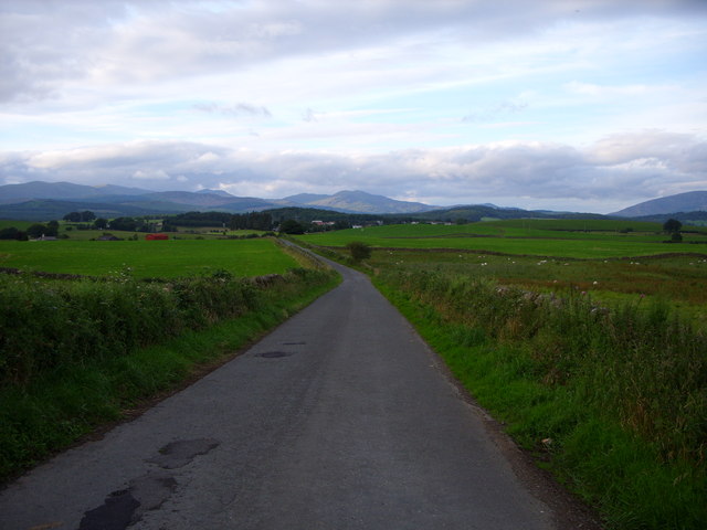
Corvisel Wood is a captivating forest located in Wigtownshire, Scotland. Covering an area of approximately 200 hectares, this enchanting woodland offers a delightful escape for nature enthusiasts and outdoor adventurers alike.

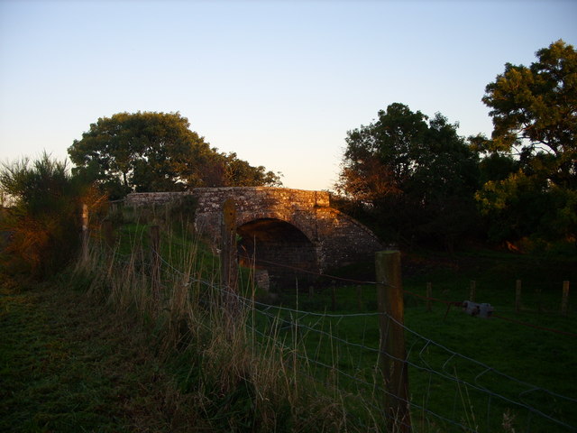
The forest is predominantly composed of native broadleaf trees, including oak, beech, and birch, creating a rich and diverse ecosystem. These magnificent trees provide a haven for a variety of wildlife, such as red squirrels, deer, and a plethora of bird species, making it a prime spot for wildlife spotting and birdwatching.

Traversing through Corvisel Wood, visitors can indulge in a network of well-maintained footpaths and trails, allowing them to explore the forest's hidden treasures. The paths wind through the woodland, leading to tranquil ponds, babbling brooks, and picturesque glades, providing a peaceful and serene atmosphere.

One of the highlights of Corvisel Wood is its vibrant display of wildflowers during spring and summer. The forest floor comes alive with a kaleidoscope of colors, as bluebells, primroses, and orchids bloom, creating a breathtaking spectacle.

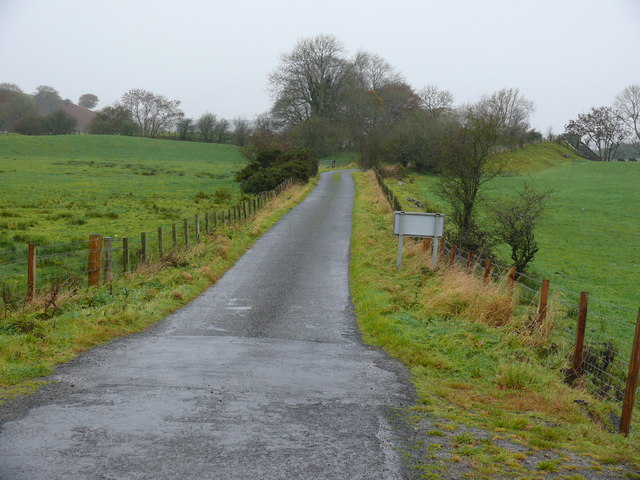
The forest is well-equipped with amenities for visitors, including picnic areas and benches, perfect for a leisurely lunch amidst nature's splendor. Additionally, there are information boards dotted throughout the woodland, offering insights into the local flora and fauna, as well as the history and cultural significance of the area.

Corvisel Wood is a true gem in Wigtownshire, offering a delightful retreat where visitors can immerse themselves in the beauty of nature and experience the tranquility of a truly enchanting forest.

If you have any feedback on the listing, please let us know in the comments section below.

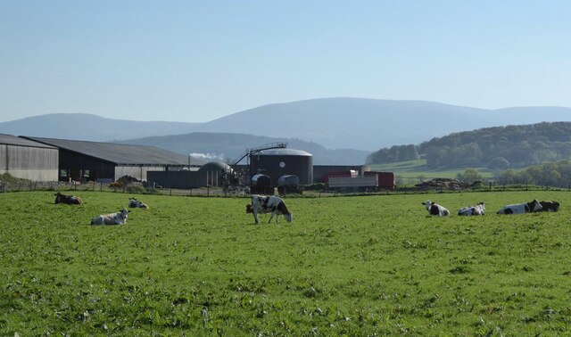
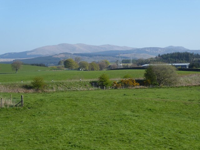
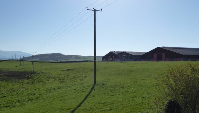
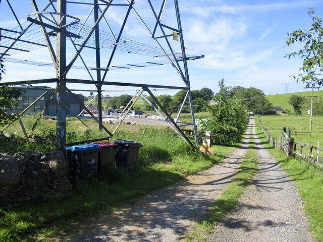
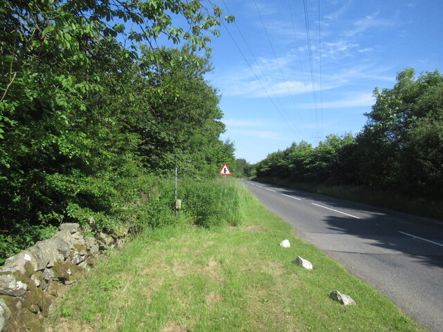
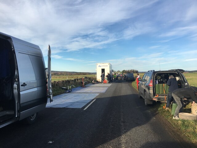
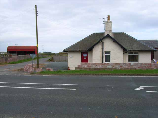
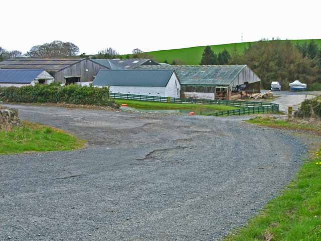
Corvisel Wood Images

Images are sourced within 2km of 54.950959/-4.4793409 or Grid Reference NX4164. Thanks to Geograph Open Source API. All images are credited.

East Knockbrex Large farm with prominent slurry tank!
East Knockbrex
Large farm with prominent slurry tank!
Pylons across the grassland High Barbuchany is hidden in the dip.
Kirroughtree Forest in the distance.
Pylons across the grassland
High Barbuchany is hidden in the dip. Kirroughtree Forest in the distance.
Electricity poles At East Knockbrex.
Electricity poles
At East Knockbrex.
Driveway, Beechbank
Driveway, Beechbank
Road west of Newton Stewart A ready made bypass between the A75 and road to Girvan.
Road west of Newton Stewart
A ready made bypass between the A75 and road to Girvan.
Minor road near Newton Stewart Closed today for service for the Roger Albert Clark Rally 2023.
Minor road near Newton Stewart
Closed today for service for the Roger Albert Clark Rally 2023.
Knockbrex Toll Old tollhouse on the A75
Knockbrex Toll
Old tollhouse on the A75
South Barnkirk This farm now appears to serve as a timber yard
South Barnkirk
This farm now appears to serve as a timber yard
Knockbrex road looking towards Newton Stewart
West Knockbrex  Bridge The Bridge runs over the old railway line
West Knockbrex Bridge
The Bridge runs over the old railway line
Knockbrex Toll View along this small road off the A75 that leads to West Knockbrex.
Knockbrex Toll
View along this small road off the A75 that leads to West Knockbrex.
Knockbrex Toll View along the A75 towards Newton Stewart.
Knockbrex Toll
View along the A75 towards Newton Stewart.
Knockbrex Toll Pretty much a rephotograph of a Geograph taken in 2006 <a href="https://www.geograph.org.uk/photo/163020">NX3964 : Knockbrex Toll</a> Amazing how Geographers see the same picture and take a shot of it!
Knockbrex Toll
Pretty much a rephotograph of a Geograph taken in 2006 NX3964 : Knockbrex Toll Amazing how Geographers see the same picture and take a shot of it!
Knockbrex Toll View along the A75 towards Newton Stewart. Left of picture is High Barbuchany Farm and Cairnsmore of Fleet is on the horizon with the first snow of winter on the tops.
Knockbrex Toll
View along the A75 towards Newton Stewart. Left of picture is High Barbuchany Farm and Cairnsmore of Fleet is on the horizon with the first snow of winter on the tops.
Knockbrex Toll View along the A75 with the Galloway Hills in the background.
Knockbrex Toll
View along the A75 with the Galloway Hills in the background.
Knockbrex Toll View of the Cairnsmore of Fleet taken from the A75 near to Newton Stewart.
Knockbrex Toll
View of the Cairnsmore of Fleet taken from the A75 near to Newton Stewart.
Woodland Path, Blairmount Park Part of the Newton Stewart Walks (walk 5).
Woodland Path, Blairmount Park
Part of the Newton Stewart Walks (walk 5).
Moss Covered Dry Stane Dyke
Show me another place!

Corvisel Wood is located at Grid Ref: NX4164 (Lat: 54.950959, Lng: -4.4793409)

Unitary Authority: Dumfries and Galloway

Police Authority: Dumfries and Galloway

What 3 Words

///louder.lock.scare. Near Newton Stewart, Dumfries & Galloway

Nearby Locations

Corvisel Wood

Related Wikis

McMillan Hall, Newton Stewart

The McMillan Hall is a municipal building in Dashwood Square in Newton Stewart, Dumfries and Galloway, Scotland. The structure, which is used as a community...

Newton Stewart Hospital

Newton Stewart Hospital is a health facility in Newton Stewart, Dumfries and Galloway, Scotland. It is managed by NHS Dumfries and Galloway. == History... ==

Newton Stewart railway station

Newton Stewart railway station served the town of Newton Stewart, Dumfries and Galloway, Scotland from 1861 to 1965 on the Portpatrick and Wigtownshire...

Penninghame

Penninghame in Wigtownshire, Dumfries and Galloway, Scotland, is a civil parish area, 8 miles (N. W.) from Wigtown. The area is approx 16 miles in length...

Newton Stewart

Newton Stewart (Gd: Baile Ùr nan Stiùbhartach) is a former burgh town in the historical county of Wigtownshire in Dumfries and Galloway, southwest Scotland...

Douglas Ewart High School

Douglas Ewart High School was opened in 1922 in Newton Stewart, Scotland. It was formed by the amalgamation of the Douglas Free School opened in 1834...

Newton Stewart F.C.

Newton Stewart Football Club are a football club from the town of Newton Stewart in the Dumfries and Galloway area of Scotland. Formed in 1880, as Newton...

Kirroughtree House

Kirroughtree House is the heritage-listed mansion house (Category B listing.) of the Kirroughtree estate. It occupies a prominent position 1 mile (1.6...

Nearby Amenities

Located within 500m of 54.950959,-4.4793409
Turning Circle
Source: bing
Lat/Long: 54.9513941/-4.4800283
Power: pole
Lat/Long: 54.946931/-4.4792321
Power: pole
Lat/Long: 54.9476622/-4.4798355
Power: pole
Lat/Long: 54.9483423/-4.4803968
Power: pole
Lat/Long: 54.946654/-4.4777131
Power: pole
Lat/Long: 54.9473953/-4.4785072
Power: pole
Lat/Long: 54.9480626/-4.4792221
Power: pole
Lat/Long: 54.9486421/-4.4798429
Power: pole
Lat/Long: 54.9469946/-4.4825553
Power: pole
Lat/Long: 54.9477713/-4.4820994
Power: pole
Lat/Long: 54.9484331/-4.4816706
Power: pole
Lat/Long: 54.949051/-4.4812496
Power: pole
Lat/Long: 54.9480434/-4.4783986
Power: pole
Lat/Long: 54.947515/-4.4777387
Power: pole
Lat/Long: 54.9468696/-4.4770119
Power: pole
Lat/Long: 54.9500013/-4.4723931
Power: pole
Lat/Long: 54.9509209/-4.4725353
Power: pole
Lat/Long: 54.9518219/-4.4726774
Power: pole
Lat/Long: 54.9524427/-4.4727954
Power: pole
Lat/Long: 54.9532359/-4.4731468
Power: pole
Lat/Long: 54.9529386/-4.474166
Power: pole
Lat/Long: 54.9526398/-4.4751772
Power: pole
Lat/Long: 54.9520499/-4.4770789
Power: pole
Lat/Long: 54.9517018/-4.4782296
Barrier: cattle_grid
Lat/Long: 54.9485425/-4.4767007
Barrier: cattle_grid
Bicycle: yes
Foot: yes
Lat/Long: 54.9483438/-4.4769341
Power: pole
Lat/Long: 54.9517927/-4.4730476
Power: pole
Lat/Long: 54.9514769/-4.4741875
Power: pole
Lat/Long: 54.9509316/-4.4761348
Power: pole
Lat/Long: 54.9505697/-4.4774303
Power: pole
Lat/Long: 54.9497487/-4.4803512
Power: pole
Lat/Long: 54.9495438/-4.4821027
Power: pole
Lat/Long: 54.9494437/-4.4829369
Power: pole
Lat/Long: 54.9494775/-4.4836128
Power: pole
Lat/Long: 54.9495761/-4.4856834
Power: substation
Source: survey
Lat/Long: 54.9523472/-4.4812658
Post Box
Post Box Type: wall
Ref: DG8 6D
Royal Cypher: VR
Royal Cypher Wikidata: Q33102356
Source: ss
Lat/Long: 54.9534254/-4.4820705
Power: pole
Lat/Long: 54.9475439/-4.4838348
Power: pole
Lat/Long: 54.947905/-4.48263
Power: pole
Lat/Long: 54.947476/-4.4837592
Power: pole
Lat/Long: 54.9491318/-4.4815134
Power: pole
Lat/Long: 54.9489814/-4.4826174
Power: pole
Lat/Long: 54.9488432/-4.4837175
Power: pole
Lat/Long: 54.948685/-4.4852948
Power: pole
Lat/Long: 54.9491/-4.4811622
Power: pole
Lat/Long: 54.9491401/-4.4810885
Power: pole
Lat/Long: 54.9523757/-4.4771604
Power: pole
Lat/Long: 54.953377/-4.4773317
Power: pole
Lat/Long: 54.9539506/-4.477426
Power: pole
Lat/Long: 54.9544612/-4.4775145
Power: pole
Lat/Long: 54.9547706/-4.476558
Ceramics
Shop: yes
Lat/Long: 54.9535717/-4.4826123
Alex McCleary
Shop: funeral_directors
Lat/Long: 54.9539444/-4.4825815
Clipso Hair
Phone: +44 1671 403359
Shop: hairdresser
Lat/Long: 54.9544889/-4.4828986
Fast Food
Cuisine: fish_and_chips
Lat/Long: 54.9535024/-4.4820363
Blossom
Phone: +44 1671 403000
Shop: hairdresser
Lat/Long: 54.9539028/-4.482273
Steven Cronnie Family Butcher
Addr City: Newton Stewart
Addr Housenumber: 87
Addr Street: Queen Street
Fhrs Id: 1429450
Phone: +44 1671 403877
Shop: butcher
Lat/Long: 54.9536741/-4.4824608
Generator Method: photovoltaic
Generator Output Electricity: yes
Generator Source: solar
Generator Type: solar_photovoltaic_panel
Location: roof
Power: generator
Source: bing
Lat/Long: 54.9510418/-4.4803646
Generator Method: photovoltaic
Generator Output Electricity: yes
Generator Source: solar
Generator Type: solar_photovoltaic_panel
Location: roof
Power: generator
Source: bing
Lat/Long: 54.9506074/-4.480661
Generator Method: photovoltaic
Generator Output Electricity: yes
Generator Source: solar
Generator Type: solar_photovoltaic_panel
Location: roof
Power: generator
Source: bing
Lat/Long: 54.950619/-4.480771
Generator Method: photovoltaic
Generator Output Electricity: yes
Generator Source: solar
Generator Type: solar_photovoltaic_panel
Location: roof
Power: generator
Source: bing
Lat/Long: 54.9506151/-4.4808622
Generator Method: photovoltaic
Generator Output Electricity: yes
Generator Source: solar
Generator Type: solar_photovoltaic_panel
Location: roof
Power: generator
Source: bing
Lat/Long: 54.9506113/-4.4809748
Generator Method: photovoltaic
Generator Output Electricity: yes
Generator Source: solar
Generator Type: solar_photovoltaic_panel
Location: roof
Power: generator
Source: bing
Lat/Long: 54.9506174/-4.4810915
Generator Method: photovoltaic
Generator Output Electricity: yes
Generator Source: solar
Generator Type: solar_photovoltaic_panel
Location: roof
Power: generator
Source: bing
Lat/Long: 54.9506159/-4.4811948
Generator Method: photovoltaic
Generator Output Electricity: yes
Generator Source: solar
Generator Type: solar_photovoltaic_panel
Location: roof
Power: generator
Source: bing
Lat/Long: 54.9506082/-4.4812994
Generator Method: photovoltaic
Generator Output Electricity: yes
Generator Source: solar
Generator Type: solar_photovoltaic_panel
Location: roof
Power: generator
Source: bing
Lat/Long: 54.9506097/-4.4814026
The data included in this document is from www.openstreetmap.org. The data is made available under ODbL.

Have you been to Corvisel Wood?

Leave your review of Corvisel Wood below (or comments, questions and feedback).