Blairlinnans Strip

Wood, Forest in Dunbartonshire

Scotland

Blairlinnans Strip

Old milestone & old milepost On the A811 north from Alexandria and Dumbarton and opposite the Gowk Inn, now a house, are these two mile markers.  The upper red sandstone set in the wall bordering Auchenlinnhe House is like the stone in Drymen opposite the Buchanan Arms at <a href="https://www.geograph.org.uk/gridref/NS47438834">NS47438834</a>.  The metal plate is one of the posts erected at the turn of the 19/20C.   The Dunbarton 6 and 8 plates were still in place a few years ago.
Old milestone & old milepost Credit: Willy Findlay

Blairlinnans Strip is a picturesque woodland area located in Dunbartonshire, Scotland. Spread across an approximate area of 100 acres, it is nestled within the scenic landscape of the region, attracting nature enthusiasts and outdoor adventurers alike.

The strip is predominantly composed of mixed deciduous and coniferous trees, creating a diverse and vibrant ecosystem. The woodland is known for its dense population of native Scottish trees, including oak, birch, and pine, which provide a rich habitat for a variety of wildlife species.

The natural beauty of Blairlinnans Strip is enhanced by its network of well-maintained walking trails, making it a popular destination for hikers and nature lovers. These trails wind through the woodland, offering visitors the opportunity to immerse themselves in the serene surroundings. The peaceful atmosphere and tranquil ambiance make it an ideal spot for a leisurely stroll or a family picnic.

The strip is also home to a wide array of flora and fauna. Wildflowers such as bluebells and primroses carpet the forest floor during the spring, creating a vibrant display of colors. The woodland is alive with the sounds of birdsong, with species such as woodpeckers, thrushes, and finches frequenting the area.

Blairlinnans Strip is not only a haven for wildlife but also serves as an important ecological site. It provides a corridor for wildlife movement and acts as a buffer zone, protecting the surrounding environment from potential development.

Overall, Blairlinnans Strip is a natural treasure in Dunbartonshire, offering visitors the chance to connect with nature and experience the beauty of Scotland's woodlands.

If you have any feedback on the listing, please let us know in the comments section below.

Blairlinnans Strip Images

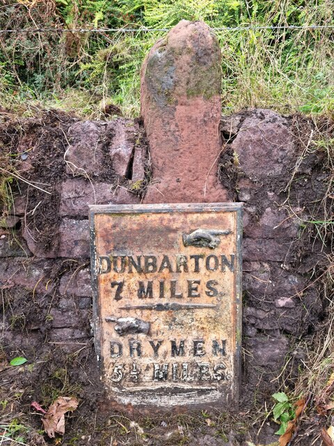
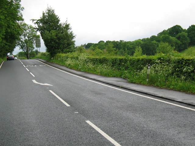
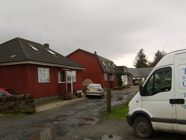
Images are sourced within 2km of 56.03614/-4.5490846 or Grid Reference NS4185. Thanks to Geograph Open Source API. All images are credited.

Old milestone & old milepost On the A811 north from Alexandria and Dumbarton and opposite the Gowk Inn, now a house, are these two mile markers.  The upper red sandstone set in the wall bordering Auchenlinnhe House is like the stone in Drymen opposite the Buchanan Arms at <a href="https://www.geograph.org.uk/gridref/NS47438834">NS47438834</a>.  The metal plate is one of the posts erected at the turn of the 19/20C.   The Dunbarton 6 and 8 plates were still in place a few years ago.
Old milestone & old milepost
On the A811 north from Alexandria and Dumbarton and opposite the Gowk Inn, now a house, are these two mile markers. The upper red sandstone set in the wall bordering Auchenlinnhe House is like the stone in Drymen opposite the Buchanan Arms at NS47438834. The metal plate is one of the posts erected at the turn of the 19/20C. The Dunbarton 6 and 8 plates were still in place a few years ago.
Old milestone This shows the left-hand side of the red sandstone milestone set in the wall surrounding Auchenlinnhe House.  The top of the newer metal milepost can just be seen.  27 is the mileage from Stirling.  MS is shown on the 1776 Taylor & Skinner map and this is the route of the Old Military Road built between 1765-97 by Major William Caufeild.
Old milestone
This shows the left-hand side of the red sandstone milestone set in the wall surrounding Auchenlinnhe House. The top of the newer metal milepost can just be seen. 27 is the mileage from Stirling. MS is shown on the 1776 Taylor & Skinner map and this is the route of the Old Military Road built between 1765-97 by Major William Caufeild.
Old milestone The right-hand face of the red sandstone milestone in the wall surrounding Auchenlinnhe House.   The inscribed 7 is the mileage to Dumbarton.
Old milestone
The right-hand face of the red sandstone milestone in the wall surrounding Auchenlinnhe House. The inscribed 7 is the mileage to Dumbarton.
East Cambusmoon Farm
A811, Gartocharn
A811, Gartocharn
A811 entering Gartocharn
Old Kirk About a mile north east of Balloch, an old black and white signpost indicates “BALLAGAN AND OLD KIRK”. It is now a struggle to reach Old Kirk even on foot. It is the site of a now derelict farm. Nearby, old maps show “Site of Chapel” where burial remains were once found.
Old Kirk
About a mile north east of Balloch, an old black and white signpost indicates “BALLAGAN AND OLD KIRK”. It is now a struggle to reach Old Kirk even on foot. It is the site of a now derelict farm. Nearby, old maps show “Site of Chapel” where burial remains were once found.
Millennium Hall, Gartocharn Community hall.
Millennium Hall, Gartocharn
Community hall.
The Aber Path On a misty morning. No helpful signs to tell me that the bridge at the far end was lifted and that I would be expected to return to here when I got there.
The Aber Path
On a misty morning. No helpful signs to tell me that the bridge at the far end was lifted and that I would be expected to return to here when I got there.
Bridge, Aber Heras and the deck lifted - looks like Lomond and Trossachs National Park being their usual helpful selves.  There is even a nice friendly notice telling you of alternative routes - basically go back to Gartocharn.  It was easy to cross.
Bridge, Aber
Heras and the deck lifted - looks like Lomond and Trossachs National Park being their usual helpful selves. There is even a nice friendly notice telling you of alternative routes - basically go back to Gartocharn. It was easy to cross.
Tree lined road, Aber
Gartocharn A dark winter's morning outside the shop and garage in Gartocharn.
Gartocharn
A dark winter's morning outside the shop and garage in Gartocharn.
Approaching Gartocharn A view looking northeast along the A811 Old Military Road on the approach to Gartocharn. The buildings of Burnbrae Farm are on the right.
Approaching Gartocharn
A view looking northeast along the A811 Old Military Road on the approach to Gartocharn. The buildings of Burnbrae Farm are on the right.
Scrapyard off the A811 A view looking to the northeast at the entrance to a scrapyard adjacent to the A811 old Military road.
Scrapyard off the A811
A view looking to the northeast at the entrance to a scrapyard adjacent to the A811 old Military road.
Ross Priory Strathclyde University's recreation and education centre on the shores of Loch Lomond. Formerly the 17th century seat of the Buchanans of Ross on the site of a priory dating back to at least 1624. See <span class="nowrap"><a title="http://en.wikipedia.org/wiki/Ross_Priory" rel="nofollow ugc noopener" href="http://en.wikipedia.org/wiki/Ross_Priory">Link</a><img style="margin-left:2px;" alt="External link" title="External link - shift click to open in new window" src="https://s1.geograph.org.uk/img/external.png" width="10" height="10"/></span>
Ross Priory
Strathclyde University's recreation and education centre on the shores of Loch Lomond. Formerly the 17th century seat of the Buchanans of Ross on the site of a priory dating back to at least 1624. See LinkExternal link
Speed signs entering Gartocharn.
A811 to Balloch just after Gartocharn.
Derelict buildings and machinery, Blairlusk.
Show me another place!

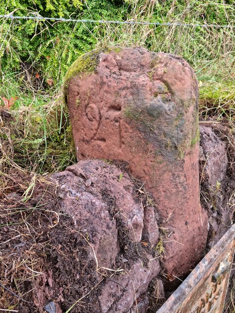
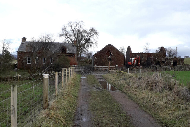
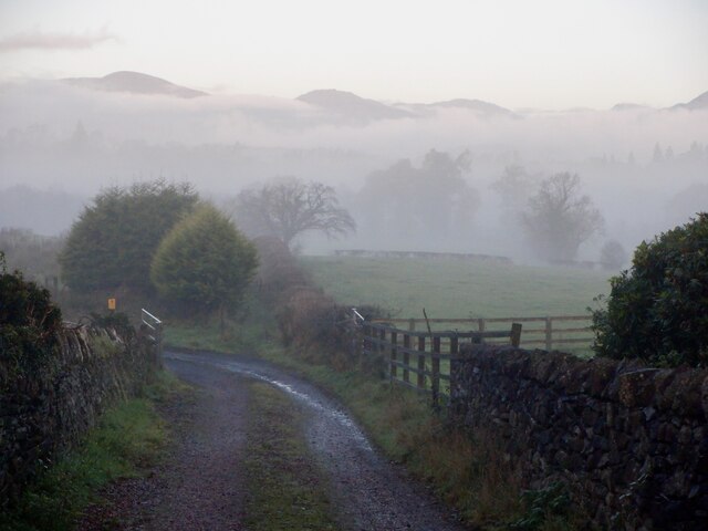
Blairlinnans Strip is located at Grid Ref: NS4185 (Lat: 56.03614, Lng: -4.5490846)

Unitary Authority: West Dunbartonshire

Police Authority: Argyll and West Dunbartonshire

What 3 Words

///witless.windows.shams. Near Balloch, West Dunbartonshire

Nearby Locations

Blairlinnans Strip

Related Wikis

Gartocharn

Gartocharn (; Scottish Gaelic: Gart a’ Chàirn [ˈkarˠʃt̪ ə ˈxaːrˠɲ]) is a village in West Dunbartonshire in Scotland, United Kingdom. It is the only village...

Ross Priory

Ross Priory is an early 19th-century country house located west of Gartocharn, West Dunbartonshire, on the south shore of Loch Lomond, Scotland. From the...

Balloch Castle

Balloch Castle is an early 19th-century country house situated at the southern tip of Loch Lomond, in West Dunbartonshire, Scotland. Balloch was a property...

Caldarvan railway station

Caldarvan railway station served the estate of Caldarvan, in the historical county of Dunbartonshire, Scotland, from 1856 to 1934 on the Forth and Clyde...

Nearby Amenities

Located within 500m of 56.03614,-4.5490846
Power: pole
Lat/Long: 56.0343491/-4.5430702
Power: pole
Lat/Long: 56.0345045/-4.5439948
Power: pole
Lat/Long: 56.0346319/-4.5447625
Power: pole
Lat/Long: 56.0348738/-4.5462371
Power: pole
Lat/Long: 56.0350421/-4.5472454
Power: pole
Lat/Long: 56.0351543/-4.5479084
Power: pole
Lat/Long: 56.0355002/-4.5487849
Power: pole
Lat/Long: 56.0358624/-4.5497534
Power: pole
Lat/Long: 56.0367424/-4.5498872
Power: pole
Lat/Long: 56.0375779/-4.550042
Power: pole
Lat/Long: 56.0383713/-4.5501842
Power: pole
Lat/Long: 56.0391788/-4.5503369
Power: pole
Lat/Long: 56.0397175/-4.5504311
Power: pole
Lat/Long: 56.0323197/-4.5475539
Power: pole
Lat/Long: 56.0327626/-4.5484554
Power: pole
Lat/Long: 56.0331956/-4.5493455
Power: pole
Lat/Long: 56.033614/-4.5502365
Power: pole
Lat/Long: 56.0344122/-4.5507741
Power: pole
Lat/Long: 56.0352022/-4.5513431
Power: pole
Lat/Long: 56.0360202/-4.551912
Power: pole
Lat/Long: 56.036726/-4.5523764
Power: pole
Lat/Long: 56.037613/-4.5530165
Power: pole
Lat/Long: 56.0385232/-4.552619
Power: pole
Lat/Long: 56.0388855/-4.5516819
Power: pole
Lat/Long: 56.0392314/-4.5507365
Power: pole
Lat/Long: 56.039548/-4.5498245
Power: pole
Lat/Long: 56.0400388/-4.5488225
Power: pole
Lat/Long: 56.0405436/-4.5478499
Power: pole
Lat/Long: 56.0335485/-4.5516924
Power: pole
Lat/Long: 56.0334819/-4.5531273
Power: pole
Lat/Long: 56.0334118/-4.5546104
Power: pole
Lat/Long: 56.0405278/-4.5505827
The data included in this document is from www.openstreetmap.org. The data is made available under ODbL.

Have you been to Blairlinnans Strip?

Leave your review of Blairlinnans Strip below (or comments, questions and feedback).