Tairlaw Plantation
Wood, Forest in Ayrshire
Scotland
Tairlaw Plantation

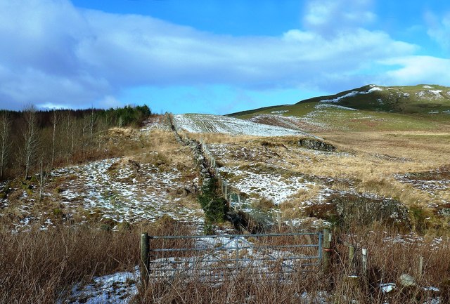
Tairlaw Plantation is a sprawling woodland located in Ayrshire, Scotland. Covering an area of approximately 500 acres, the plantation is a diverse mix of native and exotic tree species, including oak, beech, pine, and spruce. The woodland is managed by the Forestry Commission and is a designated Site of Special Scientific Interest (SSSI) due to its rich biodiversity and importance as a habitat for a variety of plant and animal species.
Tairlaw Plantation is a popular destination for nature lovers, hikers, and birdwatchers, with a network of well-maintained trails and paths winding through the forest. Visitors can enjoy peaceful walks amongst the towering trees, listening to the sounds of birdsong and the rustling of leaves in the wind.
The woodland also plays a vital role in carbon sequestration and provides important ecosystem services, such as regulating water flow and preventing soil erosion. Tairlaw Plantation is a valuable resource for the local community, offering opportunities for recreation, education, and conservation.
If you have any feedback on the listing, please let us know in the comments section below.
Tairlaw Plantation Images
Images are sourced within 2km of 55.255501/-4.5010323 or Grid Reference NX4198. Thanks to Geograph Open Source API. All images are credited.


Tairlaw Plantation is located at Grid Ref: NX4198 (Lat: 55.255501, Lng: -4.5010323)
Unitary Authority: South Ayrshire
Police Authority: Ayrshire
What 3 Words
///blunders.perusing.promote. Near Bellsbank, East Ayrshire
Nearby Locations
Related Wikis
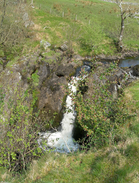
Tairlaw Linn
Tairlaw Linn is a waterfall of Scotland, near Straiton, South Ayrshire. == See also == Waterfalls of Scotland == References ==

Loch Brecbowie
Loch Brecbowie is a Scottish loch located in the Ayrshire region, near the town of Girvan.The small, freshwater loch contains four small islands. It is...

Drunmore Linn
Drunmore Linn is a waterfall of Scotland, near Straiton, South Ayrshire. == See also == Waterfalls of Scotland == References ==

Stinchar Falls
Stinchar Falls is a waterfall of Scotland. It is located on the Stinchar Burn, east of Barr in Ayrshire. == See also == Waterfalls of Scotland == References ==
Nearby Amenities
Located within 500m of 55.255501,-4.5010323Have you been to Tairlaw Plantation?
Leave your review of Tairlaw Plantation below (or comments, questions and feedback).