Canworthy Water

Settlement in Cornwall

England

Canworthy Water

Ford at Canworthy Water This farm ford is found on Canworthy Water.
Ford at Canworthy Water Credit: John Walton

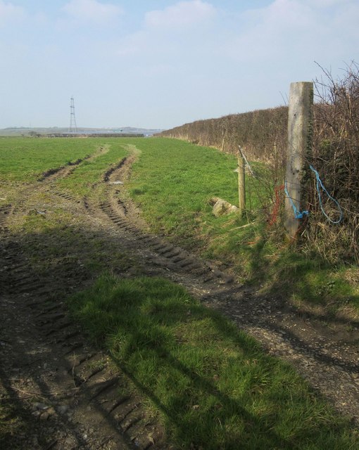
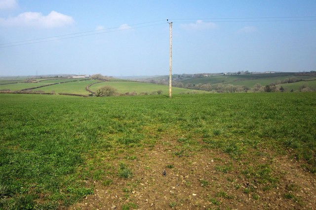
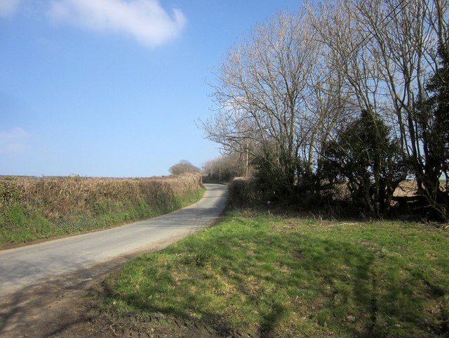
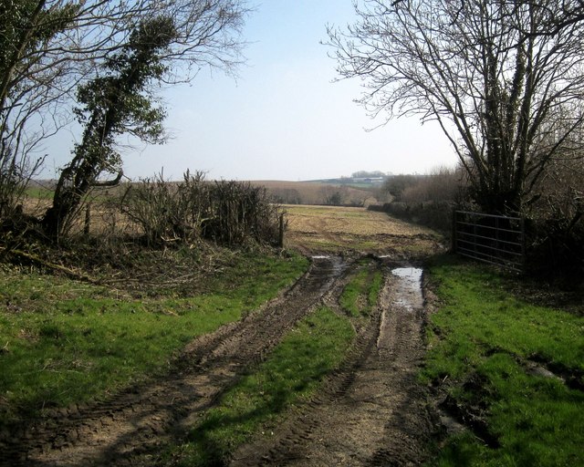
Canworthy Water is a small village located in the county of Cornwall, in the southwestern part of England. Situated near the border of Devon, it lies within the civil parish of North Tamerton. The village is nestled within a rural landscape, surrounded by picturesque countryside and rolling hills.

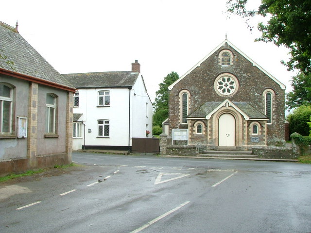
Canworthy Water is primarily a residential area, with a population of around 200 people. The village is characterized by its small cluster of houses and cottages, giving it a quaint and charming atmosphere. The architectural style of the buildings is predominantly traditional, showcasing the region's heritage and history.

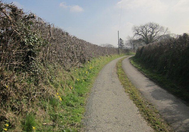
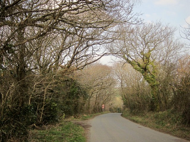
The village is known for its peaceful and tranquil surroundings, making it an ideal destination for those seeking a quiet escape from the hustle and bustle of city life. The nearby River Wolf runs through the village, adding to its natural beauty and providing opportunities for outdoor activities such as fishing and riverside walks.

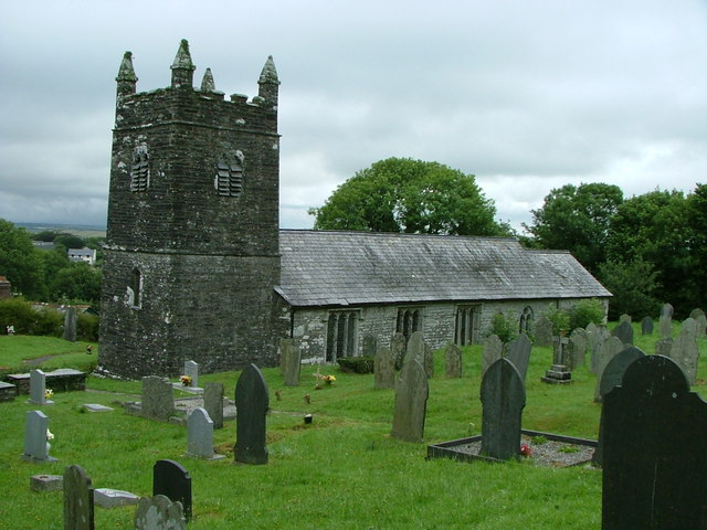
Despite its small size, Canworthy Water benefits from some local amenities, including a village hall and a community center. The village is also home to a small church, St. Stephen's Church, which dates back to the 14th century and is a testament to the area's rich history.

Canworthy Water is conveniently located within close proximity to other towns and villages, such as Launceston and Holsworthy, which offer a wider range of services and amenities. Overall, Canworthy Water is a charming and idyllic village, perfect for those seeking a peaceful retreat in the heart of the Cornish countryside.

If you have any feedback on the listing, please let us know in the comments section below.

Canworthy Water Images

Images are sourced within 2km of 50.698415/-4.516266 or Grid Reference SX2291. Thanks to Geograph Open Source API. All images are credited.

Ford at Canworthy Water This farm ford is found on Canworthy Water.
Ford at Canworthy Water
This farm ford is found on Canworthy Water.
Road through Canworthy Water On the right, partly hidden by vegetation is <a href="https://www.geograph.org.uk/photo/210874">SX2291 : Canworthy Water Methodist Church</a> while on the left, opposite the white-painted house, is <a href="https://www.geograph.org.uk/photo/210878">SX2291 : United Methodist Church School, Canworthy Water</a>.
Road through Canworthy Water
On the right, partly hidden by vegetation is SX2291 : Canworthy Water Methodist Church while on the left, opposite the white-painted house, is SX2291 : United Methodist Church School, Canworthy Water.
Road junction at Warbstow Cross The road to the left takes one to Warbstow church while that straight on ends at Hallworthy in <a href="https://www.geograph.org.uk/gridref/SX1887">SX1887</a> on the A395.
Road junction at Warbstow Cross
The road to the left takes one to Warbstow church while that straight on ends at Hallworthy in SX1887 on the A395.
Field east of Canworthy From the road between Canworthy Water and Caudworthy Bridge. At larger sizes you can just make out part of the enormous solar farm, at Lower Wheatley Farm, above the far hedge.
Field east of Canworthy
From the road between Canworthy Water and Caudworthy Bridge. At larger sizes you can just make out part of the enormous solar farm, at Lower Wheatley Farm, above the far hedge.
Field east of Canworthy Water From the lane north-west of Trossell. The line of trees along the field boundary is also following a parish boundary and a tiny tributary of the River Ottery.
Field east of Canworthy Water
From the lane north-west of Trossell. The line of trees along the field boundary is also following a parish boundary and a tiny tributary of the River Ottery.
Farmland near Trossell A slightly wider view than <a href="https://www.geograph.org.uk/photo/712198">SX2491 : Field by High Trossell</a>, taken from the same spot. Footpath 529 14/1 runs along the far side of this field, before crossing the valley and following the distinctive curved field boundary up to Parracott. Over on the right is the Caudworthy Water valley.
Farmland near Trossell
A slightly wider view than SX2491 : Field by High Trossell, taken from the same spot. Footpath 529 14/1 runs along the far side of this field, before crossing the valley and following the distinctive curved field boundary up to Parracott. Over on the right is the Caudworthy Water valley.
Farmland near Canworthy By the farm track to Witheven, looking across the valley of the River Ottery.
Farmland near Canworthy
By the farm track to Witheven, looking across the valley of the River Ottery.
Field, Fonston Fonston is a straggle of buildings along the road between Warbstow Green and Canworthy Water. This looks parallel to the road (on the left) along one of the larger gaps between the buildings.
Field, Fonston
Fonston is a straggle of buildings along the road between Warbstow Green and Canworthy Water. This looks parallel to the road (on the left) along one of the larger gaps between the buildings.
Lane to Treswen Footpath 561 3/1 follows this farm lane to Treswen, and then cuts left across country towards Trebreak.
Lane to Treswen
Footpath 561 3/1 follows this farm lane to Treswen, and then cuts left across country towards Trebreak.
Track near Langdon Crushed limestone crosses the field to what is mapped as a disused quarry, but which has perhaps come to life again.
Track near Langdon
Crushed limestone crosses the field to what is mapped as a disused quarry, but which has perhaps come to life again.
Approaching Exe Water Bridge The road from Langdon nearing the bridge shown in <a href="https://www.geograph.org.uk/photo/708429">SX2193 : Exe Water with road bridge.</a>.
Approaching Exe Water Bridge
The road from Langdon nearing the bridge shown in SX2193 : Exe Water with road bridge..
Road to Caudworthy Bridge From the same spot as <a href="https://www.geograph.org.uk/photo/4390276">SX2392 : Field east of Canworthy</a>, looking to the right, with some fairly drastic flailing evident.
Road to Caudworthy Bridge
From the same spot as SX2392 : Field east of Canworthy, looking to the right, with some fairly drastic flailing evident.
Lane north-west of Trossell From the same spot as <a href="https://www.geograph.org.uk/photo/4390289">SX2391 : Field east of Canworthy Water</a>. The lane is approaching its junction with the road between Canworthy Water and Caudworthy Bridge.
Lane north-west of Trossell
From the same spot as SX2391 : Field east of Canworthy Water. The lane is approaching its junction with the road between Canworthy Water and Caudworthy Bridge.
Field near Trossell Looking to the right from the same spot as <a href="https://www.geograph.org.uk/photo/4390304">SX2491 : Farmland near Trossell</a>.
Field near Trossell
Looking to the right from the same spot as SX2491 : Farmland near Trossell.
Road east of Canworthy Water The road to Caudworthy Bridge climbs away from the Ottery valley.
Road east of Canworthy Water
The road to Caudworthy Bridge climbs away from the Ottery valley.
Field entrance east of Canworthy Water From the same spot as <a href="https://www.geograph.org.uk/photo/4397152">SX2291 : Road east of Canworthy Water</a>, looking to the right, with an unnamed wood on the right on the edge of the Ottery flood plain.
Field entrance east of Canworthy Water
From the same spot as SX2291 : Road east of Canworthy Water, looking to the right, with an unnamed wood on the right on the edge of the Ottery flood plain.
Lane to Canworthy The no through lane from Canworthy Water climbs from the Ottery valley towards the hamlet.
Lane to Canworthy
The no through lane from Canworthy Water climbs from the Ottery valley towards the hamlet.
Farm lane to Witheven From beside the gateway where <a href="https://www.geograph.org.uk/photo/4390352">SX2292 : Farmland near Canworthy</a> was taken - not a right of way.
Farm lane to Witheven
From beside the gateway where SX2292 : Farmland near Canworthy was taken - not a right of way.
Show me another place!

Canworthy Water is located at Grid Ref: SX2291 (Lat: 50.698415, Lng: -4.516266)

Unitary Authority: Cornwall

Police Authority: Devon and Cornwall

What 3 Words

///blurts.grunt.formal. Near Jacobstow, Cornwall

Related Wikis

Canworthy Water

Canworthy Water (Cornish: Boskarn) is a settlement in northeast Cornwall, England, United Kingdom. It is situated beside the River Ottery at OS grid ref...

Fonston

Fonston is a hamlet 8 miles (13 km) north-west of Launceston in Cornwall, England. Fonston lies at around 495 metres (1,624 ft) above sea level on the...

Downinney

Downinney is a hamlet in the civil parish of Warbstow, Cornwall, England. Downinney was recorded in the Domesday Book, 1086: there was land for 12 ploughs...

Warbstow

Warbstow (Cornish: Lannwarburgh) is a village and civil parish in Cornwall, England, United Kingdom. The parish has a population of 439 according to the...

Related Videos

Warbstow Church - Churches of Cornwall

The outside of St Werburgh's church in Warbstow, near Launceston, Cornwall.

Nearby Amenities

Located within 500m of 50.698415,-4.516266
Place Of Worship
Living Water Methodist Church
Denomination: methodist
Religion: christian
Lat/Long: 50.6969854/-4.5176844
Bus Stop
Chapel
Naptan AtcoCode: 0800COX38462
Naptan Bearing: NW
Naptan CommonName: Chapel
Naptan Indicator: Opp
Naptan NaptanCode: cordpmgp
Naptan Street: Unclassified
Naptan Verified: no
Source: naptan_import
Lat/Long: 50.696772/-4.517605
Power: tower
Lat/Long: 50.7012068/-4.5198887
Canworthy Water
Name Kw: Esk
Place: village
Source: OS_OpenData_StreetView
Wikidata: Q5034160
Lat/Long: 50.6984676/-4.5166742
Power: tower
Lat/Long: 50.6992743/-4.5227448
Place Of Worship
Lat/Long: 50.6967424/-4.5174887
Ford: yes
Lat/Long: 50.6989956/-4.5126207
Telephone
Defibrillator
Booth: K6
Covered: booth
Defibrillator Location: inside old red phone box by telephone exchange, Canworthy Water
Emergency: defibrillator
Man Made: telephone_box
Lat/Long: 50.6964165/-4.5180606
The data included in this document is from www.openstreetmap.org. The data is made available under ODbL.

Have you been to Canworthy Water?

Leave your review of Canworthy Water below (or comments, questions and feedback).