Canterbury

Settlement in Kent Canterbury

England

Canterbury

Canterbury Cathedral The cathedral entrance, right in the city centre taken from the southwest. The cathedral's central 'Bell Harry Tower' (250' high) is on the right, dating from c.1500AD.
Canterbury Cathedral Credit: Pam Brophy

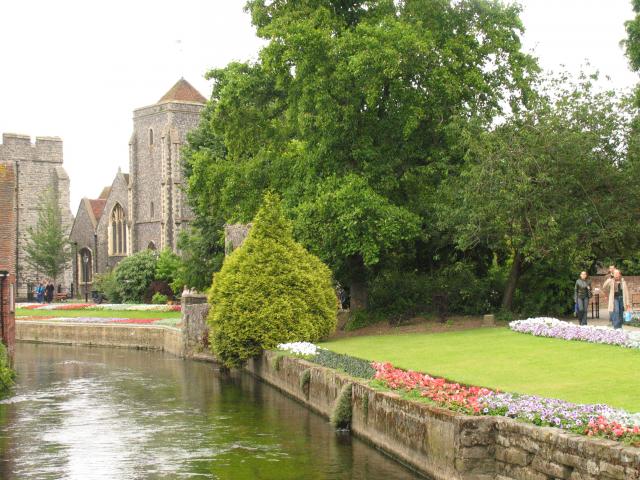
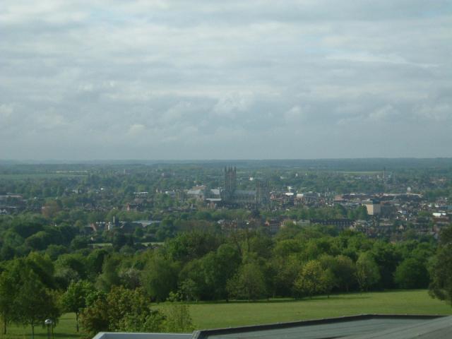
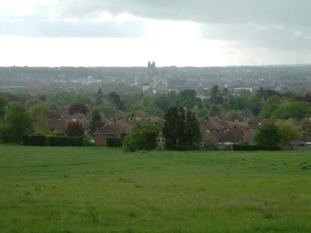
Canterbury is a historic city located in the county of Kent, in the southeastern part of England. It is situated on the River Stour and is approximately 60 miles east of London. Canterbury has a population of around 55,000 people.

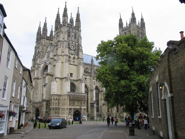
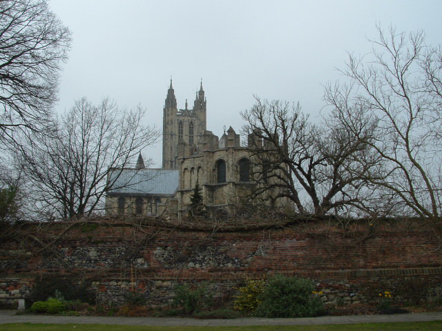
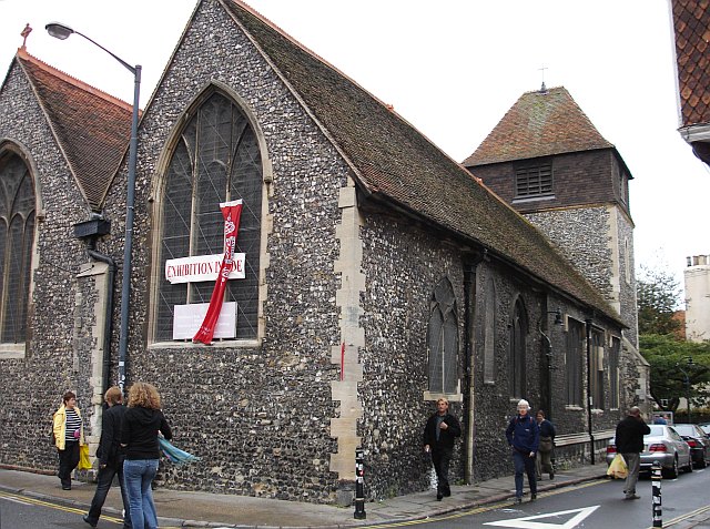
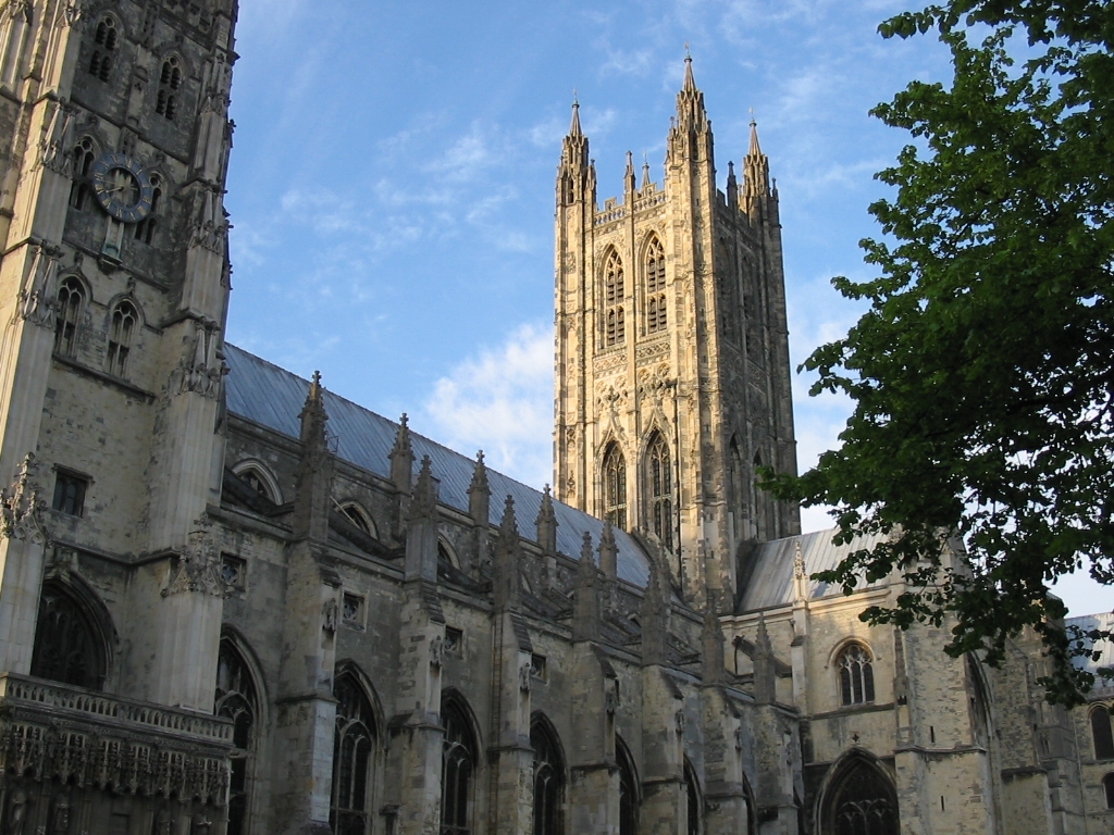
The city is renowned for its rich history and is primarily known for its famous cathedral, Canterbury Cathedral. This UNESCO World Heritage site is one of the oldest and most important Christian structures in England. Its stunning architecture and significance as the seat of the Archbishop of Canterbury make it a popular tourist destination.

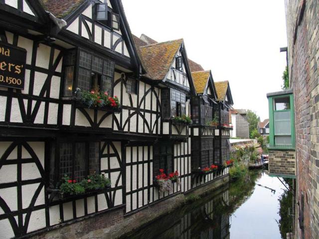
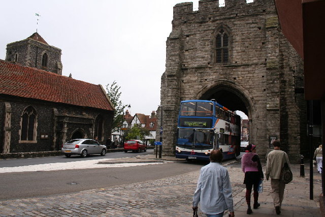
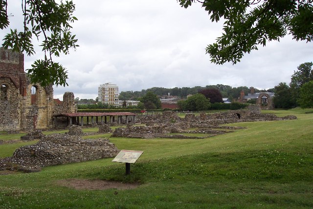
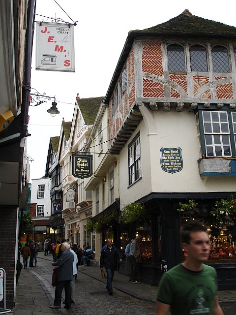
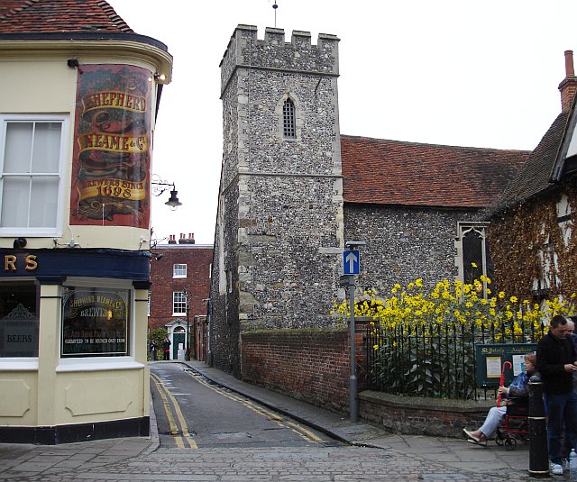
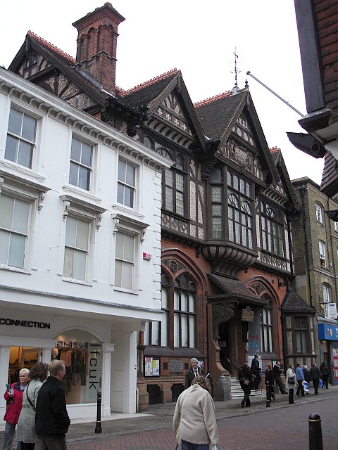
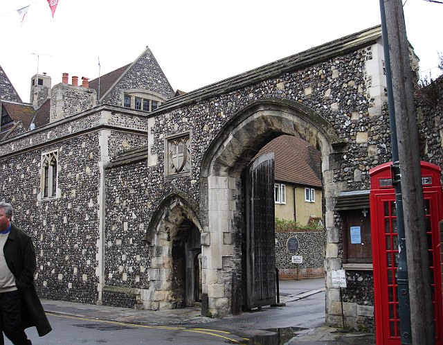
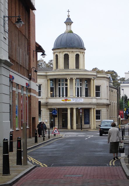
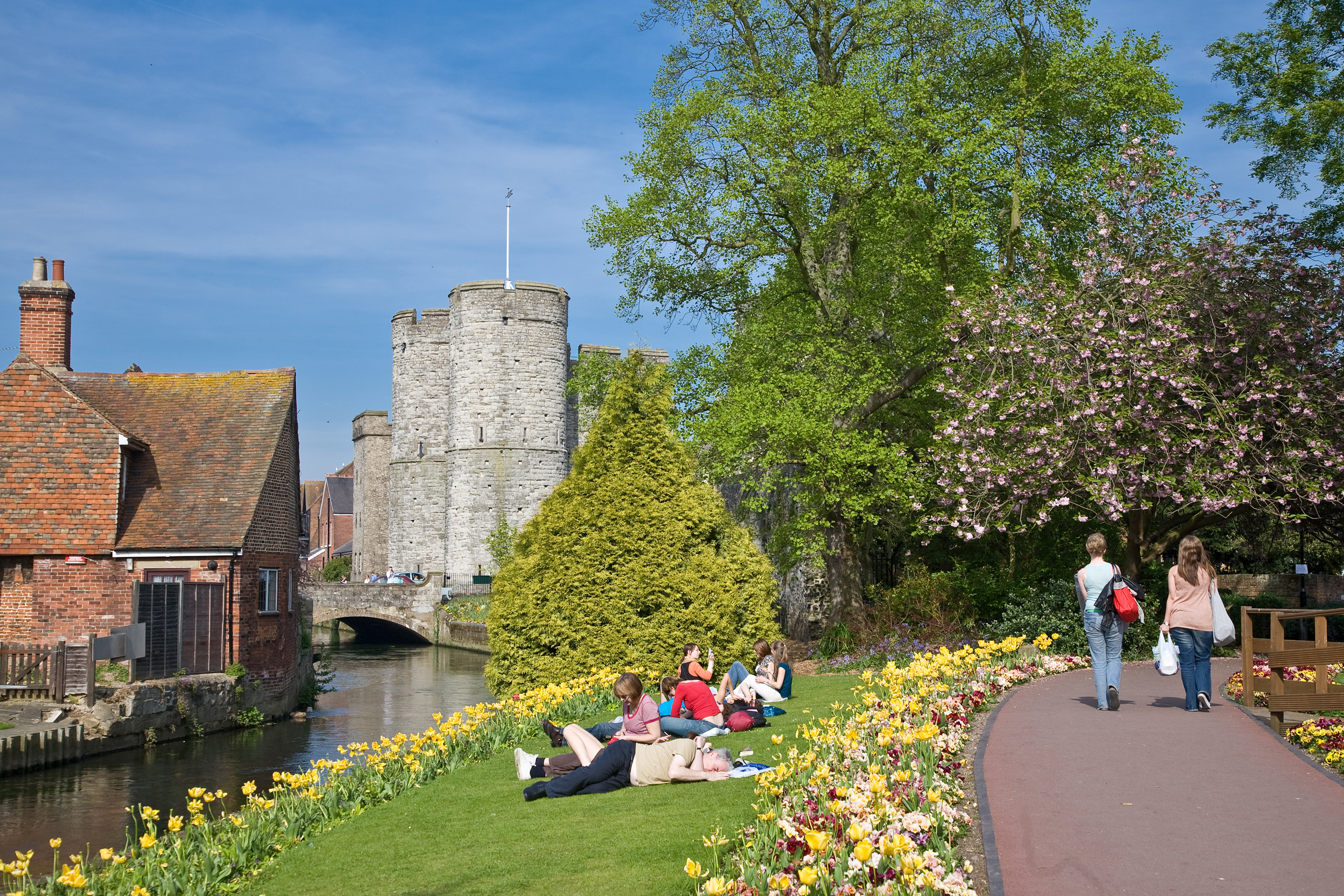
Apart from the cathedral, Canterbury is also notable for its well-preserved medieval city walls, dating back to Roman times, and the historic Canterbury Castle. The city's charming streets are lined with timber-framed buildings, picturesque gardens, and quaint shops, creating a delightful atmosphere for visitors.

Canterbury is home to three universities, including the University of Kent, which adds a vibrant and youthful energy to the city. The students contribute to the diverse cultural scene, which includes numerous theaters, art galleries, and music venues.

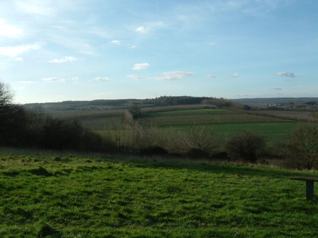
With its central location in the county of Kent, Canterbury serves as a gateway to exploring the surrounding countryside. The area is known for its beautiful landscapes, including the Kent Downs, also known as the "Garden of England," which offers opportunities for hiking, cycling, and exploring nature.

Overall, Canterbury is a captivating city that seamlessly blends its rich history with a vibrant contemporary culture, making it a must-visit destination for history enthusiasts, culture seekers, and nature lovers.

If you have any feedback on the listing, please let us know in the comments section below.

Canterbury Images

Images are sourced within 2km of 51.279615/1.078924 or Grid Reference TR1457. Thanks to Geograph Open Source API. All images are credited.

Canterbury Cathedral The cathedral entrance, right in the city centre taken from the southwest. The cathedral's central 'Bell Harry Tower' (250' high) is on the right, dating from c.1500AD.
Canterbury Cathedral
The cathedral entrance, right in the city centre taken from the southwest. The cathedral's central 'Bell Harry Tower' (250' high) is on the right, dating from c.1500AD.
City Gate seen beyond the Church, from the River: Canterbury Situated in the southern part of the grid square.
City Gate seen beyond the Church, from the River: Canterbury
Situated in the southern part of the grid square.
Approach to Canterbury Cathedral 11.00 am, Palm Sunday 2005. Photograph taken from gardens just inside city walls.
Approach to Canterbury Cathedral
11.00 am, Palm Sunday 2005. Photograph taken from gardens just inside city walls.
Canterbury A section of one of the channels of the Great Stour that flows through the centre of the town next to this 1500 building, now an Italian Restaurant. This scene is situated more or less in the centre of the square. This was taken looking more or less north east.
Canterbury
A section of one of the channels of the Great Stour that flows through the centre of the town next to this 1500 building, now an Italian Restaurant. This scene is situated more or less in the centre of the square. This was taken looking more or less north east.
Golden Hill The view from the National Trust owned 'Golden Hill'
Golden Hill
The view from the National Trust owned 'Golden Hill'
Canterbury View of Canterbury, looking south from the 4th floor of the Templeman Library at the University of Kent.
Canterbury
View of Canterbury, looking south from the 4th floor of the Templeman Library at the University of Kent.
Meadow Road Looking East over Canterbury from Neal's Place.
Meadow Road
Looking East over Canterbury from Neal's Place.
West Gate, Canterbury
Canterbury Bowling Club The club was founded in the reign of Queen Victoria. This is the club's new site, in South Canterbury Road. It boasts two well-kept greens.
Canterbury Bowling Club
The club was founded in the reign of Queen Victoria. This is the club's new site, in South Canterbury Road. It boasts two well-kept greens.
Tipsy One over the eight? No, this door has been cut to accommodate the settlement of this quaint old building over the centuries.
Tipsy
One over the eight? No, this door has been cut to accommodate the settlement of this quaint old building over the centuries.
St Augustine's Abbey, Canterbury, Kent The remains of St Augustine's Abbey in Canterbury. It was founded by St Augustine in about 598AD to mark the success of his mission to restore Christianity to England. Many of the Kings of Kent and early Archbishops of Canterbury are buried there. After the Dissolution of the Monasteries Henry VIII converted part of it to a royal palace (left end of picture). The site is now owned by English Heritage.
St Augustine's Abbey, Canterbury, Kent
The remains of St Augustine's Abbey in Canterbury. It was founded by St Augustine in about 598AD to mark the success of his mission to restore Christianity to England. Many of the Kings of Kent and early Archbishops of Canterbury are buried there. After the Dissolution of the Monasteries Henry VIII converted part of it to a royal palace (left end of picture). The site is now owned by English Heritage.
Canterbury Cathedral Sunset Sunset over Canterbury Cathedral
Canterbury Cathedral Sunset
Sunset over Canterbury Cathedral
St Alphege Lane At its junction with Palace Street. The former church is now used as a local heritage centre.
St Alphege Lane
At its junction with Palace Street. The former church is now used as a local heritage centre.
The Sun Hotel, Sun Street, Canterbury The plaque on the wall reads "Sun Hotel formerly known as The Little Inn made famous by Chas. Dickens in his travels thro' Kent Built 1503" It has been a jeweller's shop for many years. Sun Street runs around the south east side of the Cathedral precinct from the Butter Market into Palace Street.
The Sun Hotel, Sun Street, Canterbury
The plaque on the wall reads "Sun Hotel formerly known as The Little Inn made famous by Chas. Dickens in his travels thro' Kent Built 1503" It has been a jeweller's shop for many years. Sun Street runs around the south east side of the Cathedral precinct from the Butter Market into Palace Street.
St Peter's Church, Canterbury In St Peter's Lane from its junction with St Peter's Street. The pub on the left is the Cricketers.
St Peter's Church, Canterbury
In St Peter's Lane from its junction with St Peter's Street. The pub on the left is the Cricketers.
The Beaney Institute Standing in the High Street, opposite the County Hotel, this extravagantly ornate Victorian building was built at the behest of Dr Beaney, the son of a local labourer who made good, became a doctor of medicine, sailed to Australia and became very rich. The building houses the central library and the Royal museum and art gallery.
The Beaney Institute
Standing in the High Street, opposite the County Hotel, this extravagantly ornate Victorian building was built at the behest of Dr Beaney, the son of a local labourer who made good, became a doctor of medicine, sailed to Australia and became very rich. The building houses the central library and the Royal museum and art gallery.
The Mint Yard Gate, Kings School, Canterbury Housed in several buildings around the west and north of the cathedral precinct, this is the main entrance to the school, one of the oldest in the country.
The Mint Yard Gate, Kings School, Canterbury
Housed in several buildings around the west and north of the cathedral precinct, this is the main entrance to the school, one of the oldest in the country.
St Andrew's URC church, Canterbury Seen from Rose Lane looking SW. This is a recently built church and forms part of the Whitefriars redevelopment. It stands at the junction of Rose Lane and Marlowe Avenue with Watling Street.
St Andrew's URC church, Canterbury
Seen from Rose Lane looking SW. This is a recently built church and forms part of the Whitefriars redevelopment. It stands at the junction of Rose Lane and Marlowe Avenue with Watling Street.
Show me another place!

Canterbury is located at Grid Ref: TR1457 (Lat: 51.279615, Lng: 1.078924)

Administrative County: Kent

District: Canterbury

Police Authority: Kent

What 3 Words

///crops.keys.fancy. Near Canterbury, Kent

Nearby Locations

Bingley Island Canterbury

Related Wikis

Fleur de Lis Hotel

Fleur de Lis Hotel was a 13th century hotel in the city of Canterbury, Kent, England. It is recorded that Charles Dickens stayed there. The hotel was eventually...

Beaney House of Art and Knowledge

The Beaney House of Art and Knowledge is the central museum, library and art gallery of the city of Canterbury, Kent, England. It is housed in a Grade...

Siege of Canterbury

The siege of Canterbury was a major Viking raid on the city of Canterbury that occurred between 8 and 29 September 1011, fought between a Viking army led...

Canterbury

Canterbury ( , ) is a city and UNESCO World Heritage Site, in the county of Kent, England; it was until 1974 a county borough. It lies on the River Stour...

City of Canterbury

Canterbury (), commonly called the City of Canterbury, is a local government district with city status in Kent, England. As well as Canterbury itself,...

All Saints Cottage, Canterbury

All Saints Cottage, on All Saints Lane, in Canterbury, Kent, England is a building dating from the 16th century. Its origins and original purpose and configuration...

Marlowe Memorial

The Marlowe Memorial is a statue and four statuettes erected in memory of the playwright and poet Christopher Marlowe in 1891 in Canterbury, England. The...

Canterbury Heritage Museum

The Canterbury Heritage Museum (formerly the Museum of Canterbury) was a museum in Stour Street, Canterbury, South East England, telling the history of...

Nearby Amenities

Located within 500m of 51.279615,1.078924
Canterbury
Is In: Kent, England, UK
Is In Country: United Kingdom
Is In Country Code: GB
Is In County: Kent
Name Ar: كانتربيري
Name Br: Canterbury
Name Cy: Caergaint
Name En: Canterbury
Name Fr: Cantorbéry
Name Hu: Canterbury
Name Ko: 캔터베리
Name La: Cantuaria
Name Lt: Kenterberis
Name Lv: Kanterburija
Name Mk: Кантербери
Name Ru: Кентербери
Name Sr: Кентербери
Name Uk: Кентербері
Name Ur: کینٹربری
Old Name Nl: Kantelberg
Place: city
Population: 43400
Wikidata: Q29303
Wikipedia: en:Canterbury
Lat/Long: 51.2800275/1.0802533
Mini Roundabout
Direction: clockwise
Lat/Long: 51.2839742/1.0788328
Crossing
Button Operated: yes
Crossing: traffic_signals
Crossing Island: no
Crossing Ref: pelican
Kerb: lowered
Tactile Paving: yes
Traffic Signals Sound: yes
Traffic Signals Vibration: no
Lat/Long: 51.281928/1.0757128
Mini Roundabout
Westgate Roundabout
Direction: clockwise
Lat/Long: 51.2816639/1.0755051
Crossing
Bicycle: yes
Button Operated: yes
Crossing: traffic_signals
Crossing Island: no
Crossing Ref: toucan
Cyclestreets Id: 197635
Foot: yes
Tactile Paving: yes
Traffic Signals Sound: no
Traffic Signals Vibration: yes
Lat/Long: 51.2780981/1.0848634
Barrier: bollard
Bollard: fixed
Lat/Long: 51.2802262/1.0860466
Parking Entrance
Maxheight: 2.2
Maxweight: 2.5
Lat/Long: 51.2834081/1.0751663
Traffic Calming: hump
Lat/Long: 51.282186/1.0770009
Traffic Calming: hump
Lat/Long: 51.2826805/1.078367
Traffic Calming: hump
Lat/Long: 51.2825695/1.0808006
Traffic Calming: table
Lat/Long: 51.2775937/1.0784397
Traffic Calming: table
Lat/Long: 51.2837347/1.0785801
Traffic Calming: hump
Lat/Long: 51.2803865/1.0766929
Traffic Calming: choked_table
Lat/Long: 51.279896/1.0764005
Traffic Calming: choker
Lat/Long: 51.2796347/1.0760556
Traffic Calming: choked_table
Lat/Long: 51.279048/1.0753065
Traffic Calming: hump
Lat/Long: 51.2789082/1.0743949
Post Box
Collection Times: Mo-Fr 16:15; Sa 10:45
Operator: Royal Mail
Operator Wikidata: Q638098
Post Box Apertures: 2
Post Box Design: type_c
Post Box Type: pillar
Postal Code: CT1
Ref: CT1 3612;CT1 3611
Royal Cypher: EIIR
Royal Cypher Wikidata: Q33102113
Lat/Long: 51.2795821/1.0786124
Barrier: bollard
Bollard: fixed
Lat/Long: 51.2795611/1.0786686
Traffic Calming: hump
Lat/Long: 51.2785707/1.0777129
Check Date: 2023-02-18
Traffic Calming: hump
Lat/Long: 51.278051/1.0768778
Traffic Calming: hump
Lat/Long: 51.2774699/1.0759465
Check Date: 2021-07-22
Traffic Calming: hump
Lat/Long: 51.2769976/1.0752542
Barrier: yes
Lat/Long: 51.276649/1.0756362
Barrier: bollard
Lat/Long: 51.2790707/1.0790123
Barrier: bollard
Bollard: fixed
Lat/Long: 51.2792996/1.0793471
Post Box
Check Date Collection Times: 2023-07-28
Collection Plate: CP1D
Collection Times: Mo-Fr 09:00; Sa 07:00
Old Ref: CT1 2
Operator: Royal Mail
Operator Wikidata: Q638098
Post Box Type: pillar
Ref: CT1 2D
Royal Cypher: EIIR
Royal Cypher Wikidata: Q33102113
Source: survey
Survey Date: 2023-06-25
Lat/Long: 51.2791192/1.0810462
Barrier: bollard
Bollard: rising
Note: Anti-terrorism bollard. Ordinarily lowered.
Lat/Long: 51.2798527/1.0804679
Traffic Calming: hump
Lat/Long: 51.2767943/1.0795481
Traffic Calming: hump
Lat/Long: 51.2767745/1.0792748
Telephone
Booth: K6
Covered: booth
Listed Status: Grade II
Payment Coins: yes
Payment Credit Cards: yes
Payment Debit Cards: yes
Phone: +44 1227 768802
Lat/Long: 51.2794912/1.0784504
Post Box
Collection Plate: CP1D
Collection Times: Mo-Fr 09:00; Sa 07:00
Operator: Royal Mail
Operator Wikidata: Q638098
Post Box Type: pillar
Postal Code: CT1
Ref: CT1 8D
Royal Cypher: GVIR
Source: survey
Survey Date: 2023-06-25
Lat/Long: 51.2768301/1.0790252
Crossing
Crossing: uncontrolled
Crossing Ref: zebra
Tactile Paving: yes
Lat/Long: 51.2767185/1.0824536
Telephone
Booth: K6
Covered: booth
Listed Status: Grade II
Payment Card: yes
Payment Coins: yes
Phone: +44 1227 765290
Lat/Long: 51.2815418/1.0824709
Post Box
Check Date Collection Times: 2023-01-25
Collection Times: Mo-Fr 09:00; Sa 07:00
Operator: Royal Mail
Operator Wikidata: Q638098
Post Box Type: wall
Postal Code: CT1
Ref: CT1 7D
Royal Cypher: EVIIR
Royal Cypher Wikidata: Q33102324
Lat/Long: 51.281521/1.0824036
Post Box
Collection Times: Mo-Fr 17:30, Sa 13:15
Post Box Apertures: 2
Postal Code: CT2
Ref: CT2 7711;CT2 7722
Royal Cypher: EIIR
Royal Cypher Wikidata: Q33102113
Lat/Long: 51.2828013/1.0743598
Telephone
Booth: K6
Covered: booth
Listed Status: Grade II
Note: Out of order when surveyed 02/07/2021
Payment Coins: yes
Payment Credit Cards: yes
Payment Debit Cards: yes
Phone: +44 1227 768783
Lat/Long: 51.2799974/1.0790066
Telephone
Booth: K6
Covered: booth
Internet Access: terminal
Listed Status: Grade II
Note: Out of order when surveyed 02/07/2021
Payment Coins: yes
Payment Credit Cards: yes
Payment Debit Cards: yes
Phone: +44 1227 768701
Lat/Long: 51.2800001/1.0790003
Telephone
Booth: KX100
Check Date: 2022-08-02
Operator: BT
Operator Wikidata: Q593786
Lat/Long: 51.282659/1.0806311
Telephone
Booth: KX100
Check Date: 2023-12-31
Covered: booth
Lat/Long: 51.2780893/1.0811922
Post Box
Collection Times: Mo-Fr 09:00; Sa 07:00
Operator: Royal Mail
Operator Wikidata: Q638098
Post Box Apertures: 2
Post Box Design: type_c
Post Box Type: pillar
Ref: CT1 3411;CT1 3412
Royal Cypher: EIIR
Royal Cypher Wikidata: Q33102113
Source: survey
Lat/Long: 51.2781191/1.0811209
Telephone
Booth: KX100
Covered: booth
Lat/Long: 51.2811638/1.0762221
Telephone
Booth: KX100
Covered: booth
Lat/Long: 51.281153/1.0762017
Atm
Cash In: no
Fee: yes
Operator: NoteMachine
Lat/Long: 51.2811373/1.07618
Booth: K6
Covered: booth
Disused Amenity: telephone
Listed Status: Grade II
Man Made: telephone_box
Note: Telephone removed. Kiosk retained.
Lat/Long: 51.2818029/1.0757489
Booth: K6
Covered: booth
Disused Amenity: telephone
Listed Status: Grade II
Man Made: telephone_box
Note: Telephone removed. Kiosk retained.
Lat/Long: 51.2817865/1.0757325
Crossing
Crossing: uncontrolled
Crossing Island: no
Crossing Ref: zebra
Kerb: lowered
Tactile Paving: yes
Lat/Long: 51.2822103/1.0743135
Crossing
Crossing: uncontrolled
Crossing Ref: zebra
Kerb: lowered
Tactile Paving: yes
Lat/Long: 51.2764031/1.0812662
Crossing
Crossing: uncontrolled
Crossing Ref: zebra
Tactile Paving: yes
Lat/Long: 51.2765884/1.0818113
Crossing
Crossing: unmarked
Kerb: flush
Tactile Paving: yes
Lat/Long: 51.2771169/1.0833082
Barrier: bollard
Bollard: removable
Lat/Long: 51.2785878/1.0828054
Telephone
Check Date: 2022-08-02
Covered: no
Note: On outside of ATM kiosk
Payment Coins: yes
Payment Credit Cards: yes
Payment Debit Cards: yes
Lat/Long: 51.2785141/1.0829049
Bicycle Parking
Bicycle Parking: stands
Capacity: 4
Check Date: 2023-06-21
Colour: black
Covered: no
Cyclestreets Id: 25188;197636
Material: metal
Lat/Long: 51.2780829/1.0845575
Bicycle Parking
Bicycle Parking: stands
Capacity: 22
Check Date: 2023-05-10
Covered: no
Cyclestreets Id: 26745
Lat/Long: 51.2773231/1.0836607
Historic: monument
Lat/Long: 51.2793396/1.0851378
Bicycle Parking
Bicycle Parking: wall_loops
Capacity: 10
Covered: no
Cyclestreets Id: 45054
Lat/Long: 51.2794547/1.0814335
Bicycle Parking
Bicycle Parking: stands
Capacity: 6
Check Date Capacity: 2023-09-16
Colour: black
Covered: no
Cyclestreets Id: 197562
Material: metal
Lat/Long: 51.2786329/1.0803981
Bicycle Parking
Bicycle Parking: stands
Capacity: 4
Check Date Capacity: 2023-09-16
Colour: black
Covered: no
Cyclestreets Id: 197561
Material: metal
Lat/Long: 51.2785737/1.0803293
Bicycle Parking
Bicycle Parking: stands
Capacity: 12
Covered: yes
Cyclestreets Id: 197066
Old Cyclestreets Id: 26728
Lat/Long: 51.2811195/1.0761392
Bicycle Parking
Bicycle Parking: stands
Capacity: 8
Covered: no
Cyclestreets Id: 25189;39688
Lat/Long: 51.2799342/1.0788423
Bicycle Parking
Bicycle Parking: stands
Capacity: 8
Check Date: 2022-08-02
Covered: no
Cyclestreets Id: 26309
Lat/Long: 51.2826874/1.0806647
Bicycle Parking
Bicycle Parking: stands
Capacity: 6
Covered: no
Cyclestreets Id: 26305
Lat/Long: 51.2824939/1.0826409
Bicycle Parking
Bicycle Parking: stands
Capacity: 8
Check Date: 2023-05-03
Covered: no
Cyclestreets Id: 26308
Lat/Long: 51.2806279/1.078006
Bicycle Parking
Bicycle Parking: stands
Capacity: 2
Covered: no
Cyclestreets Id: 25191
Survey Date: 2021-07-22
Lat/Long: 51.2809215/1.0768916
Cafe
Real Eating Company
Addr City: Canterbury
Addr Country: GB
Addr County: Kent
Addr Housenumber: 16
Addr Postcode: CT1 2TD
Addr Street: Whitefriars Street
Addr Unit: 23
Fhrs Id: 1340743
Source Addr: FHRS Open Data
Website: https://www.real-eating.co.uk/
Lat/Long: 51.2770467/1.0812747
Pub
The Three Tuns
Addr City: Canterbury
Addr Country: GB
Addr County: Kent
Addr Housenumber: 24
Addr Postcode: CT1 2UD
Addr Street: Watling Street
Brand: Greene King
Brand Wikidata: Q5564162
Fhrs Id: 1103452
Phone: +44 1227 456391
Website: https://www.greeneking.co.uk/pubs/kent/three-tuns
Lat/Long: 51.2774772/1.0783828
The Coach House
Addr City: Canterbury
Addr Country: GB
Addr County: Kent
Addr Housenumber: 34
Addr Postcode: CT1 2UD
Addr Street: Watling Street
Fhrs Id: 1103265
Phone: +44 1227 784324
Source Addr Postcode: http://www.coachhouse-canterbury.co.uk/
Source Phone: http://www.coachhouse-canterbury.co.uk/
Tourism: guest_house
Website: http://www.coachhouse-canterbury.co.uk/
Lat/Long: 51.2767244/1.0791045
Restaurant
Azouma
Addr City: Canterbury
Addr Country: GB
Addr County: Kent
Addr Housenumber: 4
Addr Postcode: CT1 1NH
Addr Street: Church Street
Addr Suburb: St. Pauls
Contact Phone: +44 1227 760076
Contact Website: http://www.azouma.co.uk/
Cuisine: arab;north_african
Fhrs Id: 1559447
Opening Hours: Mo-Fr 12:00-15:00,17:00-23:00; Sa 12:00-00:00; Su 12:00-22:00
Source Addr Postcode: http://www.azouma.co.uk/
Lat/Long: 51.2781096/1.0853358
Post Box
Collection Times: Mo-Fr 09:00; Sa 07:00
Operator: Royal Mail
Operator Wikidata: Q638098
Post Box Type: wall
Postal Code: CT2
Ref: CT2 6D
Royal Cypher: GR
Royal Cypher Wikidata: Q33102273
Source: survey
Lat/Long: 51.2840073/1.0792242
Crossing
Check Date Crossing: 2021-09-16
Crossing: uncontrolled
Crossing Ref: zebra
Tactile Paving: yes
Lat/Long: 51.2770258/1.0833518
Barrier: bollard
Lat/Long: 51.2775208/1.0769767
Bicycle Parking
Bicycle Parking: stands
Capacity: 8
Covered: no
Cyclestreets Id: 26310
Lat/Long: 51.2815281/1.0773103
Post Box
Collection Times: Mo-Fr 18:30; Sa 12:30; Su off
Post Box Type: wall
Postal Code: CT1
Ref: CT1 160
Royal Cypher: GR
Royal Cypher Wikidata: Q33102273
Source: survey
Lat/Long: 51.2800343/1.0838192
Bicycle Parking
Access: public
Bicycle Parking: stands
Capacity: 8
Check Date: 2022-08-02
Covered: no
Cyclestreets Id: 26307
Lat/Long: 51.2809119/1.081313
Pub
The West Gate Inn
Addr City: Canterbury
Addr Country: GB
Addr County: Kent
Addr Housenumber: 1-3
Addr Postcode: CT2 7EB
Addr Street: North Lane
Brand: Wetherspoon
Brand Wikidata: Q6109362
Brand Wikipedia: en:Wetherspoons
Contact Website: https://www.jdwetherspoon.com/pubs/all-pubs/england/kent/the-west-gate-inn-canterbury
Fhrs Id: 1102560
Internet Access: wlan
Internet Access Fee: no
Opening Hours: Mo-Th 08:00-00:00;Fr 08:00-00:00;Sa 00:00-01:00,08:00-00:00;Su 00:00-01:00,08:00-00:00
Payment Cash: yes
Payment Credit Cards: yes
Payment Debit Cards: yes
Phone: +44 1227 464329
Smoking: no
Smoking Outside: yes
Source Addr: FHRS Open Data;website
Wheelchair: limited
Lat/Long: 51.2820079/1.0756173
Cafe
Beano Cafe
Addr City: Canterbury
Addr Country: GB
Addr County: Kent
Addr Housenumber: 12
Addr Postcode: CT2 7EB
Addr Street: North Lane
Fhrs Id: 1102559
Lat/Long: 51.2826002/1.0765663
Restaurant
Ancient Raj
Addr City: Canterbury
Addr Country: GB
Addr County: Kent
Addr Housenumber: 25-26
Addr Postcode: CT2 7EE
Addr Street: North Lane
Check Date: 2023-10-15
Cuisine: indian
Fhrs Id: 1102699
Opening Hours: Mo-Th 12:00-14:00, 18:00-00:00; Fr 18:00-00:00; Sa 12:00-14:00, 18:00-00:00; Su 12:00-00:00
Phone: +44 1227 470092; +44 1227 455882
Source Addr: Business card
Source Phone: Business card
Source Website: Business card
Website: https://www.ancient-raj.com/
Lat/Long: 51.2830648/1.0771656
The Flower Studio
Addr City: Canterbury
Addr Country: GB
Addr County: Kent
Addr Postcode: CT2 7EE
Addr Street: North Lane
Phone: +44 1227 456232
Shop: florist
Source Addr Postcode: http://www.flowerstudio.co.uk/contact.htm
Source Phone: Sign on front of premises.
Source Website: Sign on front of premises.
Website: https://www.flowerstudio.co.uk/
Lat/Long: 51.2836133/1.0782164
Dentist
Richard Flanagan & Associates Orthodontic Practices
Addr City: Canterbury
Addr Country: GB
Addr County: Kent
Addr Postcode: CT1 2AJ
Addr Street: King Street
Healthcare: dentist
Lat/Long: 51.2818403/1.0814843
Post Box
Check Date Collection Times: 2023-01-11
Collection Plate: CP1D
Collection Times: Mo-Fr 09:00; Sa 07:00
Lastcheck: 2023-03-14
Old Ref: CT1 78
Operator: Royal Mail
Operator Wikidata: Q638098
Post Box Mounting: building
Post Box Type: wall
Postal Code: CT1
Ref: CT1 78D
Royal Cypher: GR
Royal Cypher Wikidata: Q33102273
Source: survey
Lat/Long: 51.2825497/1.0837199
Barrier: bollard
Lat/Long: 51.2783333/1.0825249
Post Box
Collection Plate: CP1D
Collection Times: Mo-Fr 09:00; Sa 07:00
Old Ref: CT1 32
Operator: Royal Mail
Operator Wikidata: Q638098
Post Box Type: pillar
Postal Code: CT1
Ref: CT1 32D
Royal Cypher: EIIR
Source: survey
Lat/Long: 51.2763344/1.0759263
Waste Basket
Lat/Long: 51.283487/1.0813128
Bench
Backrest: yes
Lat/Long: 51.2835077/1.0813845
Waste Basket
Check Date: 2022-08-02
Lat/Long: 51.2834754/1.0812975
Bench
Backrest: yes
Lat/Long: 51.2833059/1.0810234
Waste Basket
Check Date: 2022-08-02
Lat/Long: 51.2828363/1.0805356
Crossing
Crossing: unmarked
Crossing Island: no
Kerb: lowered
Tactile Paving: yes
Lat/Long: 51.2802364/1.0730066
Bench
Backrest: yes
Lat/Long: 51.2805769/1.0735433
Waste Basket
Lat/Long: 51.2804733/1.073438
Bench
Backrest: yes
Lat/Long: 51.2804356/1.0734023
Bench
Lat/Long: 51.2803519/1.0733075
Post Box
Collection Plate: CP1D
Collection Times: Mo-Fr 09:00; Sa 07:00
Old Ref: CT1 81
Operator: Royal Mail
Operator Wikidata: Q638098
Post Box Type: pillar
Ref: CT1 81D
Royal Cypher: GR
Source: survey
Survey Date: 2023-06-25
Lat/Long: 51.2768118/1.0789967
Bicycle Parking
Capacity: 2
Note: Rings on the side of Canterbury Wholefoods.
Source: survey
Lat/Long: 51.2787205/1.0785083
Telephone
Booth: KX100
Covered: booth
Payment Coins: yes
Payment Credit Cards: yes
Payment Debit Cards: yes
Phone: +44 1227 768856
Source: survey
Survey Date: 2023-09-08
Lat/Long: 51.27664/1.0825465
Bicycle Parking
Access: yes
Bicycle Parking: stands
Capacity: 8
Covered: no
Cyclestreets Id: 26737
Fee: no
Source: survey
Survey Date: 2023-09-08
Lat/Long: 51.276608/1.0825604
Barrier: bollard
Lat/Long: 51.2776772/1.0729852
Barrier: bollard
Lat/Long: 51.2776635/1.0727358
Barrier: bollard
Lat/Long: 51.2787665/1.0748569
Barrier: bollard
Lat/Long: 51.2787253/1.0748248
Bicycle Parking
Access: private
Bicycle Parking: wall_loops
Capacity: 5
Covered: no
Source: survey
Lat/Long: 51.2759675/1.0809141
Toilets
Orange Street Car Park
Access: yes
Addr City: Canterbury
Addr Country: GB
Addr County: Kent
Addr Street: Best Lane
Female: yes
Male: yes
Opening Hours: 07:30-19:00;
Toilets Wheelchair: yes
Wheelchair: yes
Wheelchair Description: RADAR key, door opens outward. Ramp from Blue Badge spaces. [16/09/2017 Alarm cord too short]
Lat/Long: 51.2799458/1.0796825
Toilets
Lat/Long: 51.2823756/1.0784154
Bicycle Parking
Bicycle Parking: stands
Capacity: 4
Covered: no
Cyclestreets Id: 25605;39689
Source: survey
Lat/Long: 51.2795114/1.0784746
Bicycle Parking
Bicycle Parking: stands
Capacity: 4
Check Date Capacity: 2021-07-22
Covered: no
Cyclestreets Id: 27118
Source: survey
Lat/Long: 51.2784255/1.0774155
Bicycle Parking
Bicycle Parking: stands
Capacity: 8
Covered: no
Cyclestreets Id: 26747
Source: visual_estimate
Lat/Long: 51.2785035/1.0826136
Toilets
Access: yes
Check Date: 2022-08-02
Female: yes
Male: yes
Opening Hours: Mo-Sa 08:00-18:00
Wheelchair: no
Lat/Long: 51.277973/1.083261
Crossing
Crossing: uncontrolled
Crossing Ref: zebra
Tactile Paving: yes
Lat/Long: 51.2811587/1.0852862
Crossing
Crossing: unmarked
Crossing Island: yes
Tactile Paving: yes
Lat/Long: 51.2838806/1.0786372
Bicycle Parking
Bicycle Parking: stands
Capacity: 8
Covered: no
Cyclestreets Id: 25186;196756
Note: Capacity is reduced by poor placement next to a wall.
Source: survey
Lat/Long: 51.2776901/1.0826891
Bicycle Parking
Bicycle Parking: stands
Capacity: 12
Check Date: 2022-08-02
Colour: silver
Covered: no
Cyclestreets Id: 25187
Material: metal
Source: visual_estimate
Lat/Long: 51.2779107/1.0830697
Place Of Worship
Pilgrim's Relectory Chapel Undercroft
Denomination: anglican
Religion: christian
Lat/Long: 51.2798387/1.0784491
The Beaney House of Art and Knowledge
Addr City: Canterbury
Addr Country: GB
Addr County: Kent
Addr Housenumber: 18
Addr Postcode: CT1 2RA
Addr Street: High Street
Email: beaney@canterbury.gov.uk
Fee: no
Fhrs Id: 1535405
Opening Hours: Mo off; Tu-Sa 10:00-17:00; Su 11:00-16:00
Phone: +44 1227 862162
Toilets Wheelchair: yes
Tourism: museum
Website: https://canterburymuseums.co.uk/beaney/
Wheelchair: yes
Wikidata: Q7374508
Wikipedia: en:Beaney House of Art and Knowledge
Lat/Long: 51.2796732/1.0792796
Barrier: bollard
Bollard: fixed
Foot: yes
Lat/Long: 51.2814477/1.0798489
Barrier: bollard
Bicycle: no
Bollard: fixed
Foot: yes
Lat/Long: 51.2819197/1.0800632
Old Brewery Tavern
Disused Amenity: pub
Lat/Long: 51.2789415/1.078182
Entrance: main
Lat/Long: 51.2789576/1.0768391
Bus Stop
Stop E1
Bench: yes
Bin: no
Bus: yes
Lit: yes
Local Ref: E1
Naptan AtcoCode: 240096681
Naptan Bearing: NE
Naptan CommonName: Whitefriars
Naptan Indicator: Stop E1
Naptan Landmark: Fenwicks
Naptan NaptanCode: kntgmajt
Naptan PlusbusZoneRef: CNTBE
Naptan Street: St George's Lane
Naptan Verified: no
Public Transport: platform
Ref: kntgmajt
Shelter: yes
Source: naptan_import
Source Date: 2018-04-03T11:06:00
Tactile Paving: no
Lat/Long: 51.2769422/1.0830309
Bus Stop
Stop E2
Bench: yes
Bin: no
Bus: yes
Lit: yes
Local Ref: E2
Naptan AtcoCode: 240096683
Naptan Bearing: NE
Naptan CommonName: Whitefriars
Naptan Indicator: Stop E2
Naptan Landmark: Fenwicks
Naptan NaptanCode: kntgmajw
Naptan PlusbusZoneRef: CNTBE
Naptan Street: St George's Lane
Naptan Verified: no
Public Transport: platform
Ref: kntgmajw
Shelter: yes
Source: naptan_import
Source Date: 2018-04-03T11:06:00
Tactile Paving: no
Lat/Long: 51.276876/1.0828113
Bus Stop
Stop E3
Bench: yes
Bin: no
Bus: yes
Lit: yes
Local Ref: E3
Naptan AtcoCode: 240096685
Naptan Bearing: NE
Naptan CommonName: Whitefriars
Naptan Indicator: Stop E3
Naptan Landmark: H&M
Naptan NaptanCode: kntgmgdm
Naptan PlusbusZoneRef: CNTBE
Naptan Street: St George's Lane
Naptan Verified: no
Public Transport: platform
Ref: kntgmgdm
Shelter: yes
Source: naptan_import
Source Date: 2018-04-03T11:08:00
Tactile Paving: no
Lat/Long: 51.2767516/1.0820716
Bus Stop
Stop E4
Bench: yes
Bin: no
Bus: yes
Lit: yes
Local Ref: E4
Naptan AtcoCode: 240096687
Naptan Bearing: NE
Naptan CommonName: Whitefriars
Naptan Indicator: Stop E4
Naptan Landmark: H&M
Naptan NaptanCode: kntgmagw
Naptan PlusbusZoneRef: CNTBE
Naptan Street: St George's Lane
Naptan Verified: no
Public Transport: platform
Ref: kntgmagw
Shelter: yes
Source: naptan_import
Source Date: 2018-04-03T11:10:00
Tactile Paving: no
Lat/Long: 51.2766768/1.0818372
Bus Stop
Westgate Towers
Bench: yes
Bin: yes
Bus: yes
Check Date Shelter: 2023-06-20
Naptan AtcoCode: 240096701
Naptan Bearing: NE
Naptan CommonName: Westgate Towers
Naptan Indicator: NE-bound
Naptan Landmark: Westgate Towers
Naptan NaptanCode: kntgmamd
Naptan PlusbusZoneRef: CNTBE
Naptan Street: North Lane
Naptan Verified: no
Public Transport: platform
Shelter: yes
Source: naptan_import
Tactile Paving: no
Lat/Long: 51.2822327/1.0762927
Bus Stop
Bay A1
Bench: yes
Bin: yes
Bus: yes
Flag: yes
Lit: yes
Local Ref: A1
Naptan AtcoCode: 240098892
Naptan CommonName: Bus Station
Naptan Indicator: Bay A1
Naptan Landmark: Bus Station
Naptan NaptanCode: kntgpatp
Naptan PlusbusZoneRef: CNTBE
Naptan Street: Bus Station
Naptan Verified: no
Public Transport: platform
Ref: kntgpatp
Shelter: yes
Source: naptan_import
Source Date: 2018-03-29T11:44:00
Tactile Paving: no
Wheelchair: yes
Lat/Long: 51.2762329/1.0810469
Bus Stop
Bay A2
Bench: yes
Bin: yes
Bus: yes
Flag: yes
Lit: yes
Local Ref: A2
Naptan AtcoCode: 240098894
Naptan CommonName: Bus Station
Naptan Indicator: Bay A2
Naptan Landmark: Bus Station
Naptan NaptanCode: kntgwgtg
Naptan PlusbusZoneRef: CNTBE
Naptan Street: Bus Station
Naptan Verified: no
Public Transport: platform
Ref: kntgwgtg
Shelter: yes
Source: naptan_import
Tactile Paving: no
Wheelchair: yes
Lat/Long: 51.276254/1.0811103
Bus Stop
Bay D5
Bench: yes
Bin: yes
Bus: yes
Lit: no
Local Ref: D5
Naptan AtcoCode: 240098896
Naptan CommonName: Bus Station
Naptan Indicator: Bay D5
Naptan Landmark: Bus Station
Naptan NaptanCode: kntgpatd
Naptan PlusbusZoneRef: CNTBE
Naptan Street: Bus Station
Naptan Verified: no
Public Transport: platform
Ref: kntgpatd
Shelter: no
Source: naptan_import
Source Date: 2015-01-15T16:46:00
Tactile Paving: no
Wheelchair: yes
Lat/Long: 51.2766268/1.0823008
Bus Stop
Bay D4
Bench: yes
Bin: yes
Bus: yes
Lit: yes
Local Ref: D4
Naptan AtcoCode: 240098898
Naptan CommonName: Bus Station
Naptan Indicator: Bay D4
Naptan Landmark: Bus Station
Naptan NaptanCode: kntgpata
Naptan PlusbusZoneRef: CNTBE
Naptan Street: Bus Station
Naptan Verified: no
Public Transport: platform
Ref: kntgpata
Shelter: yes
Source: naptan_import
Source Date: 2015-01-15T16:46:00
Tactile Paving: no
Wheelchair: yes
Lat/Long: 51.2766235/1.082221
Bus Stop
Bay A3
Bench: yes
Bin: yes
Bus: yes
Flag: yes
Lit: yes
Local Ref: A3
Naptan AtcoCode: 240098900
Naptan CommonName: Bus Station
Naptan Indicator: Bay A3
Naptan Landmark: Bus Station
Naptan NaptanCode: kntgpamt
Naptan PlusbusZoneRef: CNTBE
Naptan Street: Bus Station
Naptan Verified: no
Public Transport: platform
Ref: kntgpamt
Shelter: yes
Source: naptan_import
Source Date: 2018-03-29T11:45:00
Tactile Paving: no
Wheelchair: yes
Lat/Long: 51.2762751/1.0811738
Bus Stop
Bay A4
Bench: yes
Bin: yes
Bus: yes
Flag: yes
Lit: yes
Local Ref: A4
Naptan AtcoCode: 240098902
Naptan CommonName: Bus Station
Naptan Indicator: Bay A4
Naptan Landmark: Bus Station
Naptan NaptanCode: kntgpamp
Naptan PlusbusZoneRef: CNTBE
Naptan Street: Bus Station
Naptan Verified: no
Public Transport: platform
Ref: kntgpamp
Shelter: yes
Source: naptan_import
Source Date: 2015-01-15T16:40:00
Tactile Paving: no
Wheelchair: yes
Lat/Long: 51.2762962/1.0812372
Bus Stop
Bay A5
Bench: yes
Bin: yes
Bus: yes
Flag: yes
Lit: yes
Local Ref: A5
Naptan AtcoCode: 240098904
Naptan CommonName: Bus Station
Naptan Indicator: Bay A5
Naptan Landmark: Bus Station
Naptan NaptanCode: kntgpamj
Naptan PlusbusZoneRef: CNTBE
Naptan Street: Bus Station
Naptan Verified: no
Public Transport: platform
Ref: kntgpamj
Shelter: yes
Source: naptan_import
Source Date: 2018-03-29T11:46:00
Tactile Paving: no
Wheelchair: yes
Lat/Long: 51.2763173/1.0813007
Bus Stop
Bay B1
Bench: yes
Bin: yes
Bus: yes
Flag: yes
Lit: yes
Local Ref: B1
Naptan AtcoCode: 240098906
Naptan CommonName: Bus Station
Naptan Indicator: Bay B1
Naptan Landmark: Bus Station
Naptan NaptanCode: kntgpagd
Naptan PlusbusZoneRef: CNTBE
Naptan Street: Bus Station
Naptan Verified: no
Public Transport: platform
Ref: kntgpagd
Shelter: yes
Source: naptan_import
Source Date: 2018-03-29T11:47:00
Tactile Paving: no
Wheelchair: yes
Lat/Long: 51.2763384/1.0813641
Bus Stop
Bay B3
Bench: yes
Bin: yes
Bus: yes
Flag: yes
Lit: yes
Local Ref: B3
Naptan AtcoCode: 240098910
Naptan CommonName: Bus Station
Naptan Indicator: Bay B3
Naptan Landmark: Bus Station
Naptan NaptanCode: kntgpadw
Naptan PlusbusZoneRef: CNTBE
Naptan Street: Bus Station
Naptan Verified: no
Public Transport: platform
Ref: kntgpadw
Shelter: yes
Source: naptan_import
Source Date: 2018-03-29T11:48:00
Tactile Paving: no
Wheelchair: yes
Lat/Long: 51.2763806/1.081491
Bus Stop
Bay B4
Bench: yes
Bin: yes
Bus: yes
Lit: yes
Local Ref: B4
Naptan AtcoCode: 240098939
Naptan CommonName: Bus Station
Naptan Indicator: Bay B4
Naptan Landmark: Bus Station
Naptan NaptanCode: kntgpadm
Naptan PlusbusZoneRef: CNTBE
Naptan Street: Bus Station
Naptan Verified: no
Public Transport: platform
Ref: kntgpadm
Shelter: yes
Source: naptan_import
Source Date: 2018-03-29T11:48:00
Tactile Paving: no
Wheelchair: yes
Lat/Long: 51.2764017/1.0815544
Bus Stop
Bay B5
Bench: yes
Bin: yes
Bus: yes
Flag: yes
Lit: yes
Local Ref: B5
Naptan AtcoCode: 240098941
Naptan CommonName: Bus Station
Naptan Indicator: Bay B5
Naptan Landmark: Bus Station
Naptan NaptanCode: kntgpadj
Naptan PlusbusZoneRef: CNTBE
Naptan Street: Bus Station
Naptan Verified: no
Public Transport: platform
Ref: kntgpadj
Shelter: yes
Source: naptan_import
Source Date: 2015-01-15T16:42:00
Tactile Paving: no
Wheelchair: yes
Lat/Long: 51.2764229/1.0816179
Bus Stop
Bay C1
Bench: yes
Bin: yes
Bus: yes
Lit: yes
Local Ref: C1
Naptan AtcoCode: 240098943
Naptan CommonName: Bus Station
Naptan Indicator: Bay C1
Naptan Landmark: Bus Station
Naptan NaptanCode: kntgpadg
Naptan PlusbusZoneRef: CNTBE
Naptan Street: Bus Station
Naptan Verified: no
Public Transport: platform
Ref: kntgpadg
Shelter: yes
Source: naptan_import
Source Date: 2015-01-15T16:43:00
Tactile Paving: no
Wheelchair: yes
Lat/Long: 51.276444/1.0816813
Bus Stop
Bay C2
Bench: yes
Bin: yes
Bus: yes
Lit: yes
Local Ref: C2
Naptan AtcoCode: 240098945
Naptan CommonName: Bus Station
Naptan Indicator: Bay C2
Naptan Landmark: Bus Station
Naptan NaptanCode: kntgpada
Naptan PlusbusZoneRef: CNTBE
Naptan Street: Bus Station
Naptan Verified: no
Public Transport: platform
Ref: kntgpada
Shelter: yes
Source: naptan_import
Source Date: 2018-03-29T11:49:00
Tactile Paving: no
Wheelchair: yes
Lat/Long: 51.2764651/1.0817448
Bus Stop
Bay C3
Bench: yes
Bin: yes
Bus: yes
Lit: yes
Local Ref: C3
Naptan AtcoCode: 240098947
Naptan CommonName: Bus Station
Naptan Indicator: Bay C3
Naptan Landmark: Bus Station
Naptan NaptanCode: kntgmwtw
Naptan PlusbusZoneRef: CNTBE
Naptan Street: Bus Station
Naptan Verified: no
Public Transport: platform
Ref: kntgmwtw
Shelter: yes
Source: naptan_import
Source Date: 2018-03-29T11:51:00
Tactile Paving: no
Wheelchair: yes
Lat/Long: 51.2764862/1.0818082
Bus Stop
Bay C4
Bench: yes
Bin: yes
Bus: yes
Lit: yes
Local Ref: C4
Naptan AtcoCode: 240098949
Naptan CommonName: Bus Station
Naptan Indicator: Bay C4
Naptan Landmark: Bus Station
Naptan NaptanCode: kntgmwtp
Naptan PlusbusZoneRef: CNTBE
Naptan Street: Bus Station
Naptan Verified: no
Public Transport: platform
Ref: kntgmwtp
Shelter: yes
Source: naptan_import
Source Date: 2015-01-15T16:44:00
Tactile Paving: no
Wheelchair: yes
Lat/Long: 51.2765073/1.0818716
Bus Stop
Bay C5
Bench: yes
Bin: yes
Bus: yes
Lit: yes
Local Ref: C5
Naptan AtcoCode: 240099188
Naptan CommonName: Bus Station
Naptan Indicator: Bay C5
Naptan Landmark: Bus Station
Naptan NaptanCode: kntgpatm
Naptan PlusbusZoneRef: CNTBE
Naptan Street: Bus Station
Naptan Verified: no
Public Transport: platform
Ref: kntgpatm
Shelter: yes
Source: naptan_import
Source Date: 2018-03-29T11:55:00
Tactile Paving: no
Wheelchair: yes
Lat/Long: 51.2765284/1.0819351
Bus Stop
Bay D1
Bench: yes
Bin: yes
Bus: yes
Lit: yes
Local Ref: D1
Naptan AtcoCode: 240099190
Naptan CommonName: Bus Station
Naptan Indicator: Bay D1
Naptan Landmark: Bus Station
Naptan NaptanCode: kntgmwtm
Naptan PlusbusZoneRef: CNTBE
Naptan Street: Bus Station
Naptan Verified: no
Public Transport: platform
Ref: kntgmwtm
Shelter: yes
Source: naptan_import
Source Date: 2018-03-29T11:55:00
Tactile Paving: no
Wheelchair: yes
Lat/Long: 51.2765495/1.0819985
Bus Stop
Bay D2
Bench: yes
Bin: yes
Bus: yes
Lit: yes
Local Ref: D2
Naptan AtcoCode: 240099192
Naptan CommonName: Bus Station
Naptan Indicator: Bay D2
Naptan Landmark: Bus Station
Naptan NaptanCode: kntgmwtj
Naptan PlusbusZoneRef: CNTBE
Naptan Street: Bus Station
Naptan Verified: no
Public Transport: platform
Ref: kntgmwtj
Shelter: yes
Source: naptan_import
Source Date: 2015-01-15T16:45:00
Tactile Paving: no
Wheelchair: yes
Lat/Long: 51.2765706/1.082062
Bus Stop
Bay D3
Bench: yes
Bin: yes
Bus: yes
Lit: yes
Local Ref: D3
Naptan AtcoCode: 240099194
Naptan CommonName: Bus Station
Naptan Indicator: Bay D3
Naptan Landmark: Bus Station
Naptan NaptanCode: kntgmwtg
Naptan PlusbusZoneRef: CNTBE
Naptan Street: Bus Station
Naptan Verified: no
Public Transport: platform
Ref: kntgmwtg
Shelter: yes
Source: naptan_import
Source Date: 2015-01-15T16:45:00
Tactile Paving: no
Wheelchair: yes
Lat/Long: 51.2765917/1.0821254
Bus Stop
Bus Station
Bench: yes
Bin: yes
Bus: yes
Lit: yes
Naptan AtcoCode: 2400A039640A
Naptan CommonName: Bus Station
Naptan Indicator: arrivals
Naptan Landmark: Bus Station
Naptan NaptanCode: kntadaga
Naptan PlusbusZoneRef: CNTBE
Naptan StopType: BCQ
Naptan Street: Bus Station
Naptan Verified: no
Note: This is an unassinged bay. What this means is that services can be assigned to this stop and will be directed to various different bays when they arrive.
Public Transport: platform
Shelter: yes
Source: naptan_import
Source Date: 2015-01-15T16:38:00
Tactile Paving: no
Wheelchair: yes
Lat/Long: 51.2761158/1.0809392
Bus Stop
Canterbury (National Express)
Bench: yes
Bin: no
Bus: yes
Flag: yes
Lit: yes
Naptan AtcoCode: 2400A039650A
Naptan CommonName: Bus Station
Naptan Indicator: departures
Naptan Landmark: Travel Shop
Naptan NaptanCode: kntdpmtg
Naptan PlusbusZoneRef: CNTBE
Naptan Street: Bus Station
Naptan Verified: no
Network: National Express
Network Wikidata: Q60188
Operator: National Express
Public Transport: platform
Ref: kntdpmtg
Shelter: yes
Source: naptan_import
Source Date: 2015-01-15T16:47:00
Tactile Paving: no
Lat/Long: 51.276712/1.0828473
Bus Stop
Westgate Towers
Bench: no
Bin: no
Check Date Shelter: 2021-04-08
Lit: yes
Naptan AtcoCode: 2400A048110A
Naptan Bearing: NW
Naptan CommonName: Westgate Towers
Naptan Indicator: NW-bound
Naptan Landmark: Westgate Towers
Naptan NaptanCode: kntgadwt
Naptan PlusbusZoneRef: CNTBE
Naptan Street: St Dunstans Street
Naptan Verified: no
Shelter: no
Source: naptan_import
Tactile Paving: no
Lat/Long: 51.28183/1.074965
Bus Stop
Westgate Towers
Bench: no
Bin: no
Check Date Shelter: 2021-04-08
Lit: no
Naptan AtcoCode: 2400A048120A
Naptan Bearing: SE
Naptan CommonName: Westgate Towers
Naptan Indicator: SE-bound
Naptan Landmark: Westgate Towers
Naptan NaptanCode: kntgagad
Naptan PlusbusZoneRef: CNTBE
Naptan Street: St Dunstans Street
Naptan Verified: no
Shelter: no
Source: naptan_import
Tactile Paving: no
Lat/Long: 51.2820205/1.0748269
Bus Stop
Westgate Towers
Bus: yes
Flag: yes
Naptan AtcoCode: 2400A049210A
Naptan Bearing: SW
Naptan BusStopType: CUS
Naptan CommonName: Westgate Towers
Naptan Indicator: SW-bound
Naptan Landmark: Car Park
Naptan NaptanCode: kntgamdp
Naptan PlusbusZoneRef: CNTBE
Naptan Street: North Lane
Naptan Verified: no
Note: NaPTAN out of date? Looks like theres a flag on sat img
Public Transport: platform
Shelter: yes
Source: naptan_import
Lat/Long: 51.2821037/1.0760818
Bus Stop
The Causeway
Bus: yes
Naptan AtcoCode: 2400A049220A
Naptan Bearing: N
Naptan CommonName: The Causeway
Naptan Indicator: opp
Naptan Landmark: Bus Depot
Naptan NaptanCode: kntgamdt
Naptan PlusbusZoneRef: CNTBE
Naptan Street: St Stephens Road
Naptan Verified: no
Public Transport: platform
Shelter: no
Source: naptan_import
Lat/Long: 51.2840914/1.0795165
Bus Stop
Magistrates Court
Bench: no
Bin: no
Lit: yes
Naptan AtcoCode: 2400A049510A
Naptan Bearing: S
Naptan CommonName: Magistrates Court
Naptan Indicator: adj
Naptan Landmark: Magistrates Court
Naptan NaptanCode: kntgamtw
Naptan PlusbusZoneRef: CNTBE
Naptan Street: Broad Street
Naptan Verified: no
Public Transport: platform
Ref: kntgamtw
Shelter: no
Source: naptan_import
Source Date: 2018-03-29T13:58:00
Tactile Paving: no
Lat/Long: 51.278669/1.0854268
Bus Stop
Magistrates Court
Bench: no
Bin: no
Flag: yes
Lit: yes
Naptan AtcoCode: 2400A049520A
Naptan Bearing: N
Naptan CommonName: Magistrates Court
Naptan Indicator: opp
Naptan Landmark: Magistrates Court
Naptan NaptanCode: kntgamwa
Naptan PlusbusZoneRef: CNTBE
Naptan Street: Broad Street
Naptan Verified: no
Public Transport: platform
Ref: kntgamwa
Shelter: no
Source: naptan_import
Source Date: 2018-03-29T13:59:00
Tactile Paving: no
Lat/Long: 51.2798002/1.0858469
Taxi
Falstaff Hotel
Capacity: 4
Naptan AtcoCode: 2400A062700R
Naptan CommonName: Falstaff Hotel
Naptan Indicator: taxi rank
Naptan Landmark: Falstaff Hotel
Naptan PlusbusZoneRef: CNTBE
Naptan Street: St Dunstan's Street
Naptan Verified: no
Source: naptan_import
Source Date: 2014-01-31T12:09:00
Lat/Long: 51.2819433/1.0749677
Taxi
Whitefriars
Capacity: 6
Naptan AtcoCode: 2400A062710R
Naptan CommonName: Whitefriars
Naptan Indicator: taxi rank
Naptan Landmark: Whitefriars
Naptan PlusbusZoneRef: CNTBE
Naptan Street: St Georges Lane
Naptan Verified: no
Source: naptan_import
Source Date: 2015-01-15T16:50:00
Lat/Long: 51.2762743/1.080786
Taxi
Canterbury Lane
Capacity: 3
Naptan AtcoCode: 2400A062720R
Naptan CommonName: Canterbury Lane
Naptan Indicator: taxi rank
Naptan Landmark: Burgate
Naptan PlusbusZoneRef: CNTBE
Naptan Street: Canterbury Lane
Naptan Verified: no
Source: naptan_import
Source Date: 2015-01-15T16:48:00
Lat/Long: 51.2781646/1.0833191
Bicycle Parking
Bicycle Parking: stands
Capacity: 2
Check Date Capacity: 2023-05-03
Covered: no
Cyclestreets Id: 26311
Source: survey
Lat/Long: 51.2809163/1.0749561
Bicycle Parking
Bicycle Parking: stands
Capacity: 4
Check Date Capacity: 2022-07-23
Covered: no
Cyclestreets Id: 25183
Source: survey
Lat/Long: 51.2769594/1.083187
Cafe
Fuego
Addr City: Canterbury
Addr Country: GB
Addr County: Kent
Addr Housename: Fenwick
Addr Postcode: CT1 2TB
Addr Street: St George's Street
Source Addr: FHRS Open Data
Source Phone: Business card
Lat/Long: 51.2769855/1.0831802
Bicycle Parking
Bicycle Parking: stands
Capacity: 2
Check Date: 2023-06-20
Covered: no
Cyclestreets Id: 27506
Source: survey
Lat/Long: 51.2826261/1.0789763
Bar
The Ballroom
Addr City: Canterbury
Addr Country: GB
Addr County: Kent
Addr Housenumber: 15
Addr Postcode: CT1 2JA
Addr Street: Orange Street
Fhrs Id: 1102692
Opening Hours: Mo-Sa 18:30-00:00
Phone: +44 1227 760801
Website: https://www.theballroom.co/
Lat/Long: 51.2804219/1.080227
Mini Roundabout
Direction: clockwise
Lat/Long: 51.2767192/1.079481
Pub
The Bishop's Finger
Addr City: Canterbury
Addr Country: GB
Addr County: Kent
Addr Housenumber: 13
Addr Postcode: CT2 8AF
Addr Street: St. Dunstan's Street
Brewery: Shepherd Neame
Contact Facebook: https://www.facebook.com/bishopsfingercanterbury
Contact Phone: +44 1227 768915
Fhrs Id: 1103328
Opening Hours: Su-Th 12:00-00:00; Fr 12:00-01:00; Sa 11:00-01:00
Source Addr: fhrs
Website: https://www.bishopsfingercanterbury.co.uk/
Lat/Long: 51.2820234/1.074921
Falstaff Hotel
Addr City: Canterbury
Addr Country: GB
Addr County: Kent
Addr Housenumber: 8-12
Addr Postcode: CT2 8AF
Addr Street: St. Dunstan's Street
Bar: yes
Contact Phone: +44 1227 462138
Fhrs Id: 1102882
Internet Access: wlan
Survey Date: 2021-07-23
Tourism: hotel
Website: https://www.thefalstaffincanterbury.com/
Wheelchair: yes
Wikidata: Q26551374
Lat/Long: 51.2819949/1.0749909
Crossing
Button Operated: yes
Crossing: traffic_signals
Crossing Island: no
Crossing Ref: pelican
Tactile Paving: yes
Traffic Signals Sound: yes
Traffic Signals Vibration: yes
Lat/Long: 51.2810684/1.0759166
Pub
Bramleys
Addr City: Canterbury
Addr Country: GB
Addr County: Kent
Addr Housenumber: 15
Addr Postcode: CT1 2JA
Addr Street: Orange Street
Contact Phone: +44 1227 379933
Fhrs Id: 1102748
Opening Hours: Mo-Th 18:00-23:00; Fr-Sa 18:00-00:30; Su off
Operator: Shepherd Neame
Website: https://www.bramleysbar.co.uk/
Lat/Long: 51.2804322/1.0801776
Telephone
Booth: KX100
Check Date: 2023-06-20
Note: Originally KX100 kiosk but dome added
Payment Coins: yes
Payment Credit Cards: yes
Payment Debit Cards: yes
Phone: +44 1227 451530
Lat/Long: 51.2771853/1.083461
Atm
Cash In: no
Check Date: 2023-05-10
Operator: Cash Zone
Lat/Long: 51.2772213/1.0835436
Bench
Lat/Long: 51.2827309/1.0778747
Waste Basket
Lat/Long: 51.2827133/1.0778547
Bench
Lat/Long: 51.2827323/1.0777844
Crossing
Crossing Island: yes
Lat/Long: 51.2840194/1.0789984
Crossing
Crossing: unmarked
Crossing Island: yes
Tactile Paving: yes
Lat/Long: 51.2840937/1.0786729
Telephone
Booth: K6
Covered: booth
Internet Access: terminal
Listed Status: Grade II
Payment Coins: yes
Payment Credit Cards: yes
Payment Debit Cards: yes
Phone: +44 1227 454706
Lat/Long: 51.279476/1.0784293
Waste Basket
Lat/Long: 51.2776938/1.0822848
Waste Basket
Check Date: 2021-04-08
Lat/Long: 51.280138/1.0781744
Waste Basket
Check Date: 2021-04-08
Lat/Long: 51.2791629/1.0797736
Waste Basket
Check Date: 2021-04-08
Lat/Long: 51.2786633/1.0805069
Waste Basket
Check Date: 2021-04-08
Lat/Long: 51.2789776/1.0800799
Bench
Backrest: yes
Lat/Long: 51.277138/1.0832936
Bench
Backrest: no
Check Date: 2021-04-08
Lat/Long: 51.2788309/1.0799901
Information: guidepost
Tourism: information
Lat/Long: 51.2768628/1.0809222
Waste Basket
Check Date: 2021-04-08
Lat/Long: 51.2797202/1.0788423
Bench
Backrest: yes
Check Date: 2021-04-08
Lat/Long: 51.2782727/1.0814519
Bench
Backrest: no
Lat/Long: 51.2799217/1.0788746
Bench
Backrest: no
Check Date: 2021-04-08
Lat/Long: 51.2787689/1.0801068
Bench
Backrest: no
Fixme: Check position. Some of these benches are apparently indoors
Lat/Long: 51.2769559/1.0811727
Information: guidepost
Tourism: information
Lat/Long: 51.2783115/1.0814596
Bench
Backrest: no
Lat/Long: 51.2800221/1.0789657
Waste Basket
Lat/Long: 51.2793138/1.0794112
Information: guidepost
Tourism: information
Lat/Long: 51.2773354/1.0803816
Bicycle Parking
Bicycle Parking: stands
Capacity: 10
Check Date: 2023-05-10
Covered: no
Cyclestreets Id: 25283
Lat/Long: 51.2781339/1.0812757
Waste Basket
Check Date: 2022-06-19
Lat/Long: 51.2768356/1.0809904
Waste Basket
Check Date: 2022-06-19
Lat/Long: 51.2768534/1.080869
Waste Basket
Check Date: 2021-04-08
Lat/Long: 51.2783461/1.0815607
Waste Basket
Lat/Long: 51.2776805/1.0822838
Booth: K6
Covered: booth
Disused Amenity: telephone
Listed Status: Grade II
Man Made: telephone_box
Note: Telephone removed; kiosk retained
Lat/Long: 51.278139/1.0847041
Waste Basket
Check Date: 2021-04-08
Lat/Long: 51.2798808/1.0785541
Atm
Brand: HSBC UK
Brand Wikidata: Q64767453
Cash In: no
Indoor: no
Operator: HSBC UK
Operator Wikidata: Q64767453
Lat/Long: 51.2775097/1.0805615
Bench
Backrest: no
Fixme: Check position. Some of these benches are apparently indoors
Lat/Long: 51.2769305/1.0811138
Bench
Backrest: yes
Check Date: 2021-04-08
Lat/Long: 51.2783557/1.081583
Waste Basket
Lat/Long: 51.2781301/1.0811409
Bench
Backrest: no
Fixme: Check position. Some of these benches are apparently indoors
Lat/Long: 51.2769825/1.0812419
Waste Basket
Lat/Long: 51.2800095/1.0789859
Bench
Backrest: yes
Lat/Long: 51.2773285/1.0804067
Waste Basket
Check Date: 2021-04-08
Lat/Long: 51.277759/1.0820777
Historic: memorial
Memorial: war_memorial
Lat/Long: 51.2788125/1.0800612
Bench
Backrest: yes
Lat/Long: 51.2786989/1.0826995
Waste Basket
Lat/Long: 51.2807336/1.0813034
Waste Basket
Lat/Long: 51.279951/1.0807519
Waste Basket
Lat/Long: 51.2785562/1.0828486
Bench
Backrest: yes
Lat/Long: 51.2786825/1.082748
Waste Basket
Lat/Long: 51.2797721/1.0808096
Waste Basket
Lat/Long: 51.2795016/1.0808501
Waste Basket
Check Date: 2021-07-23
Lat/Long: 51.2791057/1.0810668
Waste Basket
Lat/Long: 51.2792181/1.0811371
Waste Basket
Check Date: 2023-06-13
Lat/Long: 51.2786912/1.0827257
Skechers
Addr City: Canterbury
Addr Country: GB
Addr County: Kent
Addr Housenumber: 13
Addr Postcode: CT1 2SN
Addr Street: Gravel Walk
Brand: Skechers
Brand Website: http://www.sketchers.com/
Brand Wikidata: Q2945643
Brand Wikipedia: en:Skechers
Level: 0
Shop: shoes
Lat/Long: 51.2767881/1.0806872
Bicycle Parking
Bicycle Parking: stands
Capacity: 12
Check Date: 2023-07-09
Covered: yes
Lat/Long: 51.2770229/1.0797643
Bicycle Parking
Access: private
Bicycle Parking: front_wheel
Capacity: 10
Covered: yes
Cyclestreets Id: 27308
Lat/Long: 51.2774843/1.0739167
Traffic Calming: hump
Lat/Long: 51.2826392/1.0795621
Barrier: lift_gate
Lat/Long: 51.2828486/1.0807136
Traffic Calming: hump
Lat/Long: 51.2762899/1.0759677
Barrier: bollard
Bollard: removable
Lat/Long: 51.2774732/1.0780337
Restaurant
Chom Chom
Addr City: Canterbury
Addr Country: GB
Addr County: Kent
Addr Housenumber: 10-11
Addr Postcode: CT1 2HH
Addr Street: Burgate Lane
Cuisine: indian;chinese;thai;italian
Fhrs Id: 1091514
Phone: +44 1227 450200
Website: https://www.chomchomcanterbury.co.uk/
Lat/Long: 51.2775822/1.0836989
Bicycle Parking
Bicycle Parking: stands
Capacity: 20
Covered: no
Cyclestreets Id: 34482;34483
Lat/Long: 51.2810601/1.0782371
Waste Basket
Landfill: yes
Recycling Mixed: yes
Lat/Long: 51.2816761/1.0789452
Goldsmiths
Addr City: Canterbury
Addr Housenumber: 11
Addr Postcode: CT1 2TF
Addr Street: Gravel Walk
Brand: Goldsmiths
Brand Wikidata: Q16993095
Brand Wikipedia: en:Goldsmiths (retailer)
Check Date Opening Hours: 2023-06-16
Level: 0
Opening Hours: Mo-Sa 09:30-17:30; Su 10:30-16:30
Opening Hours Signed: no
Phone: +44 1227 762408
Shop: jewelry
Website: https://www.goldsmiths.co.uk/store/245
Lat/Long: 51.2769556/1.0808397
Bus: yes
Public Transport: stop_position
Lat/Long: 51.2764593/1.0821077
Whitefriars
Bus: yes
Public Transport: stop_position
Lat/Long: 51.2766876/1.0821238
Entrance: yes
Lat/Long: 51.2796284/1.0826264
Traffic Signals
Note: These do NOT interrupt the flow of traffic already on the roundabout. They just limit the traffic joining the roundabout.
Part Time: yes
Lat/Long: 51.2766211/1.083299
Dominican Priory 1315
Historic: castle
Lat/Long: 51.2815834/1.0792711
Barrier: bollard
Bollard: rising
Lat/Long: 51.2771529/1.0801798
Barrier: bollard
Bollard: rising
Lat/Long: 51.280727/1.0793587
Entrance: main
Lat/Long: 51.2783885/1.0802441
Entrance: main
Lat/Long: 51.2786235/1.0804978
Entrance: main
Lat/Long: 51.2788294/1.081596
Entrance: main
Lat/Long: 51.2787007/1.0807297
Crossing
Button Operated: yes
Crossing: traffic_signals
Crossing Ref: pelican
Tactile Paving: yes
Traffic Signals Sound: no
Traffic Signals Vibration: yes
Lat/Long: 51.2794057/1.0858367
Traffic Signals
Note: These do NOT interrupt the flow of traffic already on the roundabout. They just limit the traffic joining the roundabout.
Part Time: yes
Lat/Long: 51.2767305/1.0840774
Barrier: bollard
Lat/Long: 51.2815621/1.0756983
Bicycle Parking
Bicycle Parking: stands
Capacity: 10
Check Date: 2023-06-13
Covered: no
Cyclestreets Id: 36474
Lat/Long: 51.2818371/1.0751691
Barrier: bollard
Bollard: fixed
Lat/Long: 51.2815888/1.0804537
Cafe
Refectory Kitchen
Addr City: Canterbury
Addr Country: GB
Addr County: Kent
Addr Housenumber: 16
Addr Postcode: CT2 8AF
Addr Street: St. Dunstan's Street
Fhrs Id: 1102529
Opening Hours: Mo-Fr 08:00-17:00; Su 09:00-16:00
Twitter: refectorykitch
Website: https://refectorykitchen.wordpress.com/
Lat/Long: 51.2821284/1.0746926
Sainsbury's Local
Addr City: Canterbury
Addr Country: GB
Addr County: Kent
Addr Housenumber: 21-24
Addr Postcode: CT2 8BH
Addr Street: St. Dunstan's Street
Brand: Sainsbury's Local
Brand Wikidata: Q13218434
Brand Wikipedia: en:Sainsbury's Local
Check Date Opening Hours: 2023-06-19
Fhrs Id: 1102767
Opening Hours: Mo-Su 07:00-23:00
Shop: convenience
Source Addr Postcode: FHRS Open Data
Website: https://stores.sainsburys.co.uk/4436/canterbury-st-dunstans-street-local
Wheelchair: yes
Lat/Long: 51.2825028/1.0740056
Street Lamp
Lat/Long: 51.2751715/1.079734
Street Lamp
Lat/Long: 51.2753623/1.0802684
Street Lamp
Lat/Long: 51.2755058/1.0807904
Bicycle Parking
Bicycle Parking: stands
Capacity: 8
Covered: no
Cyclestreets Id: 199531
Lat/Long: 51.2800159/1.0792377
Atm
Cash In: no
Check Date: 2024-04-26
Fee: no
Operator: Sainsbury's bank
Lat/Long: 51.2824452/1.0739924
Mini Roundabout
St Dunstans Roundabout
Direction: clockwise
Lat/Long: 51.2823127/1.0741085
Bicycle Parking
Bicycle Parking: stands
Capacity: 4
Check Date: 2022-08-02
Covered: no
Cyclestreets Id: 44626
Lat/Long: 51.2798227/1.0803617
Crossing
Crossing: uncontrolled
Crossing Island: no
Crossing Ref: zebra
Kerb: lowered
Tactile Paving: yes
Lat/Long: 51.2808201/1.0756163
Crossing
Crossing: uncontrolled
Crossing Island: no
Crossing Ref: zebra
Kerb: lowered
Tactile Paving: yes
Lat/Long: 51.2826362/1.0744252
Man Made: monitoring_station
Monitoring Air Quality: continuous
Monitoring Air Quality NO: yes
Monitoring Air Quality NO2: yes
Lat/Long: 51.2792161/1.0736373
Man Made: monitoring_station
Monitoring Air Quality: continuous
Lat/Long: 51.2825535/1.0768109
Restaurant
A La Turka
Addr City: Canterbury
Addr Housenumber: 15
Addr Postcode: CT2 8AF
Addr Street: St. Dunstan's Street
Cuisine: turkish
Fhrs Id: 1103147
Opening Hours: Mo-Su 11:30-23:00
Phone: +44 1227 639102
Source Addr: Leaflet
Source Addr Postcode: http://data.companieshouse.gov.uk/doc/company/09049706
Source Opening Hours: website
Source Phone: Leaflet
Source Website: Leaflet
Website: https://ala-turka.co.uk/
Lat/Long: 51.2821133/1.0747355
Bicycle Parking
Bicycle Parking: stands
Capacity: 4
Covered: no
Cyclestreets Id: 47380
Lat/Long: 51.2828277/1.074346
The Lamb
Tourism: artwork
Lat/Long: 51.2767884/1.0824507
Barrier: bollard
Bollard: fixed
Lat/Long: 51.2766131/1.0817894
Bicycle Parking
Bicycle Parking: stands
Capacity: 10
Check Date Capacity: 2023-09-23
Colour: silver
Covered: no
Cyclestreets Id: 197827;48933
Material: metal
Lat/Long: 51.279247/1.0797406
Bicycle Parking
Bicycle Parking: stands
Capacity: 6
Check Date Capacity: 2023-09-23
Colour: silver
Covered: no
Cyclestreets Id: 197828;48932
Material: metal
Lat/Long: 51.2792848/1.0798617
Durodata
Addr City: Canterbury
Addr Country: GB
Addr County: Kent
Addr Housenumber: 5
Addr Postcode: CT1 2FG
Addr Street: Castle Street
Note: At no 5 Castle St
Office: company
Source: photograph
Website: http://www.durodata.co.uk/
Lat/Long: 51.2771843/1.0776028
Addr City: Canterbury
Addr Country: GB
Addr County: Kent
Addr Housename: Linen House
Addr Street: Castle Street
Lat/Long: 51.2766934/1.0766834
Pentins
Addr City: Canterbury
Addr Country: GB
Addr County: Kent
Addr Housenumber: 5
Addr Postcode: CT1 2FG
Addr Street: Castle Street
Note: At no 5 Castle St
Office: accountant
Phone: +44 1227 763400
Source: photograph
Website: https://pentins.co.uk/
Lat/Long: 51.2772041/1.077664
Barrier: bollard
Lat/Long: 51.2771171/1.0729907
Barrier: bollard
Lat/Long: 51.2775257/1.072908
The Canterbury War Memorial
Historic: monument
Source: Bing;photograph
Lat/Long: 51.2791399/1.0812169
Man Made: surveillance
Source: photograph
Surveillance: public
Lat/Long: 51.282356/1.0834032
Atm
Cash In: yes
Check Date: 2022-08-02
Indoor: no
Operator: Barclays Bank PLC
Lat/Long: 51.2780961/1.0817449
Boots
Addr City: Canterbury
Addr Country: GB
Addr County: Kent
Addr Housenumber: 12
Addr Postcode: CT1 2TF
Addr Street: Gravel Walk
Brand: Boots
Brand Wikidata: Q6123139
Check Date: 2024-04-29
Fhrs Id: 1102652
Level: 0
Opening Hours: Mo-Fr 09:00-17:30; Sa 09:00-18:00; Su 11:00-17:00
Shop: chemist
Website: https://www.boots.com/stores/1523-canterbury-whitefrs-ct1-2tf
Wheelchair: yes
Lat/Long: 51.2764845/1.0809054
Man Made: monitoring_station
Monitoring Traffic: induction_loop
Vehicle: yes
Lat/Long: 51.2797186/1.0741265
Man Made: monitoring_station
Monitoring Traffic: induction_loop
Vehicle: yes
Lat/Long: 51.2761295/1.0823989
Man Made: monitoring_station
Monitoring Traffic: induction_loop
Vehicle: yes
Lat/Long: 51.2761897/1.0823398
Bicycle Parking
Bicycle Parking: stands
Capacity: 12
Colour: silver
Covered: yes
Cyclestreets Id: 198559
Material: metal
Lat/Long: 51.2818407/1.0757889
Canterbury Visitor Information Centre
Addr City: Canterbury
Addr Country: GB
Addr County: Kent
Addr Housenumber: 18
Addr Postcode: CT1 2RA
Addr Street: High Street
Email: canterburyinformation@canterbury.gov.uk
Information: office
Opening Hours: Mo-We 09:00-18:00; Th 09:00-20:00; Fr 09:00-18:00; Sa 09:00-17:00; Su 10:00-17:00
Phone: +44 1227 862162
Tourism: information
Lat/Long: 51.2799016/1.0793948
Toilets
Access: yes
Fee: no
Female: yes
Male: yes
Opening Hours: 09:00-16:00
Toilets Wheelchair: yes
Wheelchair: yes
Lat/Long: 51.2795988/1.0792561
Addr City: Canterbury
Addr Country: GB
Addr County: Kent
Addr Housename: Exchange House
Addr Housenumber: 42A
Addr Street: Stour Street
Lat/Long: 51.2775125/1.0758888
Addr City: Canterbury
Addr Country: GB
Addr County: Kent
Addr Housename: The Old Rectory
Addr Housenumber: 47
Addr Street: Stour Street
Lat/Long: 51.2773178/1.0755469
Addr City: Canterbury
Addr Country: GB
Addr County: Kent
Addr Housenumber: 1
Addr Street: Mulberry Court
Lat/Long: 51.2777149/1.0762014
Addr City: Canterbury
Addr Country: GB
Addr County: Kent
Addr Housenumber: 31
Addr Postcode: CT1 2NZ
Addr Street: Stour Street
Source Postcode: land_registry_price_paid_data
Lat/Long: 51.2779091/1.0765249
Addr City: Canterbury
Addr Country: GB
Addr County: Kent
Addr Housenumber: 32
Addr Postcode: CT1 2NZ
Addr Street: Stour Street
Source Postcode: land_registry_price_paid_data
Lat/Long: 51.2778741/1.0764615
Addr City: Canterbury
Addr Country: GB
Addr County: Kent
Addr Housenumber: 33
Addr Postcode: CT1 2NZ
Addr Street: Stour Street
Source Postcode: land_registry_price_paid_data
Lat/Long: 51.2778393/1.0764066
Addr City: Canterbury
Addr Country: GB
Addr County: Kent
Addr Housenumber: 34
Addr Postcode: CT1 2NZ
Addr Street: Stour Street
Source Postcode: land_registry_price_paid_data
Lat/Long: 51.2778076/1.076356
Addr City: Canterbury
Addr Country: GB
Addr County: Kent
Addr Housenumber: 44
Addr Street: Stour Street
Lat/Long: 51.27742/1.0757294
Addr City: Canterbury
Addr Country: GB
Addr County: Kent
Addr Housenumber: 44A
Addr Street: Stour Street
Lat/Long: 51.2774463/1.0757897
Addr City: Canterbury
Addr Country: GB
Addr County: Kent
Addr Housenumber: 45
Addr Street: Stour Street
Lat/Long: 51.2773909/1.0756674
Addr City: Canterbury
Addr Country: GB
Addr County: Kent
Addr Housenumber: 46
Addr Street: Stour Street
Lat/Long: 51.2773578/1.0756263
Addr City: Canterbury
Addr Country: GB
Addr County: Kent
Addr Housenumber: 68
Addr Street: Stour Street
Lat/Long: 51.2778223/1.0766806
Addr City: Canterbury
Addr Country: GB
Addr County: Kent
Addr Housenumber: 69
Addr Street: Stour Street
Lat/Long: 51.2778971/1.0767913
Taylor's Hairdressing
Addr City: Canterbury
Addr Country: GB
Addr County: Kent
Addr Housenumber: 42
Addr Postcode: CT1 2PH
Addr Street: Stour Street
Email: taylorshairdressing@gmail.com
Female: yes
Male: yes
Opening Hours: Su-Mo off;Tu-We,Fr-Sa 09:00-17:00;Th 09:00-19:00
Phone: +44 1227 788777
Shop: hairdresser
Website: https://www.taylorshairdressing.com/
Lat/Long: 51.2775368/1.075943
Carpe diem
Addr City: Canterbury
Addr Country: GB
Addr County: Kent
Addr Housenumber: 27
Addr Street: Castle Street
Office: company
Lat/Long: 51.2760366/1.0757608
Addr City: Canterbury
Addr Country: GB
Addr County: Kent
Addr Housename: Tannery Mews
Lat/Long: 51.277159/1.0757326
Addr City: Canterbury
Addr Country: GB
Addr County: Kent
Addr Housenumber: 21
Addr Street: Hospital Lane
Lat/Long: 51.2775254/1.0761458
Addr City: Canterbury
Addr Country: GB
Addr County: Kent
Addr Housenumber: 25
Addr Street: Castle Street
Lat/Long: 51.2761983/1.0759465
Addr City: Canterbury
Addr Country: GB
Addr County: Kent
Addr Housenumber: 26
Addr Street: Castle Street
Lat/Long: 51.2761468/1.0758821
Addr City: Canterbury
Addr Country: GB
Addr County: Kent
Addr Housenumber: 29
Addr Postcode: CT1 2AP
Addr Street: Blackfriars Street
Source Postcode: land_registry_price_paid_data
Lat/Long: 51.2814142/1.0799337
Addr City: Canterbury
Addr Country: GB
Addr County: Kent
Addr Housenumber: 30
Addr Postcode: CT1 2AP
Addr Street: Blackfriars Street
Source Postcode: land_registry_price_paid_data
Lat/Long: 51.2814877/1.0799702
Addr City: Canterbury
Addr Country: GB
Addr County: Kent
Addr Housenumber: 31
Addr Postcode: CT1 2AP
Addr Street: Blackfriars Street
Source Addr Postcode: interpolation
Lat/Long: 51.2815448/1.079936
Addr City: Canterbury
Addr Country: GB
Addr County: Kent
Addr Housenumber: 32
Addr Postcode: CT1 2AP
Addr Street: Blackfriars Street
Source Postcode: land_registry_price_paid_data
Lat/Long: 51.2815769/1.0799474
Addr City: Canterbury
Addr Country: GB
Addr County: Kent
Addr Housenumber: 33
Addr Postcode: CT1 2AP
Addr Street: Blackfriars Street
Source Postcode: land_registry_price_paid_data
Lat/Long: 51.2816118/1.0799599
Addr City: Canterbury
Addr Country: GB
Addr County: Kent
Addr Housenumber: 34
Addr Postcode: CT1 2AP
Addr Street: Blackfriars Street
Source Addr Postcode: interpolation
Lat/Long: 51.2816518/1.0799816
Addr City: Canterbury
Addr Country: GB
Addr County: Kent
Addr Housenumber: 35
Addr Postcode: CT1 2AP
Addr Street: Blackfriars Street
Source Postcode: land_registry_price_paid_data
Lat/Long: 51.2816932/1.0799953
Addr City: Canterbury
Addr Country: GB
Addr County: Kent
Addr Housenumber: 36
Addr Postcode: CT1 2AP
Addr Street: Blackfriars Street
Source Addr Postcode: interpolation
Lat/Long: 51.2817353/1.080009
Addr City: Canterbury
Addr Country: GB
Addr County: Kent
Addr Housenumber: 37
Addr Postcode: CT1 2AP
Addr Street: Blackfriars Street
Source Addr Postcode: interpolation
Lat/Long: 51.281761/1.0800192
Addr City: Canterbury
Addr Country: GB
Addr County: Kent
Addr Housenumber: 38
Addr Postcode: CT1 2AP
Addr Street: Blackfriars Street
Source Postcode: land_registry_price_paid_data
Lat/Long: 51.2818059/1.0800375
Addr City: Canterbury
Addr Country: GB
Addr County: Kent
Addr Housenumber: 39
Addr Postcode: CT1 2AP
Addr Street: Blackfriars Street
Source Addr Postcode: interpolation
Lat/Long: 51.2818337/1.0800477
Addr City: Canterbury
Addr Country: GB
Addr County: Kent
Addr Housenumber: 40
Addr Postcode: CT1 2AP
Addr Street: Blackfriars Street
Source Postcode: land_registry_price_paid_data
Lat/Long: 51.2818716/1.0800649
Traffic Calming: table
Lat/Long: 51.2795649/1.0857665
Crossing
Crossing: unmarked
Crossing Island: no
Tactile Paving: yes
Lat/Long: 51.2814699/1.0759627
Bicycle Parking
Bicycle Parking: stands
Capacity: 6
Check Date Capacity: 2023-01-11
Covered: no
Lat/Long: 51.2817257/1.0826172
Man Made: street_cabinet
Street Cabinet: traffic_signals
Lat/Long: 51.2774939/1.0726791
Entrance: main
Lat/Long: 51.2782917/1.0811082
Entrance: main
Lat/Long: 51.2783424/1.0812959
Entrance: main
Lat/Long: 51.2783971/1.0816143
Entrance: main
Lat/Long: 51.2784118/1.0811756
Entrance: main
Lat/Long: 51.2784437/1.0815416
Entrance: main
Lat/Long: 51.2784736/1.081143
Entrance: main
Lat/Long: 51.2785367/1.081014
Entrance: main
Lat/Long: 51.2786119/1.0809
Entrance: main
Lat/Long: 51.2786499/1.0808227
Entrance: main
Lat/Long: 51.2787353/1.0806481
Entrance: yes
Lat/Long: 51.2788357/1.0806893
Entrance: main
Lat/Long: 51.2788593/1.080715
Entrance: main
Lat/Long: 51.2788963/1.0807507
Entrance: main
Lat/Long: 51.2789248/1.0807793
Entrance: main
Lat/Long: 51.278957/1.0807499
Entrance: main
Lat/Long: 51.278991/1.0808602
Entrance: main
Lat/Long: 51.2790336/1.080926
Entrance: main
Lat/Long: 51.278327/1.081048
Entrance: main
Lat/Long: 51.2783612/1.0809871
Entrance: main
Lat/Long: 51.278391/1.0809335
Entrance: yes
Lat/Long: 51.2784142/1.0808944
Entrance: main
Lat/Long: 51.2784706/1.0808017
Atm
Cash In: no
Check Date: 2022-08-02
Operator: Natwest
Lat/Long: 51.278488/1.080774
Atm
Cash In: no
Check Date: 2022-07-23
Operator: Natwest
Lat/Long: 51.2784929/1.0807665
Entrance: main
Lat/Long: 51.2785326/1.0806856
Entrance: main
Lat/Long: 51.2785896/1.0805669
Entrance: service
Lat/Long: 51.2785345/1.0812337
Entrance: main
Lat/Long: 51.2785662/1.0812762
Entrance: main
Lat/Long: 51.2786082/1.0813288
Entrance: main
Lat/Long: 51.2786267/1.081397
Entrance: main
Lat/Long: 51.2786325/1.0813607
Entrance: main
Lat/Long: 51.2786637/1.081442
Entrance: main
Lat/Long: 51.2786723/1.0814119
Entrance: main
Lat/Long: 51.2786991/1.0814859
Entrance: main
Lat/Long: 51.2787381/1.0815352
Entrance: main
Lat/Long: 51.2787636/1.08152
Entrance: main
Lat/Long: 51.2787786/1.0815864
Atm
Brand: Lloyds Bank
Brand Wikidata: Q1152847
Brand Wikipedia: en:Lloyds Bank
Cash In: no
Indoor: no
Operator: Lloyds Bank
Operator Wikidata: Q1152847
Lat/Long: 51.2786077/1.080299
Atm
Brand: Lloyds Bank
Brand Wikidata: Q1152847
Brand Wikipedia: en:Lloyds Bank
Cash In: no
Indoor: no
Operator: Lloyds Bank
Operator Wikidata: Q1152847
Lat/Long: 51.278625/1.0803221
Entrance: main
Lat/Long: 51.2777967/1.0806077
Entrance: main
Lat/Long: 51.2782207/1.0800047
Entrance: main
Lat/Long: 51.2782553/1.0800541
Entrance: main
Lat/Long: 51.278298/1.0799508
Entrance: main
Lat/Long: 51.2783166/1.0801415
Entrance: main
Lat/Long: 51.2783343/1.0799992
Entrance: yes
Lat/Long: 51.2783459/1.0797857
Entrance: main
Lat/Long: 51.2783801/1.0800597
Entrance: main
Lat/Long: 51.2784175/1.08011
Entrance: main
Lat/Long: 51.2784315/1.0802974
Entrance: main
Lat/Long: 51.2784984/1.080367
Entrance: main
Lat/Long: 51.2782279/1.0794601
Pharmacy
Boots
Brand: Boots
Brand Wikidata: Q6123139
Brand Wikipedia: en:Boots UK
Dispensing: yes
Healthcare: pharmacy
Opening Hours: Mo-Fr 09:00-17:30; Sa 09:00-18:00; Su 11:00-17:00
Operator: Boots
Website: https://www.boots.com/stores/1523-canterbury-whitefrs-ct1-2tf
Lat/Long: 51.2763862/1.0804344
Cafe
Water Lane Coffeehouse
Addr City: Canterbury
Addr Country: GB
Addr County: Kent
Addr Postcode: CT1 2NQ
Addr Street: Stour Street
Cuisine: coffee_shop
Fhrs Id: 1103638
Internet Access: wlan
Lat/Long: 51.2785044/1.0770608
Entrance: main
Lat/Long: 51.2813668/1.0806758
Entrance: main
Lat/Long: 51.2813004/1.0806083
Entrance: main
Lat/Long: 51.281285/1.0805926
Entrance: main
Lat/Long: 51.2812236/1.08053
Entrance: main
Lat/Long: 51.2812063/1.0805124
Entrance: main
Lat/Long: 51.2811377/1.0804425
Entrance: main
Lat/Long: 51.281147/1.0801629
Entrance: main
Lat/Long: 51.281105/1.0802404
Entrance: main
Lat/Long: 51.2810233/1.0802779
Entrance: main
Lat/Long: 51.2807004/1.0798852
Entrance: main
Lat/Long: 51.2806421/1.0798152
Entrance: main
Lat/Long: 51.2801532/1.0794292
Entrance: main
Lat/Long: 51.2801772/1.079455
Entrance: main
Lat/Long: 51.280231/1.0795128
Entrance: main
Lat/Long: 51.280269/1.0795535
Entrance: main
Lat/Long: 51.2802994/1.0795862
Entrance: main
Lat/Long: 51.2803361/1.0796268
Access: no
Entrance: yes
Lat/Long: 51.2803677/1.079662
Entrance: main
Lat/Long: 51.2803882/1.0796839
Entrance: yes
Lat/Long: 51.2804205/1.0797234
Entrance: main
Lat/Long: 51.2804359/1.0797421
Entrance: main
Lat/Long: 51.280542/1.0798905
Entrance: main
Lat/Long: 51.2804207/1.0800539
Entrance: yes
Lat/Long: 51.2804619/1.0799801
Entrance: main
Lat/Long: 51.2804574/1.0799882
Entrance: main
Lat/Long: 51.2804848/1.0799391
Entrance: main
Lat/Long: 51.2804957/1.0799197
Entrance: main
Lat/Long: 51.2804239/1.0796121
Entrance: main
Lat/Long: 51.2804416/1.0796317
Access: no
Entrance: yes
Lat/Long: 51.2803482/1.0795321
Access: no
Entrance: yes
Lat/Long: 51.2803622/1.0795464
Entrance: main
Lat/Long: 51.2802793/1.0794515
Entrance: main
Lat/Long: 51.2802209/1.07939
Entrance: main
Lat/Long: 51.2801609/1.0793237
Entrance: main
Lat/Long: 51.2801907/1.079356
Three.
Addr City: Canterbury
Addr Street: Gravel Walk
Brand: Three
Brand Wikidata: Q407009
Brand Wikipedia: en:3 (telecommunications)
Level: 0
Opening Hours: Mo-Th,Sa 09:00-17:30; Fr 09:30-17:30; Su 10:00-16:00
Shop: mobile_phone
Website: https://locator.three.co.uk/south/canterbury/unit-20-gravel-walk
Lat/Long: 51.2770057/1.0807808
Lost Sheep
Addr City: Canterbury
Addr Country: GB
Addr County: Kent
Addr Postcode: CT1 2SY
Addr Street: St Georges Lane
Description: coffee stand
Fhrs Id: 1103218
Shop: coffee
Source Addr: FHRS Open Data
Survey Date: 2023-09-08
Wheelchair: yes
Lat/Long: 51.2767903/1.0824045
Feathers
Addr City: Canterbury
Addr Postcode: CT2 8AF
Addr Street: St. Dunstan's Street
Shop: frame
Source Addr Postcode: code-point_open
Lat/Long: 51.2820775/1.0748105
Cinema
Curzon
Addr City: Canterbury
Addr Country: GB
Addr County: Kent
Addr Housename: Westgate Hall
Addr Postcode: CT1 2BT
Addr Street: Westgate Hall Road
Brand: Curzon
Brand Wikidata: Q16953326
Fhrs Id: 1103103
Source Addr: FHRS Open Data
Toilets Wheelchair: yes
Wheelchair: yes
Wikidata: Q40472368
Lat/Long: 51.2816203/1.077324
Addr City: Canterbury
Addr Country: GB
Addr County: Kent
Addr Housenumber: 15
Addr Street: Mill Lane
Lat/Long: 51.2816442/1.080513
Addr City: Canterbury
Addr Country: GB
Addr County: Kent
Addr Housenumber: 18
Addr Street: Mill Lane
Lat/Long: 51.281554/1.080584
Entrance: yes
Lat/Long: 51.2819581/1.0807355
Addr City: Canterbury
Addr Country: GB
Addr County: Kent
Addr Housenumber: 13
Addr Street: Mill Lane
Lat/Long: 51.2817179/1.080455
Cafe
Fond Coffee
Addr City: Canterbury
Addr Country: GB
Addr County: Kent
Addr Housenumber: 1-2
Addr Postcode: CT1 2NR
Addr Street: Jewry Lane
Cuisine: coffee_shop
Fhrs Id: 1340744
Internet Access: wlan
Old Name: Garage Coffee
Opening Hours: Mo-Sa 08:00-17:00; Su 10:00-16:00
Source Addr: FHRS Open Data
Website: https://www.fond.coffee/
Lat/Long: 51.2787174/1.0784603
Community Centre
Canterbury Umbrella Centre
Addr City: Canterbury
Addr Country: GB
Addr County: Kent
Addr Postcode: CT1 2DB
Addr Street: St. Peter's Place
Fhrs Id: 1102508
Website: https://www.canterburyumbrella.org/
Lat/Long: 51.2798056/1.0740474
The White House
Addr City: Canterbury
Addr Country: GB
Addr County: Kent
Addr Housenumber: 6
Addr Postcode: CT1 2BP
Addr Street: St. Peter's Lane
Contact Phone: +44 1227 761836
Contact Website: http://www.whitehousecanterbury.co.uk/
Fhrs Id: 1102934
Tourism: guest_house
Wikidata: Q26534992
Lat/Long: 51.2812705/1.0779221
Typo
Addr City: Canterbury
Addr Country: GB
Addr County: Kent
Addr Housenumber: 19
Addr Postcode: CT1 2TF
Addr Street: Gravel Walk
Check Date Opening Hours: 2023-06-16
Opening Hours Signed: no
Shop: stationery
Website: https://cottonon.com/UK/store-finder/store-details/?StoreID=5127
Lat/Long: 51.277061/1.0807197
H.Samuel
Addr City: Canterbury
Addr Street: Gravel Walk
Brand: H.Samuel
Brand Wikidata: Q5628558
Brand Wikipedia: en:H. Samuel
Level: 0
Opening Hours: Mo-Sa 09:30-17:00; Su 10:30-16:30
Shop: jewelry
Website: https://www.hsamuel.co.uk/store/HS4656-Canterbury
Lat/Long: 51.2771406/1.0807076
Sunglass Hut
Addr City: Canterbury
Addr Street: Gravel Walk
Brand: Sunglass Hut
Brand Wikidata: Q136311
Brand Wikipedia: en:Sunglass Hut
Level: 0
Shop: optician
Lat/Long: 51.2768353/1.0806338
Ann Summers
Addr City: Canterbury
Addr Street: Gravel Walk
Brand: Ann Summers
Brand Wikidata: Q579524
Brand Wikipedia: en:Ann Summers
Level: 0
Shop: erotic
Website: https://www.annsummers.com/stores/canterbury
Lat/Long: 51.2768898/1.0805856
Sports Direct
Addr City: Canterbury
Addr Country: GB
Addr County: Kent
Addr Postcode: CT1 2TF
Addr Street: Gravel Walk
Addr Unit: 15/15a
Brand: Sports Direct
Brand Wikidata: Q7579661
Brand Wikipedia: en:SportsDirect.com
Fhrs Id: 1102912
Level: 0
Opening Hours: Mo-Sa 09:00-18:00; Su 11:00-17:00
Shop: sports
Source Addr: FHRS Open Data
Website: https://www.sportsdirect.com/canterbury-high-st-store-0060
Lat/Long: 51.2769494/1.0805185
Sonet Digital
Addr City: Canterbury
Addr Country: GB
Addr County: Kent
Addr Housenumber: 77
Addr Postcode: CT1 2NR
Addr Street: Stour Street
Description: Sonet Digital is an Internet marketing company located in Canterbury and providing services throughout Kent and the uK
Phone: +44 1227 467988
Website: https://sonet.digital
Lat/Long: 51.27869/1.078522
Entrance: main
Lat/Long: 51.278789/1.0805028
The King's Mile
Place: suburb
Lat/Long: 51.2820881/1.0828923
Bar
The Pound
Addr City: Canterbury
Addr Housenumber: 1
Addr Postcode: CT1 2BZ
Addr Street: Pound Lane
Fhrs Id: 1103183
Source Addr: FHRS Open Data
Toilets: yes
Toilets Wheelchair: yes
Wheelchair: yes
Lat/Long: 51.2815781/1.0759621
Access: private
Addr City: Canterbury
Addr Country: GB
Addr County: Kent
Addr Housename: Dean Court
Addr Housenumber: 6-15
Addr Postcode: CT1 2LT
Addr Street: Broad Street
Entrance: main
Lat/Long: 51.2818191/1.0843552
Access: private
Addr City: Canterbury
Addr Country: GB
Addr County: Kent
Addr Housenumber: 1 Dean Court
Addr Postcode: CT1 2LT
Addr Street: Broad Street
Entrance: main
Lat/Long: 51.2819237/1.0843861
Access: private
Addr City: Canterbury
Addr Country: GB
Addr County: Kent
Addr Housenumber: 2 Dean Court
Addr Postcode: CT1 2LT
Addr Street: Broad Street
Entrance: main
Lat/Long: 51.281882/1.0844515
Access: private
Addr City: Canterbury
Addr Country: GB
Addr County: Kent
Addr Housenumber: 3 Dean Court
Addr Postcode: CT1 2LT
Addr Street: Broad Street
Entrance: main
Lat/Long: 51.2818452/1.0845091
Access: private
Addr City: Canterbury
Addr Country: GB
Addr County: Kent
Addr Housenumber: 4 Dean Court
Addr Postcode: CT1 2LT
Addr Street: Broad Street
Entrance: main
Lat/Long: 51.2818086/1.0845665
Access: private
Addr City: Canterbury
Addr Country: GB
Addr County: Kent
Addr Housenumber: 5 Dean Court
Addr Postcode: CT1 2LT
Addr Street: Broad Street
Entrance: main
Lat/Long: 51.2817755/1.0846185
Defibrillator
Defibrillator Location: Inside undercroft on right hand side
Emergency: defibrillator
Lat/Long: 51.2811221/1.0838753
Defibrillator
Defibrillator Location: Inside Mint Yard security hut
Emergency: defibrillator
Lat/Long: 51.2814861/1.0826026
Description: To side of vehicle gate. Damaged as of Feb 2019
Man Made: survey_point
Operator: Ordnance Survey
Operator Wikidata: Q548721
Survey Point: benchmark
Lat/Long: 51.2815712/1.0825663
Defibrillator
Check Date: 2024-04-03
Defibrillator Location: Next to Fire Station entrance
Emergency: defibrillator
Indoor: no
Ref GB The Circuit: 5C8ADF0F-FDFC-4CB4-9DA9-AF5E010A711E
Lat/Long: 51.275722/1.0816992
Defibrillator
Defibrillator Location: In Close Constables office
Emergency: defibrillator
Indoor: yes
Lat/Long: 51.2794519/1.0812414
Defibrillator
Defibrillator Location: Beaney Museum, behind Visitor Information desk
Emergency: defibrillator
Fixme: Approximate location
Indoor: yes
Ref GB The Circuit: 31EFB409-6994-48E4-9DC0-ADD000A17349
Lat/Long: 51.2798434/1.0793467
Defibrillator
Defibrillator Location: Marlowe Theatre, behind Box Office desk
Emergency: defibrillator
Indoor: yes
Lat/Long: 51.2808956/1.078696
Place Of Worship
Trinity Chapel
Building: chapel
Denomination: anglican
Level: 0
Religion: christian
Wikidata: Q7842627
Wikipedia: en:Trinity Chapel
Lat/Long: 51.2797313/1.0836838
Generator Method: photovoltaic
Generator Output Electricity: yes
Generator Solar Modules: 9
Generator Source: solar
Generator Type: solar_photovoltaic_panel
Location: roof
Power: generator
Lat/Long: 51.2811531/1.0727468
Generator Method: photovoltaic
Generator Output Electricity: yes
Generator Solar Modules: 20
Generator Source: solar
Generator Type: solar_photovoltaic_panel
Location: roof
Power: generator
Lat/Long: 51.2811841/1.0732765
Hobgoblin Music
Addr City: Canterbury
Addr Country: GB
Addr County: Kent
Addr Housenumber: 22
Addr Postcode: CT1 2LG
Addr Street: Lower Bridge Street
Opening Hours: Mo-Sa 10:00-18:00; Su 11:00-17:00
Phone: +44 1227 769484
Shop: musical_instrument
Website: https://hobgoblin.com/
Lat/Long: 51.2777945/1.0848469
Premium Express
Addr City: Canterbury
Addr Country: GB
Addr County: Kent
Addr Housenumber: 22A
Addr Postcode: CT1 2LG
Addr Street: Lower Bridge Street
Fhrs Id: 1413941
Opening Hours: Mo-Sa 09:00-24:00; Su 10:00-21:00
Shop: convenience
Source Addr: FHRS Open Data
Lat/Long: 51.2778551/1.0848961
Cafe
Amalis Caffè
Addr City: Canterbury
Addr Country: GB
Addr County: Kent
Addr Housenumber: 23
Addr Postcode: CT1 2LG
Addr Street: Lower Bridge Street
Cuisine: greek
Fhrs Id: 1550970
Lat/Long: 51.2779157/1.0849453
Cousins Lounge
Addr City: Canterbury
Addr Country: GB
Addr County: Kent
Addr Housename: Invicta House
Addr Housenumber: 21
Addr Postcode: CT1 2LG
Addr Street: Lower Bridge Street
Addr Unit: Suite D
Fhrs Id: 1102902
Source Addr: FHRS Open Data
Lat/Long: 51.2776732/1.0847485
Smart Nails
Addr City: Canterbury
Addr Country: GB
Addr County: Kent
Addr Housenumber: 19
Addr Street: Lower Bridge Street
Male: yes
Phone: +44 1227 459900
Shop: beauty
Lat/Long: 51.2774308/1.0845517
Hetty's Florist
Addr City: Canterbury
Addr Country: GB
Addr County: Kent
Addr Housenumber: 19A
Addr Postcode: CT1 2LG
Addr Street: Lower Bridge Street
Phone: +44 1227 686218
Shop: florist
Website: https://www.hettysflorist.co.uk/
Lat/Long: 51.2774914/1.0846009
Oriental Grocers
Addr City: Canterbury
Addr Country: GB
Addr County: Kent
Addr Housenumber: 20
Addr Street: Lower Bridge Street
Alt Name: Thais 'R' Us
Cuisine: thai;indian;malay;japanese;chinese;filipino;indonesian;korean;vietnamese
Fhrs Id: 1102885
Male: yes
Phone: +44 1227 471971
Shop: food
Website: https://www.thaisrus-grocers.co.uk/
Lat/Long: 51.277552/1.0846501
Chaps Male Grooming
Addr City: Canterbury
Addr Country: GB
Addr County: Kent
Addr Housenumber: 20A
Addr Postcode: CT1 2LG
Addr Street: Lower Bridge Street
Male: yes
Phone: +44 1227 806225
Shop: hairdresser
Source Addr Postcode: Shop sign
Website: https://www.chaps-grooming.co.uk/
Lat/Long: 51.2776126/1.0846993
Omicron Repro
Addr City: Canterbury
Addr Country: GB
Addr County: Kent
Addr Housenumber: 21A
Addr Postcode: CT1 2LG
Addr Street: Lower Bridge Street
Contact Twitter: omicronrepro
Opening Hours: Mo-Fr 08:00-17:00
Phone: +44 1227 768275
Shop: copyshop
Source Addr Housenumber: survey
Source Addr Postcode: Website
Website: https://www.omicronrepro.co.uk/
Lat/Long: 51.2777339/1.0847977
Post Office
Canterbury Post Office
Addr City: Canterbury
Addr Country: GB
Addr County: Kent
Addr Housenumber: 19
Addr Postcode: CT1 2LB
Addr Street: St. George's Street
Brand: Post Office
Brand Wikidata: Q1783168
Opening Hours: Mo-Sa 09:00-17:30; Su 10:30-14:30
Operator: Post Office
Ref Pol Id: 93728
Website: https://www.postoffice.co.uk/branch-finder/2549093/canterbury
Lat/Long: 51.2780423/1.0824061
Waste Basket
Waste: trash
Lat/Long: 51.2810923/1.0766206
Waste Basket
Waste: trash
Lat/Long: 51.2810983/1.0764862
Barrier: bollard
Bollard: rising
Note: Anti-terrorism bollard. Ordinarily lowered.
Lat/Long: 51.2811672/1.0764629
Barrier: bollard
Bollard: rising
Note: Anti-terrorism bollard. Ordinarily lowered.
Lat/Long: 51.2799716/1.0791043
Waste Basket
Waste: trash
Lat/Long: 51.2791738/1.0796287
Barrier: bollard
Bollard: rising
Note: Anti-terrorism bollard. Ordinarily lowered.
Lat/Long: 51.2783914/1.0834361
Entrance: main
Lat/Long: 51.2779744/1.0816488
Barrier: bollard
Lat/Long: 51.278335/1.0818885
Entrance: yes
Lat/Long: 51.2784391/1.0825188
Addr City: Canterbury
Addr Country: GB
Addr County: Kent
Addr Housenumber: 68A
Addr Street: Burgate
Lat/Long: 51.2781578/1.0841857
Entrance: main
Lat/Long: 51.2776028/1.0826702
Atm: yes
Lat/Long: 51.2775891/1.082694
Atm: yes
Lat/Long: 51.2776165/1.0826465
Barrier: bollard
Bollard: rising
Note: Anti-terrorism bollard. Ordinarily raised.
Lat/Long: 51.277514/1.0824189
Barrier: bollard
Bollard: rising
Note: Anti-terrorism bollard. Ordinarily raised.
Lat/Long: 51.2775524/1.0824066
Cafe
Oasis Café
Addr City: Canterbury
Addr Country: GB
Addr County: Kent
Addr Housename: St Andrew's United Reformed Church
Addr Street: Watling Street
Fhrs Id: 1102482
Opening Hours: Tu-Fr 10:00-14:00
Source: survey
Source Addr: FHRS Open Data
Lat/Long: 51.2765635/1.0794108
Waste Basket
Waste: trash
Lat/Long: 51.2778056/1.0799839
Barrier: bollard
Bollard: rising
Note: Anti-terrorism bollard. Ordinarily lowered.
Lat/Long: 51.2779043/1.0792609
Post Box
Collection Times: Mo-Fr 17:00; Sa 13:00
Level: 0
Operator: Royal Mail
Ref: CT1 4
Lat/Long: 51.2780522/1.0823445
Post Box
Collection Times: Mo-Fr 17:00; Sa 13:00
Indoor: yes
Level: 1
Note Collection Times: Additional collections may be made throughout the day until the last time shown.
Operator: Royal Mail
Post Box Design: off_street_box
Post Box Type: pillar
Ref: CT1 5
Royal Cypher: EIIR
Royal Cypher Wikidata: Q33102113
Lat/Long: 51.2780522/1.082374
Fruitworks Coworking
Office: yes
Lat/Long: 51.2786633/1.0786141
Charging Station
St Radigunds Car Park
Capacity: 2
Motorcar: yes
Ref: BMM-CP-000419
Socket Type2: 2
Lat/Long: 51.2828144/1.0807961
Barrier: lift_gate
Lat/Long: 51.2822831/1.0777171
Barrier: lift_gate
Lat/Long: 51.2822748/1.0776221
Barrier: bollard
Bollard: rising
Note: Anti-terrorism bollard. Ordinarily raised.
Lat/Long: 51.2775343/1.0785496
Parcel Locker
pang
Brand: Amazon Hub
Brand Wikidata: Q16974764
Colour: yellow
Description: Amazon locker inside Wilko
Operator: Amazon
Lat/Long: 51.2772389/1.0831487
Generator Method: photovoltaic
Generator Output Electricity: yes
Generator Solar Modules: 8
Generator Source: solar
Generator Type: solar_photovoltaic_panel
Location: roof
Power: generator
Lat/Long: 51.2806213/1.0721011
Generator Method: photovoltaic
Generator Output Electricity: yes
Generator Solar Modules: 8
Generator Source: solar
Generator Type: solar_photovoltaic_panel
Location: roof
Power: generator
Lat/Long: 51.280701/1.0720836
Traffic Calming: table
Lat/Long: 51.2792773/1.0746242
Barrier: bollard
Bicycle: yes
Bollard: fixed
Foot: yes
Horse: yes
Motor Vehicle: no
Lat/Long: 51.2822153/1.0744791
Note: No Entry Except Cycles
Traffic Sign: GB:616
Lat/Long: 51.2822241/1.0744333
Charging Station
Motorcar: yes
Note: Two bays for electric vehicle charging.
Lat/Long: 51.2813874/1.0776288
Telephone
Booth: KX100
Check Date: 2022-08-02
Covered: booth
Lat/Long: 51.2766175/1.0838622
Telephone
Booth: KX100
Check Date: 2022-08-02
Covered: booth
Lat/Long: 51.2766179/1.0838769
Telephone
Covered: no
Note: On outside of ATM kiosk
Lat/Long: 51.2811351/1.076177
Atm
Brand: Cashzone
Brand Wikidata: Q110738461
Cash In: no
Check Date: 2022-08-02
Fee: yes
Network: Allpoint
Network Wikidata: Q4733264
Operator: CashZone
Lat/Long: 51.2785093/1.0829135
Atm
Cash In: no
Check Date: 2023-06-19
Drive Through: no
Fee: yes
Operator: CashZone
Lat/Long: 51.2771941/1.0834681
Telephone
Check Date: 2023-06-20
Covered: no
Note: On outside of ATM kiosk
Payment Coins: yes
Payment Credit Cards: yes
Payment Debit Cards: yes
Lat/Long: 51.2772008/1.0834735
Geoffrey Chaucer
Artist Wikidata: Q7407615
Artist Name: Sam Holland
Artwork Type: statue
Material: bronze
Subject Wikidata: Q5683
Survey Date: 2021-07-22
Tourism: artwork
Lat/Long: 51.2798439/1.0787703
Cafe
The MOORING Cafe Bar
Survey Date: 2021-07-22
Toilets: yes
Lat/Long: 51.2784728/1.0770971
Rock Paper Scissors
Addr City: Canterbury
Addr Housenumber: 22-24
Addr Postcode: CT1 2NZ
Addr Street: Stour Street
Contact Facebook: https://facebook.com/rockpaperscissorsbrand
Contact Instagram: @rockpaperscissorsbrand
Email: info@rockpaperscissors.co.uk
Opening Hours: Mo-Sa 09:30-17:30; Su 10:30-16:30
Shop: gift
Survey Date: 2021-07-22
Website: https://www.rockpaperscissors.co.uk/
Lat/Long: 51.2783663/1.0772762
Board Type: history
Information: board
Survey Date: 2021-07-22
Tourism: information
Lat/Long: 51.2760204/1.0766685
Bulkhead
Artist Wikidata: Q1851917
Artist Name: Rick Kirby
Artwork Type: sculpture
Description: It was inspired by a line from Christopher Marlowe's play Dr Faustus, which reads: “The face that launch'd a thousand ships.” Kirby created it using scrap metal pieces from ships along the Kentish Coast.
Material: steel
Survey Date: 2021-07-22
Tourism: artwork
Wikidata: Q119951915
Lat/Long: 51.2810489/1.0792137
The Canterbury War Horse
Artist Name: Canterbury School of Visual Arts
Artwork Type: sculpture
Material: wood
Survey Date: 2021-07-23
Tourism: artwork
Lat/Long: 51.2794572/1.0840104
Entrance: main
Lat/Long: 51.2824936/1.0836247
Sundial
Artist Wikidata: Q5729981
Artist Name: Henry Weekes
Artwork Type: sculpture
Listed Status: Grade II
Start Date: 1840
Tourism: artwork
Wikidata: Q26370488
Lat/Long: 51.2756285/1.077772
Parking Entrance
Maxheight: 2.2
Maxweight: 2.5
Lat/Long: 51.282972/1.0741528
Barrier: lift_gate
Lat/Long: 51.2827932/1.0744353
Charging Station
e-taxi recharging point
Bicycle: no
Motorcar: no
Motorcycle: no
Operator: Swarco
Ref: SEC50120
Scooter: no
Socket Chademo: 1
Socket Chademo Output: 50 kW
Socket Type2 Cable: 1
Socket Type2 Cable Output: 43 kW
Socket Type2 Combo: 1
Socket Type2 Combo Output: 50 kW
Taxi: yes
Truck: no
Website: https://www.swarcoeconnect.org/
Lat/Long: 51.277699/1.0826106
Telephone
Booth: KX100
Check Date: 2023-12-31
Covered: booth
Lat/Long: 51.2780829/1.0811819
Restaurant
El Sol
Description: Tapas Bar & Restaurant
Indoor Seating: yes
Outdoor Seating: yes
Lat/Long: 51.2794684/1.0806984
Charging Station
e-taxi recharging point
Bicycle: no
Fixme: Confirm ref and refine exact location
Motorcar: no
Motorcycle: no
Operator: Swarco
Scooter: no
Socket Chademo: 1
Socket Chademo Output: 50 kW
Socket Type2 Cable: 1
Socket Type2 Cable Output: 43 kW
Socket Type2 Combo: 1
Socket Type2 Combo Output: 50 kW
Taxi: yes
Truck: no
Website: https://www.swarco-econnect.com/
Lat/Long: 51.2763445/1.0809128
Redsprout
Addr City: Canterbury
Addr Housenumber: 8b
Addr Postcode: CT2 7EB
Addr Street: North Lane
Email: hello@redsprout.co.uk/
Office: marketing
Phone: +44 1227 809240
Website: https://www.redsprout.co.uk/
Lat/Long: 51.2824808/1.0763471
Waste Basket
Waste: trash
Lat/Long: 51.2778048/1.0798124
Generator Method: photovoltaic
Generator Source: solar
Generator Type: solar_photovoltaic_panel
Location: roof
Power: generator
Start Date: 2019
Lat/Long: 51.2809664/1.0794986
Generator Method: photovoltaic
Generator Source: solar
Generator Type: solar_photovoltaic_panel
Location: roof
Power: generator
Start Date: 2019
Lat/Long: 51.280909/1.0796562
Information: board
Tourism: information
Lat/Long: 51.2756313/1.0756379
Silent Table
Artist Name: Joss Smith
Artwork Type: sculpture
Design Year: 1999
Material: concrete
Tourism: artwork
Wikimedia Commons: File:Silent Table - a sculpture in the Dane John Gardens, Canterbury - geograph.org.uk - 1106026.jpg
Lat/Long: 51.2758276/1.0806617
Board Type: history
Information: board
Tourism: information
Lat/Long: 51.2759987/1.0804069
Bench
Backrest: yes
Lat/Long: 51.2758561/1.0805839
Board Type: history
Information: board
Tourism: information
Lat/Long: 51.2761363/1.0799268
Vending Machine
Vending: parking_tickets
Lat/Long: 51.2761162/1.0798919
Information: board
Tourism: information
Lat/Long: 51.2784109/1.08325
Man Made: tower
Tower Type: defensive
Lat/Long: 51.27849/1.0829911
The tower od St Mary Magdalen Butgate
Historic: memorial
Memorial: obelisk
Lat/Long: 51.2784799/1.0830394
Artwork Type: statue
Tourism: artwork
Lat/Long: 51.2786125/1.0826773
Burgate
Historic: memorial
Lat/Long: 51.2780326/1.0845976
Information: board
Tourism: information
Lat/Long: 51.2779748/1.0853216
Bench
Backrest: yes
Lat/Long: 51.2774413/1.0742999
Bench
Backrest: yes
Lat/Long: 51.2809105/1.0739165
Direction: 50
Tourism: viewpoint
Lat/Long: 51.2811671/1.0749831
Entrance: main
Lat/Long: 51.2782547/1.0811716
iCrash Mobiles
Addr City: Canterbury
Addr Street: Parade
Mobile Phone Repair: yes
Shop: mobile_phone
Lat/Long: 51.2782707/1.0810831
The Belly Bar
Addr City: Canterbury
Addr Street: Canterbury Lane
Check Date Opening Hours: 2024-04-28
Opening Hours Signed: no
Shop: piercing;tattoo
Lat/Long: 51.2780522/1.0833509
Kent Museum of Freemasonry
Fee: no
Opening Hours: Mo-Sa 10:00-16:00
Tourism: museum
Wheelchair: yes
Wikidata: Q6391840
Wikipedia: en:Kent Museum of Freemasonry
Lat/Long: 51.2809593/1.0760339
Canterbury North Lane
Historic Railway: station
Railway: site
Wikidata: Q96374383
Wikipedia: en:Canterbury North Lane railway station
Lat/Long: 51.2838436/1.0773047
Waste Basket
Survey Date: 2022-06-19
Waste: litter
Lat/Long: 51.2754453/1.0797941
Bus: yes
Public Transport: stop_position
Lat/Long: 51.276795/1.0828594
Waste Basket
Lat/Long: 51.2782321/1.0812628
Thérapie Clinic
Beauty: aesthetic;hair_removal
Brand: Thérapie Clinic
Brand Wikidata: Q123034602
Check Date Opening Hours: 2023-06-16
Opening Hours Signed: no
Shop: beauty
Website: https://www.therapieclinic.com/
Lat/Long: 51.2769972/1.0810576
city center quiet hidden gem
Addr Housenumber: 9a
Tourism: apartment
Lat/Long: 51.2780788/1.0782398
North Downs Way
Board Type: history
Information: board
Tourism: information
Lat/Long: 51.2799223/1.078934
Something Different
Shop: variety_store
Lat/Long: 51.2782365/1.0811623
Fast Food
The Sandwich Bar
Addr City: Canterbury
Addr Housenumber: 41
Addr Postcode: CT1 2TY
Addr Street: St. Margaret's Street
Cuisine: sandwich
Fhrs Id: 1103124
Lat/Long: 51.2776268/1.0785846
Spain Brothers & Co
Office: accountant
Lat/Long: 51.2818046/1.0747375
Barrier: bollard
Bollard: fixed
Lat/Long: 51.2805771/1.0773051
Toilets
Access: yes
Changing Table: yes
Charge: 0.30 GBP
Fee: yes
Female: yes
Male: yes
Opening Hours: Mo-Sa 9:30-17:00; Su 10:00-16:00
Operator: Whitefriers Canterbury
Unisex: yes
Wheelchair: yes
Lat/Long: 51.2766755/1.0819687
Bench
Lat/Long: 51.2810701/1.0750641
Bench
Lat/Long: 51.2811458/1.0752123
Addr Housenumber: 1
Addr Street: Albion Place
Lat/Long: 51.2814277/1.0850669
Addr Housenumber: 55
Addr Street: Broad Street
Lat/Long: 51.2815901/1.0847511
Addr Housenumber: 23a
Addr Street: Hawk's Lane
Lat/Long: 51.2781832/1.0789128
Addr Housenumber: 24
Addr Street: Hawk's Lane
Lat/Long: 51.2781575/1.0789708
Langridge Partnership
Office: financial_advisor
Lat/Long: 51.2773385/1.0785918
H&T Pawnbrokers
Check Date: 2024-04-29
Opening Hours: Mo-Sa 09:30-17:30
Shop: pawnbroker
Lat/Long: 51.277916/1.0841561
Burgate Express
Addr City: Canterbury
Addr County: Kent
Addr Housenumber: 1
Addr Postcode: CT1 2HH
Addr Street: Burgate Lane
Check Date: 2024-04-29
Fhrs Id: 1339167
Opening Hours: 08:30-21:00
Shop: convenience
Source Addr: FHRS Open Data
Lat/Long: 51.2780042/1.0842553
Topcut Barber
Check Date: 2024-04-29
Shop: hairdresser
Lat/Long: 51.2779576/1.0842057
Fast Food
The Saffa Bru
Addr City: Canterbury
Addr County: Kent
Addr Housenumber: 40
Addr Postcode: CT1 2BG
Addr Street: St Peters Street
Fhrs Id: 1562777
Source: https://westnordost.de/p/156222.jpg
Source Addr: FHRS Open Data
Lat/Long: 51.280919/1.0766313
Colour: green
Man Made: street_cabinet
Street Cabinet: telecom
Lat/Long: 51.2795522/1.0785437
Waste Basket
Colour: black
Waste: trash
Lat/Long: 51.2795458/1.0785319
Entrance: yes
Lat/Long: 51.2795409/1.0785089
Waste Basket
Lat/Long: 51.2827302/1.0805202
Waste Basket
Waste: dog_excrement
Lat/Long: 51.2827308/1.0804322
Barrier: lift_gate
Lat/Long: 51.2827592/1.0806396
Bicycle Parking
Lat/Long: 51.2824654/1.0769702
St. Radigund's Garden
Board Type: history
Information: board
Tourism: information
Lat/Long: 51.2824353/1.0830208
Artwork Type: statue
Tourism: artwork
Lat/Long: 51.279457/1.077192
Franciscan Garden & Greyfriars Chapel
Fee: yes
Tourism: museum
Lat/Long: 51.2799892/1.0782272
Entrance: main
Lat/Long: 51.279999/1.079239
River boat tours
Tourism: attraction
Lat/Long: 51.2800215/1.0783917
Entrance: main
Lat/Long: 51.2796072/1.0791317
Entrance: main
Lat/Long: 51.2800044/1.0782685
No entry, private entry
Barrier: yes
Lat/Long: 51.279284/1.077705
Entrance: main
Lat/Long: 51.2799212/1.0781599
Bench
Lat/Long: 51.2791334/1.0812621
Bench
Lat/Long: 51.2791153/1.0812409
The Buffs
Historic: memorial
Memorial: statue
Lat/Long: 51.2794777/1.0846264
Entrance: main
Lat/Long: 51.2783266/1.0831627
St Georgery the Great with an Anglian slave in the Roman Forum
Artwork Type: sculpture
Note: relief
Tourism: artwork
Lat/Long: 51.2783878/1.0829863
Barrier: bollard
Lat/Long: 51.2780111/1.0752099
River boat tours
Tourism: attraction
Lat/Long: 51.2785487/1.0770907
Artwork Type: sculpture
Note: visible from the river
Tourism: artwork
Lat/Long: 51.2798529/1.0782386
Greyfrairs Island
Place: locality
Lat/Long: 51.2791332/1.0774932
St Francis holding a bird
Artwork Type: statue
Tourism: artwork
Lat/Long: 51.279346/1.077534
Artwork Type: statue
Tourism: artwork
Lat/Long: 51.2809159/1.0791636
Former Mill Race
Historic: ruins
Historic Civilization: modern
Ruins: building
Lat/Long: 51.2824522/1.0802908
Marlowe Memorial
Historic: memorial
Memorial: statue
Wikidata: Q26370483
Wikipedia: en:Marlowe Memorial
Lat/Long: 51.2806645/1.0781226
London Gate Tower
Description: Plague marking location of former London Gate Tower
Historic: memorial
Memorial: plaque
Lat/Long: 51.279439/1.072897
River boat tours
Tourism: attraction
Lat/Long: 51.2815168/1.0754444
Roman Road
Description: Series of stones across the path mark the course of the Roman road of Watling Street, which crossed the River Stour here. The actual Roman road is buried a metre under the ground level.
Historic: memorial
Memorial: plaque
Lat/Long: 51.2795365/1.0725303
Pier of bridge
Historic: yes
Lat/Long: 51.2812619/1.0749598
Fountain
Lat/Long: 51.2754178/1.0780497
Cafe
Opening Hours: Mo-Fr 10:00-18:00; Sa 09:00-17:30; Su 10:30-16:00
Lat/Long: 51.2778666/1.0805832
Bench
Backrest: no
Colour: brown
Material: wood
Seats: 10
Lat/Long: 51.2781994/1.0814439
Bench
Backrest: yes
Colour: brown
Material: wood
Seats: 2
Lat/Long: 51.2778764/1.0818543
Bench
Backrest: yes
Colour: brown
Material: wood
Seats: 2
Lat/Long: 51.2779209/1.0819548
Bench
Backrest: yes
Colour: brown
Material: wood
Seats: 2
Lat/Long: 51.2778026/1.0821117
Bench
Backrest: yes
Colour: brown
Material: wood
Seats: 2
Lat/Long: 51.2777602/1.0820266
Bench
Backrest: yes
Colour: brown
Material: wood
Seats: 2
Lat/Long: 51.2776717/1.0821272
Bench
Backrest: yes
Colour: brown
Material: wood
Seats: 2
Lat/Long: 51.2777199/1.0822284
Bench
Backrest: no
Colour: brown
Material: wood
Seats: 10
Lat/Long: 51.2776887/1.0822284
Bench
Backrest: no
Colour: brown
Material: wood
Seats: 10
Lat/Long: 51.2775937/1.0823273
Bench
Backrest: no
Colour: brown
Material: wood
Seats: 10
Lat/Long: 51.277578/1.0823428
Skin and Laser
Shop: beauty
Lat/Long: 51.2761672/1.0759038
Bench
Lat/Long: 51.2761624/1.0766038
Bench
Lat/Long: 51.2762829/1.0765723
Bench
Lat/Long: 51.2764289/1.0765338
Bench
Lat/Long: 51.276391/1.076605
Bench
Lat/Long: 51.2762354/1.0766412
Bench
Backrest: yes
Material: wood
Seats: 3
Survey Date: 2023-09-08
Lat/Long: 51.2766635/1.0826965
Waste Basket
Material: plastic
Survey Date: 2023-09-08
Waste: trash
Lat/Long: 51.2766716/1.0823118
Waste Basket
Material: plastic
Survey Date: 2023-09-08
Waste: trash
Lat/Long: 51.276648/1.0821733
Toilets
Access: yes
Description: Located in Marks & Spencer, on the top floor in the menswear section
Female: yes
Male: yes
Unisex: yes
Wheelchair: yes
Lat/Long: 51.2776821/1.0811886
Parcel Locker
Brand: Amazon Hub
Brand Wikidata: Q100274430
Lat/Long: 51.2766598/1.0825289
Parcel Locker
Brand: InPost
Brand Wikidata: Q3182097
Parcel Mail In: yes
Parcel Pickup: yes
Lat/Long: 51.2766707/1.0825088
Crossing
Crossing: uncontrolled
Tactile Paving: yes
Lat/Long: 51.2767701/1.0829956
Count Louis Zborowski
Historic: memorial
Inscription: Count Louis Zborowski 1895 –1924 Constructed two Chitty Chitty Bang Bang racing cars here at the former Bligh Brothers Coachworks 1921-1922
Memorial: blue_plaque
Subject Wikidata: Q3072009
Subject Wikipedia: en:Louis Zborowski
Lat/Long: 51.2826161/1.0819086
Cafe
The Snuggery
Addr City: Canterbury
Addr County: Kent
Addr Housenumber: 27
Addr Postcode: CT1 2BQ
Addr Street: St Peters Street
Fhrs Id: 1650020
Source Addr: FHRS Open Data
Lat/Long: 51.2812915/1.0764121
Bar
No 10 Bar
Lat/Long: 51.2804471/1.0778431
Crossing
Crossing: uncontrolled
Crossing Island: no
Crossing Ref: zebra
Tactile Paving: yes
Traffic Calming: table
Lat/Long: 51.2760952/1.0802208
Language School
Concorde International
Addr City: Canterbury
Addr Housename: Garden House
Addr Housenumber: 16
Addr Street: Watling Street
Phone: +44 1227 451 035
Website: https://www.concorde-int.com/
Lat/Long: 51.2769202/1.0791565
Porchlight
Office: charity
Lat/Long: 51.2769956/1.0790529
Addr Housename: Graylaw House
Addr Street: Watling Street
Lat/Long: 51.2770966/1.0789253
Bicycle Parking
Bicycle Parking: stands
Capacity: 8
Colour: black
Covered: no
Cyclestreets Id: 199624
Material: metal
Lat/Long: 51.277079/1.0833898
Bus Stop
St Peter's Place
Bench: yes
Bin: no
Bus: yes
Public Transport: platform
Shelter: yes
Lat/Long: 51.280937/1.0758628
Bench
Artwork Type: installation
Lat/Long: 51.2829823/1.0780872
Entrance: main
Lat/Long: 51.2797244/1.0817996
Bicycle Parking
Bicycle Parking: wall_loops
Capacity: 3
Colour: silver
Covered: yes
Cyclestreets Id: 202607
Material: metal
Lat/Long: 51.2801985/1.083068
Defibrillator
Access: yes
Colour: yellow
Defibrillator Location: Left of front door to Friends Meeting House
Emergency: defibrillator
Indoor: no
Level: 0
Opening Hours: 24/7
Ref GB The Circuit: 8F897044-4CB9-4673-8FB7-ADDC009F306C
Lat/Long: 51.2809084/1.0794853
Shree Brow Bar
Shop: beauty
Survey Date: 2024-04-29
Lat/Long: 51.2766009/1.0811191
Waste Basket
Colour: silver
Material: metal
Survey Date: 2024-04-29
Waste: trash
Lat/Long: 51.2769728/1.0811338
Waste Basket
Colour: silver
Material: metal
Survey Date: 2024-04-29
Waste: trash
Lat/Long: 51.2769297/1.0815613
Waste Basket
Colour: black
Material: plastic
Survey Date: 2024-04-29
Waste: trash
Lat/Long: 51.2775459/1.082565
Waste Basket
Colour: plastic
Material: plastic
Survey Date: 2024-04-29
Waste: trash
Lat/Long: 51.2776991/1.0827329
Waste Basket
Colour: black
Material: plastic
Survey Date: 2024-04-29
Waste: trash
Lat/Long: 51.2779612/1.0832354
The data included in this document is from www.openstreetmap.org. The data is made available under ODbL.

Have you been to Canterbury?

Leave your review of Canterbury below (or comments, questions and feedback).