Barlogan Wood

Wood, Forest in Renfrewshire

Scotland

Barlogan Wood

Entering Inverclyde on NCR 75 As noted in <a href="https://www.geograph.org.uk/photo/3527703">NS3667 : National Cycle Network Route 75</a>, National Cycle Route 75 crosses the Renfrew/Inverclyde boundary at this point. A sign now welcomes westbound cyclists to Inverclyde - at least careful ones.
Entering Inverclyde on NCR 75 Credit: Alec MacKinnon

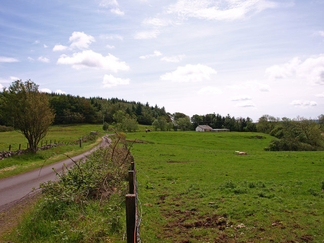
Barlogan Wood is a picturesque forest located in Renfrewshire, Scotland. Covering an area of approximately 180 acres, it is a popular destination for nature enthusiasts and outdoor lovers. The wood is situated near the village of Kilbarchan, just a short drive from Glasgow.

The woodland features a diverse range of trees, including oak, beech, and birch, creating a lush and vibrant landscape. These trees provide a habitat for a variety of wildlife, making it an ideal spot for birdwatching and nature photography. Visitors can expect to see species such as red squirrels, roe deer, and a wide array of bird species.

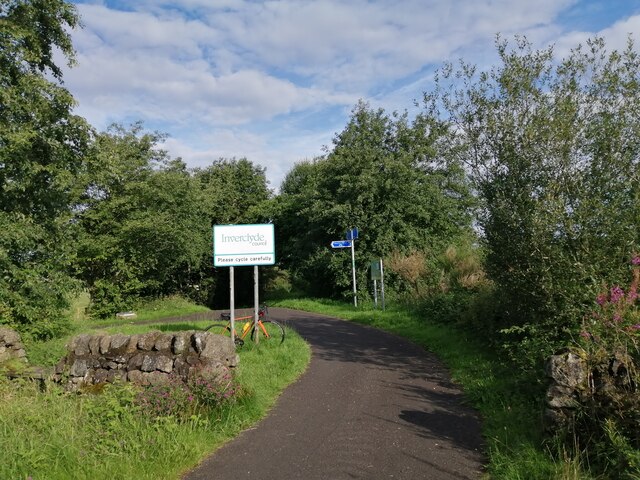
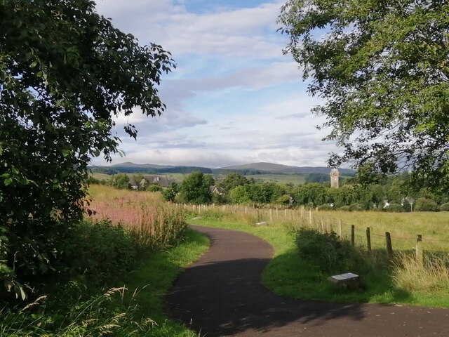
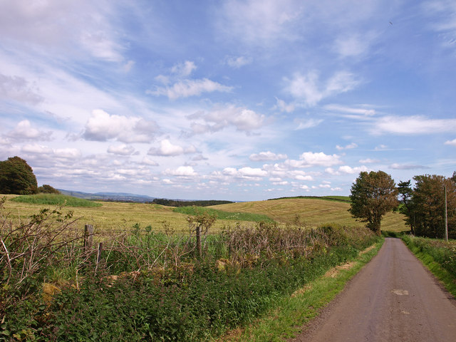
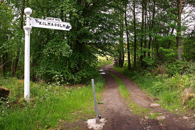
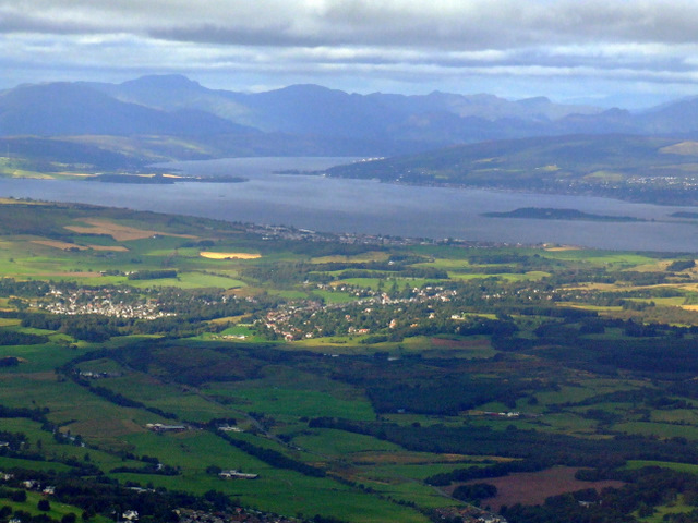
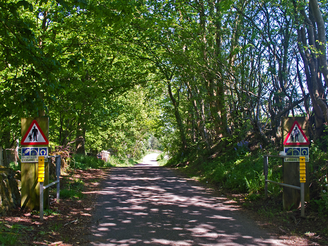
The forest offers a network of well-maintained walking trails, allowing visitors to explore the area at their own pace. A favorite trail is the Barlogan Loop, a circular route that takes approximately 1.5 hours to complete. Along the way, hikers can enjoy panoramic views of the surrounding countryside and the nearby Clyde Muirshiel Regional Park.

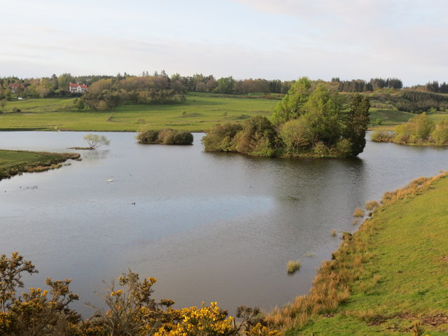
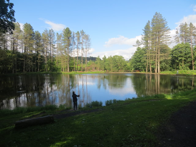
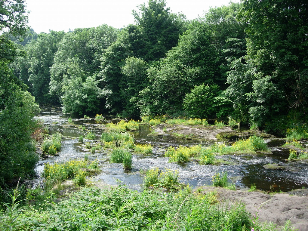
Barlogan Wood is also home to a small pond, known as Barlogans Pond, which provides a tranquil setting for reflection and relaxation. The pond is a haven for dragonflies and other aquatic insects, attracting further wildlife to the area.

With its peaceful atmosphere and natural beauty, Barlogan Wood offers the perfect escape from the hustle and bustle of everyday life. Whether it's a leisurely stroll, a picnic with family and friends, or a chance to connect with nature, this woodland is a must-visit destination for anyone seeking tranquility in the heart of Renfrewshire.

If you have any feedback on the listing, please let us know in the comments section below.

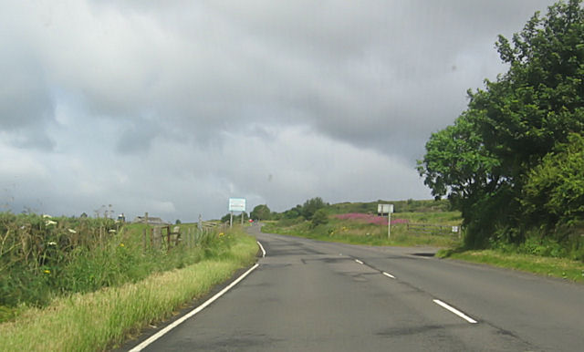
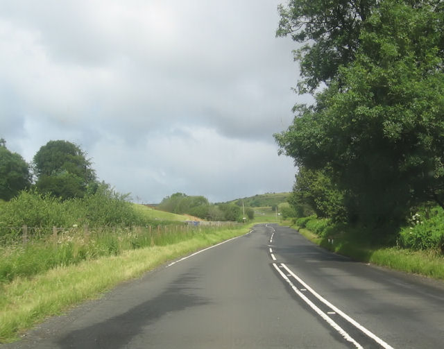
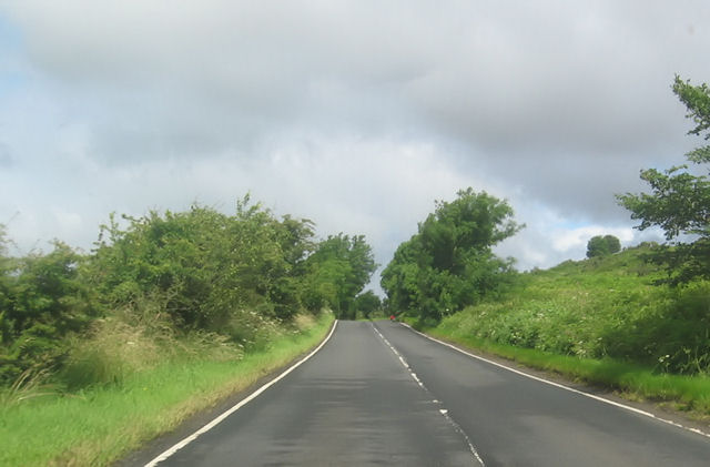
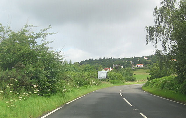
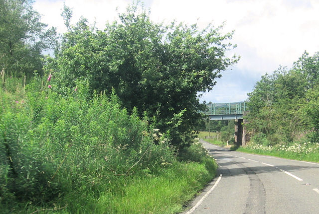
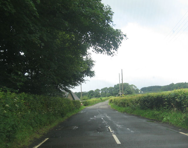
Barlogan Wood Images

Images are sourced within 2km of 55.87437/-4.6012042 or Grid Reference NS3767. Thanks to Geograph Open Source API. All images are credited.

Entering Inverclyde on NCR 75 As noted in <a href="https://www.geograph.org.uk/photo/3527703">NS3667 : National Cycle Network Route 75</a>, National Cycle Route 75 crosses the Renfrew/Inverclyde boundary at this point. A sign now welcomes westbound cyclists to Inverclyde - at least careful ones.
Entering Inverclyde on NCR 75
As noted in NS3667 : National Cycle Network Route 75, National Cycle Route 75 crosses the Renfrew/Inverclyde boundary at this point. A sign now welcomes westbound cyclists to Inverclyde - at least careful ones.
Path to Quarriers Village This short path leads from National Cycle Route 75 to Quarriers Village.
Path to Quarriers Village
This short path leads from National Cycle Route 75 to Quarriers Village.
View towards Wraes Wood The cottage in the view is abandoned.
View towards Wraes Wood
The cottage in the view is abandoned.
Kilallan Road Minor road near Houston.
Kilallan Road
Minor road near Houston.
Footpath, Kilmacolm This path cuts across the golf course.
Footpath, Kilmacolm
This path cuts across the golf course.
Kilmacolm and the Firth of Clyde from the air The former Princes Pier railway line can be seen curving through the Gryfe Valley towards Kilmacolm. Port Glasgow is visible on the south bank of the Clyde, Helensburgh on the north, beyond Ardmore Peninsula. The Gareloch and the Arrochar Alps provide a dramatic backdrop.
Kilmacolm and the Firth of Clyde from the air
The former Princes Pier railway line can be seen curving through the Gryfe Valley towards Kilmacolm. Port Glasgow is visible on the south bank of the Clyde, Helensburgh on the north, beyond Ardmore Peninsula. The Gareloch and the Arrochar Alps provide a dramatic backdrop.
Knapps Loch Kilmacolm
Threeply Farm near Bridge of Weir
Minor road near Bridge of Weir A minor road to the north of Bridge of Weir. This is one of Renfrewshire's leisure lanes, very popular with local cyclists.
Minor road near Bridge of Weir
A minor road to the north of Bridge of Weir. This is one of Renfrewshire's leisure lanes, very popular with local cyclists.
Fishing pond in Milton Wood Kilmacolm
A761 leaving Bridge of Weir
A761 near Fodston
A761 near Fodston
Barlogan Farm entrance from A761
Bend south of Barlogan Farm
A761 north of Craigends
B788 junction from A761
Old railway bridge on B788
B788 passing the lodge near Milton Bridge
Show me another place!

Barlogan Wood is located at Grid Ref: NS3767 (Lat: 55.87437, Lng: -4.6012042)

Unitary Authority: Renfrewshire

Police Authority: Renfrewshire and Inverclyde

What 3 Words

///nods.example.plums. Near Bridge of Weir, Renfrewshire

Nearby Locations

Scart Wood Barlogan Wood

Related Wikis

Quarrier's Village

Quarrier's Village or Quarriers Village is a small settlement in the civil parish of Kilmacolm in Inverclyde council area and the historic county of Renfrewshire...

St Fillan's Kirk, Seat and Well

St Fillan's Kirk, Seat and Well are located in the hamlet of Kilallan, once the main religious centre of the ancient parish of Kilallan (Cill Fhaolain...

Gryffe Castle

Gryffe Castle was a castle existing in 1474, probably about 0.5 miles (0.80 km) north of Bridge of Weir, Renfrewshire, Scotland.The present Gryffe Castle...

Strathgryffe

Strathgryffe or Gryffe Valley (Scottish Gaelic: Srath Ghriobhaidh) is the strath of River Gryffe, which lies within the historic county of Renfrewshire...

Duchal House

Duchal House is an 18th-century mansion and estate near Kilmacolm, Scotland. It is located in Inverclyde, in the former county of Renfrewshire. Duchal...

Windy Hill, Kilmacolm

Windy Hill or Windyhill is a house designed by Charles Rennie Mackintosh and furnished by him and his wife, Margaret Macdonald, in Kilmacolm, Scotland...

Bridge of Weir

Bridge of Weir is a village within the Renfrewshire council area and wider historic county of Renfrewshire in the west central Lowlands of Scotland. Lying...

Ranfurly Castle

Ranfurly Castle is a ruined 15th century castle, about 0.5 miles (0.80 km) south west of Bridge of Weir, Renfrewshire, Scotland, in Ranfurly golf course...

Nearby Amenities

Located within 500m of 55.87437,-4.6012042
Power: pole
Lat/Long: 55.8760451/-4.5946428
Power: pole
Lat/Long: 55.875371/-4.5940554
Power: pole
Lat/Long: 55.8746728/-4.5934305
Power: pole
Lat/Long: 55.8746307/-4.5936826
Power: pole
Lat/Long: 55.8753274/-4.5942861
Power: pole
Lat/Long: 55.87607/-4.5949245
Power: pole
Lat/Long: 55.8767109/-4.5954716
Power: pole
Lat/Long: 55.8737265/-4.5979516
Power: pole
Lat/Long: 55.8733233/-4.5984203
Power: pole
Lat/Long: 55.8729107/-4.5988891
Power: pole
Lat/Long: 55.8724117/-4.5994328
Power: pole
Lat/Long: 55.8718869/-4.5999869
Power: pole
Lat/Long: 55.87123/-4.6006744
Power: pole
Lat/Long: 55.8706971/-4.6012452
Power: pole
Lat/Long: 55.8699537/-4.6020159
The data included in this document is from www.openstreetmap.org. The data is made available under ODbL.

Have you been to Barlogan Wood?

Leave your review of Barlogan Wood below (or comments, questions and feedback).