Bankfell Plantation

Wood, Forest in Wigtownshire

Scotland

Bankfell Plantation

Derelict farm buildings at Chilcarroch
Derelict farm buildings at Chilcarroch Credit: Leslie Barrie

Bankfell Plantation is a picturesque woodland located in Wigtownshire, Scotland. Covering an area of approximately 500 acres, this enchanting forest is nestled on the banks of the River Bladnoch, providing a serene and idyllic setting for nature enthusiasts and outdoor enthusiasts alike.

The plantation boasts an impressive variety of tree species, including oak, beech, birch, and spruce, creating a diverse and thriving ecosystem. The ancient woodland is known for its rich biodiversity, with an abundance of wildlife such as red squirrels, roe deer, and a wide array of bird species, making it a popular spot for birdwatching and wildlife photography.

Visitors to Bankfell Plantation can explore the numerous walking trails that wind their way through the forest. These well-maintained paths cater to a range of abilities, from leisurely strolls to more challenging hikes, ensuring that there is something for everyone to enjoy. The tranquil atmosphere provides the perfect opportunity to connect with nature and escape the hustle and bustle of everyday life.

In addition to its natural beauty, Bankfell Plantation also offers recreational activities such as mountain biking and horse riding, with designated trails and facilities available for these pursuits. The plantation is also equipped with picnic areas and benches, allowing visitors to relax and take in the stunning surroundings.

Bankfell Plantation is a true gem in Wigtownshire, offering a peaceful retreat for those seeking solace in nature. Whether it's a leisurely walk, a wildlife encounter, or simply a moment of tranquility, this woodland sanctuary has something to offer everyone.

If you have any feedback on the listing, please let us know in the comments section below.

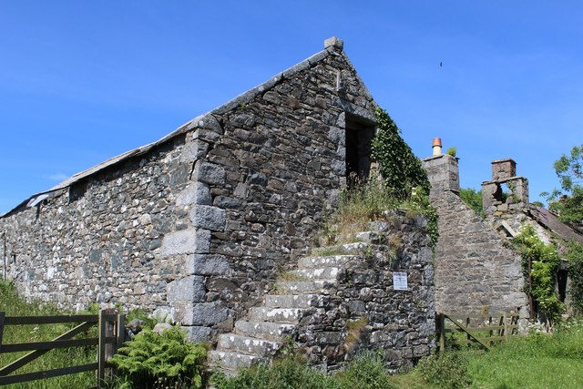
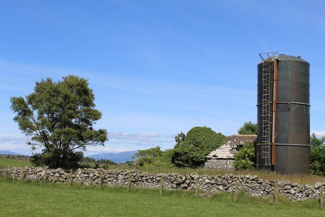
Bankfell Plantation Images

Images are sourced within 2km of 54.82022/-4.5431967 or Grid Reference NX3650. Thanks to Geograph Open Source API. All images are credited.

Derelict farm buildings at Chilcarroch
Chilcarroch
Chilcarroch
Capenoch Farm View across to what remains of the farm. OS Mapping shows a building to be where I was standing to take this picture, clearly no more.
Capenoch Farm
View across to what remains of the farm. OS Mapping shows a building to be where I was standing to take this picture, clearly no more.
Capenoch Farm track leading across to the moorland to the north west of the farm. Much of the land in this area is arable.
Capenoch
Farm track leading across to the moorland to the north west of the farm. Much of the land in this area is arable.
Capenoch View north from the farm towards Doon Wood centre of picture.
Capenoch
View north from the farm towards Doon Wood centre of picture.
Last Post As you'd expect with an out-lying farm, the telegraph posts come to a halt and go nowhere else
Last Post
As you'd expect with an out-lying farm, the telegraph posts come to a halt and go nowhere else
Capenoch Farm These two smaller buildings and a couple of barns now make up the farm.
Capenoch Farm
These two smaller buildings and a couple of barns now make up the farm.
Capenoch View across to Woodside and Carseduchan.
Capenoch
View across to Woodside and Carseduchan.
Capenoch This track leads from the farm down to the B7052.
Capenoch
This track leads from the farm down to the B7052.
Track from North Kildarroch This track to the right leads to Kildarroch Moor.
Track from North Kildarroch
This track to the right leads to Kildarroch Moor.
Track from North Kildarroch View across to Capenoch Farm.
Track from North Kildarroch
View across to Capenoch Farm.
Track from North Kildarroch View across towards West Kildarroch.
Track from North Kildarroch
View across towards West Kildarroch.
Track from North Kildarroch View across towards Carseduchan.
Track from North Kildarroch
View across towards Carseduchan.
Track from North Kildarroch View across to North Kildarroch Farm.
Track from North Kildarroch
View across to North Kildarroch Farm.
Track from Faldarroch This track across a peat bog constructed just over 12 months ago <a href="https://www.geograph.org.uk/photo/1947828">NX3750 : Constructing farm track</a> now enables access to these fields by Kildarroch Moor and Craigdarroch. It was still pretty boggy when I visited on foot.
Track from Faldarroch
This track across a peat bog constructed just over 12 months ago NX3750 : Constructing farm track now enables access to these fields by Kildarroch Moor and Craigdarroch. It was still pretty boggy when I visited on foot.
Track from Faldarroch View across open fields towards Craigdarroch.
Track from Faldarroch
View across open fields towards Craigdarroch.
Track from Faldarroch As the sun drops down the mist starts to roll in as the temperature drops by this track near Faldarroch.
Track from Faldarroch
As the sun drops down the mist starts to roll in as the temperature drops by this track near Faldarroch.
Track from Faldarroch As I was walking back along this track late afternoon the sun hid behind cloud cover for a few minutes allowing a rare opportunity to shoot this shot into the sun without the usual flare effect. The temperature was starting to drop quite quickly and the trees ahead were becoming covered in the advancing mists.
Track from Faldarroch
As I was walking back along this track late afternoon the sun hid behind cloud cover for a few minutes allowing a rare opportunity to shoot this shot into the sun without the usual flare effect. The temperature was starting to drop quite quickly and the trees ahead were becoming covered in the advancing mists.
Show me another place!

Bankfell Plantation is located at Grid Ref: NX3650 (Lat: 54.82022, Lng: -4.5431967)

Unitary Authority: Dumfries and Galloway

Police Authority: Dumfries and Galloway

What 3 Words

///smallest.foremost.cubic. Near Whithorn, Dumfries & Galloway

Related Wikis

Mochrum

Mochrum () is a coastal civil and Church of Scotland parish situated to the east of Luce Bay on the Machars peninsula and 8 miles (13 km) southwest of...

Whauphill railway station

Whauphill (NX 40462 49887) was a railway station on the Wigtownshire Railway branch line, from Newton Stewart to Whithorn, of the Portpatrick and Wigtownshire...

Whauphill

Whauphill is a small village located in the historical county of Wigtownshire in the Machars, Dumfries and Galloway, Scotland.Whauphill is a hub that supports...

Elrig

Elrig (Scottish Gaelic: An Eileirg, meaning "the deer run") is a clachan or hamlet in the historical county of Wigtownshire in Dumfries and Galloway...

Kirkinner railway station

Kirkinner was a railway station on the Wigtownshire Railway branch line, from Newton Stewart to Whithorn, of the Portpatrick and Wigtownshire Joint Railway...

Drumtroddan standing stones

The Drumtroddan standing stones (grid reference NX 36449 44300) are a small Neolithic or Bronze Age stone alignment in the parish of Mochrum, Wigtownshire...

Kirkinner

Kirkinner (Scottish Gaelic: Cille Chainneir, IPA: [ˈkʲʰiʎə ˈxaɲɪɾʲ]) is a village in the Machars, in the historical county of Wigtownshire in Dumfries...

Machars

The Machars (Scottish Gaelic: Machair Ghallghaidhealaibh) is a peninsula in the historical county of Wigtownshire in Galloway in the south-west of Scotland...

Nearby Amenities

Located within 500m of 54.82022,-4.5431967
Place: farm
Lat/Long: 54.8201283/-4.547937
Place: farm
Lat/Long: 54.8189785/-4.5427228
Power: pole
Lat/Long: 54.8158041/-4.543005
Power: pole
Lat/Long: 54.8163475/-4.5429627
Power: pole
Lat/Long: 54.8169369/-4.542918
Power: pole
Lat/Long: 54.817611/-4.5428627
Power: pole
Lat/Long: 54.8181639/-4.5428251
Power: pole
Lat/Long: 54.8187628/-4.5427769
Power: pole
Lat/Long: 54.81938/-4.5443338
Power: pole
Lat/Long: 54.8195225/-4.5454346
Power: pole
Lat/Long: 54.8196629/-4.5464875
Power: pole
Lat/Long: 54.8197932/-4.5475308
Power: pole
Lat/Long: 54.8233776/-4.5428877
Power: pole
Lat/Long: 54.8229964/-4.5423277
Power: pole
Lat/Long: 54.8224583/-4.5422702
Power: pole
Lat/Long: 54.8218805/-4.5422012
Power: pole
Lat/Long: 54.8213645/-4.5424869
Power: pole
Lat/Long: 54.820917/-4.5426461
Power: pole
Lat/Long: 54.8204695/-4.5431313
The data included in this document is from www.openstreetmap.org. The data is made available under ODbL.

Have you been to Bankfell Plantation?

Leave your review of Bankfell Plantation below (or comments, questions and feedback).