Balloch Plantation

Wood, Forest in Ayrshire

Scotland

Balloch Plantation

Towards Linfern Loch Looking towards Linfern Loch from the fishermen's access track on Eldrick Hill.  The track didn't show much sign of recent use. Linfern can also be reached from the forestry road on the north side.
Towards Linfern Loch Credit: Mary and Angus Hogg

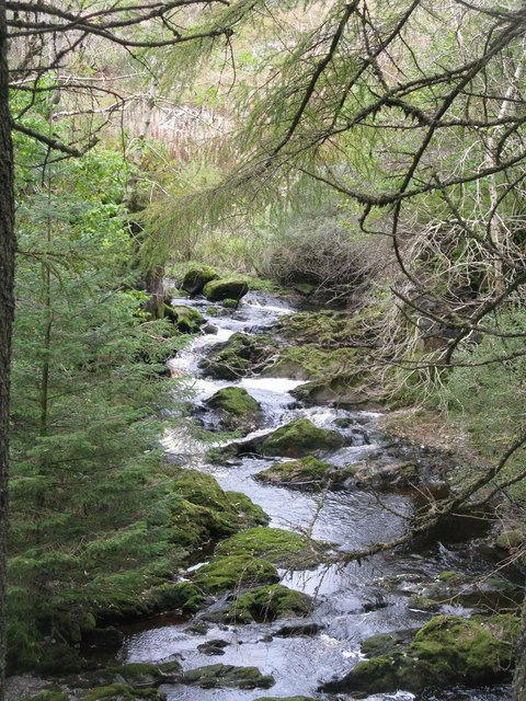
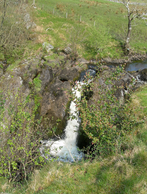
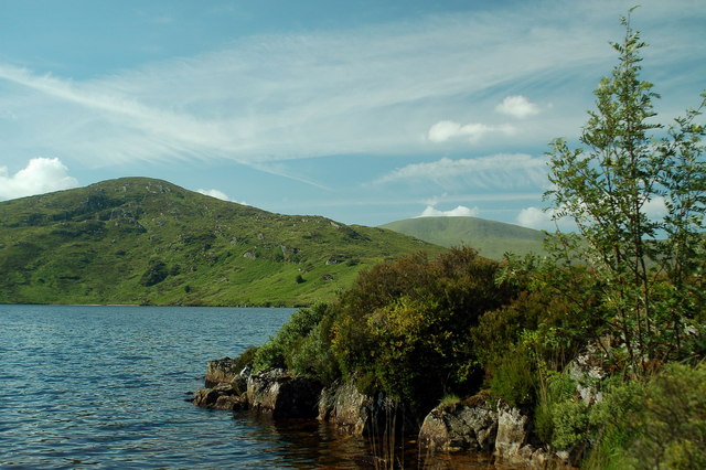
Balloch Plantation is a picturesque woodland located in Ayrshire, Scotland. Covering an area of approximately 200 acres, it is a significant natural asset in the region. The plantation consists mainly of native Scottish trees such as oak, birch, and pine, which create a diverse and vibrant ecosystem.

The woodland is well-preserved and managed, with well-maintained paths and trails that allow visitors to explore its beauty. These paths offer stunning views of the surrounding countryside, including rolling hills and the nearby Balloch Castle. The plantation is also home to a variety of wildlife, including deer, squirrels, and a wide range of bird species, making it a popular spot for nature enthusiasts and birdwatchers.

Balloch Plantation has a rich history, with evidence of human habitation dating back to prehistoric times. The area has served various purposes over the centuries, including timber production and hunting grounds for local nobility. Today, it is primarily used for recreational purposes, attracting locals and tourists alike.

Visitors to Balloch Plantation can enjoy activities such as walking, jogging, and cycling. The tranquil atmosphere and scenic surroundings make it an ideal place for relaxation and connecting with nature. There are also picnic areas and designated spots for nature education and interpretation, ensuring that the plantation caters to a wide range of interests and needs.

Overall, Balloch Plantation offers a beautiful and serene natural environment, rich in biodiversity and historical significance. It is a valuable asset to Ayrshire, providing a haven for wildlife and a peaceful escape for those seeking to immerse themselves in nature.

If you have any feedback on the listing, please let us know in the comments section below.

Balloch Plantation Images

Images are sourced within 2km of 55.23036/-4.5765827 or Grid Reference NX3695. Thanks to Geograph Open Source API. All images are credited.

Towards Linfern Loch Looking towards Linfern Loch from the fishermen's access track on Eldrick Hill.  The track didn't show much sign of recent use. Linfern can also be reached from the forestry road on the north side.
Towards Linfern Loch
Looking towards Linfern Loch from the fishermen's access track on Eldrick Hill. The track didn't show much sign of recent use. Linfern can also be reached from the forestry road on the north side.
Spot the Track The fishermen's access track for Linfern Loch becomes difficult to follow at this stage.
Spot the Track
The fishermen's access track for Linfern Loch becomes difficult to follow at this stage.
Stinchar Valley View Looking up the valley from the southern side of Eldrick Hill.
Stinchar Valley View
Looking up the valley from the southern side of Eldrick Hill.
Stinchar Falls (Upper Section) The River Stinchar flowing through the gradual start of the waterfall.
Stinchar Falls (Upper Section)
The River Stinchar flowing through the gradual start of the waterfall.
Stinchar Falls (Lower Section) A difficult section of the falls to photograph since the river flows through a deep gorge here.
Stinchar Falls (Lower Section)
A difficult section of the falls to photograph since the river flows through a deep gorge here.
Stinchar valley in Balloch Plantation
Towards Dunamoddie Low cloud was creeping over Dunamoddie Hill, on the other side of the River Stinchar and in the next square, when this shot was taken. The cloud spread over the whole area soon afterwards.
Towards Dunamoddie
Low cloud was creeping over Dunamoddie Hill, on the other side of the River Stinchar and in the next square, when this shot was taken. The cloud spread over the whole area soon afterwards.
November In The Stinchar Valley Low cloud was creeping over the hills when this shot was taken, spreading over the whole area soon afterwards.
November In The Stinchar Valley
Low cloud was creeping over the hills when this shot was taken, spreading over the whole area soon afterwards.
Short back and sides Exceptionally clear light enables this distant view of the Balloch Plantation, South Ayrshire, from Rowantree Craig.  On the left, a narrow strip of sea is visible (beyond the coast at Girvan) and the blue haze of mountains on the Kintyre peninsula.
Short back and sides
Exceptionally clear light enables this distant view of the Balloch Plantation, South Ayrshire, from Rowantree Craig. On the left, a narrow strip of sea is visible (beyond the coast at Girvan) and the blue haze of mountains on the Kintyre peninsula.
Logging road on Eldrick Hill There is an anemometer mast surveying the area for a possible wind farm. The road is well surfaced.
Logging road on Eldrick Hill
There is an anemometer mast surveying the area for a possible wind farm. The road is well surfaced.
Anemometer mast, Eldrick Hill Surveying the area for a possible wind farm.
Anemometer mast, Eldrick Hill
Surveying the area for a possible wind farm.
Felled area beside the Linfern Loch Burn Vast forests of Galloway: this bit was mapped as moorland by the Ordnance Survey as late as 1958.
Felled area beside the Linfern Loch Burn
Vast forests of Galloway: this bit was mapped as moorland by the Ordnance Survey as late as 1958.
Logging road above Stinchar Falls A steep descent across an even steeper hillside into the lower glen of the Stinchar. The road has a very good surface.
Logging road above Stinchar Falls
A steep descent across an even steeper hillside into the lower glen of the Stinchar. The road has a very good surface.
Felled area Very steep ground with the hidden Stinchar and its falls below.
Felled area
Very steep ground with the hidden Stinchar and its falls below.
Logging road beside the Stinchar At the foot of a long steep descent and approaching an exit from the plantations at Black Row.
Logging road beside the Stinchar
At the foot of a long steep descent and approaching an exit from the plantations at Black Row.
River Stinchar Downstream view from a road bridge below Black Row.
River Stinchar
Downstream view from a road bridge below Black Row.
River Stinchar In the open at last, upstream of Aldinna.
River Stinchar
In the open at last, upstream of Aldinna.
Aldinna The road continues into the forests beyond and a well surfaced route is available to the Straiton - Newton Stewart road and beyond.
Aldinna
The road continues into the forests beyond and a well surfaced route is available to the Straiton - Newton Stewart road and beyond.
Show me another place!

Balloch Plantation is located at Grid Ref: NX3695 (Lat: 55.23036, Lng: -4.5765827)

Unitary Authority: South Ayrshire

Police Authority: Ayrshire

What 3 Words

///vehicle.purified.subway. Near Bellsbank, East Ayrshire

Nearby Locations

Balloch Plantation

Related Wikis

Stinchar Falls

Stinchar Falls is a waterfall of Scotland. It is located on the Stinchar Burn, east of Barr in Ayrshire. == See also == Waterfalls of Scotland == References ==

Shalloch on Minnoch

Shalloch on Minnoch is a hill in the Range of the Awful Hand, a sub-range of the Galloway Hills range, part of the Southern Uplands of Scotland. It is...

Tairlaw Linn

Tairlaw Linn is a waterfall of Scotland, near Straiton, South Ayrshire. == See also == Waterfalls of Scotland == References ==

Loch Brecbowie

Loch Brecbowie is a Scottish loch located in the Ayrshire region, near the town of Girvan.The small, freshwater loch contains four small islands. It is...

Drunmore Linn

Drunmore Linn is a waterfall of Scotland, near Straiton, South Ayrshire. == See also == Waterfalls of Scotland == References ==

Ayr, Carrick and Cumnock (UK Parliament constituency)

Ayr, Carrick, and Cumnock is a county constituency represented in the House of Commons of the Parliament of the United Kingdom. It was created for the...

Loch Macaterick

Loch Macaterick is a loch in East Ayrshire, Scotland within Galloway Forest Park and Merrick Kells SSSI. The loch is situated to the north of Macaterick...

Barr, Ayrshire

Barr is a village in the South West of Ayrshire, Scotland, approximately 8 miles (13 km) from the town of Girvan. There are various opinions as to the...

Nearby Amenities

Located within 500m of 55.23036,-4.5765827
The data included in this document is from www.openstreetmap.org. The data is made available under ODbL.

Have you been to Balloch Plantation?

Leave your review of Balloch Plantation below (or comments, questions and feedback).