Doire Dhubh

Wood, Forest in Ross-shire
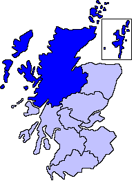
Scotland

Doire Dhubh

Road in Strath Vaich
Road in Strath Vaich Credit: Richard Webb

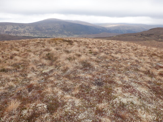
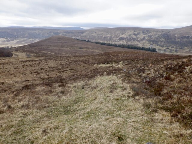
Doire Dhubh, located in Ross-shire, Scotland, is a beautiful and expansive wood known for its lush greenery and diverse wildlife. The forest covers a vast area and is home to a variety of tree species, including oak, birch, and pine. The rich vegetation provides a habitat for numerous animals, such as red deer, squirrels, and a variety of bird species.

Doire Dhubh is a popular destination for nature enthusiasts and outdoor enthusiasts alike, with many walking and hiking trails that wind through the forest. These trails offer visitors the opportunity to explore the wood's natural beauty and observe its wildlife up close. The peaceful atmosphere of the forest makes it an ideal spot for relaxation and contemplation, away from the hustle and bustle of everyday life.

In addition to its natural beauty, Doire Dhubh also holds cultural significance, with many local myths and legends associated with the forest. Visitors can learn about the history and folklore of the area through guided tours and informational displays. Overall, Doire Dhubh is a serene and enchanting destination that offers a glimpse into the beauty of Scotland's natural landscape.

If you have any feedback on the listing, please let us know in the comments section below.

Doire Dhubh Images

Images are sourced within 2km of 57.725642/-4.7633984 or Grid Reference NH3574. Thanks to Geograph Open Source API. All images are credited.

Road in Strath Vaich
Young plantation, Strath Vaich The plantation surrounds  the cattle pastures in this part of the glen.
Young plantation, Strath Vaich
The plantation surrounds the cattle pastures in this part of the glen.
Summit, Creag Bhreac Mhòir
Strath Vaich View from Creag Bhreac Mhòir. The woodland has been expanded.
Strath Vaich
View from Creag Bhreac Mhòir. The woodland has been expanded.
View north from Creag Bhreac Mhòir Very boggy ground.
View north from Creag Bhreac Mhòir
Very boggy ground.
Bog above Strath Vaich Heavy going north of Creag Bhreac Mhòr.
Bog above Strath Vaich
Heavy going north of Creag Bhreac Mhòr.
Bog above Strathrannoch.
Moorland top between Strath Rannoch and Strath Vaich
Bog above Strath Vaich
Road over Meallan Donn A landrover track between Strath Vaich and Strath Rannoch.
Road over Meallan Donn
A landrover track between Strath Vaich and Strath Rannoch.
View from Meallan Donn Into Strath Vaich.
View from Meallan Donn
Into Strath Vaich.
Summit, Meallan Donn Meall na Grianain in the background.
Summit, Meallan Donn
Meall na Grianain in the background.
Pony path on Meallan Donn Predates the nearby Landrover track.
Pony path on Meallan Donn
Predates the nearby Landrover track.
Bog, Cnoc a' Chasteil Quite a tricky bit of ground.
Bog, Cnoc a' Chasteil
Quite a tricky bit of ground.
Bog, Cnoc a' Chasteil Some tricky going here, the usual maze. Using the stob on the ground was the solution.
Bog, Cnoc a' Chasteil
Some tricky going here, the usual maze. Using the stob on the ground was the solution.
Summit, Cnoc a' Chaisteil A small hill above Strath Vaich.  If combining with Meallan Donn, beware of the bogs.
Summit, Cnoc a' Chaisteil
A small hill above Strath Vaich. If combining with Meallan Donn, beware of the bogs.
Strath Vaich View from Cnoc a' Chasteil
Strath Vaich
View from Cnoc a' Chasteil
Strath Vaich View from  Cnoc a' Chaisteil. This part of the strath is farmed.
Strath Vaich
View from Cnoc a' Chaisteil. This part of the strath is farmed.
Show me another place!

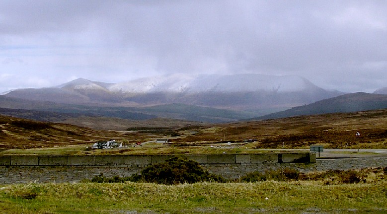
Doire Dhubh is located at Grid Ref: NH3574 (Lat: 57.725642, Lng: -4.7633984)

Unitary Authority: Highland

Police Authority: Highlands and Islands

What 3 Words

///bulges.cubed.latter. Near Strathpeffer, Highland

Nearby Locations

Doire Dhubh Strath Vaich

Related Wikis

A835 road

The A835 is a road in the Scottish Highlands linking Inverness to Ullapool and the Far North of Scotland. == Route == The A835 starts at Tore on the Black...

Loch Glascarnoch

Loch Glascarnoch is a 7-kilometre-long (4.3 mi) reservoir in the highlands of Scotland between Ullapool and Inverness. It is dammed on its eastern end...

Northern Scotland

Northern Scotland was an administrative division of Scotland used for police and fire services. It consisted of Highland, the Orkney Islands, the Shetland...

Battle of Bealach nam Broig

The Battle of Bealach nam Broig (Scottish Gaelic: Pass of the Brogue; also known as the Great Battle of Bealach nam Broig, Bealach nam Brog, Beallighne...

Nearby Amenities

Located within 500m of 57.725642,-4.7633984
Power: pole
Lat/Long: 57.7261857/-4.770242
Power: pole
Lat/Long: 57.7224646/-4.763743
Power: pole
Lat/Long: 57.7217234/-4.7608275
Power: pole
Lat/Long: 57.7267993/-4.7712193
Power: pole
Lat/Long: 57.7255597/-4.7692479
Power: pole
Lat/Long: 57.7243129/-4.7672604
Power: pole
Lat/Long: 57.7248973/-4.7682045
Power: pole
Lat/Long: 57.7229429/-4.7650771
Power: pole
Lat/Long: 57.7236703/-4.7662348
The data included in this document is from www.openstreetmap.org. The data is made available under ODbL.

Have you been to Doire Dhubh?

Leave your review of Doire Dhubh below (or comments, questions and feedback).