Mereburn Strip

Wood, Forest in Renfrewshire
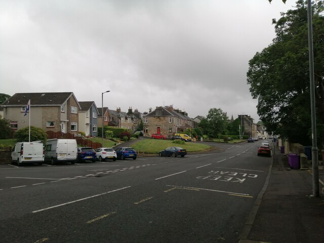
Scotland

Mereburn Strip

Loanhead Quarry from the air The whinstone quarry is on the outskirts of Beith, with Beith Golf Club visible on the far side. The left side of the quarry, as seen in this photo, is an active quarry, whereas the right side is a landfill site for inert soils, which are being used to infill the quarry void. The dolerite dyke which separates these two areas of the quarry can be seen by following the line of the access road into the quarry, where it is located beyond a Nissen hut.

To give some idea of the scale, the quarry is around 900 metres wide at the widest point.

Further interesting reading about the quarry and surrounding area geology and the minerals found there can be found at <span class="nowrap"><a title="https://www.mindat.org/loc-3035.html" rel="nofollow ugc noopener" href="https://www.mindat.org/loc-3035.html">Link</a><img style="margin-left:2px;" alt="External link" title="External link - shift click to open in new window" src="https://s1.geograph.org.uk/img/external.png" width="10" height="10"/></span> and <span class="nowrap"><a title="http://earthwise.bgs.ac.uk/index.php/Loanhead_Quarry_-_an_excursion" rel="nofollow ugc noopener" href="http://earthwise.bgs.ac.uk/index.php/Loanhead_Quarry_-_an_excursion">Link</a><img style="margin-left:2px;" alt="External link" title="External link - shift click to open in new window" src="https://s1.geograph.org.uk/img/external.png" width="10" height="10"/></span> .
Loanhead Quarry from the air Credit: Thomas Nugent

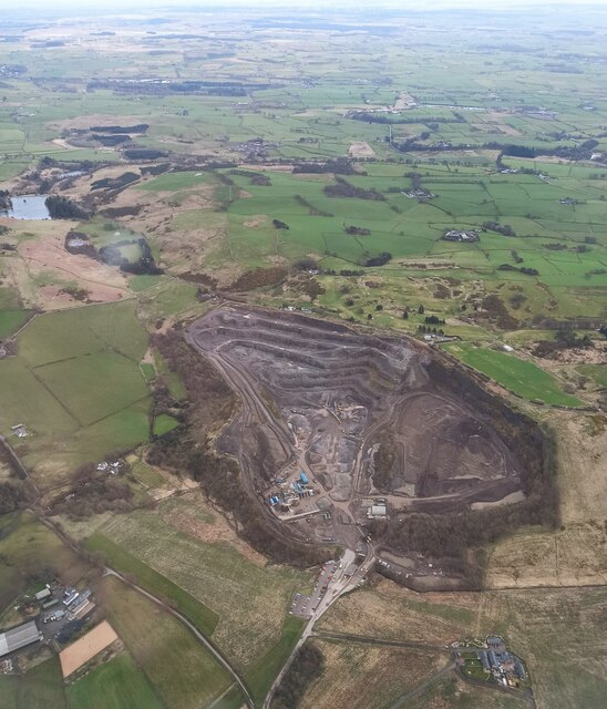
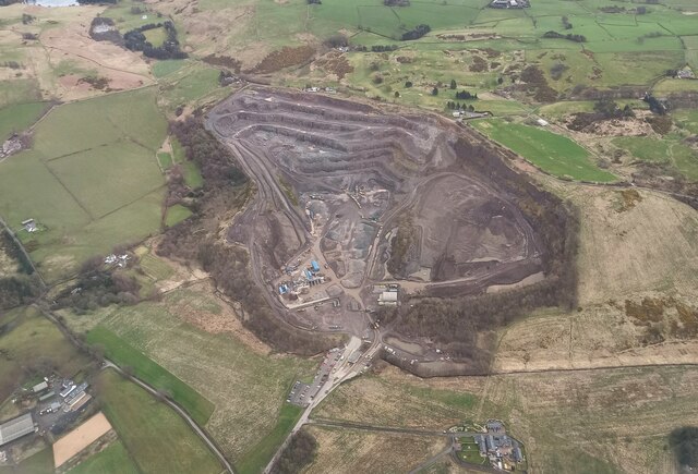
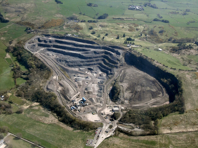
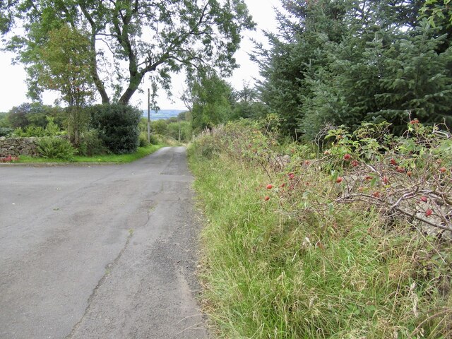
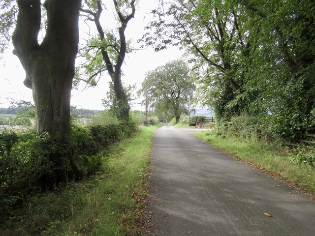
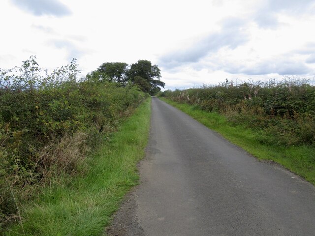
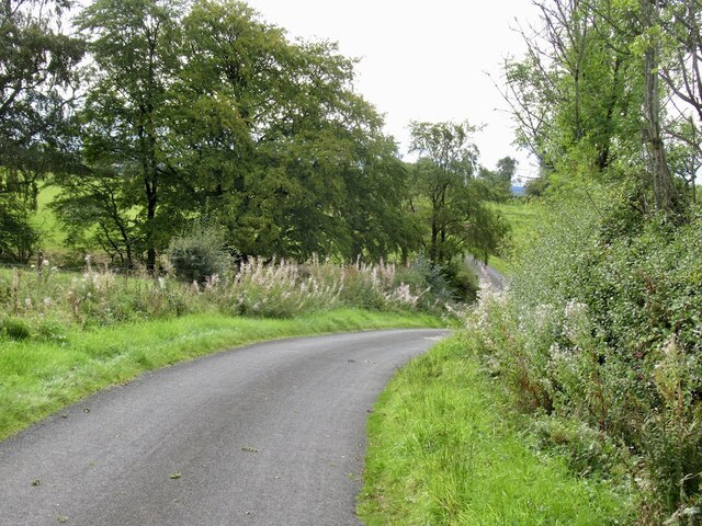
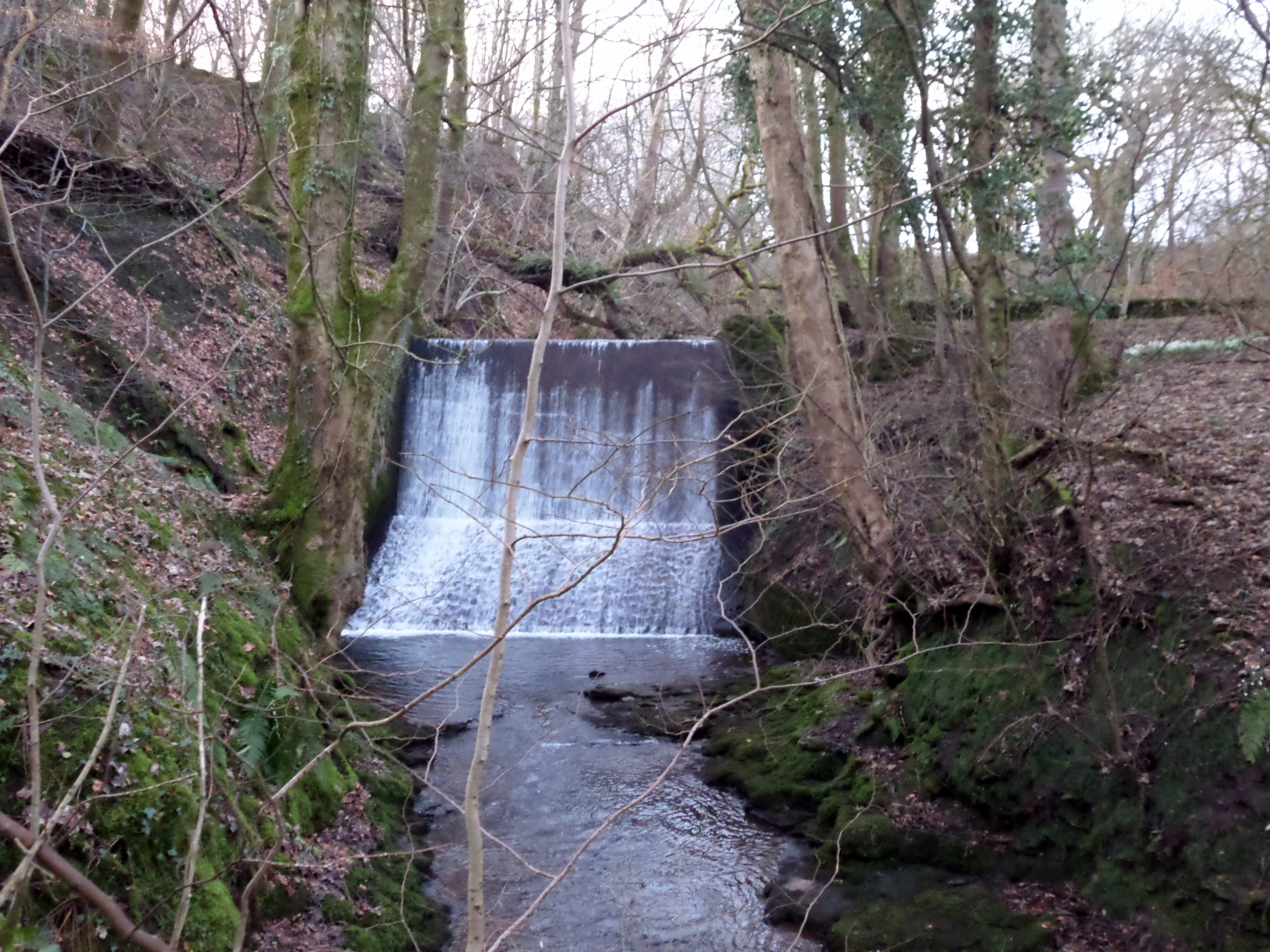
Mereburn Strip is a picturesque woodland area located in Renfrewshire, Scotland. Covering an approximate area of 50 hectares, this forest is characterized by its dense and diverse vegetation, making it a haven for nature enthusiasts and wildlife alike.

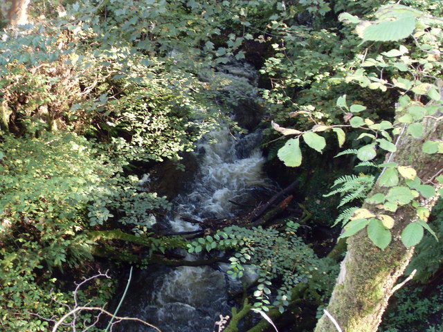
The strip gets its name from the Mereburn River that runs through the heart of the forest, adding to the serene atmosphere of the surroundings. The river also serves as a source of water for the rich flora and fauna found within the strip.

The woodland is predominantly composed of native deciduous trees, such as oak, birch, and beech, which create a vibrant and colorful canopy during the autumn months. These trees provide a habitat for a variety of bird species, including woodpeckers, owls, and thrushes, making it a popular spot for birdwatching enthusiasts.

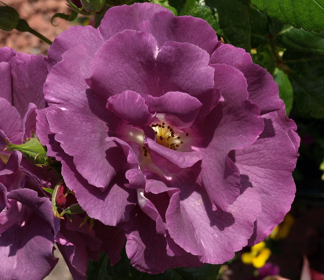
Additionally, Mereburn Strip boasts an array of wildflowers and ferns that flourish along the forest floor, adding to the natural beauty of the area. Visitors can enjoy peaceful walks along the well-maintained trails, immersing themselves in the tranquility of the surroundings.

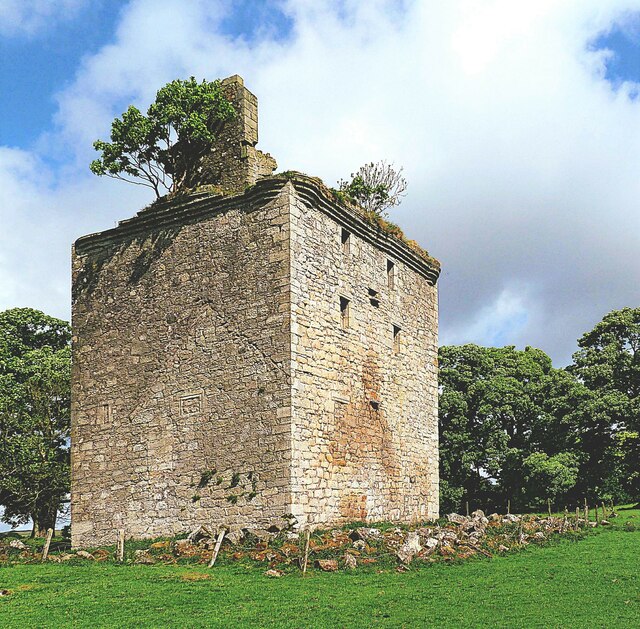
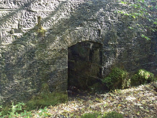
The strip also holds historical significance, with remnants of ancient settlements and burial sites dating back to the Bronze Age. Archaeological discoveries have shed light on the early human activity in the area, making it of interest to history enthusiasts.

Overall, Mereburn Strip in Renfrewshire is a captivating woodland filled with biodiversity, offering visitors a chance to reconnect with nature and explore the rich cultural heritage of the region.

If you have any feedback on the listing, please let us know in the comments section below.

Mereburn Strip Images

Images are sourced within 2km of 55.770884/-4.6342307 or Grid Reference NS3456. Thanks to Geograph Open Source API. All images are credited.

Loanhead Quarry from the air The whinstone quarry is on the outskirts of Beith, with Beith Golf Club visible on the far side. The left side of the quarry, as seen in this photo, is an active quarry, whereas the right side is a landfill site for inert soils, which are being used to infill the quarry void. The dolerite dyke which separates these two areas of the quarry can be seen by following the line of the access road into the quarry, where it is located beyond a Nissen hut.

To give some idea of the scale, the quarry is around 900 metres wide at the widest point.

Further interesting reading about the quarry and surrounding area geology and the minerals found there can be found at <span class="nowrap"><a title="https://www.mindat.org/loc-3035.html" rel="nofollow ugc noopener" href="https://www.mindat.org/loc-3035.html">Link</a><img style="margin-left:2px;" alt="External link" title="External link - shift click to open in new window" src="https://s1.geograph.org.uk/img/external.png" width="10" height="10"/></span> and <span class="nowrap"><a title="http://earthwise.bgs.ac.uk/index.php/Loanhead_Quarry_-_an_excursion" rel="nofollow ugc noopener" href="http://earthwise.bgs.ac.uk/index.php/Loanhead_Quarry_-_an_excursion">Link</a><img style="margin-left:2px;" alt="External link" title="External link - shift click to open in new window" src="https://s1.geograph.org.uk/img/external.png" width="10" height="10"/></span> .
Loanhead Quarry from the air
The whinstone quarry is on the outskirts of Beith, with Beith Golf Club visible on the far side. The left side of the quarry, as seen in this photo, is an active quarry, whereas the right side is a landfill site for inert soils, which are being used to infill the quarry void. The dolerite dyke which separates these two areas of the quarry can be seen by following the line of the access road into the quarry, where it is located beyond a Nissen hut. To give some idea of the scale, the quarry is around 900 metres wide at the widest point. Further interesting reading about the quarry and surrounding area geology and the minerals found there can be found at LinkExternal link and LinkExternal link .
Loanhead quarry from the air The whinstone quarry is on the outskirts of Beith, with Beith Golf Club visible on the far side. The left side of the quarry, as seen in this photo, is an active quarry, whereas the right side is a landfill site for inert soils, which are being used to infill the quarry void. The dolerite dyke which separates these two areas of the quarry can be seen by following the line of the access road into the quarry, where it is located beyond a Nissen hut.

To give some idea of the scale, the quarry is around 900 metres wide at the widest point.

Further interesting reading about the quarry and surrounding area geology and the minerals found there can be found at <span class="nowrap"><a title="https://www.mindat.org/loc-3035.html" rel="nofollow ugc noopener" href="https://www.mindat.org/loc-3035.html">Link</a><img style="margin-left:2px;" alt="External link" title="External link - shift click to open in new window" src="https://s1.geograph.org.uk/img/external.png" width="10" height="10"/></span> and <span class="nowrap"><a title="http://earthwise.bgs.ac.uk/index.php/Loanhead_Quarry_-_an_excursion" rel="nofollow ugc noopener" href="http://earthwise.bgs.ac.uk/index.php/Loanhead_Quarry_-_an_excursion">Link</a><img style="margin-left:2px;" alt="External link" title="External link - shift click to open in new window" src="https://s1.geograph.org.uk/img/external.png" width="10" height="10"/></span> .
Loanhead quarry from the air
The whinstone quarry is on the outskirts of Beith, with Beith Golf Club visible on the far side. The left side of the quarry, as seen in this photo, is an active quarry, whereas the right side is a landfill site for inert soils, which are being used to infill the quarry void. The dolerite dyke which separates these two areas of the quarry can be seen by following the line of the access road into the quarry, where it is located beyond a Nissen hut. To give some idea of the scale, the quarry is around 900 metres wide at the widest point. Further interesting reading about the quarry and surrounding area geology and the minerals found there can be found at LinkExternal link and LinkExternal link .
Loanhead Quarry from the air The whinstone quarry is on the outskirts of Beith, with Beith Golf Club visible on the far side. The left side of the quarry, as seen in this photo, is an active quarry, whereas the right side is a landfill site for inert soils, which are being used to infill the quarry void. The dolerite dyke which separates these two areas of the quarry can be seen by following the line of the access road into the quarry, where it is located beyond a Nissen hut.

To give some idea of the scale, the quarry is around 900 metres wide at the widest point.

Further interesting reading about the quarry and surrounding area geology and the minerals found there can be found at <span class="nowrap"><a title="https://www.mindat.org/loc-3035.html" rel="nofollow ugc noopener" href="https://www.mindat.org/loc-3035.html">Link</a><img style="margin-left:2px;" alt="External link" title="External link - shift click to open in new window" src="https://s1.geograph.org.uk/img/external.png" width="10" height="10"/></span> and <span class="nowrap"><a title="http://earthwise.bgs.ac.uk/index.php/Loanhead_Quarry_-_an_excursion" rel="nofollow ugc noopener" href="http://earthwise.bgs.ac.uk/index.php/Loanhead_Quarry_-_an_excursion">Link</a><img style="margin-left:2px;" alt="External link" title="External link - shift click to open in new window" src="https://s1.geograph.org.uk/img/external.png" width="10" height="10"/></span> .
Loanhead Quarry from the air
The whinstone quarry is on the outskirts of Beith, with Beith Golf Club visible on the far side. The left side of the quarry, as seen in this photo, is an active quarry, whereas the right side is a landfill site for inert soils, which are being used to infill the quarry void. The dolerite dyke which separates these two areas of the quarry can be seen by following the line of the access road into the quarry, where it is located beyond a Nissen hut. To give some idea of the scale, the quarry is around 900 metres wide at the widest point. Further interesting reading about the quarry and surrounding area geology and the minerals found there can be found at LinkExternal link and LinkExternal link .
Road above Mill of Beith
Boydstone Road
Boydstone Road
Clerksbridge Toll roundabout Loanhead Quarry in the background.
Clerksbridge Toll roundabout
Loanhead Quarry in the background.
Alter Supplies, Park Farm Off Clerksbridge Toll Roundabout.
Alter Supplies, Park Farm
Off Clerksbridge Toll Roundabout.
Field, Roebank
Field, Roebank
Road to Netherhouses
Road crossing the Yardfoot Burn
Loanhead Quarry from the air The whinstone quarry is on the outskirts of Beith, with Beith Golf Club visible on the far side. The left side of the quarry, as seen in this photo, is an active quarry, whereas the right side is a landfill site for inert soils, which are being used to infill the quarry void. The dolerite dyke which separates these two areas of the quarry can be seen by following the line of the access road into the quarry, where it is located beyond a Nissen hut.

To give some idea of the scale, the quarry is around 900 metres wide at the widest point.

Further interesting reading about the quarry and surrounding area geology and the minerals found there can be found at <span class="nowrap"><a title="https://www.mindat.org/loc-3035.html" rel="nofollow ugc noopener" href="https://www.mindat.org/loc-3035.html">Link</a><img style="margin-left:2px;" alt="External link" title="External link - shift click to open in new window" src="https://s1.geograph.org.uk/img/external.png" width="10" height="10"/></span> and <span class="nowrap"><a title="http://earthwise.bgs.ac.uk/index.php/Loanhead_Quarry_-_an_excursion" rel="nofollow ugc noopener" href="http://earthwise.bgs.ac.uk/index.php/Loanhead_Quarry_-_an_excursion">Link</a><img style="margin-left:2px;" alt="External link" title="External link - shift click to open in new window" src="https://s1.geograph.org.uk/img/external.png" width="10" height="10"/></span> .
Loanhead Quarry from the air
The whinstone quarry is on the outskirts of Beith, with Beith Golf Club visible on the far side. The left side of the quarry, as seen in this photo, is an active quarry, whereas the right side is a landfill site for inert soils, which are being used to infill the quarry void. The dolerite dyke which separates these two areas of the quarry can be seen by following the line of the access road into the quarry, where it is located beyond a Nissen hut. To give some idea of the scale, the quarry is around 900 metres wide at the widest point. Further interesting reading about the quarry and surrounding area geology and the minerals found there can be found at LinkExternal link and LinkExternal link .
Grangehill from the air With Threepwood Road beyond.
Grangehill from the air
With Threepwood Road beyond.
Barr Castle - Lochwinnoch Barr Castle was constructed in the early 16th century. It passed into the hands of the Hamiltons of Ferguslie at the end of the 16th century. They retained the castle until the late 18th century, when they sold and abandoned it for a new mansion.
Various inscriptions are carved into the fabric of Barr Castle. These include IW and MH on the pediment above the main entrance, IH and IC 1680 above the lintel at the head of the stair, and WO 1699 on the battlements. The carvings are the initials of various Hamilton Lairds of Barr, John Wallace and his wife Margaret Hamilton, John Hamilton. and Jean Cochrane.

Barr Castle is owed by Fergus Day Hort Macdowall, 27th of Garthland. He is the Chief of Clan Macdowall and the castle is regarded as the seat of Clan Macdowall.
Barr Castle - Lochwinnoch
Barr Castle was constructed in the early 16th century. It passed into the hands of the Hamiltons of Ferguslie at the end of the 16th century. They retained the castle until the late 18th century, when they sold and abandoned it for a new mansion. Various inscriptions are carved into the fabric of Barr Castle. These include IW and MH on the pediment above the main entrance, IH and IC 1680 above the lintel at the head of the stair, and WO 1699 on the battlements. The carvings are the initials of various Hamilton Lairds of Barr, John Wallace and his wife Margaret Hamilton, John Hamilton. and Jean Cochrane. Barr Castle is owed by Fergus Day Hort Macdowall, 27th of Garthland. He is the Chief of Clan Macdowall and the castle is regarded as the seat of Clan Macdowall.
Wilson Street, Beith We look along the street from the bus stop opposite the former Beith Trinity Church.
Wilson Street, Beith
We look along the street from the bus stop opposite the former Beith Trinity Church.
Lochwinnoch railway station On the Ayr Line, between Howwood and Glengarnock Was once known as Lochside, possibly to avoid confusion with the station that once stood in the centre of Lochwinnoch.
Lochwinnoch railway station
On the Ayr Line, between Howwood and Glengarnock Was once known as Lochside, possibly to avoid confusion with the station that once stood in the centre of Lochwinnoch.
Rhaposody in Blue Modern Floribunda cluster rose. Great scent.
Rhaposody in Blue
Modern Floribunda cluster rose. Great scent.
Loanhead waterfall Loanhead waterfall next to A737 in Beith, Ayrshire taken 28/9/11
Loanhead waterfall
Loanhead waterfall next to A737 in Beith, Ayrshire taken 28/9/11
Clarks Bridge/ Dam, Beith Clarks bridge Beith
Clarks Bridge/ Dam, Beith
Clarks bridge Beith
Show me another place!

Mereburn Strip is located at Grid Ref: NS3456 (Lat: 55.770884, Lng: -4.6342307)

Unitary Authority: Renfrewshire

Police Authority: Renfrewshire and Inverclyde

What 3 Words

///dash.blemishes.moth. Near Beith, North Ayrshire

Related Wikis

Beith North railway station

Beith North railway station was a railway station serving the north of the town of Beith, North Ayrshire, Scotland. The station was originally part of...

Meikle Millbank Mill

Millbank Mill or Meikle Millbank Mill was an old corn mill in Burnbank Glen overlooking the Barr Loch near Lochwinnoch in Renfrewshire, south-west Scotland...

Beith

Beith is a small town in the Garnock Valley, North Ayrshire, Scotland approximately 20 miles (30 kilometres) south-west of Glasgow. The town is situated...

Lochwinnoch railway station

Lochwinnoch railway station is a railway station serving the village of Lochwinnoch, Renfrewshire, Scotland. The station is managed by ScotRail and is...

Loch Brand

Loch Brand or Loch of Boghall was a loch situated in a depression between the Grange Estate, Crummock, Hill of Beith Castle site and Boghall in the Parish...

Bellsdale Park

Bellsdale Park is a football ground in Beith, Scotland. It was the home ground of Beith F.C. during their time in the Scottish Football League, and is...

Lands of Brownmuir

The lands of Brownmuir, Brown Muir (1832) or Brimmer (1821) in Scots were located in the Parish of Beith, at the western boundary between East Renfrewshire...
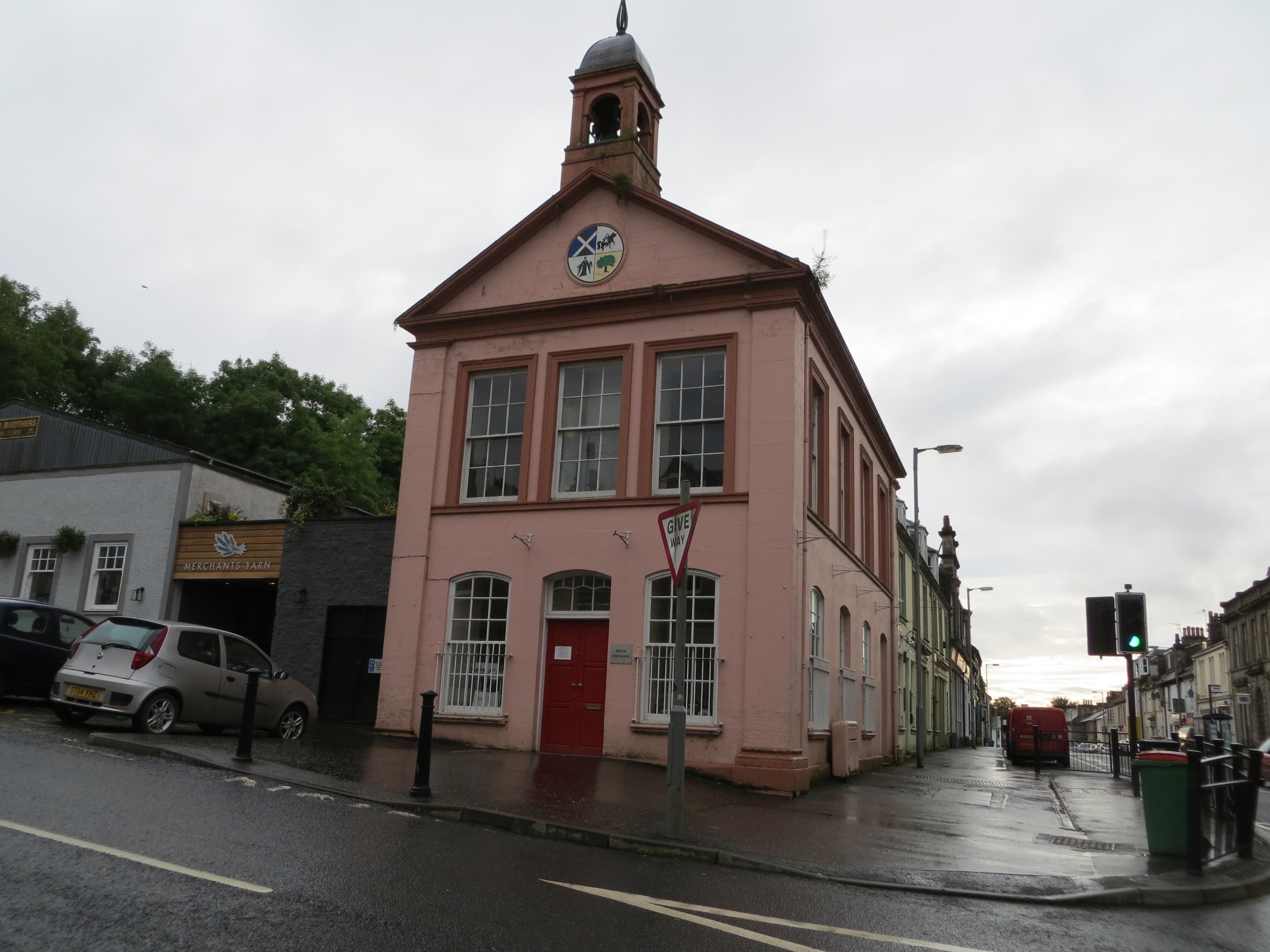
Beith Townhouse

Beith Townhouse is a municipal building in The Strand, Beith, North Ayrshire, Scotland. The structure, which is currently used as an information and heritage...

Have you been to Mereburn Strip?

Leave your review of Mereburn Strip below (or comments, questions and feedback).