Canal Wharf
Settlement in Yorkshire
England
Canal Wharf

Canal Wharf is a picturesque area located in the county of Yorkshire, England. Nestled along the banks of the Leeds and Liverpool Canal, it is a popular destination for locals and tourists alike. The wharf is situated in the city of Leeds, specifically in the vibrant neighborhood of Granary Wharf.
Canal Wharf boasts a rich history, as it was once a bustling hub for the transportation of goods along the canal system. Today, it has been transformed into a vibrant area filled with trendy bars, restaurants, and shops. Its unique blend of old and new architecture creates a charming atmosphere that attracts visitors from far and wide.
The wharf is known for its stunning canal-side views, with picturesque walkways providing the perfect spot for a leisurely stroll. Visitors can also enjoy boat rides along the canal, immersing themselves in the tranquil surroundings. Additionally, Canal Wharf is home to a number of quaint cafes and eateries, offering a variety of cuisines to suit all tastes.
For those interested in history, the area also features several historic buildings, including the iconic Leeds Bridge. This 19th-century structure adds to the charm and character of Canal Wharf, serving as a reminder of its maritime past.
Overall, Canal Wharf in Yorkshire is a delightful destination that offers a mix of history, culture, and stunning natural beauty. With its canal-side setting and vibrant atmosphere, it provides a unique experience for visitors seeking a taste of Yorkshire charm.
If you have any feedback on the listing, please let us know in the comments section below.
Canal Wharf Images
Images are sourced within 2km of 53.79251/-1.5612655 or Grid Reference SE2933. Thanks to Geograph Open Source API. All images are credited.


Canal Wharf is located at Grid Ref: SE2933 (Lat: 53.79251, Lng: -1.5612655)
Division: West Riding
Unitary Authority: Leeds
Police Authority: West Yorkshire
What 3 Words
///inches.remain.prime. Near Holbeck, West Yorkshire
Nearby Locations
Related Wikis

Holbeck railway station
Holbeck railway station was a railway station that served the district of Holbeck, in Leeds, West Yorkshire, England. == Overview == Holbeck Station was...
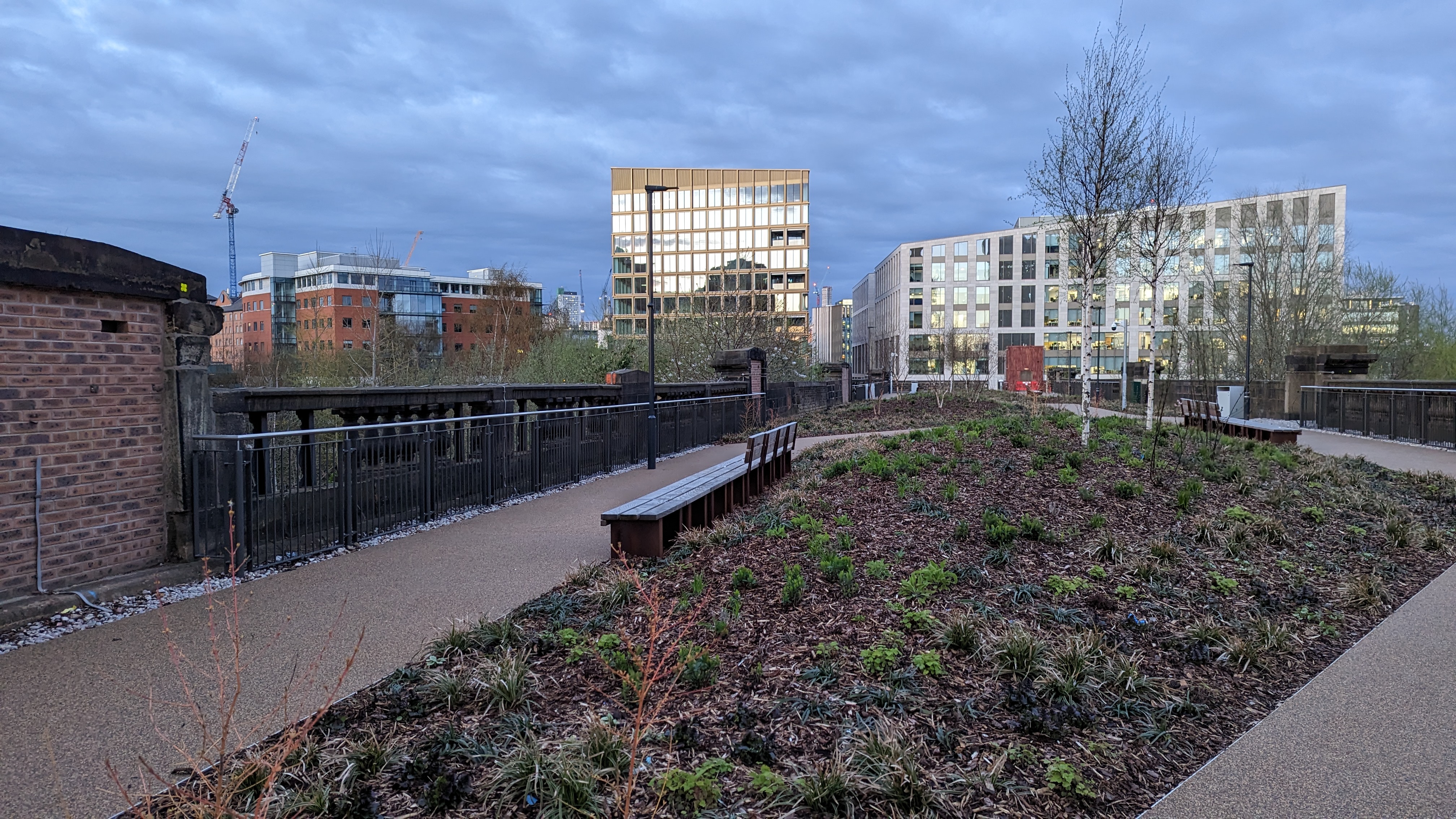
Monk Bridge Viaduct Garden
The Monk Bridge Viaduct Garden, initially marketed as the Viaduct Urban Garden, is an elevated park and garden in Leeds, England. The garden or park is...

Brick Man
Brick Man was an Antony Gormley sculpture proposed in the 1980s for the city of Leeds, West Yorkshire, England. A male human figure standing over 100 feet...

Midland Mills, Leeds
Midland Mills is a former flax mill on Silver Street in Holbeck, Leeds, West Yorkshire, England, in the Holbeck Urban Village regeneration area. Since...
Nearby Amenities
Located within 500m of 53.79251,-1.5612655Have you been to Canal Wharf?
Leave your review of Canal Wharf below (or comments, questions and feedback).