Chapelton Wood

Wood, Forest in Ayrshire

Scotland

Chapelton Wood

Buildings near Cullochknowes
Buildings near Cullochknowes Credit: Gordon Brown

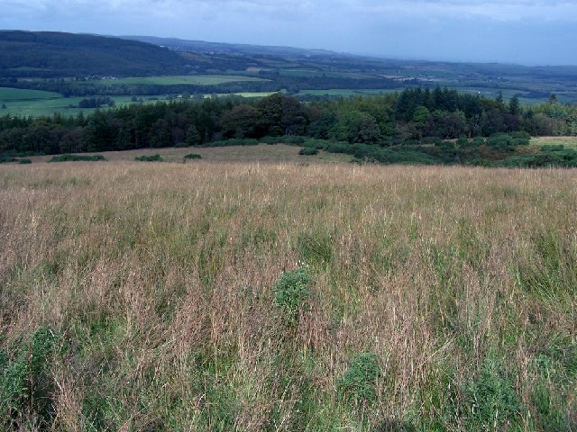
Chapelton Wood is a picturesque woodland located in Ayrshire, Scotland. Covering an area of approximately 200 acres, this enchanting forest is renowned for its natural beauty and diverse wildlife. Situated near the village of Chapelton, the wood is easily accessible and attracts visitors from both local communities and tourists alike.

The wood is predominantly comprised of native broadleaf trees such as oak, birch, and beech. These trees create a captivating canopy that provides shelter and habitat for a wide variety of flora and fauna. The forest floor is adorned with an array of wildflowers, including bluebells and primroses, which add vibrant colors to the landscape during the spring season.

Chapelton Wood is home to numerous bird species, making it a haven for birdwatchers. Visitors may catch a glimpse of woodpeckers, thrushes, and owls, among others. The forest is also inhabited by mammals such as red squirrels, badgers, and roe deer, adding to its rich biodiversity.

The wood offers a network of well-maintained trails, allowing visitors to explore its beauty on foot. Whether strolling through the forest, admiring the tranquil surroundings, or picnicking in one of the designated areas, Chapelton Wood provides a peaceful escape from the hustle and bustle of everyday life.

Managed by local authorities, the wood is carefully preserved to maintain its natural integrity. Educational programs and guided walks are organized to raise awareness about the importance of conservation and to enhance visitors' understanding of the woodland ecosystem.

In conclusion, Chapelton Wood is a cherished natural gem in Ayrshire, offering a serene and captivating environment for nature enthusiasts, families, and those seeking solace in the enchanting embrace of nature.

If you have any feedback on the listing, please let us know in the comments section below.

Chapelton Wood Images

Images are sourced within 2km of 55.296635/-4.651285 or Grid Reference NS3103. Thanks to Geograph Open Source API. All images are credited.

Buildings near Cullochknowes
Autumn tones at Auchalton A simple roadside shot of tall beech trees near Auchalton Meadow.
Autumn tones at Auchalton
A simple roadside shot of tall beech trees near Auchalton Meadow.
Barcully sky The promise of a fine winter sunset didn’t live up to expectation with the colours fading shortly after this shot was taken.
Barcully sky
The promise of a fine winter sunset didn’t live up to expectation with the colours fading shortly after this shot was taken.
Winter sunset at Drumgirnan A late-January view looking down the Water of Girvan. The colours didn’t last long. We’ve been here before - <a href="https://www.geograph.org.uk/photo/594310">NS3004 : River Girvan At Drumgirnan</a> in October 2007 and <a href="https://www.geograph.org.uk/photo/1657435">NS3004 : Snowy Kilkerran</a> during the January 2010 Big Freeze.
Winter sunset at Drumgirnan
A late-January view looking down the Water of Girvan. The colours didn’t last long. We’ve been here before - NS3004 : River Girvan At Drumgirnan in October 2007 and NS3004 : Snowy Kilkerran during the January 2010 Big Freeze.
Rough Grazing above Kilkerran Rough grazing viewed from track leading from quarries below Barony Hill to Glengee Wood
Rough Grazing above Kilkerran
Rough grazing viewed from track leading from quarries below Barony Hill to Glengee Wood
Dog Training Sheep dog training at Rowanston Farm, near Crosshill
Dog Training
Sheep dog training at Rowanston Farm, near Crosshill
Girvan valley Looking from the B741 Girvan to Maybole road towards Kilkerran House.
Girvan valley
Looking from the B741 Girvan to Maybole road towards Kilkerran House.
Grass runway on the Kilkerran estate Beside the Water of Girvan
Grass runway on the Kilkerran estate
Beside the Water of Girvan
Lodge and entrance to Kilkerran Estate Some fine specimen trees in the park.
Lodge and entrance to Kilkerran Estate
Some fine specimen trees in the park.
Country road at Ladyburn, Kilkerran
Auchalton Toll Cottage On the old toll road from Ayr to Newton Stewart.
Auchalton Toll Cottage
On the old toll road from Ayr to Newton Stewart.
Auchalton Meadow A wildlife reserve managed by the Scottish Wildlife Trust.
Auchalton Meadow
A wildlife reserve managed by the Scottish Wildlife Trust.
Fields near Auchalton
Lodge to Kilkerran Castle One of three or four entrances to the Castle grounds. This is the northernmost, close to Ruglen.
Lodge to Kilkerran Castle
One of three or four entrances to the Castle grounds. This is the northernmost, close to Ruglen.
Ladyburn
Ladyburn
Cattle near Ladyburn
Auchalton Farm
Auchalton Farm
A South Carrick View Looking from the Crosshill Hill Road on a fine March morning. In the background, Maybole is just visible through the haze.
A South Carrick View
Looking from the Crosshill Hill Road on a fine March morning. In the background, Maybole is just visible through the haze.
Show me another place!

Chapelton Wood is located at Grid Ref: NS3103 (Lat: 55.296635, Lng: -4.651285)

Unitary Authority: South Ayrshire

Police Authority: Ayrshire

What 3 Words

///consoled.counters.nests. Near Maybole, South Ayrshire

Nearby Locations

Chapelton Wood Lady Glen

Related Wikis

Kilkerran House

Kilkerran House is an 18th-century private house near Maybole, Ayrshire, Scotland. It is a category A listed building set within grounds included in the...

Ayr, Carrick and Cumnock (UK Parliament constituency)

Ayr, Carrick and Cumnock is a county constituency represented in the House of Commons of the Parliament of the United Kingdom. It was created for the 2005...

Kilkerran railway station

Kilkerran railway station served an area of rural Ayrshire, Scotland from 1860 to 1965 on the Maybole and Girvan Railway. == History == The station opened...

Crosshill, South Ayrshire

Crosshill is a small village in South Ayrshire, Scotland. Crosshill has a primary school. == References ==

Nearby Amenities

Located within 500m of 55.296635,-4.651285
The data included in this document is from www.openstreetmap.org. The data is made available under ODbL.

Have you been to Chapelton Wood?

Leave your review of Chapelton Wood below (or comments, questions and feedback).