Birkhill Wood

Wood, Forest in Ayrshire

Scotland

Birkhill Wood

Windburned trees Trees suffering from windburn after an unusual May storm, creating a misleadingly autumnal scene.
Windburned trees Credit: Mark Nightingale

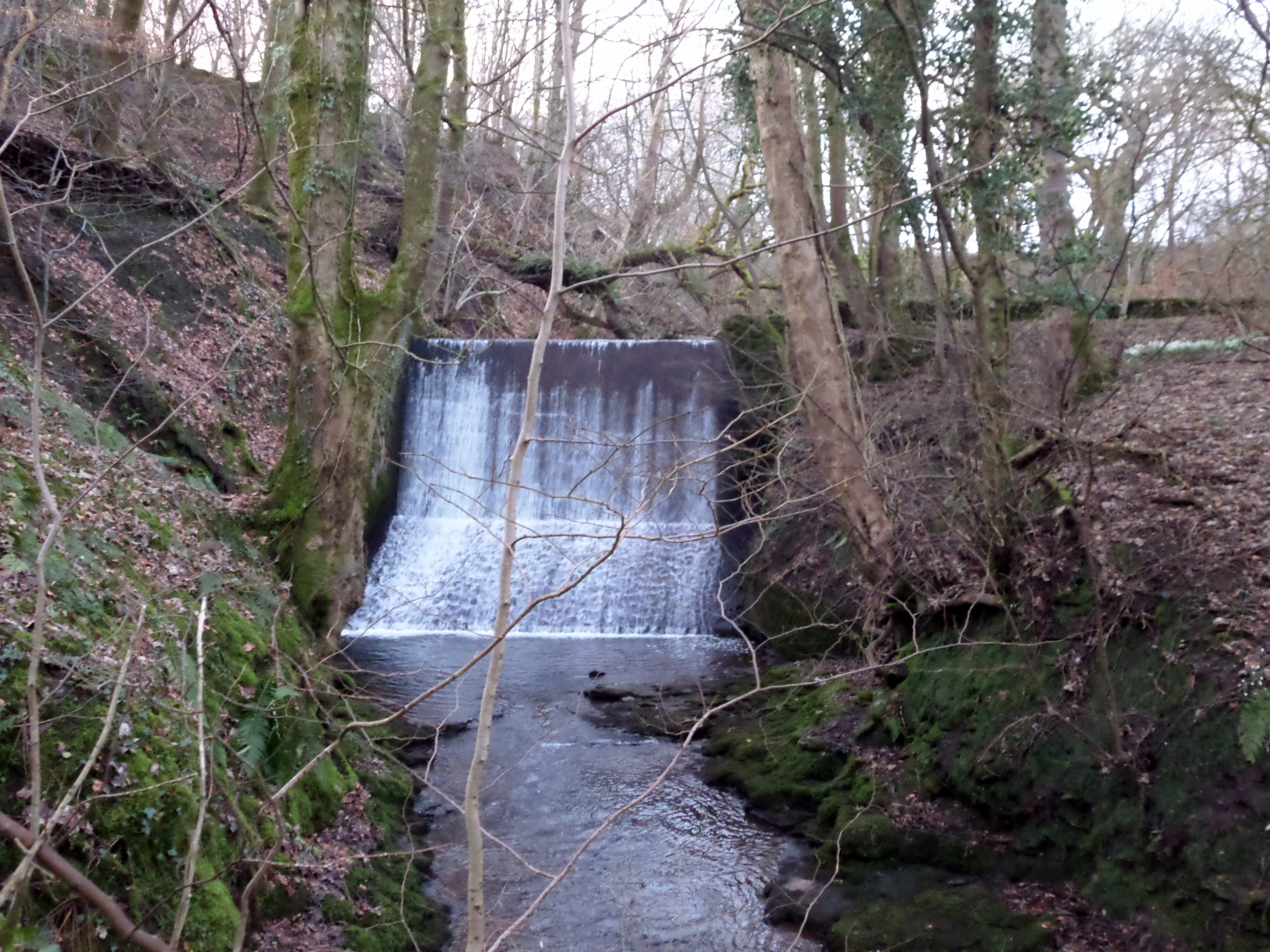
Birkhill Wood is a picturesque forest located in Ayrshire, Scotland. Covering an area of approximately 100 acres, this enchanting woodland is a popular destination for nature lovers and outdoor enthusiasts alike.

The wood boasts a diverse range of trees, including oak, birch, and beech, which provide a rich habitat for a variety of wildlife. Visitors can expect to spot numerous bird species, such as woodpeckers, owls, and finches, as well as small mammals like squirrels and rabbits.

Tranquil walking trails wind their way through the wood, offering visitors the chance to explore its beauty at their own pace. These well-maintained paths lead to secluded clearings and peaceful glades, providing perfect spots for picnics or simply taking in the serene surroundings.

The forest also features a small pond, providing a habitat for aquatic plants and creatures. This serene water feature adds to the overall charm and tranquility of the wood, providing a peaceful spot for visitors to relax and enjoy the natural surroundings.

Throughout the year, Birkhill Wood showcases the changing seasons, with vibrant displays of bluebells in spring, lush green foliage in summer, and a stunning array of autumn colors in the fall. The wood truly offers a visual feast for the senses throughout the year.

Birkhill Wood is easily accessible, with a car park located nearby, making it a popular destination for both locals and tourists. Whether you are seeking a peaceful stroll, a chance to connect with nature, or a place to unwind, Birkhill Wood offers a delightful escape into the natural beauty of Ayrshire.

If you have any feedback on the listing, please let us know in the comments section below.

Birkhill Wood Images

Images are sourced within 2km of 55.783649/-4.6909842 or Grid Reference NS3157. Thanks to Geograph Open Source API. All images are credited.

Windburned trees Trees suffering from windburn after an unusual May storm, creating a misleadingly autumnal scene.
Windburned trees
Trees suffering from windburn after an unusual May storm, creating a misleadingly autumnal scene.
Edge of  a new woodland A young woodland, but old enough to be on the maps (it is not yet). A muddy outlook during a very prolonged wet spell.
Edge of a new woodland
A young woodland, but old enough to be on the maps (it is not yet). A muddy outlook during a very prolonged wet spell.
A young woodland A well established wood, planted on former agricultural land.
A young woodland
A well established wood, planted on former agricultural land.
Fields, High Glengarth Wet today after months of rainfall. The land is grazed by cattle.
Fields, High Glengarth
Wet today after months of rainfall. The land is grazed by cattle.
High Glengarth A gap in a grown out hedge, raining as usual.
High Glengarth
A gap in a grown out hedge, raining as usual.
Grass in Glengarnock Grazing for cattle, an electricity pole awaits erection.
Grass in Glengarnock
Grazing for cattle, an electricity pole awaits erection.
Sunset Trees Near Nervelstone Farm.
Sunset Trees
Near Nervelstone Farm.
Maich Water, near Langstilly Farm Langstilly Farm in the distance.
Maich Water, near Langstilly Farm
Langstilly Farm in the distance.
Nervelstone Farm Rough grazing here.
Nervelstone Farm
Rough grazing here.
Mossy Tree Unnamed Burn flowing towards Maigh Water through wooded glen.
Mossy Tree
Unnamed Burn flowing towards Maigh Water through wooded glen.
Tree Decay Surprised to see this tree still standing after the recent gales.
Tree Decay
Surprised to see this tree still standing after the recent gales.
Woods near Nervelstone Evening sun lights the wood.
Woods near Nervelstone
Evening sun lights the wood.
Trees near Nervelstone Mainly Beech trees.
Trees near Nervelstone
Mainly Beech trees.
Ruins of Glengarnock Castle Taken on a sunny day in September 2013. Looking toward the back wall of the castle from the approach. Behind the castle the ground falls away steeply to the River Garnock, making the location a good defensive site.
Ruins of Glengarnock Castle
Taken on a sunny day in September 2013. Looking toward the back wall of the castle from the approach. Behind the castle the ground falls away steeply to the River Garnock, making the location a good defensive site.
Glengarnock from above Glengarnock Castle, View down Glengarnock taken from above Glengarnock Castle, which is just to the right of the picture. Kilbirnie can be seen in the distance. Taken on a sunny day in September 2013.
Glengarnock from above Glengarnock Castle,
View down Glengarnock taken from above Glengarnock Castle, which is just to the right of the picture. Kilbirnie can be seen in the distance. Taken on a sunny day in September 2013.
Boundary of Glenlora Estate View looking South toward Kilbirnie from hill alongside boundary of Glenlora Estate. Grey roofed green walled building in middle distance is next to the now-empty Maich fishery. Castle Hill is at right edge of picture.
Boundary of Glenlora Estate
View looking South toward Kilbirnie from hill alongside boundary of Glenlora Estate. Grey roofed green walled building in middle distance is next to the now-empty Maich fishery. Castle Hill is at right edge of picture.
Kilbirnie countryside Looking northwest from Dipple Road, towards Rashlieyett.
Kilbirnie countryside
Looking northwest from Dipple Road, towards Rashlieyett.
Road to Birhill Just off Dipple road, near Kilbirnie.
Road to Birhill
Just off Dipple road, near Kilbirnie.
Show me another place!

Birkhill Wood is located at Grid Ref: NS3157 (Lat: 55.783649, Lng: -4.6909842)

Unitary Authority: North Ayrshire

Police Authority: Ayrshire

What 3 Words

///passage.sprouting.thatched. Near Kilbirnie, North Ayrshire

Related Wikis

Glengarnock Castle

Glengarnock Castle is one of the ancient ruined fortifications of Ayrshire. Its keep is located on a remote rocky promontory overlooking the River Garnock...

Barony of Ladyland

The Barony of Ladyland was in the old feudal Baillerie of Cunninghame, near Kilbirnie in what is now North Ayrshire, Scotland. == The history of the... ==

Nether Mill

Nether Mill or the Nethermiln of Kilbirnie was originally the Barony of Kilbirnie corn mill and later became a meal mill as well, located in the Parish...

Meikle Millbank Mill

Millbank Mill or Meikle Millbank Mill was an old corn mill in Burnbank Glen overlooking the Barr Loch near Lochwinnoch in Renfrewshire, south-west Scotland...

Nearby Amenities

Located within 500m of 55.783649,-4.6909842
Power: pole
Lat/Long: 55.7797205/-4.6872279
Power: pole
Lat/Long: 55.7803906/-4.6868633
Power: pole
Lat/Long: 55.7810127/-4.6865633
Power: pole
Lat/Long: 55.7817742/-4.6861675
Power: pole
Lat/Long: 55.7821608/-4.6859655
Power: pole
Lat/Long: 55.7827629/-4.6856322
Power: pole
Lat/Long: 55.783085/-4.6854718
Power: pole
Lat/Long: 55.7837609/-4.6860925
Power: pole
Lat/Long: 55.7835981/-4.6869529
Power: pole
Lat/Long: 55.7833732/-4.6881195
Power: pole
Lat/Long: 55.7831401/-4.6889694
Power: pole
Lat/Long: 55.782798/-4.6902027
Power: pole
Lat/Long: 55.7827301/-4.6842385
The data included in this document is from www.openstreetmap.org. The data is made available under ODbL.

Have you been to Birkhill Wood?

Leave your review of Birkhill Wood below (or comments, questions and feedback).