Doire Daraich

Wood, Forest in Inverness-shire

Scotland

Doire Daraich

Small borrow-pit near ruined Lundie
Small borrow-pit near ruined Lundie Credit: Gordon Brown

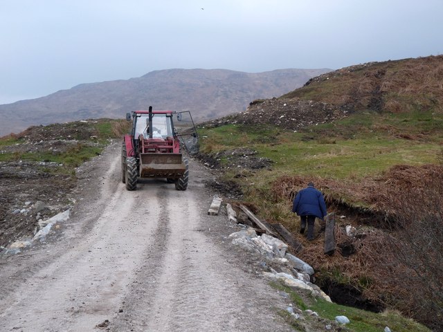
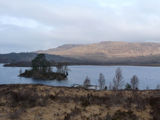
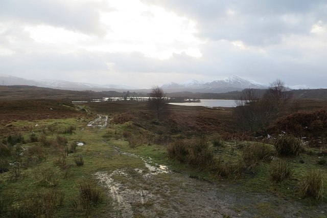
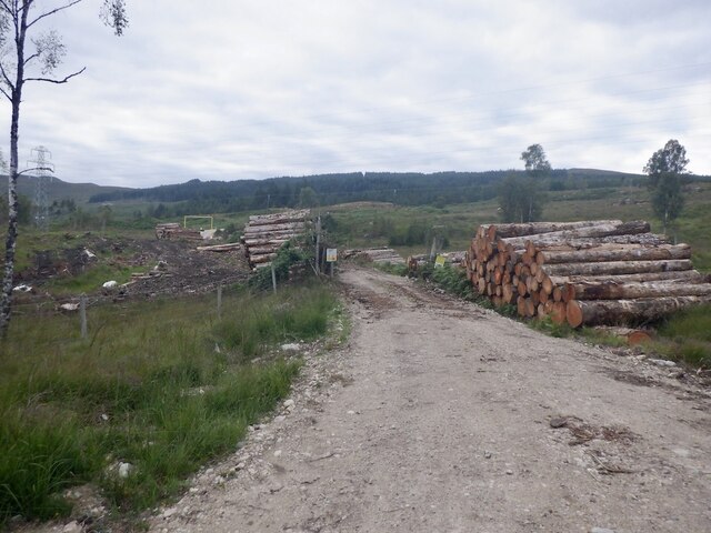
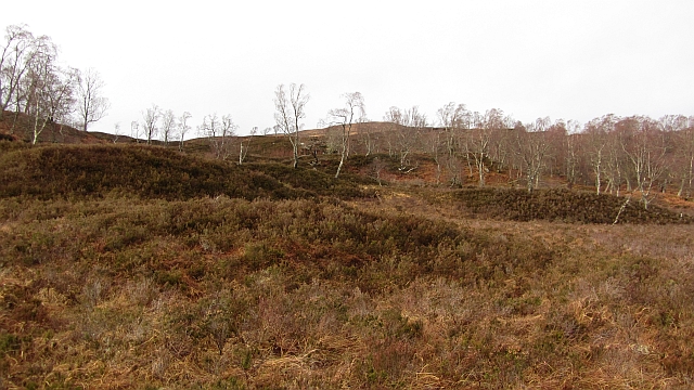
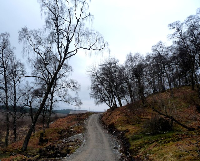
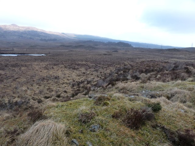
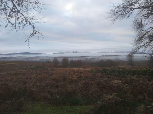
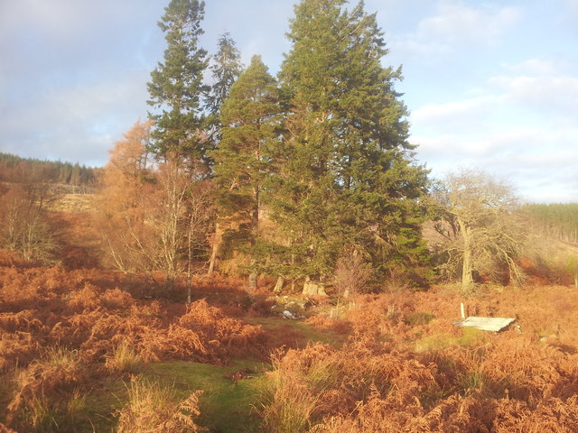
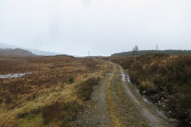
Doire Daraich, located in Inverness-shire, Scotland, is a picturesque wood or forest known for its natural beauty and rich biodiversity. Covering an expansive area, this woodland is a haven for outdoor enthusiasts and nature lovers alike.

The forest is characterized by its diverse array of tree species, including oak, birch, pine, and rowan. These trees create a stunning canopy that provides shade and shelter for a variety of wildlife. Doire Daraich is home to numerous bird species, such as woodpeckers, owls, and finches, which can be observed and heard chirping throughout the forest. Deer, squirrels, and rabbits are also commonly spotted within its boundaries.

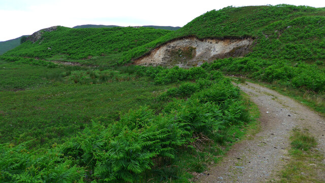
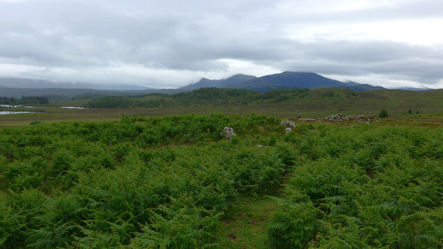
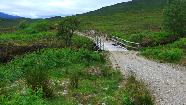
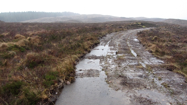
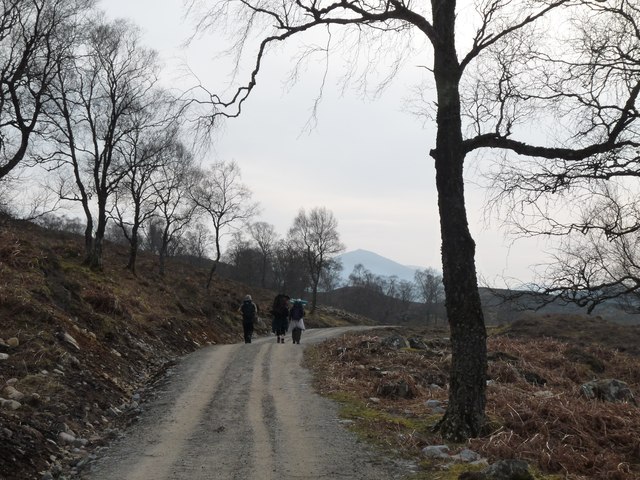
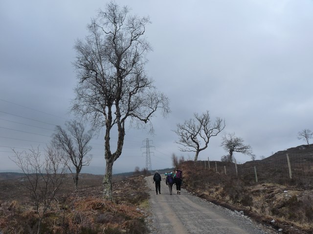
Trails and pathways wind through Doire Daraich, allowing visitors to explore the forest and discover its hidden gems. These paths offer breathtaking views of the surrounding landscape, including rolling hills, sparkling lochs, and rugged mountains.

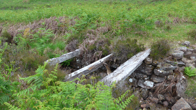
In addition to its natural beauty, Doire Daraich holds historical significance. It is believed that the forest was once part of the ancient Caledonian Forest, which covered large areas of Scotland thousands of years ago. This forest has witnessed centuries of human activity, including timber extraction and charcoal production.

Doire Daraich is a popular destination for hikers, photographers, and nature enthusiasts seeking tranquility and a connection with the natural world. Its serene atmosphere, coupled with its diverse flora and fauna, make it a must-visit location for those exploring Inverness-shire.

If you have any feedback on the listing, please let us know in the comments section below.

Doire Daraich Images

Images are sourced within 2km of 57.104916/-4.7975139 or Grid Reference NH3005. Thanks to Geograph Open Source API. All images are credited.

Small borrow-pit near ruined Lundie
All that remains of the sheiling at Lundie As they say "just a rickle o' stanes" amongst the bracken.
All that remains of the sheiling at Lundie
As they say "just a rickle o' stanes" amongst the bracken.
Strange bridge over the Allt Lundie The bridge is strange because the track stretches 30 or so metres beyond and then comes to a turning circle - and nothing else!  It does parallel the ford lower down and in spate could be used as the preferred crossing, but there is no path or track joining up the far side.
Strange bridge over the Allt Lundie
The bridge is strange because the track stretches 30 or so metres beyond and then comes to a turning circle - and nothing else! It does parallel the ford lower down and in spate could be used as the preferred crossing, but there is no path or track joining up the far side.
Derelict bridge over the Allt Glac na Connspeach The state of this bridge pretty well sums up the state of the path (OS 50,000) or track (OS 25,000).  Fine at times, boggy frequently, totally absent a lot of the time.
Derelict bridge over the Allt Glac na Connspeach
The state of this bridge pretty well sums up the state of the path (OS 50,000) or track (OS 25,000). Fine at times, boggy frequently, totally absent a lot of the time.
Improvements on the estate road to Lundie
Eilean na Faoileige in Loch Lundie
Track, Loch Lundie A dark and wet afternoon on moorland near Loch Lundie.
Track, Loch Lundie
A dark and wet afternoon on moorland near Loch Lundie.
Loch Lundie View over the loch towards Ben Tee.
Loch Lundie
View over the loch towards Ben Tee.
Log stacks, Auchteraw
Doire Daraich A birch wood, now regenerating behind a fence.
Doire Daraich
A birch wood, now regenerating behind a fence.
Track improvements, Loch Lundie It was pouring with rain, and quite a few folk were up here looking for a low level alternative to stormbound hills. Heading back to Invergarry along a road which seems to be halfway through a rebuilding exercise.
Track improvements, Loch Lundie
It was pouring with rain, and quite a few folk were up here looking for a low level alternative to stormbound hills. Heading back to Invergarry along a road which seems to be halfway through a rebuilding exercise.
Track by Invervigar Burn
Track through Dail a' Chuirn
Track to Faichem
Track to Faichem
Moorland at Loch Lundie
View from Achadh-nan-darach
Achadh - nan - darach
Track, Loch Lundie The track runs from Faichem or Invergarry to Bridge of Oich. It had got quite overgrown at one time but mostly has a new surface now.
Track, Loch Lundie
The track runs from Faichem or Invergarry to Bridge of Oich. It had got quite overgrown at one time but mostly has a new surface now.
Show me another place!

Doire Daraich is located at Grid Ref: NH3005 (Lat: 57.104916, Lng: -4.7975139)

Unitary Authority: Highland

Police Authority: Highlands and Islands

What 3 Words

///flamenco.shocking.adding. Near Gairlochy, Highland

Related Wikis

Loch Lundie

Loch Lundie is a small, lowland freshwater loch in Glen Garry, about 1.5 miles (2.4 km) north-west of Invergarry in the Scottish Highlands. The loch is...
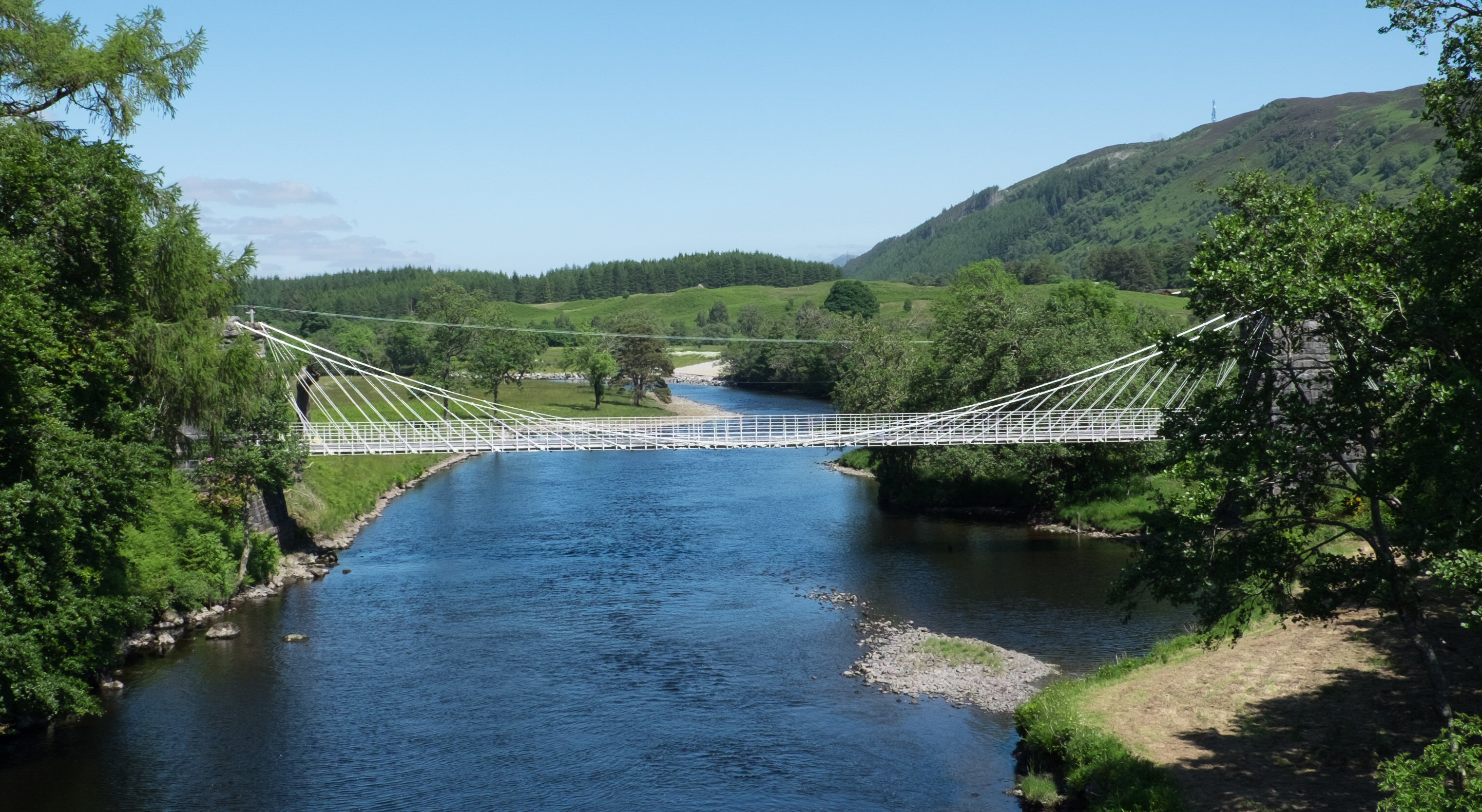
Bridge of Oich

The Bridge of Oich (also known as Victoria Bridge, Aberchalder) is a taper principle suspension bridge, designed by James Dredge, across the River Oich...

Great Glen Fault

The Great Glen Fault is a strike-slip fault that runs through the Great Glen in Scotland. The fault is mostly inactive today, but occasional moderate tremors...

Caledonian Canal

The Caledonian Canal connects the Scottish east coast at Inverness with the west coast at Corpach near Fort William in Scotland. The canal was constructed...

Nearby Amenities

Located within 500m of 57.104916,-4.7975139
Power: tower
Lat/Long: 57.1064544/-4.7925008
Power: pole
Lat/Long: 57.1009023/-4.7972435
Power: pole
Lat/Long: 57.1015025/-4.796868
Power: pole
Lat/Long: 57.1021668/-4.7964039
Power: pole
Lat/Long: 57.1027874/-4.7959963
Power: pole
Lat/Long: 57.1034386/-4.7956449
Power: pole
Lat/Long: 57.1040912/-4.7951916
Power: pole
Lat/Long: 57.1047555/-4.7947893
Power: pole
Lat/Long: 57.1054329/-4.7943306
Power: pole
Lat/Long: 57.1061306/-4.7939256
Power: pole
Lat/Long: 57.1067206/-4.7935689
Power: pole
Lat/Long: 57.1069711/-4.7927025
Power: pole
Lat/Long: 57.1073076/-4.7915706
The data included in this document is from www.openstreetmap.org. The data is made available under ODbL.

Have you been to Doire Daraich?

Leave your review of Doire Daraich below (or comments, questions and feedback).