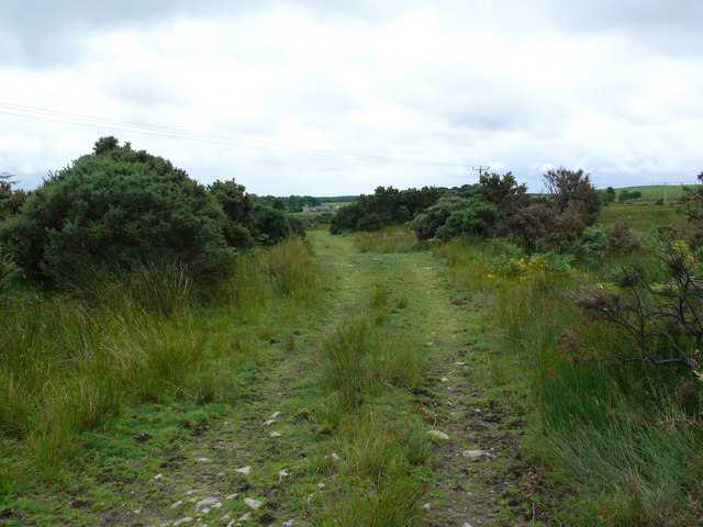
Craighlaw Wood

Wood, Forest in Wigtownshire

Scotland

Craighlaw Wood

Old milestone Looking towards Kirkcowan.   This milestone was spotted by a Milestone Society member from Dumfries in 2017.   It wasn't seen in 2008.   The dyke (wall) in front of Oldland Farm may have been rebuilt at some time and the repainted milestone set within it.
Old milestone Credit: Chris Minto

Craighlaw Wood is a picturesque forest located in Wigtownshire, Scotland. It covers an area of approximately 200 acres and is known for its diverse range of flora and fauna. The wood is situated on the slopes of Craighlaw Hill, offering breathtaking views of the surrounding countryside.

The forest primarily consists of native broadleaf trees, including oak, beech, and birch. These trees provide a stunning canopy that shades the forest floor and creates a tranquil and peaceful atmosphere. The woodland is also home to a variety of wildlife, including deer, foxes, badgers, and a wide array of bird species.

Craighlaw Wood is a popular destination for nature enthusiasts and outdoor enthusiasts alike. It offers several walking trails that wind through the forest, allowing visitors to explore its beauty at their own pace. The trails are well-maintained and suitable for all ages and fitness levels.

One of the highlights of Craighlaw Wood is its ancient oak trees, some of which are estimated to be over 300 years old. These majestic trees provide a glimpse into the area's rich history and are a sight to behold.

The wood is also a designated Site of Special Scientific Interest (SSSI) due to its importance for biodiversity and conservation. It is managed by the local forestry authority to ensure the preservation of its natural habitat.

Overall, Craighlaw Wood is a stunning natural gem in Wigtownshire, offering visitors a chance to immerse themselves in the beauty of Scotland's woodlands and experience its rich biodiversity.

If you have any feedback on the listing, please let us know in the comments section below.

Craighlaw Wood Images

Images are sourced within 2km of 54.917497/-4.6436835 or Grid Reference NX3061. Thanks to Geograph Open Source API. All images are credited.

Old milestone Looking towards Kirkcowan.   This milestone was spotted by a Milestone Society member from Dumfries in 2017.   It wasn't seen in 2008.   The dyke (wall) in front of Oldland Farm may have been rebuilt at some time and the repainted milestone set within it.
Old milestone
Looking towards Kirkcowan. This milestone was spotted by a Milestone Society member from Dumfries in 2017. It wasn't seen in 2008. The dyke (wall) in front of Oldland Farm may have been rebuilt at some time and the repainted milestone set within it.
Old milestone A short distance from this milestone can be seen the road sign for the A75 and the Give Way sign.   This is the last of a complete set of 10 milestones on the B733 from Wigtown 0.   It is now 8 miles of A75, new and old sections, into Glenluce.
Old milestone
A short distance from this milestone can be seen the road sign for the A75 and the Give Way sign. This is the last of a complete set of 10 milestones on the B733 from Wigtown 0. It is now 8 miles of A75, new and old sections, into Glenluce.
Old milestone From this photograph it can be seen that the milestone has, at some time, been reset with the W face to the road.  And it has been painted since 2008 when first recorded for the Milestone Society.
Old milestone
From this photograph it can be seen that the milestone has, at some time, been reset with the W face to the road. And it has been painted since 2008 when first recorded for the Milestone Society.
Farmland near Muil Farm The ridge is called Near Barbunny - barr buin duibh - the hill of the black bottom, or bog.
Farmland near Muil Farm
The ridge is called Near Barbunny - barr buin duibh - the hill of the black bottom, or bog.
The old military road near Kiltersan Built in the 18th century, it runs to the port at Portpatrick. It was constructed so that troops could be moved quickly to Ireland in times of trouble.
The old military road near Kiltersan
Built in the 18th century, it runs to the port at Portpatrick. It was constructed so that troops could be moved quickly to Ireland in times of trouble.
Kiltersan Kiltersan - Cill tarsuinn - means the chapel at the crossing, although the crossing of what isn't obvious.
Kiltersan
Kiltersan - Cill tarsuinn - means the chapel at the crossing, although the crossing of what isn't obvious.
Muil farm and the A75 The work taking place behind the farm is in connection with a new water mains being run across the breadth of the county.
Muil farm and the A75
The work taking place behind the farm is in connection with a new water mains being run across the breadth of the county.
Kiltersan Farm from the Gargrie Taken at dusk. Kiltersan farm is in the middle distance. The hill on the horizon is the Knock of Luce.
Kiltersan Farm from the Gargrie
Taken at dusk. Kiltersan farm is in the middle distance. The hill on the horizon is the Knock of Luce.
Mobile phone masts, Barskeoch Fell The farm seen in the distance between the masts is Kiltersan.
Mobile phone masts, Barskeoch Fell
The farm seen in the distance between the masts is Kiltersan.
Stones of Kiltersan Looking due east along the Old Military Road.
Stones of Kiltersan
Looking due east along the Old Military Road.
Winter at Kiltersan
Winter at Kiltersan
Kiltersan Farm Looking towards Kiltersan Farm and reservoir from the Old Military Road
Kiltersan Farm
Looking towards Kiltersan Farm and reservoir from the Old Military Road
Military Road This track forms part of the old military road and looks towards Kiltersan.
Military Road
This track forms part of the old military road and looks towards Kiltersan.
Knockbreck View east past the power lines and masts that run for miles through this open countryside.
Knockbreck
View east past the power lines and masts that run for miles through this open countryside.
Knockbreck View across to Barskeoch Fell and the two mobile phone masts that stand on the hill <a href="https://www.geograph.org.uk/photo/778790">NX2962 : Mobile phone masts, Barskeoch Fell</a>.
Knockbreck
View across to Barskeoch Fell and the two mobile phone masts that stand on the hill NX2962 : Mobile phone masts, Barskeoch Fell.
Knockbreck View along the line of pylons northwards past Kiltersan Farm.
Knockbreck
View along the line of pylons northwards past Kiltersan Farm.
Knockbreck View across the A75 towards Craighlaw Wood.
Knockbreck
View across the A75 towards Craighlaw Wood.
Knockbreck View across the A75 towards the Galloway Hills.
Knockbreck
View across the A75 towards the Galloway Hills.
Show me another place!

Craighlaw Wood is located at Grid Ref: NX3061 (Lat: 54.917497, Lng: -4.6436835)

Unitary Authority: Dumfries and Galloway

Police Authority: Dumfries and Galloway

What 3 Words

///noise.deprives.grandson. Near Newton Stewart, Dumfries & Galloway

Related Wikis

Kirkcowan railway station

Kirkcowan railway station served the village of Kirkcowan, Dumfries and Galloway, Scotland from 1861 to 1965 on the Portpatrick and Wigtownshire Joint...

Kirkcowan

Kirkcowan is an area about 15 miles in length, and from nearly two to nearly seven miles in breadth, comprising 30,580 acres, of which 7000 are arable...

Barhapple Loch

Barhapple Loch is a small semicircular freshwater loch located in Wigtownshire, Dumfries and Galloway in Scotland. Barhapple Loch is principally known...

Tarf Water, Wigtownshire

The Tarf Water is a river in the former county of Wigtownshire in south-west Scotland. It rises on the Ayrshire border (55.0048°N 4.7815°W / 55.0048;...

Castle Loch, Dumfries and Galloway

Castle Loch is a large, shallow, freshwater loch in Dumfries and Galloway, in the Southern Uplands of south-west Scotland. It lies to the west of Mochrum...

Castle Loch

Castle Loch is a shallow eutrophic loch covering an area of around 100 hectares in the town of Lochmaben in Dumfries and Galloway, Scotland. It lies to...

Mochrum Loch

Mochrum Loch is a large, irregular shaped, shallow, freshwater loch in Dumfries and Galloway, in the Southern Uplands of south-west Scotland. It lies approximately...

Torhouse

The Standing Stones of Torhouse (also Torhousekie) are a stone circle of nineteen granite boulders on the land of Torhouse, three miles west of Wigtown...

Nearby Amenities

Located within 500m of 54.917497,-4.6436835
Halfway House
Naptan AtcoCode: 680000900333
Naptan Bearing: SW
Naptan BusStopType: CUS
Naptan CommonName: Halfway House
Naptan Indicator: opp House
Naptan Landmark: B733
Naptan NaptanCode: 34235242
Naptan Notes: none
Naptan Street: A75
Naptan Verified: no
Source: naptan_import
Lat/Long: 54.9202667/-4.6455474
Halfway House
Naptan AtcoCode: 680000900444
Naptan Bearing: NE
Naptan BusStopType: CUS
Naptan CommonName: Halfway House
Naptan Indicator: at House
Naptan Landmark: B733
Naptan NaptanCode: 34235239
Naptan Notes: none
Naptan Street: A75
Naptan Verified: no
Source: naptan_import
Lat/Long: 54.9203471/-4.6455683
Power: pole
Lat/Long: 54.9210462/-4.6484697
Power: pole
Lat/Long: 54.9212/-4.6470282
Power: pole
Lat/Long: 54.921335/-4.6457302
Power: pole
Lat/Long: 54.9214543/-4.644601
Power: pole
Lat/Long: 54.9215747/-4.6434039
Power: pole
Lat/Long: 54.9217353/-4.64191
Power: pole
Lat/Long: 54.9215234/-4.6424261
Power: pole
Lat/Long: 54.9212736/-4.6430236
Power: pole
Lat/Long: 54.9210339/-4.6436115
Power: pole
Lat/Long: 54.920802/-4.6441567
Power: pole
Lat/Long: 54.9205388/-4.644861
Power: pole
Lat/Long: 54.9158654/-4.6505738
Power: pole
Lat/Long: 54.9151138/-4.6496561
Power: pole
Lat/Long: 54.9143811/-4.6487481
Power: pole
Lat/Long: 54.914148/-4.647229
Power: pole
Lat/Long: 54.9139071/-4.6456788
Power: pole
Lat/Long: 54.9137287/-4.6445573
Power: pole
Lat/Long: 54.9135547/-4.6433816
Power: pole
Lat/Long: 54.9133774/-4.6422446
Power: pole
Lat/Long: 54.9218674/-4.6455216
Post Box
Lat/Long: 54.9204283/-4.6451685
The data included in this document is from www.openstreetmap.org. The data is made available under ODbL.

Have you been to Craighlaw Wood?

Leave your review of Craighlaw Wood below (or comments, questions and feedback).