Crow Wood

Wood, Forest in Wigtownshire

Scotland

Crow Wood

Wall and fence-lined minor road between High Mindork and Barnearnie Looking north-eastward.
Wall and fence-lined minor road between High Mindork and Barnearnie Credit: Peter Wood

Crow Wood is a picturesque forest located in Wigtownshire, a region in the southwest of Scotland. Covering an area of approximately 200 hectares, this enchanting woodland is nestled between the villages of Kirkcowan and Newton Stewart. Known for its diverse range of flora and fauna, Crow Wood offers visitors a tranquil escape into nature.

The forest is primarily composed of native broadleaf trees, including oak, birch, and beech, which create a dense canopy that provides shade and shelter to the woodland floor. Walking through the wood, visitors can encounter a variety of wildlife, such as red squirrels, roe deer, and numerous bird species, including great spotted woodpeckers and tawny owls.

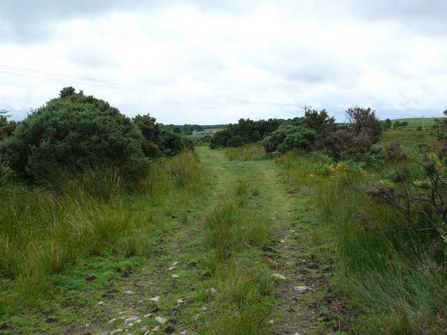
Several well-maintained trails wind their way through Crow Wood, allowing visitors to explore the forest at their own pace. These paths lead to hidden gems, such as a picturesque waterfall and a small pond, further enhancing the natural beauty of the area. There are also picnic spots scattered throughout the forest, providing an ideal setting for a leisurely lunch amidst the peaceful surroundings.

Crow Wood is not only appreciated for its natural beauty but also for its historical significance. Within the forest, there are remnants of ancient settlements and burial cairns, indicating human occupation dating back thousands of years. These archaeological remains add an intriguing dimension to the woodland, making it a destination for history enthusiasts as well.

Overall, Crow Wood in Wigtownshire is a captivating destination that offers a unique blend of natural beauty, wildlife, and historical intrigue. Whether for a peaceful stroll, birdwatching, or a glimpse into Scotland's rich past, this woodland provides a memorable experience for all who visit.

If you have any feedback on the listing, please let us know in the comments section below.

Crow Wood Images

Images are sourced within 2km of 54.912879/-4.6455964 or Grid Reference NX3060. Thanks to Geograph Open Source API. All images are credited.

Wall and fence-lined minor road between High Mindork and Barnearnie Looking north-eastward.
Wall and fence-lined minor road between High Mindork and Barnearnie
Looking north-eastward.
Old milestone Looking towards Kirkcowan.   This milestone was spotted by a Milestone Society member from Dumfries in 2017.   It wasn't seen in 2008.   The dyke (wall) in front of Oldland Farm may have been rebuilt at some time and the repainted milestone set within it.
Old milestone
Looking towards Kirkcowan. This milestone was spotted by a Milestone Society member from Dumfries in 2017. It wasn't seen in 2008. The dyke (wall) in front of Oldland Farm may have been rebuilt at some time and the repainted milestone set within it.
Old milestone A short distance from this milestone can be seen the road sign for the A75 and the Give Way sign.   This is the last of a complete set of 10 milestones on the B733 from Wigtown 0.   It is now 8 miles of A75, new and old sections, into Glenluce.
Old milestone
A short distance from this milestone can be seen the road sign for the A75 and the Give Way sign. This is the last of a complete set of 10 milestones on the B733 from Wigtown 0. It is now 8 miles of A75, new and old sections, into Glenluce.
Old milestone From this photograph it can be seen that the milestone has, at some time, been reset with the W face to the road.  And it has been painted since 2008 when first recorded for the Milestone Society.
Old milestone
From this photograph it can be seen that the milestone has, at some time, been reset with the W face to the road. And it has been painted since 2008 when first recorded for the Milestone Society.
Farmland near Muil Farm The ridge is called Near Barbunny - barr buin duibh - the hill of the black bottom, or bog.
Farmland near Muil Farm
The ridge is called Near Barbunny - barr buin duibh - the hill of the black bottom, or bog.
The old military road near Kiltersan Built in the 18th century, it runs to the port at Portpatrick. It was constructed so that troops could be moved quickly to Ireland in times of trouble.
The old military road near Kiltersan
Built in the 18th century, it runs to the port at Portpatrick. It was constructed so that troops could be moved quickly to Ireland in times of trouble.
Kiltersan Kiltersan - Cill tarsuinn - means the chapel at the crossing, although the crossing of what isn't obvious.
Kiltersan
Kiltersan - Cill tarsuinn - means the chapel at the crossing, although the crossing of what isn't obvious.
Muil farm and the A75 The work taking place behind the farm is in connection with a new water mains being run across the breadth of the county.
Muil farm and the A75
The work taking place behind the farm is in connection with a new water mains being run across the breadth of the county.
Kiltersan Farm from the Gargrie Taken at dusk. Kiltersan farm is in the middle distance. The hill on the horizon is the Knock of Luce.
Kiltersan Farm from the Gargrie
Taken at dusk. Kiltersan farm is in the middle distance. The hill on the horizon is the Knock of Luce.
Stones of Kiltersan Looking due east along the Old Military Road.
Stones of Kiltersan
Looking due east along the Old Military Road.
Winter at Kiltersan
Winter at Kiltersan
Kiltersan Farm Looking towards Kiltersan Farm and reservoir from the Old Military Road
Kiltersan Farm
Looking towards Kiltersan Farm and reservoir from the Old Military Road
Military Road This track forms part of the old military road and looks towards Kiltersan.
Military Road
This track forms part of the old military road and looks towards Kiltersan.
Knockbreck View south from this hill across the A75 centre of picture towards Mark of Luce Moss on the horizon and Mark of Luce Farm left of the Moss.
Knockbreck
View south from this hill across the A75 centre of picture towards Mark of Luce Moss on the horizon and Mark of Luce Farm left of the Moss.
Knockbreck View east past the power lines and masts that run for miles through this open countryside.
Knockbreck
View east past the power lines and masts that run for miles through this open countryside.
Knockbreck View across to Barskeoch Fell and the two mobile phone masts that stand on the hill <a href="https://www.geograph.org.uk/photo/778790">NX2962 : Mobile phone masts, Barskeoch Fell</a>.
Knockbreck
View across to Barskeoch Fell and the two mobile phone masts that stand on the hill NX2962 : Mobile phone masts, Barskeoch Fell.
Knockbreck View along the line of pylons northwards past Kiltersan Farm.
Knockbreck
View along the line of pylons northwards past Kiltersan Farm.
Knockbreck View across the A75 towards Craighlaw Wood.
Knockbreck
View across the A75 towards Craighlaw Wood.
Show me another place!

Crow Wood is located at Grid Ref: NX3060 (Lat: 54.912879, Lng: -4.6455964)

Unitary Authority: Dumfries and Galloway

Police Authority: Dumfries and Galloway

What 3 Words

///clumped.canal.gathering. Near Newton Stewart, Dumfries & Galloway

Nearby Locations

Crow Wood

Related Wikis

Kirkcowan railway station

Kirkcowan railway station served the village of Kirkcowan, Dumfries and Galloway, Scotland from 1861 to 1965 on the Portpatrick and Wigtownshire Joint...

Kirkcowan

Kirkcowan is an area about 15 miles in length, and from nearly two to nearly seven miles in breadth, comprising 30,580 acres, of which 7000 are arable...

Barhapple Loch

Barhapple Loch is a small semicircular freshwater loch located in Wigtownshire, Dumfries and Galloway in Scotland. Barhapple Loch is principally known...

Tarf Water, Wigtownshire

The Tarf Water is a river in the former county of Wigtownshire in south-west Scotland. It rises on the Ayrshire border (55.0048°N 4.7815°W / 55.0048;...

Nearby Amenities

Located within 500m of 54.912879,-4.6455964
Power: pole
Lat/Long: 54.9158654/-4.6505738
Power: pole
Lat/Long: 54.9151138/-4.6496561
Power: pole
Lat/Long: 54.9143811/-4.6487481
Power: pole
Lat/Long: 54.914148/-4.647229
Power: pole
Lat/Long: 54.9139071/-4.6456788
Power: pole
Lat/Long: 54.9137287/-4.6445573
Power: pole
Lat/Long: 54.9135547/-4.6433816
Power: pole
Lat/Long: 54.9133774/-4.6422446
Power: pole
Lat/Long: 54.9131844/-4.6409991
Power: pole
Lat/Long: 54.9129837/-4.6396797
Power: pole
Lat/Long: 54.9130027/-4.6382692
The data included in this document is from www.openstreetmap.org. The data is made available under ODbL.

Have you been to Crow Wood?

Leave your review of Crow Wood below (or comments, questions and feedback).