Coille Torr a' Chait

Wood, Forest in Inverness-shire

Scotland

Coille Torr a' Chait

Coille Creag an t-Sagairt A scenic track, which leads to a familyphobic   campsite.  It gives very fine views over woodland around Invergarry.
Coille Creag an t-Sagairt Credit: Richard Webb

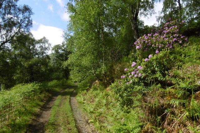
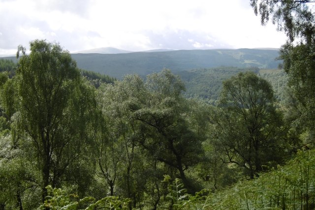
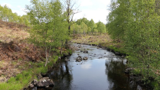
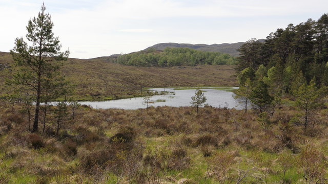
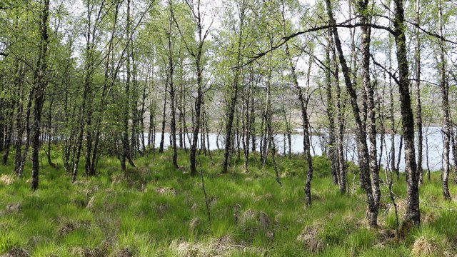
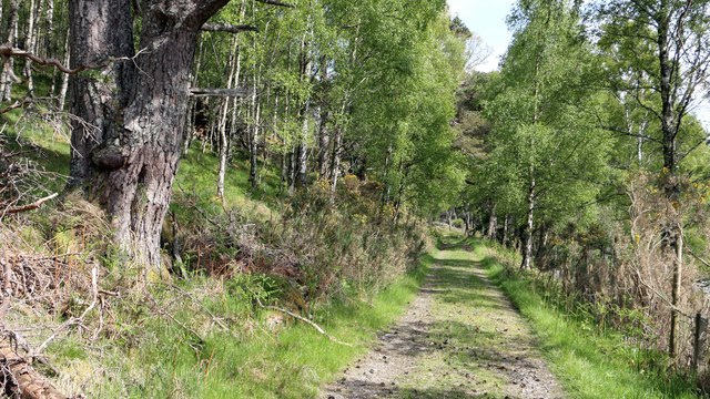
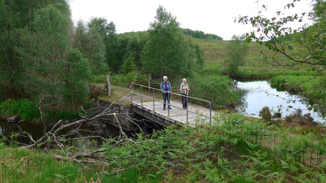
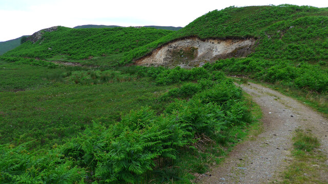
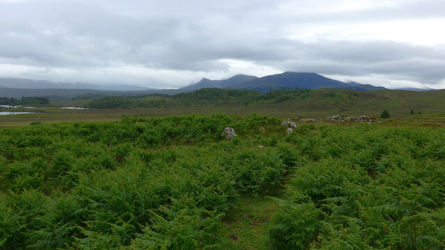
Coille Torr a' Chait is a captivating woodland located in Inverness-shire, Scotland. Spread across a vast area, this enchanting forest is nestled amidst the picturesque Scottish Highlands. The name "Coille Torr a' Chait" translates to "wood of the cat's hill," adding an air of mystery and intrigue to the location.

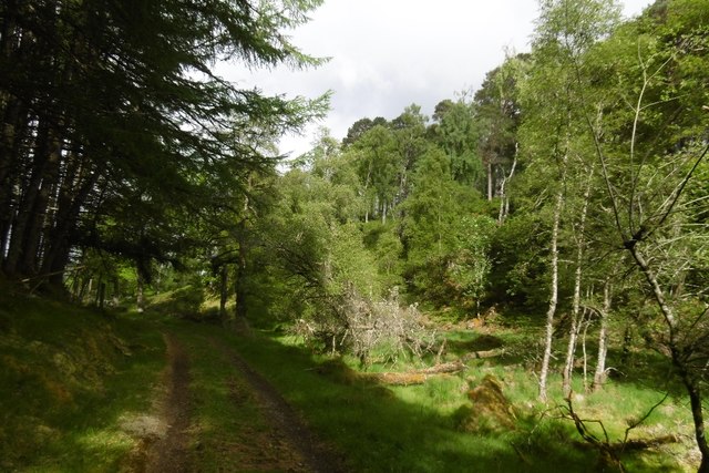
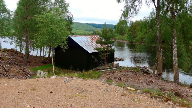
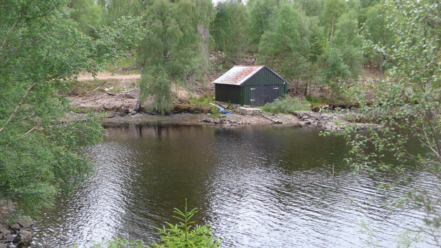
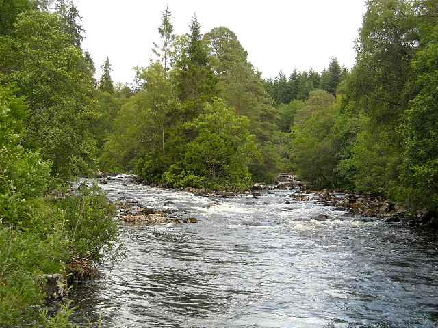
The woodland is characterized by its diverse range of trees, including native species such as Scots pine, birch, rowan, and oak. These majestic trees create a lush canopy, filtering sunlight and casting beautiful shadows on the forest floor. The woodland is also home to a variety of flora and fauna, making it a haven for nature lovers and wildlife enthusiasts.

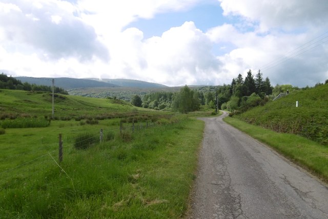
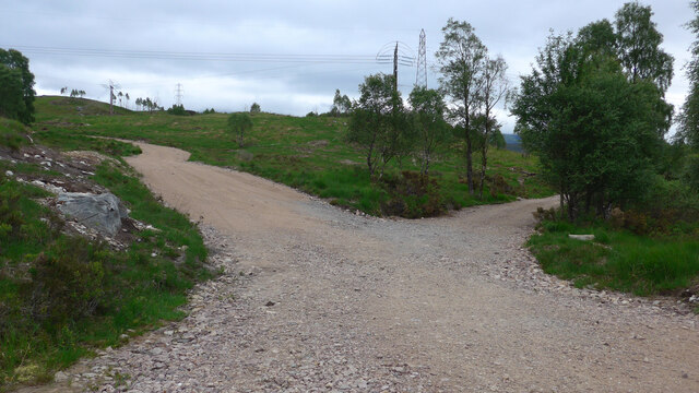
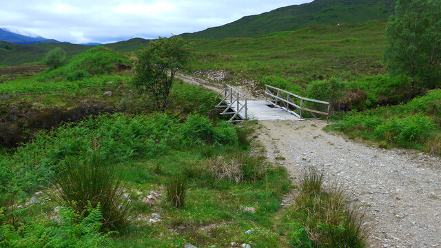
Visitors to Coille Torr a' Chait can explore the forest through a network of well-maintained trails, which wind their way through the trees and offer breathtaking views of the surrounding landscape. These paths cater to all levels of fitness and are suitable for both leisurely strolls and more adventurous hikes.

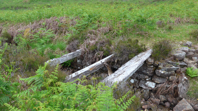
The woodland is steeped in history, with remnants of ancient settlements and archaeological sites scattered throughout. These remnants provide a glimpse into the lives of those who once called this area home, adding an element of cultural significance to the natural beauty of the forest.

Overall, Coille Torr a' Chait offers a tranquil and immersive experience for visitors, providing an escape from the hustle and bustle of modern life. Its captivating scenery, diverse wildlife, and rich history make it a must-visit destination for anyone seeking a connection with nature and a deeper understanding of Scotland's natural heritage.

If you have any feedback on the listing, please let us know in the comments section below.

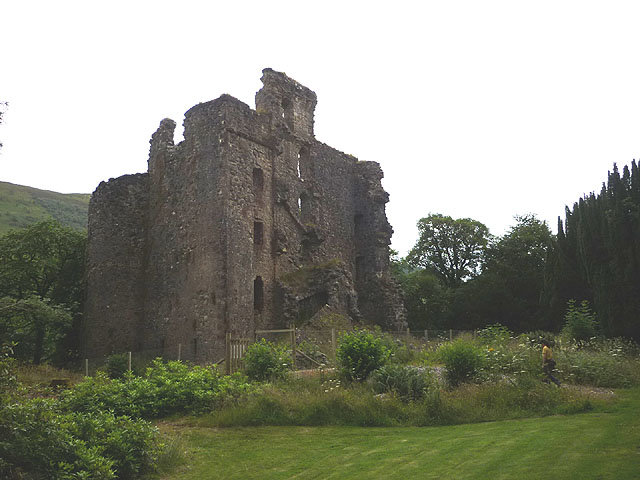
Coille Torr a' Chait Images

Images are sourced within 2km of 57.090029/-4.8237143 or Grid Reference NH2903. Thanks to Geograph Open Source API. All images are credited.

Coille Creag an t-Sagairt A scenic track, which leads to a familyphobic   campsite.  It gives very fine views over woodland around Invergarry.
Coille Creag an t-Sagairt
A scenic track, which leads to a familyphobic campsite. It gives very fine views over woodland around Invergarry.
Woodland, Invergarry A view over Glen Garry and the Great Glen from Coille Creag an t-Sagairt.
Woodland, Invergarry
A view over Glen Garry and the Great Glen from Coille Creag an t-Sagairt.
Coille Creag an t-Sagairt A very scenic track in fine woodland above Invergarry.
Coille Creag an t-Sagairt
A very scenic track in fine woodland above Invergarry.
Road, Faichem Single track road above Invergarry.
Road, Faichem
Single track road above Invergarry.
Aldernaig Burn  
This photograph was taken from a bridge over the burn. The bridge carries a track upstream to a point where the <a href="https://www.geograph.org.uk/photo/5660944">NH2902 : Outflow from Loch Lundie</a> can be viewed.

Some 500m to the south of the viewpoint (off the right of this photograph) the track splits with the left fork following the burn toward Invergarry and the right fork heading toward Faichemard Farm. To see a photograph of this branch, click here <a href="https://www.geograph.org.uk/photo/5661047">NH2901 : Track in woodland below Coille Creag an t-Sagairt</a>.

The photograph was taken in June. To see the same view, but taken in March see this photograph by Alan Reid, <a href="https://www.geograph.org.uk/photo/2942138">NH2902 : Aldernaig Burn</a>.
Aldernaig Burn
  This photograph was taken from a bridge over the burn. The bridge carries a track upstream to a point where the NH2902 : Outflow from Loch Lundie can be viewed. Some 500m to the south of the viewpoint (off the right of this photograph) the track splits with the left fork following the burn toward Invergarry and the right fork heading toward Faichemard Farm. To see a photograph of this branch, click here NH2901 : Track in woodland below Coille Creag an t-Sagairt. The photograph was taken in June. To see the same view, but taken in March see this photograph by Alan Reid, NH2902 : Aldernaig Burn.
Outflow from Loch Lundie  
The photograph shows the outflow from Loch Lundie. Some 250m north of this viewpoint, to the right of this photograph is a <a href="https://www.geograph.org.uk/photo/5660961">NH2903 : Birch wood on the shore of Loch Lundie</a>.

The water from the loch drains into the <a href="https://www.geograph.org.uk/photo/5660926">NH2902 : Aldernaig Burn</a>, which then descends some 90m over an approximate distance of 2.5km through a series of dams and waterfalls to join the River Garry at Invergarry.

In the middle distance the hill with the trees is Torr a’ Chait and the summit beyond that is Meall a’ Chrom Dhòire.

The photograph was taken in June. To see the same view, but photographed in January see these photographs by Richard Webb:- <a href="https://www.geograph.org.uk/photo/4311727">NH2902 : Loch Lundie</a> and <a href="https://www.geograph.org.uk/photo/471181">NH2902 : Outflow from Loch Lundie</a>.
Outflow from Loch Lundie
  The photograph shows the outflow from Loch Lundie. Some 250m north of this viewpoint, to the right of this photograph is a NH2903 : Birch wood on the shore of Loch Lundie. The water from the loch drains into the NH2902 : Aldernaig Burn, which then descends some 90m over an approximate distance of 2.5km through a series of dams and waterfalls to join the River Garry at Invergarry. In the middle distance the hill with the trees is Torr a’ Chait and the summit beyond that is Meall a’ Chrom Dhòire. The photograph was taken in June. To see the same view, but photographed in January see these photographs by Richard Webb:- NH2902 : Loch Lundie and NH2902 : Outflow from Loch Lundie.
Birch wood on the shore of Loch Lundie  
The viewpoint is at the southern end of the loch and is some 250m north of <a href="https://www.geograph.org.uk/photo/5660944">NH2902 : Outflow from Loch Lundie</a>.
Birch wood on the shore of Loch Lundie
  The viewpoint is at the southern end of the loch and is some 250m north of NH2902 : Outflow from Loch Lundie.
Track in woodland below Coille Creag an t-Sagairt  
About a kilometre ahead along the track is a bridge over the <a href="https://www.geograph.org.uk/photo/5660926">NH2902 : Aldernaig Burn</a>.

Some 650m behind the viewpoint is Faichemard Farm.
Track in woodland below Coille Creag an t-Sagairt
  About a kilometre ahead along the track is a bridge over the NH2902 : Aldernaig Burn. Some 650m behind the viewpoint is Faichemard Farm.
Old Milestone by the A87, Munerigie Wood, Loch Garry Highland granite by the A87, in parish of Kilmonivaig (Lochaber District), East end of Loch Garry, near bends chevron.

Surveyed

Milestone Society National ID: HI_IGTD03
Old Milestone by the A87, Munerigie Wood, Loch Garry
Highland granite by the A87, in parish of Kilmonivaig (Lochaber District), East end of Loch Garry, near bends chevron. Surveyed Milestone Society National ID: HI_IGTD03
Bridge over the Aldernaig Burn
New track junction by the Aldernaig Burn There has been a lot of track development in this area;  not clear whether for windfarm, hydro or general estate development.
New track junction by the Aldernaig Burn
There has been a lot of track development in this area; not clear whether for windfarm, hydro or general estate development.
Jetty at the boathouse on Loch Lundie Sadly, the boathouse is locked and looks unused and unloved.
Jetty at the boathouse on Loch Lundie
Sadly, the boathouse is locked and looks unused and unloved.
Boathouse on Loch Lundie
Small borrow-pit near ruined Lundie
All that remains of the sheiling at Lundie As they say "just a rickle o' stanes" amongst the bracken.
All that remains of the sheiling at Lundie
As they say "just a rickle o' stanes" amongst the bracken.
Strange bridge over the Allt Lundie The bridge is strange because the track stretches 30 or so metres beyond and then comes to a turning circle - and nothing else!  It does parallel the ford lower down and in spate could be used as the preferred crossing, but there is no path or track joining up the far side.
Strange bridge over the Allt Lundie
The bridge is strange because the track stretches 30 or so metres beyond and then comes to a turning circle - and nothing else! It does parallel the ford lower down and in spate could be used as the preferred crossing, but there is no path or track joining up the far side.
Derelict bridge over the Allt Glac na Connspeach The state of this bridge pretty well sums up the state of the path (OS 50,000) or track (OS 25,000).  Fine at times, boggy frequently, totally absent a lot of the time.
Derelict bridge over the Allt Glac na Connspeach
The state of this bridge pretty well sums up the state of the path (OS 50,000) or track (OS 25,000). Fine at times, boggy frequently, totally absent a lot of the time.
Show me another place!

Coille Torr a' Chait is located at Grid Ref: NH2903 (Lat: 57.090029, Lng: -4.8237143)

Unitary Authority: Highland

Police Authority: Highlands and Islands

What 3 Words

///museum.dodges.chap. Near Gairlochy, Highland

Related Wikis

Loch Lundie

Loch Lundie is a small, lowland freshwater loch in Glen Garry, about 1.5 miles (2.4 km) north-west of Invergarry in the Scottish Highlands. The loch is...

Invergarry

Invergarry (Scottish Gaelic: Inbhir Garadh) is a village in the Highlands of Scotland. It is in the Great Glen, near where the River Garry flows into Loch...

River Garry, Inverness-shire

The River Garry (Scottish Gaelic: Garadh / Abhainn Gharadh) in Inverness-shire is a Scottish river punctuated by two long Lochs, in the region of Lochaber...

Loch Oich

Loch Oich (; Scottish Gaelic: Loch Omhaich) is a freshwater loch in the Highlands of Scotland which forms part of the Caledonian Canal, of which it is...

Have you been to Coille Torr a' Chait?

Leave your review of Coille Torr a' Chait below (or comments, questions and feedback).