Annabaglish Moss

Wood, Forest in Wigtownshire

Scotland

Annabaglish Moss

Knock Moss This picture direction north across Derskelpin Moss shows the Mark of Luce Moss on the horizon beyond which is the A75. The journey to get to this grid square for a first geograph took seven hours, walking a circular route across the moors and hills and bagging another seven grid square firsts on the way. Heavy overnight rain made the walking difficult and treacherous at times. 

My two walking partners and I crossed dozens of flooded burns and creeks, tore clothing on barbed fences and fell into a couple of burns for good measure (although I think it was the same one, Lannygore Burn, twice!). Not so much moor walking as bog trotting. The name Annabaglish, which was one of the forests we walked around, means "the path across the bog" and we now understand why.

It was a long hard slog to get here, but we did it and left the moors in the dark with happy faces, knowing that we had also bashed the NX25 hectad which has taken five and a half years to Geograph fully.

Credit for this achievement also goes to Brian and Billy, two experienced mountain climbers and hill walkers who accompanied me on this bog trot across the moors.
Knock Moss Credit: Andy Farrington

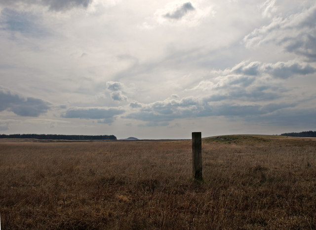
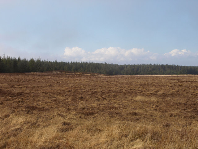
Annabaglish Moss is a picturesque wood located in Wigtownshire, a region in southwestern Scotland. Nestled amidst the natural beauty of the area, this tranquil forest is a haven for nature enthusiasts and outdoor adventurers alike.

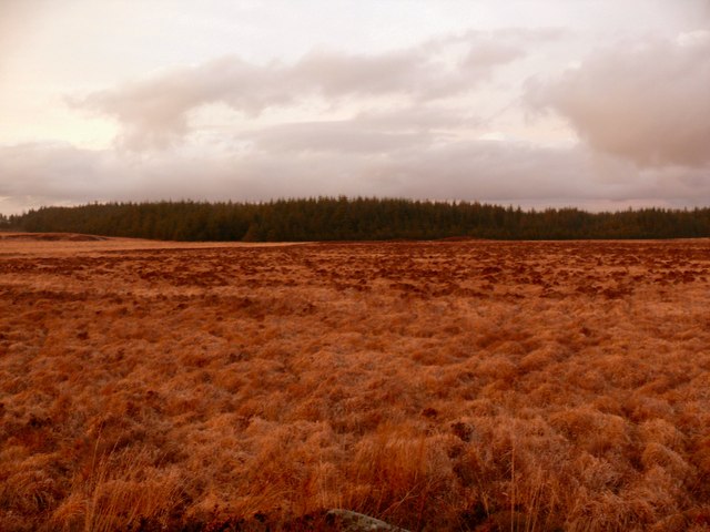
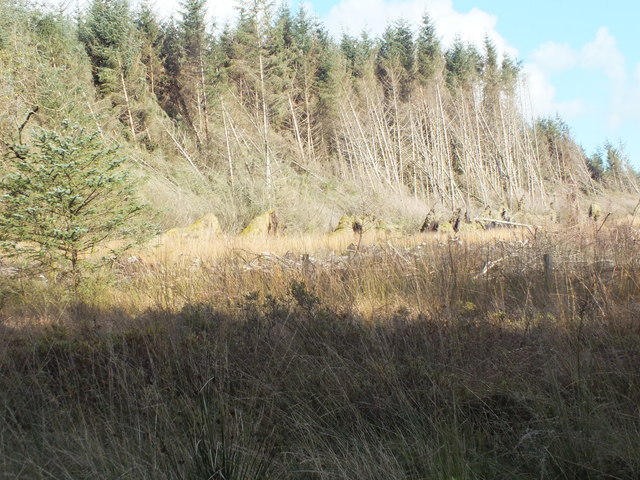
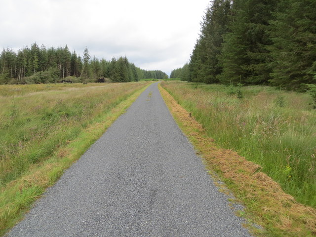
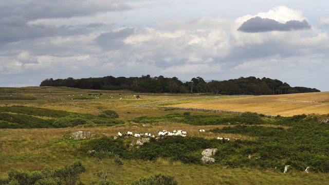
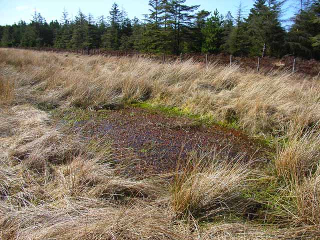
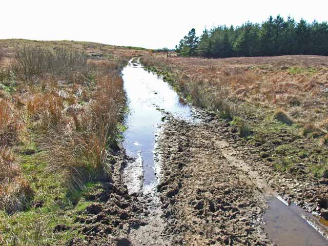
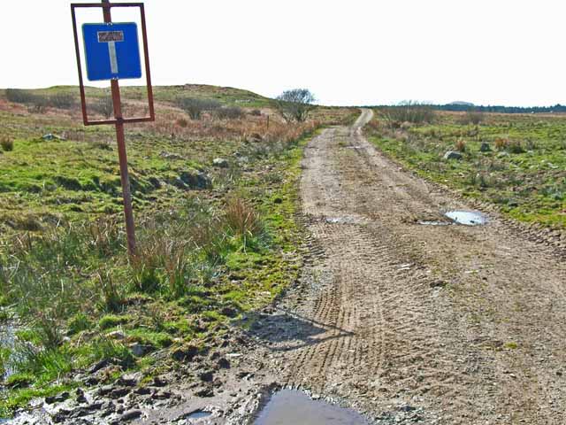
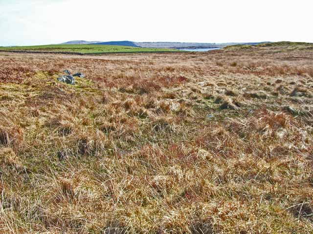
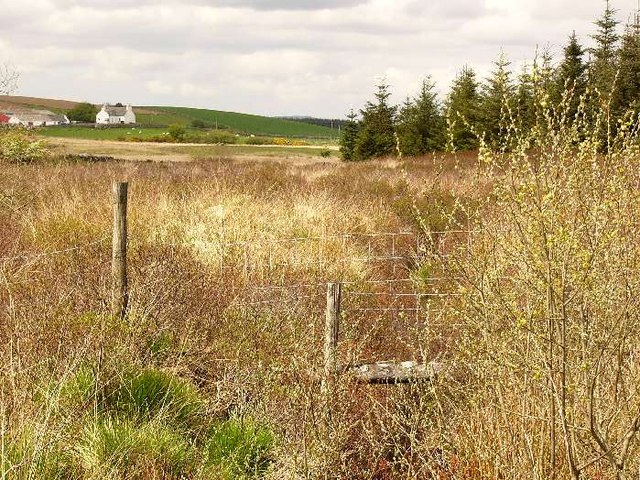
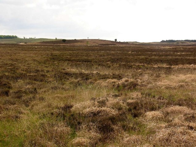
Covering an area of approximately 150 hectares, Annabaglish Moss is renowned for its diverse ecosystem and abundance of plant and animal species. The forest floor is carpeted with a thick layer of moss, giving the wood its name and creating a unique and enchanting atmosphere. The mossy landscape is interspersed with ancient, towering trees such as oak, ash, and birch, providing a rich habitat for a variety of woodland creatures.

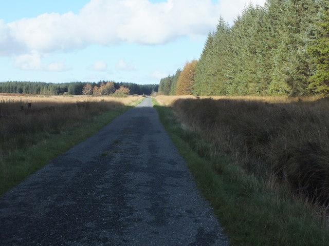
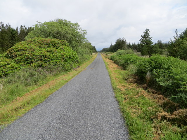
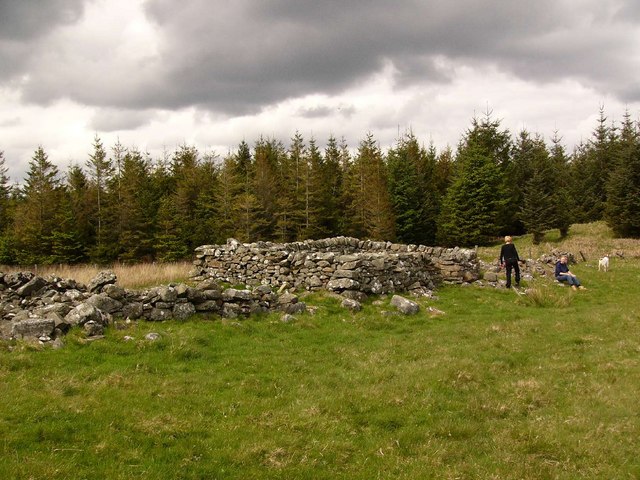
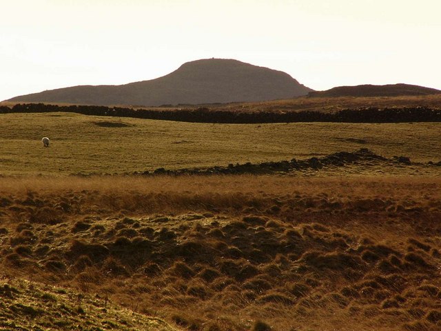
Visitors to Annabaglish Moss can embark on scenic walks or hikes along the well-maintained trails that wind through the forest. The paths offer breathtaking views of the surrounding countryside, including rolling hills and the nearby coastline. Along the way, one may encounter a plethora of wildlife, including deer, foxes, and a wide range of bird species.

Due to its ecological significance, Annabaglish Moss is a designated Site of Special Scientific Interest (SSSI). This recognition underscores its importance as a protected area for the preservation of the natural environment and its contribution to scientific research and education.

Whether you are seeking a peaceful retreat, an opportunity for wildlife spotting, or simply a chance to immerse yourself in nature, Annabaglish Moss is a must-visit destination for those exploring the beauty of Wigtownshire.

If you have any feedback on the listing, please let us know in the comments section below.

Annabaglish Moss Images

Images are sourced within 2km of 54.876462/-4.6698676 or Grid Reference NX2856. Thanks to Geograph Open Source API. All images are credited.

Knock Moss This picture direction north across Derskelpin Moss shows the Mark of Luce Moss on the horizon beyond which is the A75. The journey to get to this grid square for a first geograph took seven hours, walking a circular route across the moors and hills and bagging another seven grid square firsts on the way. Heavy overnight rain made the walking difficult and treacherous at times. 

My two walking partners and I crossed dozens of flooded burns and creeks, tore clothing on barbed fences and fell into a couple of burns for good measure (although I think it was the same one, Lannygore Burn, twice!). Not so much moor walking as bog trotting. The name Annabaglish, which was one of the forests we walked around, means "the path across the bog" and we now understand why.

It was a long hard slog to get here, but we did it and left the moors in the dark with happy faces, knowing that we had also bashed the NX25 hectad which has taken five and a half years to Geograph fully.

Credit for this achievement also goes to Brian and Billy, two experienced mountain climbers and hill walkers who accompanied me on this bog trot across the moors.
Knock Moss
This picture direction north across Derskelpin Moss shows the Mark of Luce Moss on the horizon beyond which is the A75. The journey to get to this grid square for a first geograph took seven hours, walking a circular route across the moors and hills and bagging another seven grid square firsts on the way. Heavy overnight rain made the walking difficult and treacherous at times. My two walking partners and I crossed dozens of flooded burns and creeks, tore clothing on barbed fences and fell into a couple of burns for good measure (although I think it was the same one, Lannygore Burn, twice!). Not so much moor walking as bog trotting. The name Annabaglish, which was one of the forests we walked around, means "the path across the bog" and we now understand why. It was a long hard slog to get here, but we did it and left the moors in the dark with happy faces, knowing that we had also bashed the NX25 hectad which has taken five and a half years to Geograph fully. Credit for this achievement also goes to Brian and Billy, two experienced mountain climbers and hill walkers who accompanied me on this bog trot across the moors.
The Road Goes On And On Through Mindork Forest.
The Road Goes On And On
Through Mindork Forest.
A Wall Of Root Plates Clearfelling the area nearest the camera has caused the conifers on the edge of the standing timber to lose their tenuous grip and get blown over.
A Wall Of Root Plates
Clearfelling the area nearest the camera has caused the conifers on the edge of the standing timber to lose their tenuous grip and get blown over.
Minor road near to Loch Wayoch Looking northward.
Minor road near to Loch Wayoch
Looking northward.
Minor road passing through forestry land near Mindork Moss Looking northward.
Minor road passing through forestry land near Mindork Moss
Looking northward.
Challochglass Plantation A shelterbelt planted originally to protect the farm of Challochglass from the worst of the wind.
Challochglass Plantation
A shelterbelt planted originally to protect the farm of Challochglass from the worst of the wind.
...and worse The road which left the tarmac at <a href="https://www.geograph.org.uk/gridref/NX2654">NX2654</a> is virtually impassable over this stretch, even on foot!
...and worse
The road which left the tarmac at NX2654 is virtually impassable over this stretch, even on foot!
A slight improvement The road which left the tarmac at <a href="https://www.geograph.org.uk/gridref/NX2654">NX2654</a> and deteriorated so badly through the forest begins to improve - slightly!
A slight improvement
The road which left the tarmac at NX2654 and deteriorated so badly through the forest begins to improve - slightly!
A decent surface again! The road which left the tarmac at <a href="https://www.geograph.org.uk/gridref/NX2654">NX2654</a> and deteriorated so badly through the forest, at last becomes a decent track again. The tarmac starts again just this side of the camera.
A decent surface again!
The road which left the tarmac at NX2654 and deteriorated so badly through the forest, at last becomes a decent track again. The tarmac starts again just this side of the camera.
Challochglass Moor Castle Loch can be glimpsed in the distance
Challochglass Moor
Castle Loch can be glimpsed in the distance
Drumdow
Drumdow
Drumdow Burn Almost completely hidden by vegetation. The farm is Annabaglish.
Drumdow Burn
Almost completely hidden by vegetation. The farm is Annabaglish.
Drumdow Moss and Far Hill
Knock of Luce from Drumdow
The Merrick seen from the north end of Drumcagerie
Looking over Annabaglish Moss to the Galloway Hills Annabaglish Moss was planted with conifers in the 1970's. The name Annabaglish (ath na boglaich) means a ford across the marsh. The distant hill with the cap of snow is the Merrick.
Looking over Annabaglish Moss to the Galloway Hills
Annabaglish Moss was planted with conifers in the 1970's. The name Annabaglish (ath na boglaich) means a ford across the marsh. The distant hill with the cap of snow is the Merrick.
Knocketie Moss Knocketie (Cnoc an tighe) - the hill of the house.
Knocketie Moss
Knocketie (Cnoc an tighe) - the hill of the house.
Corbie Craig This small rock outcrop (the crows crag)  is the only named feature in this square.
Corbie Craig
This small rock outcrop (the crows crag) is the only named feature in this square.
Show me another place!

Annabaglish Moss is located at Grid Ref: NX2856 (Lat: 54.876462, Lng: -4.6698676)

Unitary Authority: Dumfries and Galloway

Police Authority: Dumfries and Galloway

What 3 Words

///pins.cosmic.unzipped. Near Newton Stewart, Dumfries & Galloway

Nearby Locations

Annabaglish Moss

Related Wikis

Castle Loch, Dumfries and Galloway

Castle Loch is a large, shallow, freshwater loch in Dumfries and Galloway, in the Southern Uplands of south-west Scotland. It lies to the west of Mochrum...

Castle Loch

Castle Loch is a shallow eutrophic loch covering an area of around 100 hectares in the town of Lochmaben in Dumfries and Galloway, Scotland. It lies to...

Barhapple Loch

Barhapple Loch is a small semicircular freshwater loch located in Wigtownshire, Dumfries and Galloway in Scotland. Barhapple Loch is principally known...

Mochrum Loch

Mochrum Loch is a large, irregular shaped, shallow, freshwater loch in Dumfries and Galloway, in the Southern Uplands of south-west Scotland. It lies approximately...

Doon of May

The Doon of May is a conifer plantation associated with an Iron Age hill fort in Dumfries and Galloway, south-west Scotland. Located around 14 kilometres...

Kirkcowan railway station

Kirkcowan railway station served the village of Kirkcowan, Dumfries and Galloway, Scotland from 1861 to 1965 on the Portpatrick and Wigtownshire Joint...

Kirkcowan

Kirkcowan is an area about 15 miles in length, and from nearly two to nearly seven miles in breadth, comprising 30,580 acres, of which 7000 are arable...

Machars

The Machars (Scottish Gaelic: Machair Ghallghaidhealaibh) is a peninsula in the historical county of Wigtownshire in Galloway in the south-west of Scotland...

Have you been to Annabaglish Moss?

Leave your review of Annabaglish Moss below (or comments, questions and feedback).