Monadh Liath

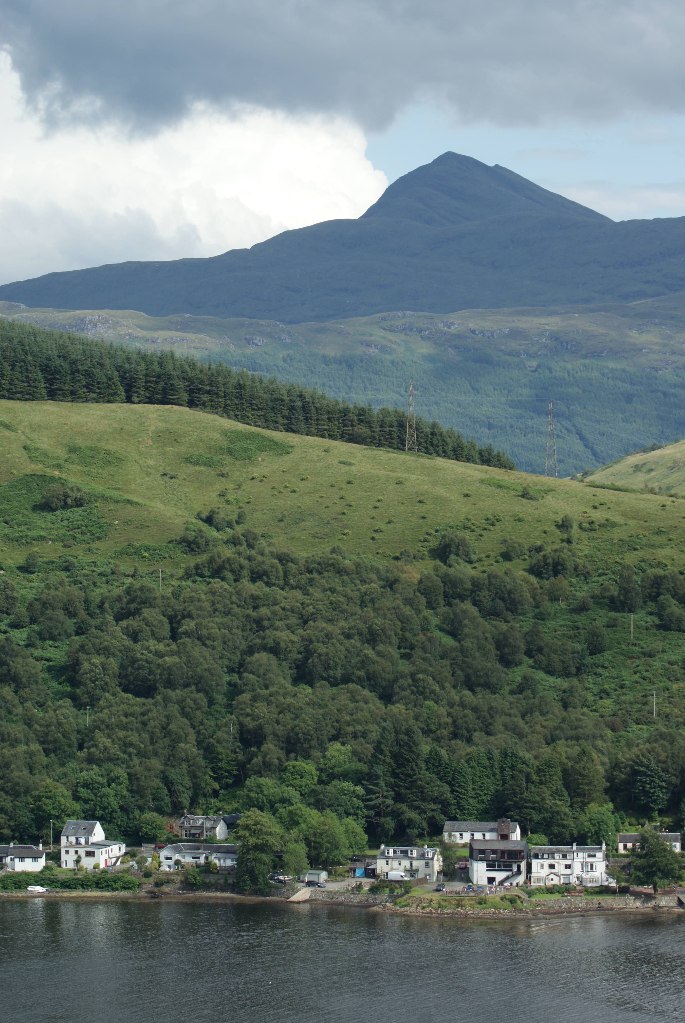
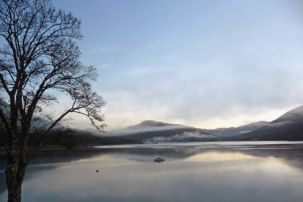
Wood, Forest in Argyllshire

Scotland

Monadh Liath

A83 The A83 is a major road which links two of the most remote areas of mainland Britain, Cowal and Kintyre, with the rest of Scotland. 

The A83 runs for 98 miles from Tarbet, on the western shore of Loch Lomond where it splits from the A82, to Campbeltown. On the way, it runs along the shore of Loch Fyne and almost the entire length of the Kintyre peninsula.
A83 Credit: N Chadwick

The requested URL returned error: 429 Too Many Requests

If you have any feedback on the listing, please let us know in the comments section below.

Monadh Liath Images

Images are sourced within 2km of 56.200794/-4.7613878 or Grid Reference NN2804. Thanks to Geograph Open Source API. All images are credited.

A83 The A83 is a major road which links two of the most remote areas of mainland Britain, Cowal and Kintyre, with the rest of Scotland. 

The A83 runs for 98 miles from Tarbet, on the western shore of Loch Lomond where it splits from the A82, to Campbeltown. On the way, it runs along the shore of Loch Fyne and almost the entire length of the Kintyre peninsula.
A83
The A83 is a major road which links two of the most remote areas of mainland Britain, Cowal and Kintyre, with the rest of Scotland. The A83 runs for 98 miles from Tarbet, on the western shore of Loch Lomond where it splits from the A82, to Campbeltown. On the way, it runs along the shore of Loch Fyne and almost the entire length of the Kintyre peninsula.
Railway bridge, A83
Railway bridge, A83
Pylon, Glen Loin
Pylon, Glen Loin
Pylon, Glen Loin
Pylon, Glen Loin
The Three Lochs Way, Glen Loin The Loch Lomond and Cowal Way is a waymarked footpath through the Cowal peninsula, in Argyll and Bute, between Portavadie on Cowal and Inveruglas on Loch Lomond side. It was formerly known as the Cowal Way, but was renamed in December 2018 to reflect the fact that half of the route lies with the Loch Lomond and The Trossachs National Park. The way is 92 kilometres long.
Wikipedia: <span class="nowrap"><a title="https://en.wikipedia.org/wiki/Loch_Lomond_and_Cowal_Way" rel="nofollow ugc noopener" href="https://en.wikipedia.org/wiki/Loch_Lomond_and_Cowal_Way">Link</a><img style="margin-left:2px;" alt="External link" title="External link - shift click to open in new window" src="https://s1.geograph.org.uk/img/external.png" width="10" height="10"/></span>
The Three Lochs Way, Glen Loin
The Loch Lomond and Cowal Way is a waymarked footpath through the Cowal peninsula, in Argyll and Bute, between Portavadie on Cowal and Inveruglas on Loch Lomond side. It was formerly known as the Cowal Way, but was renamed in December 2018 to reflect the fact that half of the route lies with the Loch Lomond and The Trossachs National Park. The way is 92 kilometres long. Wikipedia: LinkExternal link
The Loch Lomond and Cowal Way, Glen Loin The Three Lochs Way is a 55-kilometre long-distance path in Argyll and Bute that links Balloch and Inveruglas. The path crosses the Highland Boundary Fault, which divides the Scottish Highlands from the Lowlands, and is named for the three major lochs linked by the route: Loch Lomond, the Gare Loch and Loch Long.
Wikipedia: <span class="nowrap"><a title="https://en.wikipedia.org/wiki/Three_Lochs_Way" rel="nofollow ugc noopener" href="https://en.wikipedia.org/wiki/Three_Lochs_Way">Link</a><img style="margin-left:2px;" alt="External link" title="External link - shift click to open in new window" src="https://s1.geograph.org.uk/img/external.png" width="10" height="10"/></span>
The Loch Lomond and Cowal Way, Glen Loin
The Three Lochs Way is a 55-kilometre long-distance path in Argyll and Bute that links Balloch and Inveruglas. The path crosses the Highland Boundary Fault, which divides the Scottish Highlands from the Lowlands, and is named for the three major lochs linked by the route: Loch Lomond, the Gare Loch and Loch Long. Wikipedia: LinkExternal link
The Three Lochs Way, Glen Loin The Three Lochs Way is a 55-kilometre long-distance path in Argyll and Bute that links Balloch and Inveruglas. The path crosses the Highland Boundary Fault, which divides the Scottish Highlands from the Lowlands, and is named for the three major lochs linked by the route: Loch Lomond, the Gare Loch and Loch Long.
Wikipedia: <span class="nowrap"><a title="https://en.wikipedia.org/wiki/Three_Lochs_Way" rel="nofollow ugc noopener" href="https://en.wikipedia.org/wiki/Three_Lochs_Way">Link</a><img style="margin-left:2px;" alt="External link" title="External link - shift click to open in new window" src="https://s1.geograph.org.uk/img/external.png" width="10" height="10"/></span>
The Three Lochs Way, Glen Loin
The Three Lochs Way is a 55-kilometre long-distance path in Argyll and Bute that links Balloch and Inveruglas. The path crosses the Highland Boundary Fault, which divides the Scottish Highlands from the Lowlands, and is named for the three major lochs linked by the route: Loch Lomond, the Gare Loch and Loch Long. Wikipedia: LinkExternal link
The Loch Lomond and Cowal Way, Glen Loin The Three Lochs Way is a 55-kilometre long-distance path in Argyll and Bute that links Balloch and Inveruglas. The path crosses the Highland Boundary Fault, which divides the Scottish Highlands from the Lowlands, and is named for the three major lochs linked by the route: Loch Lomond, the Gare Loch and Loch Long.
Wikipedia: <span class="nowrap"><a title="https://en.wikipedia.org/wiki/Three_Lochs_Way" rel="nofollow ugc noopener" href="https://en.wikipedia.org/wiki/Three_Lochs_Way">Link</a><img style="margin-left:2px;" alt="External link" title="External link - shift click to open in new window" src="https://s1.geograph.org.uk/img/external.png" width="10" height="10"/></span>
The Loch Lomond and Cowal Way, Glen Loin
The Three Lochs Way is a 55-kilometre long-distance path in Argyll and Bute that links Balloch and Inveruglas. The path crosses the Highland Boundary Fault, which divides the Scottish Highlands from the Lowlands, and is named for the three major lochs linked by the route: Loch Lomond, the Gare Loch and Loch Long. Wikipedia: LinkExternal link
Pasture, Glen Loin
Pasture, Glen Loin
Stronafyne
Stronafyne
Stronafyne
Stronafyne
Stronafyne
Stronafyne
The Three Lochs Way, Glen Loin The Loch Lomond and Cowal Way is a waymarked footpath through the Cowal peninsula, in Argyll and Bute, between Portavadie on Cowal and Inveruglas on Loch Lomond side. It was formerly known as the Cowal Way, but was renamed in December 2018 to reflect the fact that half of the route lies with the Loch Lomond and The Trossachs National Park. The way is 92 kilometres long.
Wikipedia: <span class="nowrap"><a title="https://en.wikipedia.org/wiki/Loch_Lomond_and_Cowal_Way" rel="nofollow ugc noopener" href="https://en.wikipedia.org/wiki/Loch_Lomond_and_Cowal_Way">Link</a><img style="margin-left:2px;" alt="External link" title="External link - shift click to open in new window" src="https://s1.geograph.org.uk/img/external.png" width="10" height="10"/></span>
The Three Lochs Way, Glen Loin
The Loch Lomond and Cowal Way is a waymarked footpath through the Cowal peninsula, in Argyll and Bute, between Portavadie on Cowal and Inveruglas on Loch Lomond side. It was formerly known as the Cowal Way, but was renamed in December 2018 to reflect the fact that half of the route lies with the Loch Lomond and The Trossachs National Park. The way is 92 kilometres long. Wikipedia: LinkExternal link
The Three Lochs Way, Glen Loin The Three Lochs Way is a 55-kilometre long-distance path in Argyll and Bute that links Balloch and Inveruglas. The path crosses the Highland Boundary Fault, which divides the Scottish Highlands from the Lowlands, and is named for the three major lochs linked by the route: Loch Lomond, the Gare Loch and Loch Long.
Wikipedia: <span class="nowrap"><a title="https://en.wikipedia.org/wiki/Three_Lochs_Way" rel="nofollow ugc noopener" href="https://en.wikipedia.org/wiki/Three_Lochs_Way">Link</a><img style="margin-left:2px;" alt="External link" title="External link - shift click to open in new window" src="https://s1.geograph.org.uk/img/external.png" width="10" height="10"/></span>
The Three Lochs Way, Glen Loin
The Three Lochs Way is a 55-kilometre long-distance path in Argyll and Bute that links Balloch and Inveruglas. The path crosses the Highland Boundary Fault, which divides the Scottish Highlands from the Lowlands, and is named for the three major lochs linked by the route: Loch Lomond, the Gare Loch and Loch Long. Wikipedia: LinkExternal link
The Loch Lomond and Cowal Way, Glen Loin The Loch Lomond and Cowal Way is a waymarked footpath through the Cowal peninsula, in Argyll and Bute, between Portavadie on Cowal and Inveruglas on Loch Lomond side. It was formerly known as the Cowal Way, but was renamed in December 2018 to reflect the fact that half of the route lies with the Loch Lomond and The Trossachs National Park. The way is 92 kilometres long.
Wikipedia: <span class="nowrap"><a title="https://en.wikipedia.org/wiki/Loch_Lomond_and_Cowal_Way" rel="nofollow ugc noopener" href="https://en.wikipedia.org/wiki/Loch_Lomond_and_Cowal_Way">Link</a><img style="margin-left:2px;" alt="External link" title="External link - shift click to open in new window" src="https://s1.geograph.org.uk/img/external.png" width="10" height="10"/></span>
The Loch Lomond and Cowal Way, Glen Loin
The Loch Lomond and Cowal Way is a waymarked footpath through the Cowal peninsula, in Argyll and Bute, between Portavadie on Cowal and Inveruglas on Loch Lomond side. It was formerly known as the Cowal Way, but was renamed in December 2018 to reflect the fact that half of the route lies with the Loch Lomond and The Trossachs National Park. The way is 92 kilometres long. Wikipedia: LinkExternal link
Show me another place!

Monadh Liath is located at Grid Ref: NN2804 (Lat: 56.200794, Lng: -4.7613878)

Unitary Authority: Argyll and Bute

Police Authority: Argyll and West Dunbartonshire

What 3 Words

///insulated.attracts.handbook. Near Garelochhead, Argyll & Bute

Nearby Locations

Monadh Liath

Related Wikis

Arrochar, Argyll

Arrochar ( ARR-ə-khər; Scottish Gaelic: An t-Àrchar [ən̪ˠ t̪aːɾəɾ] or An Tairbeart an Iar) is a village located near the head of Loch Long, on the Cowal...

Succoth, Argyll

Succoth; (Scottish Gaelic: An Socach and sometimes referred to as Succoff or Succot in Scots) is a village on the Cowal peninsula in Argyll and Bute, Scotland...

Ardmay

Ardmay is a settlement in Argyll and Bute, Scotland, on the shore of Loch Long. == References ==

Ardgartan

Ardgartan is a hamlet, on the Cowal peninsula in Argyll and Bute, Scottish Highlands. It is located on the shores of Loch Long, at the bottom of Glen Croe...

Nearby Amenities

Located within 500m of 56.200794,-4.7613878
Created By: almien_coastlines
Lat/Long: 56.196702/-4.76445
Created By: almien_coastlines
Lat/Long: 56.2007797/-4.7556283
Created By: almien_coastlines
Lat/Long: 56.202477/-4.754607
Man Made: mast
Lat/Long: 56.2035122/-4.7600842
Bench
Backrest: yes
Colour: brown
Material: wood
Seats: 4
Lat/Long: 56.2040718/-4.7591483
The data included in this document is from www.openstreetmap.org. The data is made available under ODbL.

Have you been to Monadh Liath?

Leave your review of Monadh Liath below (or comments, questions and feedback).