Doire Darach

Wood, Forest in Argyllshire

Scotland

Doire Darach

Forest Lodge
Forest Lodge Credit: Andy Waddington

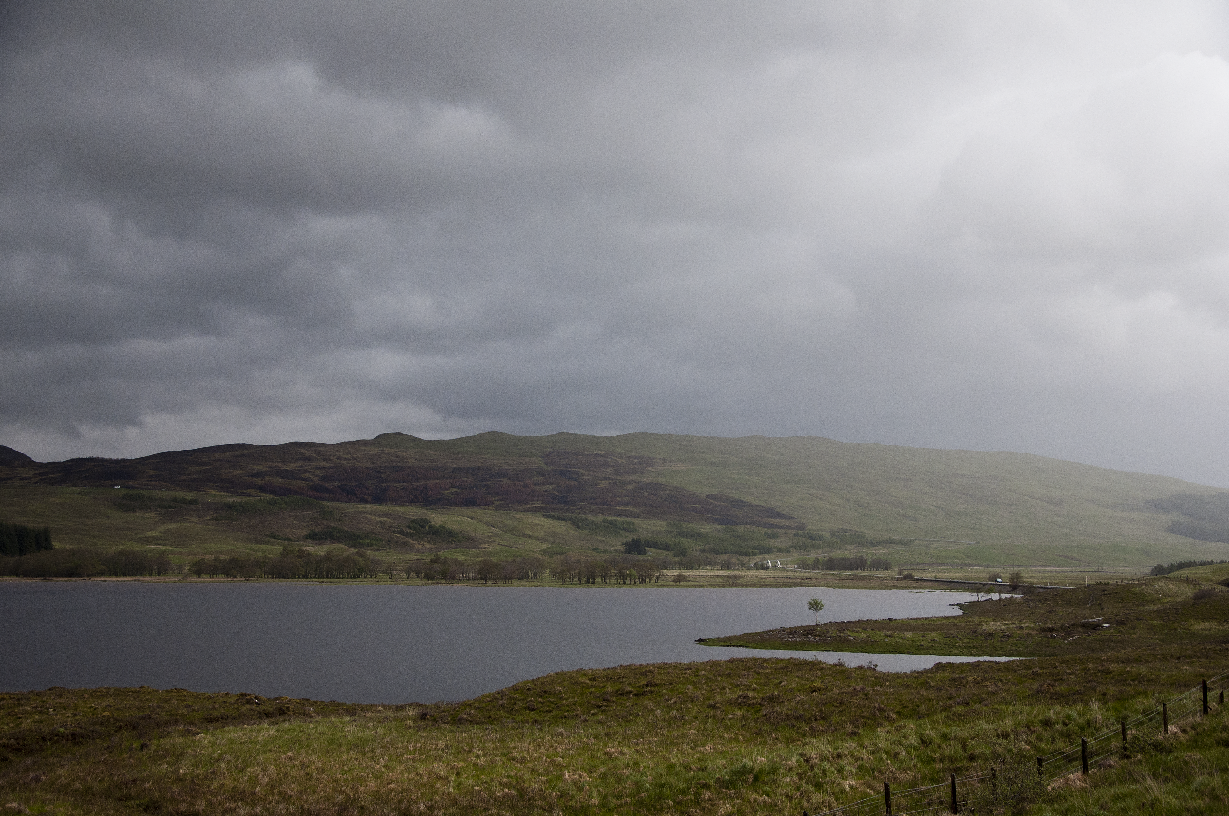
Doire Darach, located in Argyllshire, Scotland, is a captivating woodland area renowned for its lush greenery and diverse range of trees. The name "Doire Darach" translates to "Wood of the Oak" in Gaelic, reflecting the prevalence of oak trees that dominate the landscape.

Situated amidst the breathtaking beauty of Argyllshire, Doire Darach offers a serene and tranquil escape from the hustle and bustle of everyday life. The forest covers an extensive area, providing ample space for exploration and adventure. Visitors are immediately greeted by a symphony of bird songs and the gentle rustling of leaves, creating a peaceful ambiance.

The woodland is home to a rich variety of flora and fauna, making it a haven for nature lovers and wildlife enthusiasts. The towering oak trees, with their gnarled branches and thick foliage, provide a habitat for numerous bird species, including woodpeckers and owls. The forest floor is adorned with vibrant wildflowers, offering a stunning display of colors during the spring and summer months.

Doire Darach offers an array of recreational activities for visitors to enjoy. Hiking trails wind through the forest, allowing visitors to immerse themselves in the natural beauty and discover hidden gems along the way. Picnic spots are scattered throughout the woodland, providing the perfect setting for a leisurely lunch amidst the tranquil surroundings.

Whether seeking solace in nature, embarking on an adventure, or simply marveling at the picturesque landscape, a visit to Doire Darach is sure to leave a lasting impression on all who venture into its enchanting embrace.

If you have any feedback on the listing, please let us know in the comments section below.

Doire Darach Images

Images are sourced within 2km of 56.535669/-4.7902018 or Grid Reference NN2841. Thanks to Geograph Open Source API. All images are credited.

Forest Lodge
Forest Lodge
Walking the A82 towards Bridge of Orchy
A82 near Bridge of Orchy
Minor road towards Inveroran
Minor road near Inveroran
Minor road at Inveroran
Minor road near Inveroran
Loch Tulla Evening. A pine tree by the south shore.
Loch Tulla
Evening. A pine tree by the south shore.
Loch Tulla SW end of the loch at sunset. Stob Ghabhar is the hill on the right.
Loch Tulla
SW end of the loch at sunset. Stob Ghabhar is the hill on the right.
Abhainn Shira Looking downstream to Victoria Bridge. Beinn na Dòthaidh is in the mist in the background.
Abhainn Shira
Looking downstream to Victoria Bridge. Beinn na Dòthaidh is in the mist in the background.
Allt Orain Looking upstream from the road bridge by the Inveroran Hotel.
Allt Orain
Looking upstream from the road bridge by the Inveroran Hotel.
A82, southbound The A82 is a trunk road in Scotland. It is the principal route from Lowland Scotland to the western Scottish Highlands, running from Glasgow to Inverness, going by Loch Lomond, Glen Coe, Fort William and the Great Glen. It is 167 miles long.
<span class="nowrap"><a title="https://www.sabre-roads.org.uk/wiki/index.php?title=A82" rel="nofollow ugc noopener" href="https://www.sabre-roads.org.uk/wiki/index.php?title=A82">Link</a><img style="margin-left:2px;" alt="External link" title="External link - shift click to open in new window" src="https://s1.geograph.org.uk/img/external.png" width="10" height="10"/></span>
A82, southbound
The A82 is a trunk road in Scotland. It is the principal route from Lowland Scotland to the western Scottish Highlands, running from Glasgow to Inverness, going by Loch Lomond, Glen Coe, Fort William and the Great Glen. It is 167 miles long. LinkExternal link
Glen Orchy See Wikipedia: <span class="nowrap"><a title="http://en.wikipedia.org/wiki/River_Orchy" rel="nofollow ugc noopener" href="http://en.wikipedia.org/wiki/River_Orchy">Link</a><img style="margin-left:2px;" alt="External link" title="External link - shift click to open in new window" src="https://s1.geograph.org.uk/img/external.png" width="10" height="10"/></span>
Glen Orchy
See Wikipedia: LinkExternal link
Abhainn Shira from Victoria Bridge. A splendid view through clear air from Victoria Bridge with the river flowing over and among the rocks of its stony bed.
Abhainn Shira from Victoria Bridge.
A splendid view through clear air from Victoria Bridge with the river flowing over and among the rocks of its stony bed.
Loch Tulla
Loch Tulla
Inveroran Bridge over Allt Orain Carries the West Highland Way
Inveroran Bridge over Allt Orain
Carries the West Highland Way
Victoria Bridge over Abhainn Shira
Show me another place!

Doire Darach is located at Grid Ref: NN2841 (Lat: 56.535669, Lng: -4.7902018)

Unitary Authority: Argyll and Bute

Police Authority: Argyll and West Dunbartonshire

What 3 Words

///cherry.promote.dares. Near Tyndrum, Stirling

Related Wikis

Black Mount

Black Mount (also Blackmount) is a mountain range located in Argyll and Bute, Scotland. It is situated between Glen Orchy and Glen Coe. Its four Munros...

Loch Tulla

Loch Tulla (Scottish Gaelic: Loch Toilbhe [l̪ˠɔx ˈt̪ʰɔlɔvə]) is a small loch at grid reference NN293428 near Bridge of Orchy and Glen Coe in Scotland and...

Bridge of Orchy

Bridge of Orchy (Scottish Gaelic: Drochaid Urchaidh) is a village in Glen Orchy in Argyll and Bute, Scotland. It is named after the crossing over the River...

Bridge of Orchy railway station

Bridge of Orchy railway station is a railway station in the village of Bridge of Orchy in the west of Scotland. The station is on the West Highland Line...

Nearby Amenities

Located within 500m of 56.535669,-4.7902018
Power: pole
Lat/Long: 56.5364057/-4.7979895
Power: pole
Lat/Long: 56.5367611/-4.7973008
Power: pole
Lat/Long: 56.5373507/-4.7961993
Power: pole
Lat/Long: 56.5376846/-4.7955642
Power: pole
Lat/Long: 56.5381944/-4.7946048
Power: pole
Lat/Long: 56.5385712/-4.7938624
Power: pole
Lat/Long: 56.5387012/-4.7926203
Power: pole
Lat/Long: 56.5388653/-4.7911558
Power: pole
Lat/Long: 56.5389953/-4.7900382
Power: pole
Lat/Long: 56.5391342/-4.788638
Power: pole
Lat/Long: 56.5392347/-4.7877188
Power: pole
Lat/Long: 56.5394039/-4.7863534
The data included in this document is from www.openstreetmap.org. The data is made available under ODbL.

Have you been to Doire Darach?

Leave your review of Doire Darach below (or comments, questions and feedback).