Kibbert Wood

Wood, Forest in Ayrshire

Scotland

Kibbert Wood

Hadyard Hill (Summit) 360 Panorama This photo was taken back in Feb.2004 before the Windfarm was constructed in the same area, Centre of picture is due North, Penwhapple Reservoir can be seen to the left of the picture.
Hadyard Hill (Summit) 360 Panorama Credit: Brian Wotherspoon

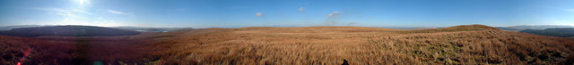
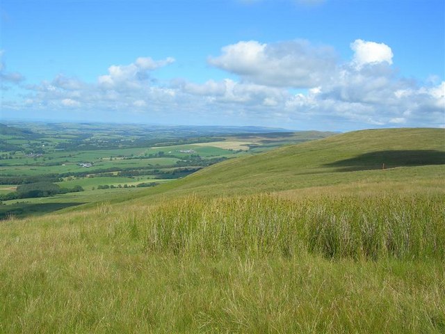
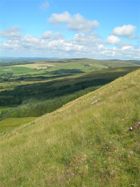
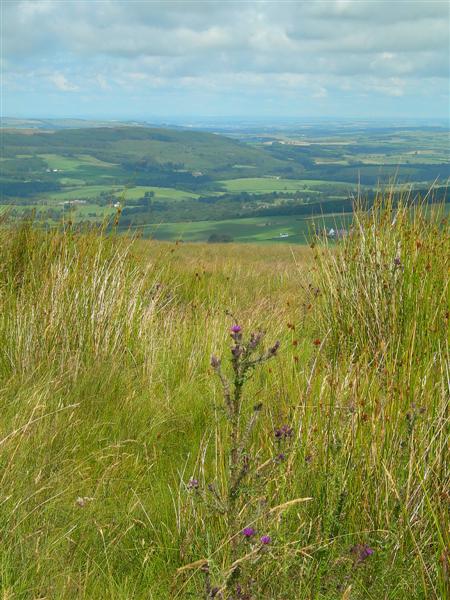
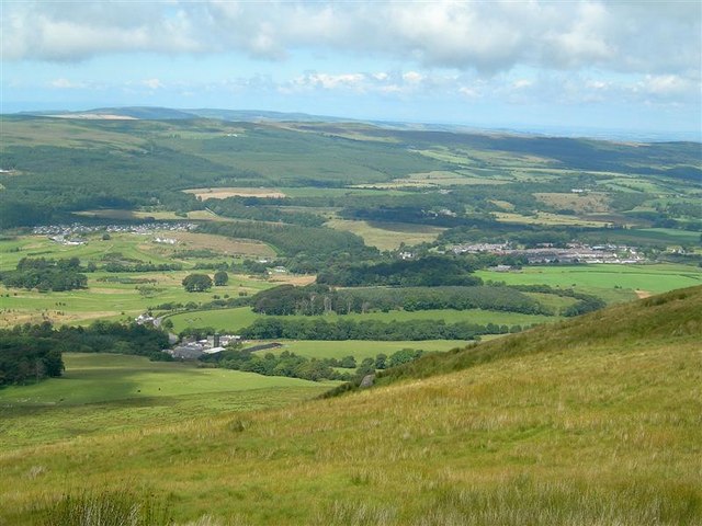
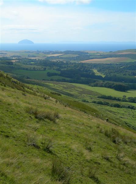
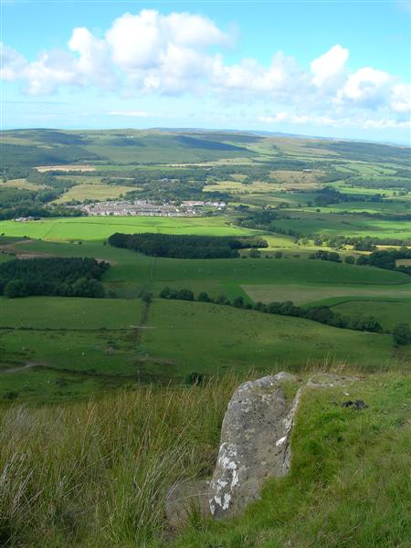
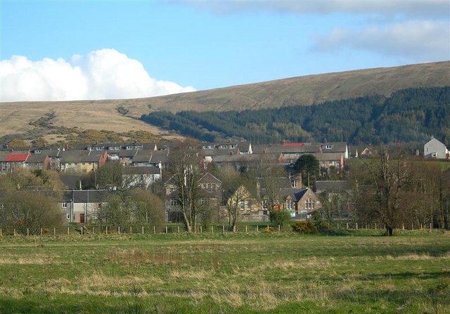
Kibbert Wood is a sprawling forest located in Ayrshire, Scotland. Covering an area of approximately 500 acres, it is a natural haven for wildlife and a popular destination for nature enthusiasts. The wood is situated near the village of Kibberton, which lends its name to this magnificent woodland.

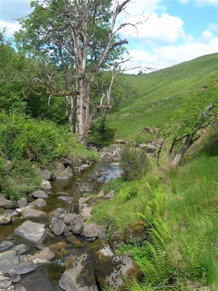
The wood boasts a diverse range of tree species, including oak, birch, and beech, creating a rich and vibrant ecosystem. The dense foliage and towering canopies provide a sheltered habitat for a variety of bird species, such as woodpeckers, owls, and thrushes. Additionally, the forest floor is teeming with wildlife, including foxes, badgers, and deer.

The wood is crisscrossed with a network of well-maintained trails, allowing visitors to explore its serene beauty on foot or by bicycle. These trails lead visitors through the heart of the wood, offering breathtaking views of the lush surroundings and allowing for peaceful moments of solitude amongst nature.

Kibbert Wood also offers several designated picnic spots and rest areas, where visitors can take a break and enjoy a packed lunch amidst the tranquility of the forest. Furthermore, the wood is equipped with informative signposts that provide details about the various tree species and highlight points of interest along the trails.

Overall, Kibbert Wood is a cherished natural gem in Ayrshire, offering a peaceful retreat for those seeking solace in nature. With its diverse wildlife, scenic trails, and serene ambiance, it is a must-visit destination for anyone exploring the beauty of Scotland's woodlands.

If you have any feedback on the listing, please let us know in the comments section below.

Kibbert Wood Images

Images are sourced within 2km of 55.271371/-4.7120439 or Grid Reference NS2700. Thanks to Geograph Open Source API. All images are credited.

Hadyard Hill (Summit) 360 Panorama This photo was taken back in Feb.2004 before the Windfarm was constructed in the same area, Centre of picture is due North, Penwhapple Reservoir can be seen to the left of the picture.
Hadyard Hill (Summit) 360 Panorama
This photo was taken back in Feb.2004 before the Windfarm was constructed in the same area, Centre of picture is due North, Penwhapple Reservoir can be seen to the left of the picture.
View From Craig Hill Looking from the rough grazing slopes of Craig Hill back down towards Delamford Farm.
View From Craig Hill
Looking from the rough grazing slopes of Craig Hill back down towards Delamford Farm.
The Start of the Southern Uplands Looking along the hilltop between Maxwellston and Hadyard Hills. These hills mark the edge of Central Lowlands and the Southern Uplands of Scotland. The Southern Uplands Boundary Fault lies roughly between Girvan and Dunbar. For an updated view, see <a href="https://www.geograph.org.uk/photo/6545968">NX2699 : Heading for Hadyard Hill</a>
The Start of the Southern Uplands
Looking along the hilltop between Maxwellston and Hadyard Hills. These hills mark the edge of Central Lowlands and the Southern Uplands of Scotland. The Southern Uplands Boundary Fault lies roughly between Girvan and Dunbar. For an updated view, see NX2699 : Heading for Hadyard Hill
The Edge of Hadyard Hill Hadyard Hill marks the edge of the Central Lowlands and the Southern Uplands of Scotland along the lower section of the Girvan Valley.  The Southern Uplands Boundary Fault lies roughly between Girvan and Dunbar.  This view shows the upper part of the hill edge, above the very steep lower part close to the valley.
The Edge of Hadyard Hill
Hadyard Hill marks the edge of the Central Lowlands and the Southern Uplands of Scotland along the lower section of the Girvan Valley. The Southern Uplands Boundary Fault lies roughly between Girvan and Dunbar. This view shows the upper part of the hill edge, above the very steep lower part close to the valley.
From Craig Hill Looking from the upper slopes of Craig Hill towards Knockrochar and Dobbingstone Farms on a fine July afternoon.
From Craig Hill
Looking from the upper slopes of Craig Hill towards Knockrochar and Dobbingstone Farms on a fine July afternoon.
Girvan Valley From Craig Hill Looking up the Girvan Valley, showing the wooded slopes of Craigfin Hill in the distance.
Girvan Valley From Craig Hill
Looking up the Girvan Valley, showing the wooded slopes of Craigfin Hill in the distance.
Sheep on Craig Hill A lamb and a recently clipped ewe on Craig Hill, with turbines on Delamford Hill in the background.
Sheep on Craig Hill
A lamb and a recently clipped ewe on Craig Hill, with turbines on Delamford Hill in the background.
Girvan Valley View Looking north across the Girvan Valley from the saddle between Maxwellston and Hadyard Hills.  In the background, from the left - Brunstane Castle Golf Course, Maxwellston Farm, and the village of Dailly. For an updated view, see <a href="https://www.geograph.org.uk/photo/6545963">NX2699 : The Girvan Valley viewed again</a>
Girvan Valley View
Looking north across the Girvan Valley from the saddle between Maxwellston and Hadyard Hills. In the background, from the left - Brunstane Castle Golf Course, Maxwellston Farm, and the village of Dailly. For an updated view, see NX2699 : The Girvan Valley viewed again
Hadyard Hill Slope The steep slope of Hadyard Hill, overlooking the Girvan Valley.  In the background - the Firth of Clyde, Ailsa Craig and Arran. For an updated view taken from the shoulder of the hill, see <a href="https://www.geograph.org.uk/photo/6545979">NX2799 : Hadyard Hill view</a>
Hadyard Hill Slope
The steep slope of Hadyard Hill, overlooking the Girvan Valley. In the background - the Firth of Clyde, Ailsa Craig and Arran. For an updated view taken from the shoulder of the hill, see NX2799 : Hadyard Hill view
From Hadyard Hill Looking down towards Dailly and the Girvan Valley.
From Hadyard Hill
Looking down towards Dailly and the Girvan Valley.
Delamford Burn The water level is unusually low, due to a lengthy spell of dry spring weather.
Delamford Burn
The water level is unusually low, due to a lengthy spell of dry spring weather.
Delamford The road from Dailly to Barr.
Delamford
The road from Dailly to Barr.
The Girvan Valley viewed again The Girvan Valley viewed from Maxwellston Hill on the edge of the Southern Uplands. From the left, there’s the Holiday Village, then Maxwellston Farm tucked away at the foot of the steep slope and then the village of Dailly.
The Girvan Valley viewed again
The Girvan Valley viewed from Maxwellston Hill on the edge of the Southern Uplands. From the left, there’s the Holiday Village, then Maxwellston Farm tucked away at the foot of the steep slope and then the village of Dailly.
Heading for Hadyard Hill Heading for Hadyard Hill on the edge of the Southern Uplands, showing a marked difference in landscape from the farmland of the Central Lowlands.
Heading for Hadyard Hill
Heading for Hadyard Hill on the edge of the Southern Uplands, showing a marked difference in landscape from the farmland of the Central Lowlands.
Towards the Firth of Clyde from Maxwellston Hill Looking towards the Firth of Clyde from the edge of Maxwellston Hill showing Grangestone Industrial Estate and, on the far right, Killochan Castle. Ailsa Craig and the island of Arran provide an attractive background.
Towards the Firth of Clyde from Maxwellston Hill
Looking towards the Firth of Clyde from the edge of Maxwellston Hill showing Grangestone Industrial Estate and, on the far right, Killochan Castle. Ailsa Craig and the island of Arran provide an attractive background.
From the slopes of Maxwellston Hill Looking towards the Firth of Clyde from the edge of Maxwellston Hill. From the left, it’s some of the turbines of the Hadyard Hill wind farm, then a more distant Brae Hill with its comms masts, then the northern edge of Girvan, followed by Grangestone Industrial Estate and Killochan Castle on the far right. Ailsa Craig  provides an attractive background.
From the slopes of Maxwellston Hill
Looking towards the Firth of Clyde from the edge of Maxwellston Hill. From the left, it’s some of the turbines of the Hadyard Hill wind farm, then a more distant Brae Hill with its comms masts, then the northern edge of Girvan, followed by Grangestone Industrial Estate and Killochan Castle on the far right. Ailsa Craig provides an attractive background.
Hadyard Hill view Looking towards the Firth of Clyde from Hadyard Hill on the edge of the Southern Uplands. This viewpoint is available from the shoulder of the hills, not from the footpath which runs at a higher level. This is where the valley opens out to show the arable fields that take advantage of Girvan’s good sunshine record in an otherwise wet part of Carrick.
Hadyard Hill view
Looking towards the Firth of Clyde from Hadyard Hill on the edge of the Southern Uplands. This viewpoint is available from the shoulder of the hills, not from the footpath which runs at a higher level. This is where the valley opens out to show the arable fields that take advantage of Girvan’s good sunshine record in an otherwise wet part of Carrick.
Towards Dailly Looking from Hadyard Hill on the edge of the Southern Uplands towards the village of Dailly, in the Central Lowlands. Hadyard Hill makes a prominent feature, rising sharply from the valley. The Southern Uplands Boundary Fault lies roughly between Girvan and Dunbar.
Towards Dailly
Looking from Hadyard Hill on the edge of the Southern Uplands towards the village of Dailly, in the Central Lowlands. Hadyard Hill makes a prominent feature, rising sharply from the valley. The Southern Uplands Boundary Fault lies roughly between Girvan and Dunbar.
Show me another place!

Kibbert Wood is located at Grid Ref: NS2700 (Lat: 55.271371, Lng: -4.7120439)

Unitary Authority: South Ayrshire

Police Authority: Ayrshire

What 3 Words

///foam.trophy.bedding. Near Girvan, South Ayrshire

Nearby Locations

Wet Wood Kibbert Wood

Related Wikis

Dailly

Dailly (Scottish Gaelic: Dail Mhaol Chiarain) is a village in South Ayrshire, Scotland. It is located on the Water of Girvan, five miles (eight kilometres...

Dalquharran Castle

Dalquharran Castle is a category A listed building in South Ayrshire, Scotland, designed by Robert Adam and completed around 1790. The first recorded lord...

South Ayrshire

South Ayrshire (Scots: Sooth Ayrshire; Scottish Gaelic: Siorrachd Àir a Deas, pronounced [ˈʃirˠəxk aːɾʲ ə ˈtʲes̪]) is one of thirty-two council areas of...

Dailly railway station

Dailly railway station served the village of Dailly, South Ayrshire, Scotland, from 1860 to 1965 on the Maybole and Girvan Railway. == History == The station...

Related Videos

Ayr & District Rambling Club, Barony Hill, Dailly, Jan 29th 2023

It stays dry and mild as we head to Dailly for a walk up to Barony Hill.

Take A Hike, Kilgrammie Trail and Bargany Gardens , Dailly, May 9th 2023

Due to ongoing knee injury I was unable to do the Merrick. So i joined up with the other part of Take A Hike as we walked from ...

Nearby Amenities

Located within 500m of 55.271371,-4.7120439
Power: pole
Lat/Long: 55.2756468/-4.7121586
Power: pole
Lat/Long: 55.2751062/-4.7109734
Power: pole
Lat/Long: 55.2758189/-4.7112473
Power: pole
Lat/Long: 55.2716727/-4.7194771
Power: pole
Lat/Long: 55.2713028/-4.7180512
Power: pole
Lat/Long: 55.2710124/-4.7169322
Power: pole
Lat/Long: 55.2707165/-4.715806
Power: pole
Lat/Long: 55.2704085/-4.7146233
Power: pole
Lat/Long: 55.26997/-4.7129542
Power: pole
Lat/Long: 55.2696392/-4.7116415
Power: pole
Lat/Long: 55.2692975/-4.7103195
Power: pole
Lat/Long: 55.2689909/-4.7091627
Power: pole
Lat/Long: 55.2686681/-4.7079091
Power: pole
Lat/Long: 55.2683695/-4.7067735
Power: pole
Lat/Long: 55.2707165/-4.7177514
Power: pole
Lat/Long: 55.2700628/-4.717402
Power: pole
Lat/Long: 55.269393/-4.7170785
Power: pole
Lat/Long: 55.2687676/-4.7167598
Power: pole
Lat/Long: 55.2680574/-4.7163962
The data included in this document is from www.openstreetmap.org. The data is made available under ODbL.

Have you been to Kibbert Wood?

Leave your review of Kibbert Wood below (or comments, questions and feedback).