Burninghill Wood

Wood, Forest in Ayrshire

Scotland

Burninghill Wood

Kirk Hill View up the Girvan water from the summit of Kirk Hill (259m)
Kirk Hill Credit: Richard Webb

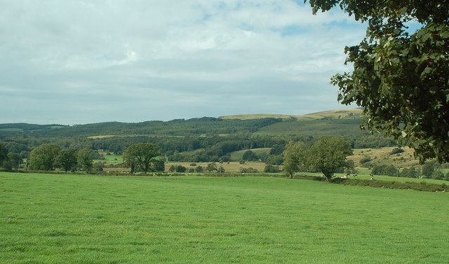
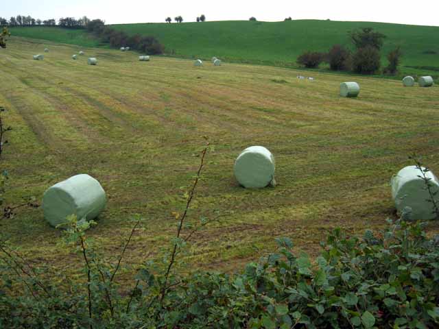
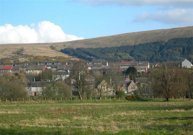
Burninghill Wood is a picturesque woodland located in Ayrshire, Scotland. Spanning over 100 acres, it is a popular destination for nature enthusiasts and outdoor lovers. The wood is situated near the town of Ayr and is easily accessible by road, making it a convenient getaway for locals and tourists alike.

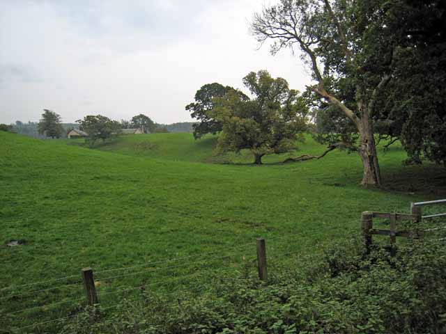
The woodland is characterized by its diverse range of flora and fauna, providing a haven for a variety of wildlife species. The towering oak and beech trees dominate the landscape, creating a dense canopy that offers shade and shelter. Other tree varieties, such as birch and rowan, can also be found scattered throughout the wood.

Walking trails meander through the forest, allowing visitors to explore its natural beauty at their own pace. These paths lead to charming spots like tranquil ponds, babbling brooks, and open clearings, providing opportunities for relaxation and wildlife observation. Birdwatchers will be delighted by the numerous species that call Burninghill Wood home, including woodpeckers, owls, and various songbirds.

Burninghill Wood is a designated Site of Special Scientific Interest (SSSI) due to its ecological significance. The wood has a rich history, with evidence of human activity dating back centuries. Today, it is managed by the local authorities, who strive to maintain its delicate balance of conservation and public access.

Overall, Burninghill Wood is a natural gem in Ayrshire, offering an escape from the hustle and bustle of everyday life. Whether one seeks a peaceful walk, a chance to connect with nature, or a glimpse into the region's history, this woodland provides a truly enchanting experience.

If you have any feedback on the listing, please let us know in the comments section below.

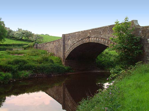
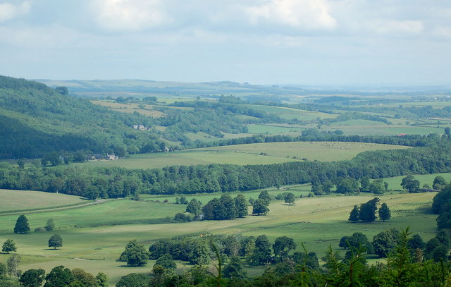
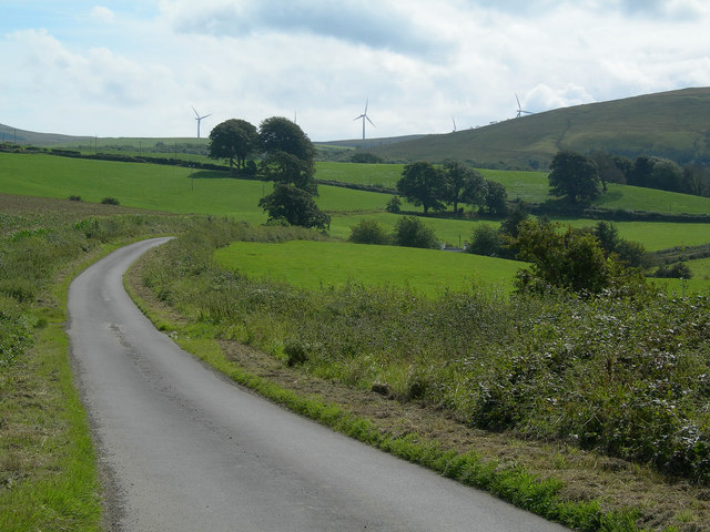
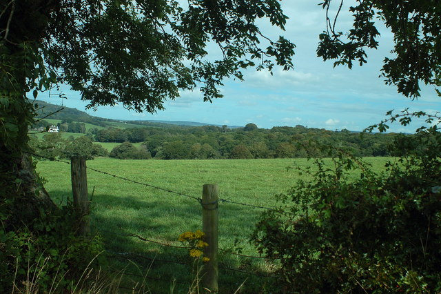
Burninghill Wood Images

Images are sourced within 2km of 55.293226/-4.7139607 or Grid Reference NS2703. Thanks to Geograph Open Source API. All images are credited.

Kirk Hill View up the Girvan water from the summit of Kirk Hill (259m)
Kirk Hill
View up the Girvan water from the summit of Kirk Hill (259m)
Dailly Parish Church and War Memorial
Dalquharran Castle
Dalquharran Castle
Poundland Wood Lane through Poundland Wood, near Dailly
Poundland Wood
Lane through Poundland Wood, near Dailly
Dailly bridge This remarkable bridge in the village of Dailly in south Ayrshire spans the Water of Girvan, and lies at the very heart of the remarkable Dailly Community Paths and Sculptures Project. The bridge was opened in April, 2002 and reconnects the village to the north side of the river for the first time in 50 years. The delicate tracery of the balustrades and arches perfectly complements the woodland setting. <span class="nowrap"><a title="http://www.rsa.org.uk/afanew/snapshots/Region/Details.asp?SnapShotID=1" rel="nofollow ugc noopener" href="http://www.rsa.org.uk/afanew/snapshots/Region/Details.asp?SnapShotID=1">Link</a><img style="margin-left:2px;" alt="External link" title="External link - shift click to open in new window" src="https://s1.geograph.org.uk/img/external.png" width="10" height="10"/></span> <span class="nowrap"><a title="http://www.lunemillenniumbridge.info/Dailly.html" rel="nofollow ugc noopener" href="http://www.lunemillenniumbridge.info/Dailly.html">Link</a><img style="margin-left:2px;" alt="External link" title="External link - shift click to open in new window" src="https://s1.geograph.org.uk/img/external.png" width="10" height="10"/></span>
Dailly bridge
This remarkable bridge in the village of Dailly in south Ayrshire spans the Water of Girvan, and lies at the very heart of the remarkable Dailly Community Paths and Sculptures Project. The bridge was opened in April, 2002 and reconnects the village to the north side of the river for the first time in 50 years. The delicate tracery of the balustrades and arches perfectly complements the woodland setting. LinkExternal link LinkExternal link
Dailly Bridge This remarkable bridge in the village of Dailly in south Ayrshire spans the Water of Girvan, and lies at the very heart of the remarkable Dailly Community Paths and Sculptures Project. The bridge was opened in April, 2002 and reconnects the village to the north side of the river for the first time in 50 years. The delicate tracery of the balustrades and arches perfectly complements the woodland setting. <span class="nowrap"><a title="http://www.rsa.org.uk/afanew/snapshots/Region/Details.asp?SnapShotID=1" rel="nofollow ugc noopener" href="http://www.rsa.org.uk/afanew/snapshots/Region/Details.asp?SnapShotID=1">Link</a><img style="margin-left:2px;" alt="External link" title="External link - shift click to open in new window" src="https://s1.geograph.org.uk/img/external.png" width="10" height="10"/></span> <span class="nowrap"><a title="http://www.lunemillenniumbridge.info/Dailly.html" rel="nofollow ugc noopener" href="http://www.lunemillenniumbridge.info/Dailly.html">Link</a><img style="margin-left:2px;" alt="External link" title="External link - shift click to open in new window" src="https://s1.geograph.org.uk/img/external.png" width="10" height="10"/></span>
Dailly Bridge
This remarkable bridge in the village of Dailly in south Ayrshire spans the Water of Girvan, and lies at the very heart of the remarkable Dailly Community Paths and Sculptures Project. The bridge was opened in April, 2002 and reconnects the village to the north side of the river for the first time in 50 years. The delicate tracery of the balustrades and arches perfectly complements the woodland setting. LinkExternal link LinkExternal link
Aird Bridge Crossing the Water of Girvan and a haven for the midges!
Aird Bridge
Crossing the Water of Girvan and a haven for the midges!
Kilkerran estate Looking north over River Girvan valley from Glengee Wood
Kilkerran estate
Looking north over River Girvan valley from Glengee Wood
Towards Lindsayston The minor road from the B741 towards Lindsayston, with the new wind turbines on the skyline.
Towards Lindsayston
The minor road from the B741 towards Lindsayston, with the new wind turbines on the skyline.
The Girvan valley near Moorston Farm Looking down into the Girvan valley from just east of Moorston
The Girvan valley near Moorston Farm
Looking down into the Girvan valley from just east of Moorston
Girvan valley near Moorston Farm Looking west into River Girvan floodplain from just east of Moorston Farm.
Girvan valley near Moorston Farm
Looking west into River Girvan floodplain from just east of Moorston Farm.
Disused building at Mains of Dalquharran Possibly an old military building from WWII?
Disused building at Mains of Dalquharran
Possibly an old military building from WWII?
New building at Wallacetown
Bales at Poundland
Bales at Poundland
Fields near Wallacetown
In the Girvan valley Maitland Farm can be seen in the distance. Viewed from the B741 Girvan to Maybole road.
In the Girvan valley
Maitland Farm can be seen in the distance. Viewed from the B741 Girvan to Maybole road.
Aird Bridge over the River Girvan On the B741, Girvan to Maybole road.
Aird Bridge over the River Girvan
On the B741, Girvan to Maybole road.
Railway bridge near Dailly The Ayr to Girvan line passes over a minor road just north of Dailly.
Railway bridge near Dailly
The Ayr to Girvan line passes over a minor road just north of Dailly.
Show me another place!

Burninghill Wood is located at Grid Ref: NS2703 (Lat: 55.293226, Lng: -4.7139607)

Unitary Authority: South Ayrshire

Police Authority: Ayrshire

What 3 Words

///caskets.unless.binds. Near Maybole, South Ayrshire

Related Wikis

Dalquharran Castle

Dalquharran Castle is a category A listed building in South Ayrshire, Scotland, designed by Robert Adam and completed around 1790. The first recorded lord...

South Ayrshire

South Ayrshire (Scots: Sooth Ayrshire; Scottish Gaelic: Siorrachd Àir a Deas, pronounced [ˈʃirˠəxk aːɾʲ ə ˈtʲes̪]) is one of thirty-two council areas of...

Dailly railway station

Dailly railway station served the village of Dailly, South Ayrshire, Scotland, from 1860 to 1965 on the Maybole and Girvan Railway. == History == The station...

Dailly

Dailly (Scottish Gaelic: Dail Mhaol Chiarain) is a village in South Ayrshire, Scotland. It is located on the Water of Girvan, five miles (eight kilometres...

Nearby Amenities

Located within 500m of 55.293226,-4.7139607
Turning Loop
Lat/Long: 55.291057/-4.7145666
Wallacetown
Place: hamlet
Lat/Long: 55.2918432/-4.7139265
Power: pole
Lat/Long: 55.2914732/-4.7070368
Power: pole
Lat/Long: 55.2917811/-4.7070887
Power: pole
Lat/Long: 55.2922099/-4.7071666
Power: pole
Lat/Long: 55.2928833/-4.7065174
Power: pole
Lat/Long: 55.2933565/-4.7068337
Power: pole
Lat/Long: 55.2938068/-4.7071288
Power: pole
Lat/Long: 55.2942584/-4.7074287
Power: pole
Lat/Long: 55.2950636/-4.7076317
Power: pole
Lat/Long: 55.2957652/-4.7078017
Power: pole
Lat/Long: 55.2920459/-4.7082644
Power: pole
Lat/Long: 55.2918752/-4.7093716
Power: pole
Lat/Long: 55.2916937/-4.7105284
Power: pole
Lat/Long: 55.2915257/-4.7115908
Power: pole
Lat/Long: 55.2913549/-4.712665
The data included in this document is from www.openstreetmap.org. The data is made available under ODbL.

Have you been to Burninghill Wood?

Leave your review of Burninghill Wood below (or comments, questions and feedback).