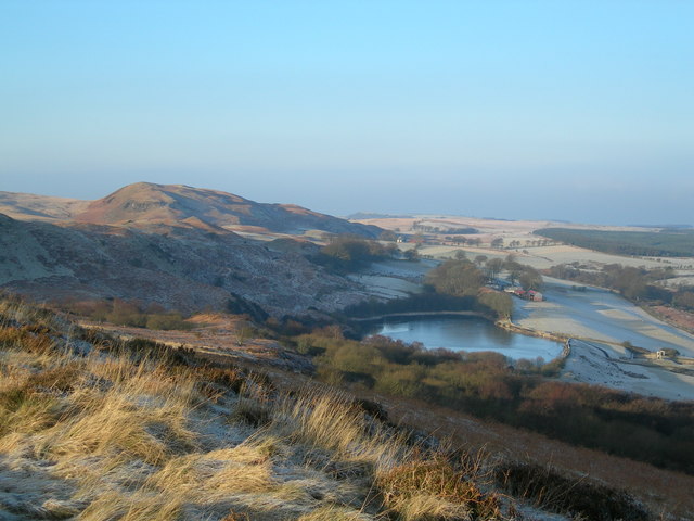
Crostonhill Moor

Wood, Forest in Ayrshire

Scotland

Crostonhill Moor

Crossraguel Abbey Built in 1214 with funds provided by Lord Duncan.
Crossraguel Abbey Credit: James Hearton

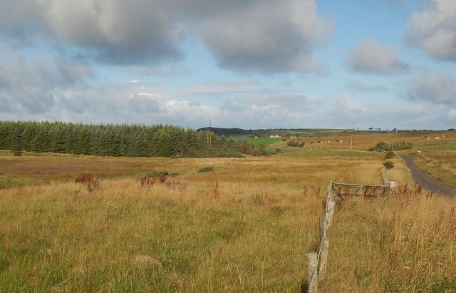
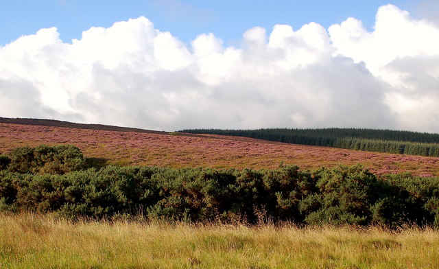
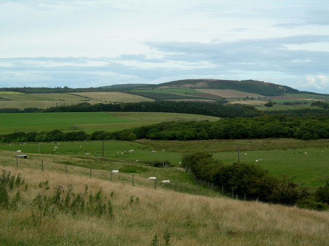
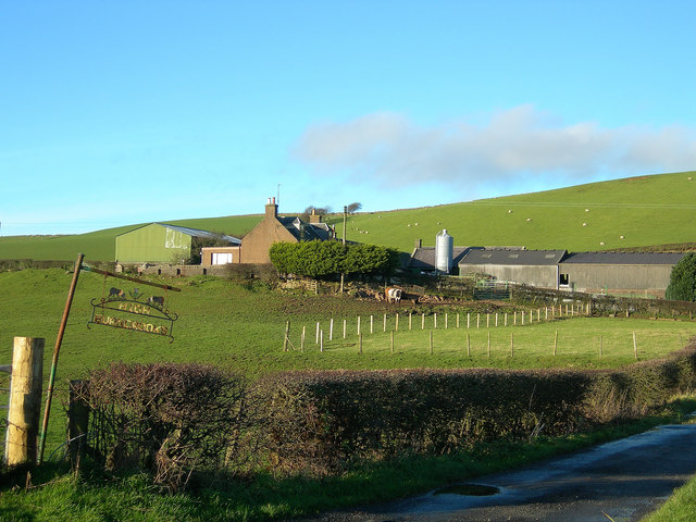
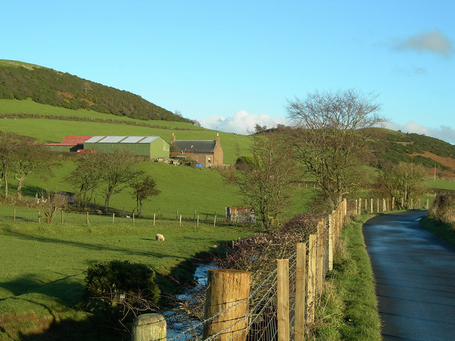
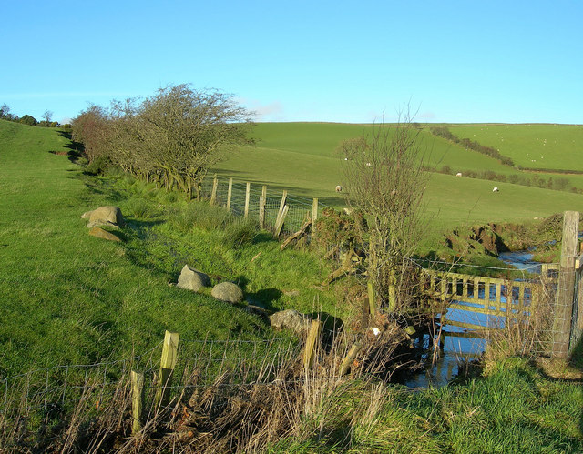
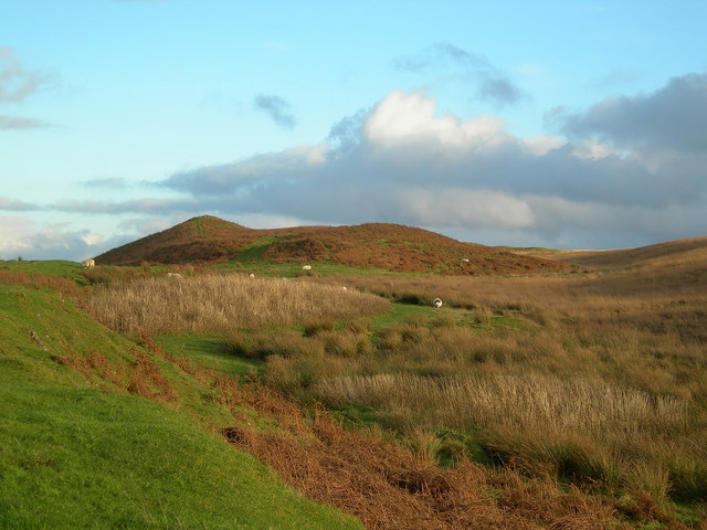
Crostonhill Moor is a picturesque woodland located in Ayrshire, Scotland. Covering an area of approximately 200 hectares, it is a prominent natural attraction in the region. The moor is situated near the village of Crostonhill and is surrounded by rolling hills and scenic landscapes.

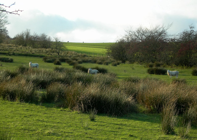
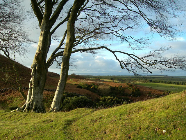
The woodland is primarily composed of native trees such as oak, birch, and rowan, creating a diverse and vibrant ecosystem. It is home to a wide range of wildlife, including various bird species, small mammals, and insects. Visitors to Crostonhill Moor can often spot red squirrels, roe deer, and numerous bird species like woodpeckers and owls.

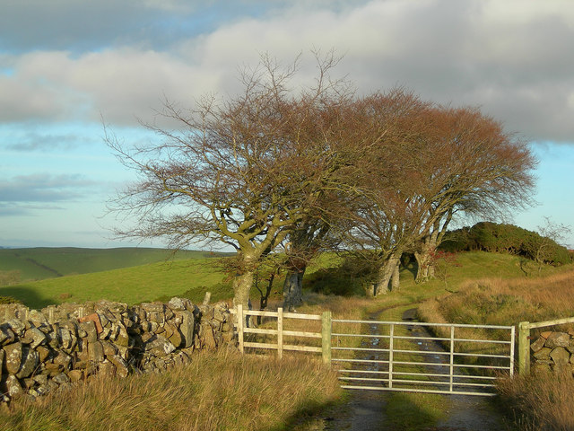
The moor offers several well-maintained walking trails, allowing visitors to explore and immerse themselves in the tranquil beauty of the natural surroundings. These paths provide opportunities for both leisurely strolls and more challenging hikes, catering to individuals of all fitness levels.

Additionally, Crostonhill Moor boasts a rich historical background. It is believed that the woodland has been present for centuries, with evidence of human activity dating back to prehistoric times. Archaeological discoveries, including ancient stone tools and pottery shards, have been unearthed in the area.

Overall, Crostonhill Moor in Ayrshire is a sublime destination for nature enthusiasts and history buffs alike. Its breathtaking scenery, diverse wildlife, and historical significance make it a must-visit location for anyone seeking a peaceful retreat in the heart of Scotland.

If you have any feedback on the listing, please let us know in the comments section below.

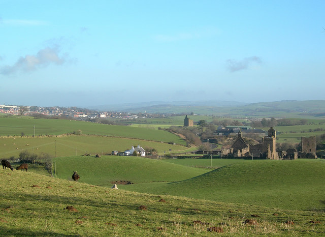
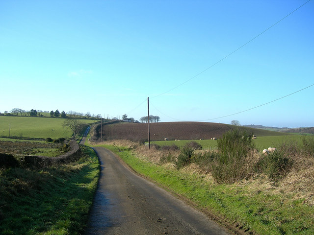
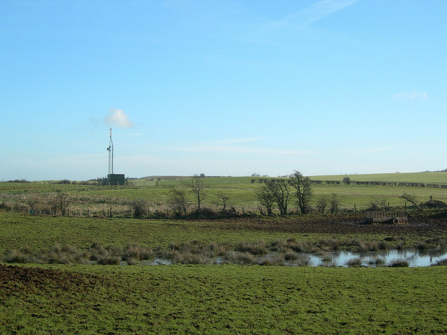
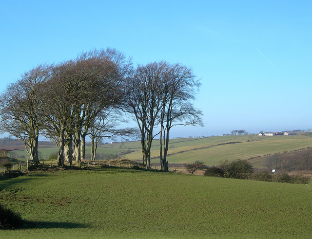
Crostonhill Moor Images

Images are sourced within 2km of 55.321576/-4.7253418 or Grid Reference NS2706. Thanks to Geograph Open Source API. All images are credited.

Crossraguel Abbey Built in 1214 with funds provided by Lord Duncan.
Crossraguel Abbey
Built in 1214 with funds provided by Lord Duncan.
Craigens Wood Craigens Wood (on left) with Hallowshean in distance
Craigens Wood
Craigens Wood (on left) with Hallowshean in distance
Craigens Wood and Kirk Hill Remnant heather moorland on lower slopes of Kirk Hill with Craigens Wood on right
Craigens Wood and Kirk Hill
Remnant heather moorland on lower slopes of Kirk Hill with Craigens Wood on right
View towards Mochrum Hill Mixed farmland and woodland from the minor road to Kirkoswald with Mochrum Hill in the background.
View towards Mochrum Hill
Mixed farmland and woodland from the minor road to Kirkoswald with Mochrum Hill in the background.
High Burncrooks Farm Located on the southern slopes of Knockbrake Hill.
High Burncrooks Farm
Located on the southern slopes of Knockbrake Hill.
High Burncrooks The hills in the background are Knockbrake, on the left and Kildoon, on the right.
High Burncrooks
The hills in the background are Knockbrake, on the left and Kildoon, on the right.
Water gate Between Altewan and High Burncrooks.
Water gate
Between Altewan and High Burncrooks.
Sheep on Rough Grazing
Towards Craigfin Hill Looking east from the Craigdow Farm track.
Towards Craigfin Hill
Looking east from the Craigdow Farm track.
Towards Craigdow Farm Looking through the windswept beech trees towards Craigdow Farm on a fine November afternoon.
Towards Craigdow Farm
Looking through the windswept beech trees towards Craigdow Farm on a fine November afternoon.
The Craigdow track A fine stand of windswept beech trees on the road to Craigdow Farm.
The Craigdow track
A fine stand of windswept beech trees on the road to Craigdow Farm.
Crossraguel View The photo shows the ruins of Crossraguel Abbey in the foreground, Baltersan Castle in the middle distance, and Maybole in the background.
Crossraguel View
The photo shows the ruins of Crossraguel Abbey in the foreground, Baltersan Castle in the middle distance, and Maybole in the background.
Country Road
Country Road
Communications Mast
Communications Mast
Winter View Looking through a stand of beech trees on a fine February day.  Birniehill Farm is on the skyline, on the right.
Winter View
Looking through a stand of beech trees on a fine February day. Birniehill Farm is on the skyline, on the right.
Doocot at Crossraguel The circular conical building in the foreground is a two-storey pigeon house, with the remaining ruins of Crossraguel Abbey in the background.
Doocot at Crossraguel
The circular conical building in the foreground is a two-storey pigeon house, with the remaining ruins of Crossraguel Abbey in the background.
Wood near Leffinwyne Forestry and arable land, east of Leffinwyne farm.
Wood near Leffinwyne
Forestry and arable land, east of Leffinwyne farm.
Show me another place!

Crostonhill Moor is located at Grid Ref: NS2706 (Lat: 55.321576, Lng: -4.7253418)

Unitary Authority: South Ayrshire

Police Authority: Ayrshire

What 3 Words

///swordfish.crunchy.tweezers. Near Maybole, South Ayrshire

Related Wikis

Lochspouts

Lochspouts Loch (NS 2885 0586) or Lochspouts was situated in a hollow, surrounded by hilly ground on three sides and bounded by a narrow trap dyke to the...
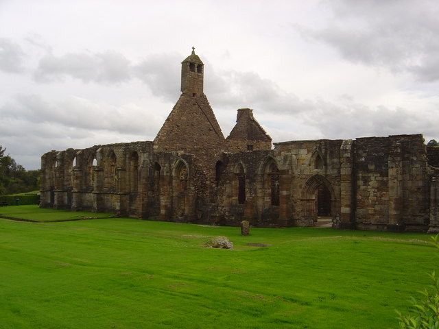
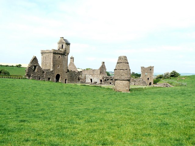
Crossraguel Abbey

The Abbey of Saint Mary of Crossraguel is a ruin of a former abbey near the town of Maybole, South Ayrshire, Scotland. Although it is a ruin, visitors...

Baltersan Castle

Baltersan Castle is a ruined L-plan tower house located near Maybole, South Ayrshire, Scotland. It was originally graded as a Category B listed building...

Kirkoswald, South Ayrshire

Kirkoswald (Scots: Kirkossald) is a village and parish in the Carrick district of Ayrshire, Scotland, 1+3⁄4 miles (3 kilometres) from the coast and four...

Nearby Amenities

Located within 500m of 55.321576,-4.7253418
Power: pole
Lat/Long: 55.3217463/-4.7321489
Power: pole
Lat/Long: 55.3227138/-4.7304564
Power: pole
Lat/Long: 55.3231793/-4.7296169
Power: pole
Lat/Long: 55.3236401/-4.728772
Power: pole
Lat/Long: 55.3241071/-4.7279137
Power: pole
Lat/Long: 55.3245275/-4.7271841
Power: pole
Lat/Long: 55.3251074/-4.726248
The data included in this document is from www.openstreetmap.org. The data is made available under ODbL.

Have you been to Crostonhill Moor?

Leave your review of Crostonhill Moor below (or comments, questions and feedback).