Affric Forest

Wood, Forest in Inverness-shire

Scotland

Affric Forest

View over Loch an Eang A small loch in the Caledonian forest, above Glen Affric. It is surrounded by Scots pine trees.

A similar view from 2005: <a href="https://www.geograph.org.uk/photo/864819">NH2423 : Loch an Eang</a>
View over Loch an Eang Credit: Craig Wallace

Affric Forest, located in Inverness-shire, Scotland, is a breathtaking woodland area that covers a vast expanse of approximately 36,000 acres. It lies within the larger Glen Affric National Nature Reserve, renowned for its outstanding natural beauty and diverse ecosystem. The forest is situated about 15 miles west of the town of Cannich, making it easily accessible to visitors.

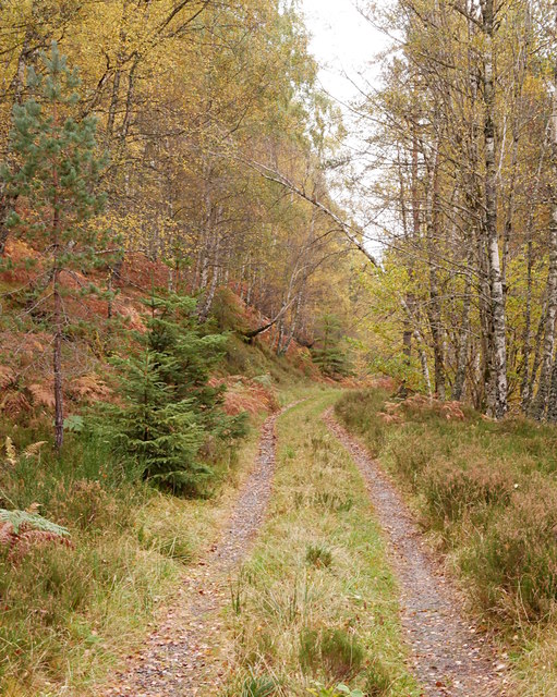
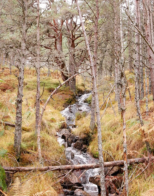
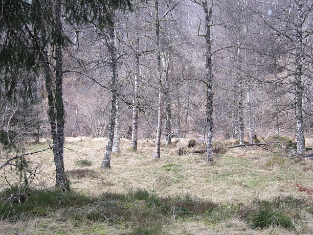
Affric Forest boasts a remarkable variety of trees, including Caledonian pines, birches, rowans, and aspens, which create a stunning tapestry of colors throughout the seasons. These ancient Caledonian pinewoods are of significant ecological importance, showcasing a unique and diverse range of plant and animal species. The forest is also home to several rare and protected species, such as capercaillie birds and red squirrels.

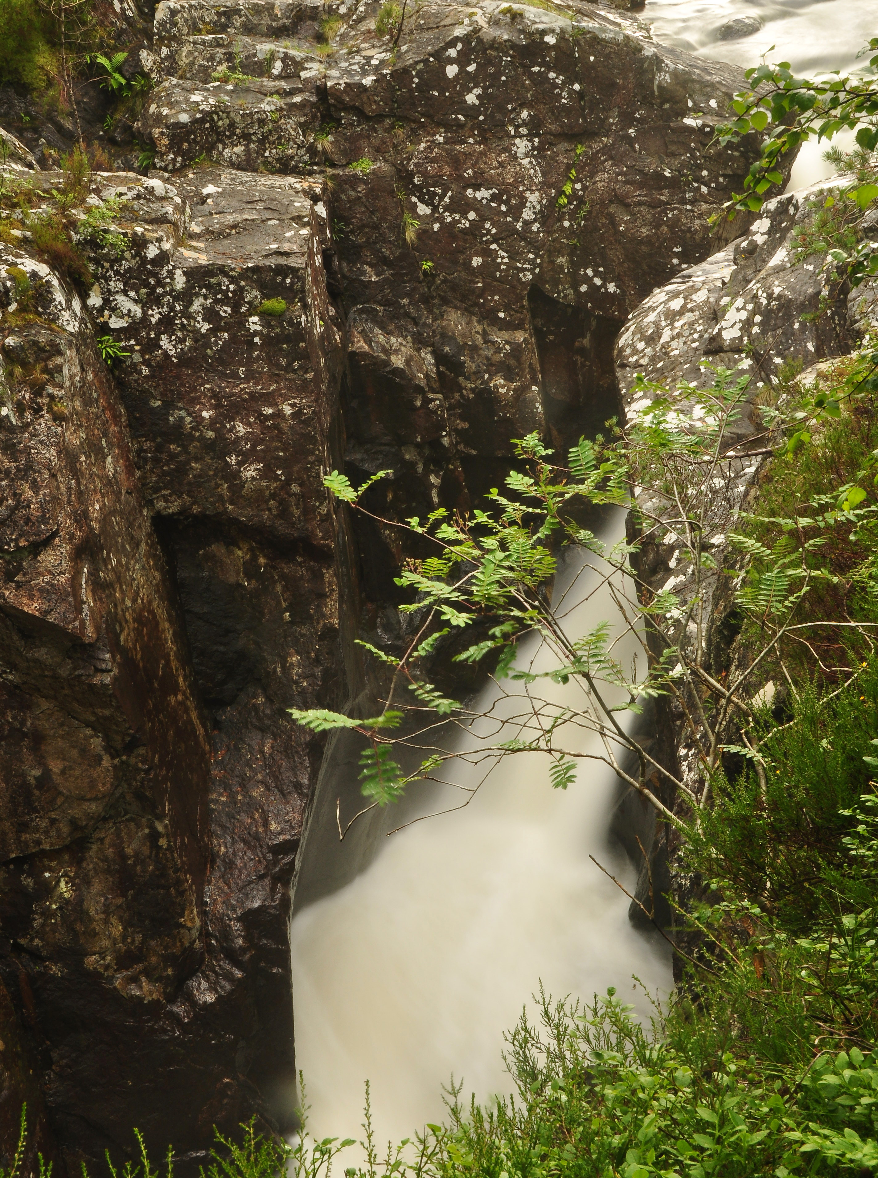
Visitors to Affric Forest can explore a network of well-maintained trails, providing opportunities for walking, hiking, and cycling. The popular Affric Kintail Way, a long-distance footpath, passes through the forest, offering stunning views of Loch Beinn a' Mheadhoin and the surrounding mountains. Additionally, there are several viewpoints and picnic areas scattered throughout the forest, allowing visitors to immerse themselves in the tranquility and natural splendor of the area.

Affric Forest is not only a haven for nature enthusiasts but also a place of cultural significance. The forest is deeply rooted in Scottish history and folklore, with ancient ruins and standing stones scattered throughout its grounds.

Overall, Affric Forest in Inverness-shire is a captivating destination that offers a rich tapestry of natural beauty, biodiversity, and cultural significance, making it a must-visit location for those seeking an immersive and memorable outdoor experience.

If you have any feedback on the listing, please let us know in the comments section below.

Affric Forest Images

Images are sourced within 2km of 57.269407/-4.892567 or Grid Reference NH2523. Thanks to Geograph Open Source API. All images are credited.

View over Loch an Eang A small loch in the Caledonian forest, above Glen Affric. It is surrounded by Scots pine trees.

A similar view from 2005: <a href="https://www.geograph.org.uk/photo/864819">NH2423 : Loch an Eang</a>
View over Loch an Eang
A small loch in the Caledonian forest, above Glen Affric. It is surrounded by Scots pine trees. A similar view from 2005: NH2423 : Loch an Eang
Forest track, Coille an Leth-uillt This track runs up through the forest from Knockfin, heading towards Loch an Eang.
A variety of trees - plenty of  birch, as well as some Scots pine, and a few Sitka spruce and larch.
Forest track, Coille an Leth-uillt
This track runs up through the forest from Knockfin, heading towards Loch an Eang. A variety of trees - plenty of birch, as well as some Scots pine, and a few Sitka spruce and larch.
Woodland stream, by Loch an Eang A small stream in the Caledonian forest. Flowing between Scots pine trees.
Woodland stream, by Loch an Eang
A small stream in the Caledonian forest. Flowing between Scots pine trees.
Woodland colours, by Coille an Leth-uillt A mixture of trees, starting to change colour. Plenty of birch and rowan, as well as conifers.
Woodland colours, by Coille an Leth-uillt
A mixture of trees, starting to change colour. Plenty of birch and rowan, as well as conifers.
Unsurfaced public road passing through Guisachan Forest Looking south-westward from near to Coille Mhòr.
Unsurfaced public road passing through Guisachan Forest
Looking south-westward from near to Coille Mhòr.
Unsurfaced public road passing through Guisachan Forest Looking south-westward towards Garve Bridge.
Unsurfaced public road passing through Guisachan Forest
Looking south-westward towards Garve Bridge.
Unsurfaced public road passing through Guisachan Forest Looking south-westward in the direction of Cougie.
Unsurfaced public road passing through Guisachan Forest
Looking south-westward in the direction of Cougie.
Unsurfaced public road passing through Guisachan Forest Looking north-eastward from near to Drochaid na Luib
Unsurfaced public road passing through Guisachan Forest
Looking north-eastward from near to Drochaid na Luib
Allt na Bodachan below Plodda Falls Another small cataract.
Allt na Bodachan below Plodda Falls
Another small cataract.
Douglas firs Big trees beside the Abhainn Dheabhag.
Douglas firs
Big trees beside the Abhainn Dheabhag.
Birch wood, Abhainn Dheabhag Woodland beside the river contrasting with the big Douglas firs which grow here.
Birch wood, Abhainn Dheabhag
Woodland beside the river contrasting with the big Douglas firs which grow here.
Forest road beside Abhainn Dheabhag Part of a waymarked path taking in the Plodda Falls. This woodland is dominated by several very large Douglas firs.
Forest road beside Abhainn Dheabhag
Part of a waymarked path taking in the Plodda Falls. This woodland is dominated by several very large Douglas firs.
Abhainn Deabhag A river at the head of Strathglass, here it flows through a deep gorge, where a tributary falls over the Plodda Falls.
Abhainn Deabhag
A river at the head of Strathglass, here it flows through a deep gorge, where a tributary falls over the Plodda Falls.
Ford, Abhainn Deabhag A track crosses the river where it leaves a deep gorge.
Ford, Abhainn Deabhag
A track crosses the river where it leaves a deep gorge.
Abhainn Deabhag A snow shower at the mouth of the gorge containing the Plodda Falls.
Abhainn Deabhag
A snow shower at the mouth of the gorge containing the Plodda Falls.
Woodland near Plodda Falls Forest at the head of Strath Glass, beside the Abhainn Deabhag.
Woodland near Plodda Falls
Forest at the head of Strath Glass, beside the Abhainn Deabhag.
Forgotten woodland to the SE of Beinn nan Sparra Pine woodland in very boggy ground. No evidence of any management resulting in many dead, fallen trees.
Forgotten woodland to the SE of Beinn nan Sparra
Pine woodland in very boggy ground. No evidence of any management resulting in many dead, fallen trees.
Clearing near Drochaid na Luib View into the woodland from the road to Cougie.
Clearing near Drochaid na Luib
View into the woodland from the road to Cougie.
Show me another place!

Affric Forest is located at Grid Ref: NH2523 (Lat: 57.269407, Lng: -4.892567)

Unitary Authority: Highland

Police Authority: Highlands and Islands

What 3 Words

///snowy.lyrics.afternoon. Near Cannich, Highland

Related Wikis

Plodda Falls

Plodda Falls (Gaelic: Eas Ploda) is a waterfall, situated 5 km south-west of the village of Tomich, near Glen Affric, in the Highlands of Scotland. The...

Guisachan Fall

Guisachan Fall is a waterfall of Scotland. Known locally as Home Falls, they are located near to the ruins of Guisachan House, and can be accessed by a...

Dog Falls, Glen Affric

Dog Falls (Gaelic: Eas a' Choin) is a series of waterfalls on the River Affric, in Glen Affric in the Highlands of Scotland. The falls are within the Glen...

Tomich (village)

Tomich (Scottish Gaelic: Tomaich) is a Victorian model conservation village situated in the Scottish Highlands at the western end of Strathglass, approximately...

Nearby Amenities

Located within 500m of 57.269407,-4.892567
Ford: yes
Lat/Long: 57.2701558/-4.8979275
The data included in this document is from www.openstreetmap.org. The data is made available under ODbL.

Have you been to Affric Forest?

Leave your review of Affric Forest below (or comments, questions and feedback).