Coille Achaidh Luachraich

Wood, Forest in Inverness-shire

Scotland

Coille Achaidh Luachraich

Tomdoun road junction in a blizzard
Tomdoun road junction in a blizzard Credit: Alan Reid

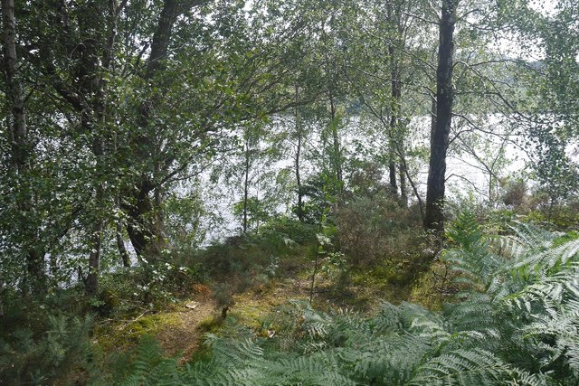
Coille Achaidh Luachraich is a beautiful forest located in Inverness-shire, Scotland. Covering a vast area of lush greenery, this woodland is a haven for nature lovers and outdoor enthusiasts. The forest is home to a diverse range of flora and fauna, including native Scottish species such as red deer, pine martens, and capercaillie birds.

Visitors to Coille Achaidh Luachraich can enjoy a variety of activities such as hiking, birdwatching, and photography. The forest boasts a network of well-maintained trails that wind through the trees, offering stunning views of the surrounding countryside. There are also picnic areas and camping spots for those looking to enjoy a peaceful retreat in nature.

Coille Achaidh Luachraich is not only a popular destination for recreational activities, but it also plays an important role in conservation efforts. The forest is carefully managed to ensure the preservation of its natural beauty and biodiversity.

Overall, Coille Achaidh Luachraich is a must-visit destination for anyone looking to experience the beauty of the Scottish wilderness. Its tranquil atmosphere and stunning scenery make it a perfect retreat for nature lovers of all ages.

If you have any feedback on the listing, please let us know in the comments section below.

Coille Achaidh Luachraich Images

Images are sourced within 2km of 57.083548/-4.8802013 or Grid Reference NH2502. Thanks to Geograph Open Source API. All images are credited.

Tomdoun road junction in a blizzard
Passing place on the road along Loch Garry
Forest road at Daingean Leading to the car park and footpath for Daingean, an abandoned highland settlement.
Forest road at Daingean
Leading to the car park and footpath for Daingean, an abandoned highland settlement.
The path to Daingean In the 18th century there were at least six houses in the highland settlement of Daingean. As a result of various historical forces, the settlement was finally abandoned about 1930, but a trail has been established to the remains.
The path to Daingean
In the 18th century there were at least six houses in the highland settlement of Daingean. As a result of various historical forces, the settlement was finally abandoned about 1930, but a trail has been established to the remains.
Forest road at Daingean With a distant view of the lower end of Loch Garry.
Forest road at Daingean
With a distant view of the lower end of Loch Garry.
March of the pylons Pylons carrying the output from the Loch Quoich Power Station.
March of the pylons
Pylons carrying the output from the Loch Quoich Power Station.
House under construction A large house under construction at the start of the road to Kinloch Hourn, just off the junction with the A87. The notice over the door of the shed reads "Hotel Caledonia", but it is far from clear whether this is the name of a new business venture, or merely a reference to the "Eagles" tribute band!
House under construction
A large house under construction at the start of the road to Kinloch Hourn, just off the junction with the A87. The notice over the door of the shed reads "Hotel Caledonia", but it is far from clear whether this is the name of a new business venture, or merely a reference to the "Eagles" tribute band!
Damp, misty view across Loch Garry
Forest road at Daingean
Dense birch woods, Glen Garry A few years back I clambered down this hillside for a bit to get a first visit to a grid square for the site. I did not try again this time, the trees have grown a fair bit since. I have done my fair share (and lost a camera) bashing through dense birks in Norway.
Dense birch woods, Glen Garry
A few years back I clambered down this hillside for a bit to get a first visit to a grid square for the site. I did not try again this time, the trees have grown a fair bit since. I have done my fair share (and lost a camera) bashing through dense birks in Norway.
Coille Bolinn Lots of old pines here, south of Loch Garry.
Coille Bolinn
Lots of old pines here, south of Loch Garry.
Coille Bolinn Birch and pine forest south of Loch Garry.
Coille Bolinn
Birch and pine forest south of Loch Garry.
Standing live pine An old tree beside the road. There is strong growth of birches on felled ground either side of the road.
Standing live pine
An old tree beside the road. There is strong growth of birches on felled ground either side of the road.
Wooded shore of Loch Garry Between the road and the water.
Wooded shore of Loch Garry
Between the road and the water.
A87 beside Loch Garry
Old Milestone by the A87, Munerigie Wood, Loch Garry Highland granite by the A87, in parish of Kilmonivaig (Lochaber District), East end of Loch Garry, near bends chevron.

Surveyed

Milestone Society National ID: HI_IGTD03
Old Milestone by the A87, Munerigie Wood, Loch Garry
Highland granite by the A87, in parish of Kilmonivaig (Lochaber District), East end of Loch Garry, near bends chevron. Surveyed Milestone Society National ID: HI_IGTD03
Old Milestone by the A87, Loch Garry, Kilmonivaig parish Highland granite by the A87, in parish of Kilmonivaig (Lochaber District), Loch Garry, East of lay-by, 100m from 'Bends' sign, North side of road.

Inscription reads:-
: INGY / 4 : : TOMN. / 6½ :
(To Invergarry and Tomdoun)
Carved bench mark and rivet on top.

Surveyed

Milestone Society National ID: HI_IGTD04
Old Milestone by the A87, Loch Garry, Kilmonivaig parish
Highland granite by the A87, in parish of Kilmonivaig (Lochaber District), Loch Garry, East of lay-by, 100m from 'Bends' sign, North side of road. Inscription reads:- : INGY / 4 : : TOMN. / 6½ : (To Invergarry and Tomdoun) Carved bench mark and rivet on top. Surveyed Milestone Society National ID: HI_IGTD04
Show me another place!

Coille Achaidh Luachraich is located at Grid Ref: NH2502 (Lat: 57.083548, Lng: -4.8802013)

Unitary Authority: Highland

Police Authority: Highlands and Islands

What 3 Words

///durations.addicted.awkward. Near Gairlochy, Highland

Nearby Locations

Coille Achaidh Luachraich

Related Wikis

Loch Garry

Loch Garry (Scottish Gaelic: Loch Garraidh) is a freshwater loch 25 km north of Fort William, Lochaber, Scotland. Loch Garry is 11 km long and 50 m deep...

Loch Lundie

Loch Lundie is a small, lowland freshwater loch in Glen Garry, about 1.5 miles (2.4 km) north-west of Invergarry in the Scottish Highlands. The loch is...
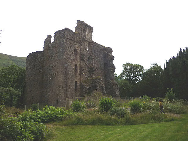
Invergarry

Invergarry (Scottish Gaelic: Inbhir Garadh) is a village in the Highlands of Scotland. It is in the Great Glen, near where the River Garry flows into Loch...
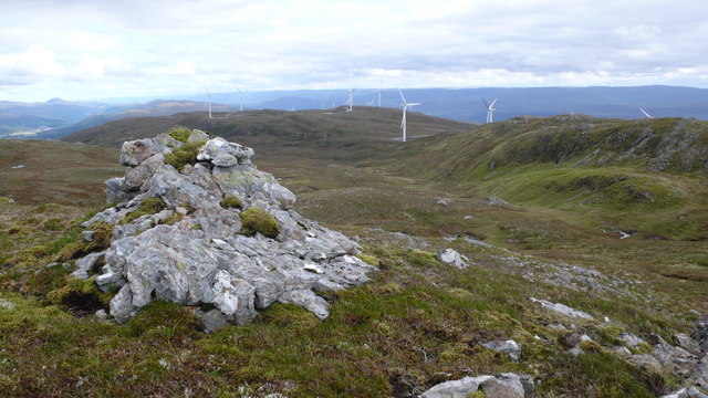
Meall Dubh

Meall Dubh (789 m) is a mountain in the Northwest Highlands, Scotland. Lying near the village of Fort Augustus, it is the highest peak between the valleys...

Nearby Amenities

Located within 500m of 57.083548,-4.8802013
Parking
Source: survey
Lat/Long: 57.0810365/-4.8803852
Power: tower
Lat/Long: 57.0841463/-4.8749938
Power: tower
Lat/Long: 57.0842773/-4.8787244
Power: tower
Lat/Long: 57.0843911/-4.8818691
Power: tower
Lat/Long: 57.0845215/-4.88521
Parking
Source: Bing
Lat/Long: 57.0814532/-4.8831732
Parking
Source: Bing
Lat/Long: 57.0809004/-4.8757663
Bill Muirhead memorial
Historic: memorial
Source: survey
Lat/Long: 57.081484/-4.8835153
Power: pole
Lat/Long: 57.0820819/-4.8723733
Power: pole
Lat/Long: 57.0819973/-4.8729542
Power: pole
Lat/Long: 57.0820754/-4.8742747
Power: pole
Lat/Long: 57.0821812/-4.8761611
Power: pole
Lat/Long: 57.0822544/-4.8774098
Power: pole
Lat/Long: 57.0823146/-4.8784249
Power: pole
Lat/Long: 57.0824253/-4.8801466
Power: pole
Lat/Long: 57.0825245/-4.8818593
Power: pole
Lat/Long: 57.0826059/-4.8832876
Power: pole
Lat/Long: 57.0826954/-4.8845033
Power: pole
Lat/Long: 57.082767/-4.885722
Power: pole
Lat/Long: 57.0828353/-4.8868748
Power: pole
Lat/Long: 57.0829232/-4.8881714
The data included in this document is from www.openstreetmap.org. The data is made available under ODbL.

Have you been to Coille Achaidh Luachraich?

Leave your review of Coille Achaidh Luachraich below (or comments, questions and feedback).