Bad an Nathrach

Wood, Forest in Sutherland

Scotland

Bad an Nathrach

Loch na Seilge Looking down to Loch na Seilge from Ben Stack.
Loch na Seilge Credit: Raibeart MacAoidh

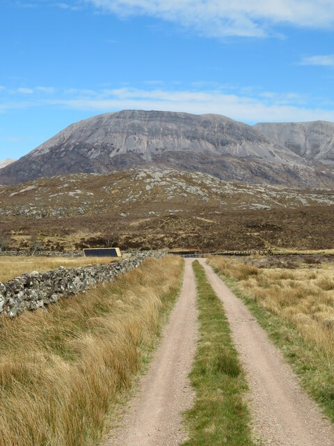
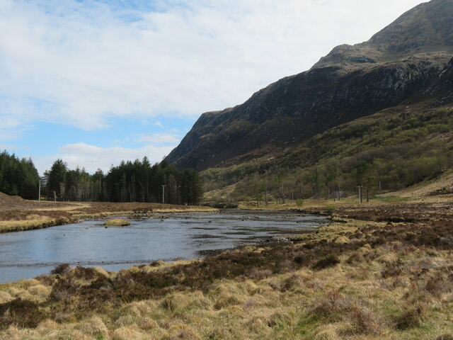
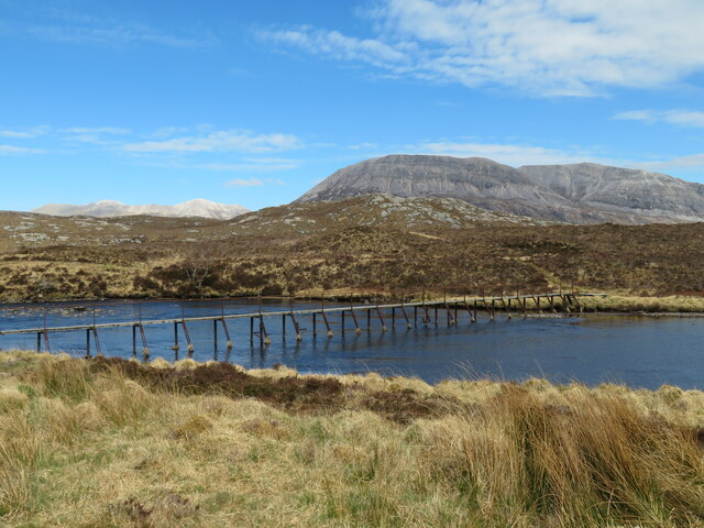
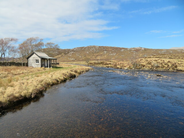
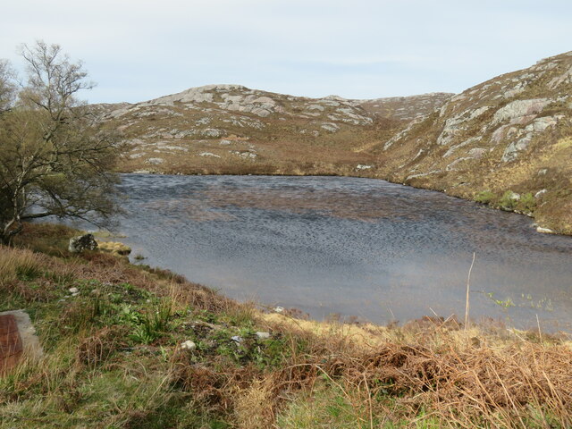
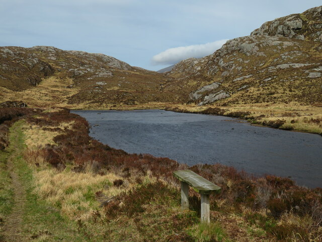
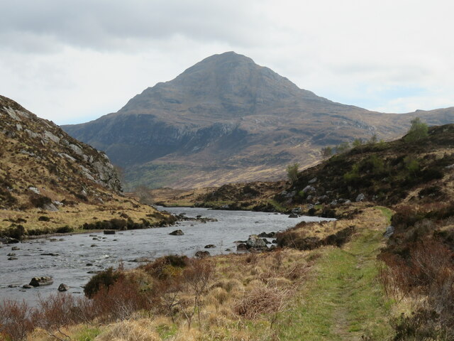
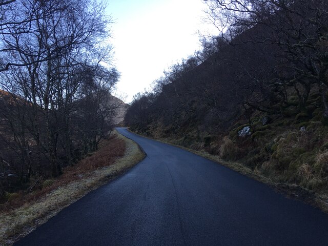
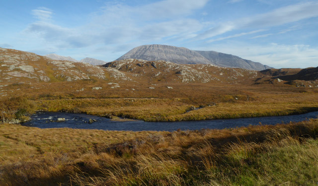
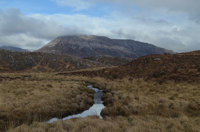
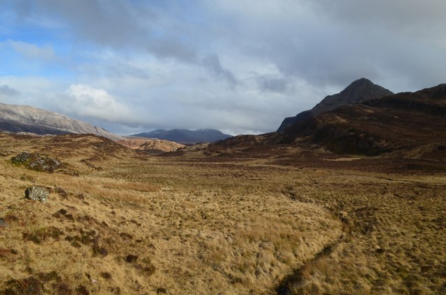
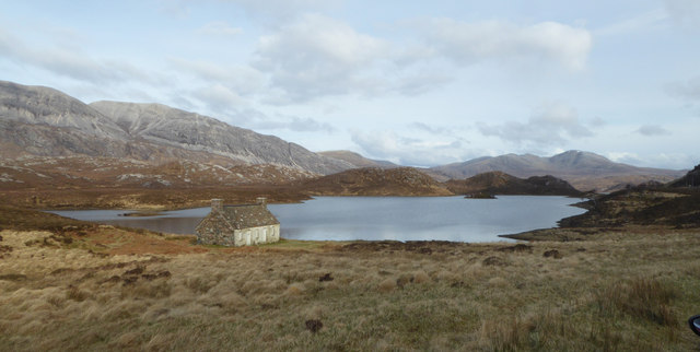
Bad an Nathrach, also known as Sutherland Wood or Sutherland Forest, is a stunning natural area located in the Scottish Highlands. It covers a vast expanse of land, stretching over rolling hills and valleys, and is home to a diverse range of flora and fauna.

The forest is known for its ancient Caledonian pine trees, some of which are centuries old and tower majestically over the landscape. These trees provide a habitat for a variety of wildlife, including red deer, pine martens, and Scottish wildcats.

Visitors to Bad an Nathrach can explore the network of walking trails that wind through the forest, offering breathtaking views of the surrounding mountains and lochs. The area is popular with hikers, nature enthusiasts, and photographers looking to capture the natural beauty of the Scottish Highlands.

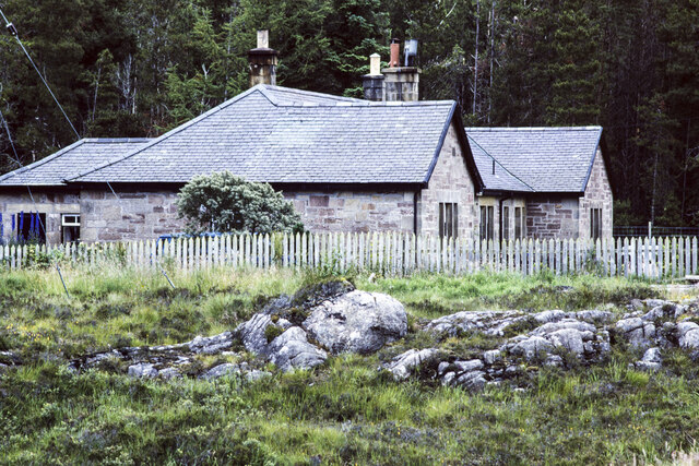
In addition to its natural splendor, Bad an Nathrach also holds cultural significance, with several historic sites scattered throughout the forest. These include ancient stone circles, burial cairns, and remnants of old settlements, providing a glimpse into the area's rich history.

Overall, Bad an Nathrach is a peaceful and enchanting destination, offering visitors the chance to immerse themselves in the unspoiled beauty of the Scottish wilderness.

If you have any feedback on the listing, please let us know in the comments section below.

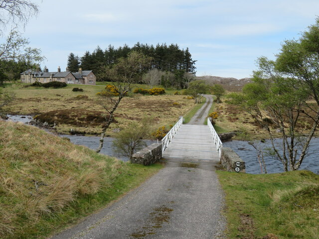
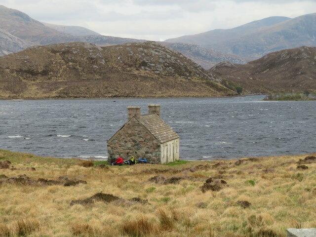
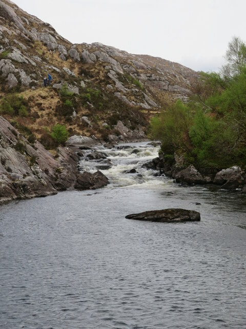
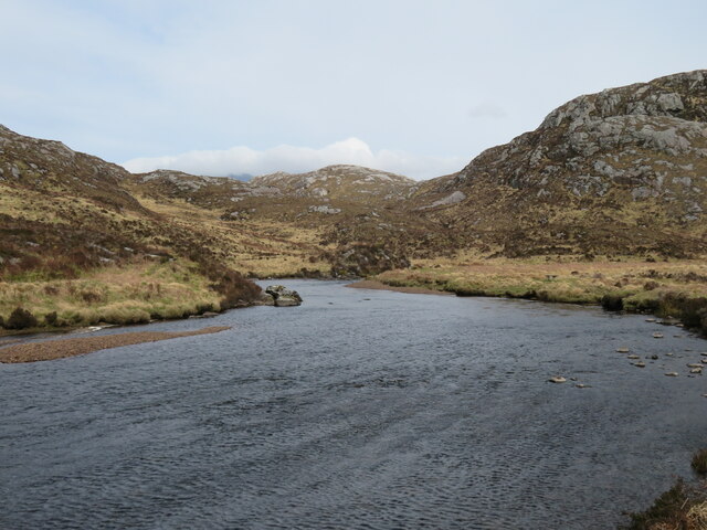
Bad an Nathrach Images

Images are sourced within 2km of 58.35575/-4.9843871 or Grid Reference NC2544. Thanks to Geograph Open Source API. All images are credited.

Loch na Seilge Looking down to Loch na Seilge from Ben Stack.
Loch na Seilge
Looking down to Loch na Seilge from Ben Stack.
Track down to the river Access path to the River Laxford and a footbridge, beyond which rise the steep quartzite slopes towards Arkle's summit ridge.
Track down to the river
Access path to the River Laxford and a footbridge, beyond which rise the steep quartzite slopes towards Arkle's summit ridge.
Upstream along the Laxford A view upstream along the River Laxford just a short way downstream from where it exits Loch Stack. To the right are the dark cliffs that form the ramparts of Ben Stack.
Upstream along the Laxford
A view upstream along the River Laxford just a short way downstream from where it exits Loch Stack. To the right are the dark cliffs that form the ramparts of Ben Stack.
Footbridge over the River Laxford The Laxford is a prime salmon river and has a network of good paths on either bank.
Footbridge over the River Laxford
The Laxford is a prime salmon river and has a network of good paths on either bank.
Fishing hut by the river The River Laxford is noted for salmon fishing and has a series of good footpaths on either bank. There's also superior shelter for fishermen, like this riverbank hut.
Fishing hut by the river
The River Laxford is noted for salmon fishing and has a series of good footpaths on either bank. There's also superior shelter for fishermen, like this riverbank hut.
Estate bridge over the River Laxford The main approach to Laxford Lodge from the main road. The bridge crosses the river at the point where it leaves Loch Stack.
Estate bridge over the River Laxford
The main approach to Laxford Lodge from the main road. The bridge crosses the river at the point where it leaves Loch Stack.
Shelter from the wind A view towards Loch Stack on a day with a fierce east wind, enough for a group of three walkers to take shelter on the lee side of the small building that sits right on the grid line.
Shelter from the wind
A view towards Loch Stack on a day with a fierce east wind, enough for a group of three walkers to take shelter on the lee side of the small building that sits right on the grid line.
Upstream from the footbridge The River Laxford flowing through a short section of deeply cut valley away from the road.
Upstream from the footbridge
The River Laxford flowing through a short section of deeply cut valley away from the road.
Fern Pool, River Laxford Here the river widens out and is shallow and slow moving. Fishermen's paths on either side make this a pleasant short excursion from the road.
Fern Pool, River Laxford
Here the river widens out and is shallow and slow moving. Fishermen's paths on either side make this a pleasant short excursion from the road.
Lochan Glac na Lann Small lochan at the roadside, trapped between hills in a narrow defile.
Lochan Glac na Lann
Small lochan at the roadside, trapped between hills in a narrow defile.
A place to enjoy the river view Not only are there good footpaths either side of the Laxford River, but there are also several seats where one can admire the view - or maybe fish for salmon.
A place to enjoy the river view
Not only are there good footpaths either side of the Laxford River, but there are also several seats where one can admire the view - or maybe fish for salmon.
River and Ben The River Laxford and the impressive pyramid shaped Ben Stack beyond.
River and Ben
The River Laxford and the impressive pyramid shaped Ben Stack beyond.
Rounded rocks with semi-detached cottages The location of the two properties is named Alltnasuileig; they are on the west side of the A838 just north of Ben Stack. In 1996 the cottages were owned by the Duke of Westminster's estate, and probably still are. At that time the farther of them was in use as a holiday let.
Rounded rocks with semi-detached cottages
The location of the two properties is named Alltnasuileig; they are on the west side of the A838 just north of Ben Stack. In 1996 the cottages were owned by the Duke of Westminster's estate, and probably still are. At that time the farther of them was in use as a holiday let.
A838 near Laxford Bridge
River Laxford With a backdrop of Arkle.
River Laxford
With a backdrop of Arkle.
Allt Bad na h-Achlaise and Arkle, Sutherland The Allt Bad na h-Achlaise (watercourse) which is a small tributary to the River Laxford in northwest Sutherland.  The mountain in the background is Arkle (787 m, 2582 ft).
Allt Bad na h-Achlaise and Arkle, Sutherland
The Allt Bad na h-Achlaise (watercourse) which is a small tributary to the River Laxford in northwest Sutherland. The mountain in the background is Arkle (787 m, 2582 ft).
Bad na h-Achlaise and Ben Stack, Sutherland An area of moorland in the far northwest of the Scottish Highlands, near the River Laxford.  The area in the immediate vicinity of this photo is identified as the Gaelic 'Bad na h-Achlaise' on Ordnance Survey mapping.  The Peak on the right of the horizon is Ben Stack (720 m, 2362 ft).
Bad na h-Achlaise and Ben Stack, Sutherland
An area of moorland in the far northwest of the Scottish Highlands, near the River Laxford. The area in the immediate vicinity of this photo is identified as the Gaelic 'Bad na h-Achlaise' on Ordnance Survey mapping. The Peak on the right of the horizon is Ben Stack (720 m, 2362 ft).
Old Croft, Loch Stack A now derelict building at the northern end of the loch.
Old Croft, Loch Stack
A now derelict building at the northern end of the loch.
Show me another place!

Bad an Nathrach is located at Grid Ref: NC2544 (Lat: 58.35575, Lng: -4.9843871)

Unitary Authority: Highland

Police Authority: Highlands and Islands

What 3 Words

///conspire.galaxies.finishing. Near Oldshoremore, Highland

Nearby Locations

Bad an Nathrach

Related Wikis

Ben Stack

Ben Stack (Scottish Gaelic: Beinn Stac) is a mountain in Sutherland, in the northwest of Scotland. It is 721 m (2,365 ft) high. It lies southeast of Laxford...

Laxford

Laxford is a remote area in the far Northwest Highlands of Scotland around the River Laxford which runs northwest from Loch Stack to Laxford Bay. This...

Laxford Bridge

The Laxford Bridge is a stone arch bridge in Sutherland, Scotland which carries the A838 across the River Laxford north to Rhiconich and Durness. The bridge...

A838 road

The A838 is a major road in Sutherland, in the Highland area of Scotland. It runs generally northwest from the A836 in the Lairg area to Laxford Bridge...

Nearby Amenities

Located within 500m of 58.35575,-4.9843871
Passing Place
Lat/Long: 58.3557588/-4.9799953
Power: pole
Lat/Long: 58.3536589/-4.9770368
Power: pole
Lat/Long: 58.3583836/-4.9848629
Power: pole
Lat/Long: 58.356711/-4.9819856
Power: pole
Lat/Long: 58.3573904/-4.9831626
Power: pole
Lat/Long: 58.3580671/-4.9842413
Power: pole
Lat/Long: 58.358597/-4.9852549
Passing Place
Lat/Long: 58.3602024/-4.9851258
Power: pole
Lat/Long: 58.3594703/-4.9865119
Passing Place
Lat/Long: 58.35875/-4.9844639
Passing Place
Lat/Long: 58.3579705/-4.9839976
Passing Place
Lat/Long: 58.3569686/-4.9821389
Passing Place
Lat/Long: 58.3544975/-4.9778983
The data included in this document is from www.openstreetmap.org. The data is made available under ODbL.

Have you been to Bad an Nathrach?

Leave your review of Bad an Nathrach below (or comments, questions and feedback).