Campions

Settlement in Essex Epping Forest

England

Campions

Lee and Stort Navigation: Lock no 7 - Feakes Lock Feakes Lock is situated a kilometre to the east of Pishiobury Park. This is another pretty location with a remote feel about it despite being only about 200 metres from the railway line. There are nearby fields and hedgerows and this is a pleasant and peaceful place to stop on a warm summer's day. The lock is in a quieter stretch of the route between the built-up areas of Sawbridgeworth and Harlow Town.
Lee and Stort Navigation: Lock no 7 - Feakes Lock Credit: Peter S

Campions is a small village located in the county of Essex, England. Situated approximately 25 miles northeast of London, it falls within the administrative district of Uttlesford. With a population of around 500 residents, Campions is known for its peaceful and rural atmosphere.

The village is surrounded by beautiful countryside, offering residents and visitors opportunities for scenic walks and outdoor activities. The landscape is characterized by rolling green hills, picturesque meadows, and charming country lanes. Campions is also home to a number of historic buildings, including a 12th-century church known as St. Mary's, which adds to the village's quintessential English charm.

Despite its small size, Campions offers a range of amenities for its residents. The village features a local pub, The Campions Inn, where locals and visitors can enjoy traditional British cuisine and a relaxed atmosphere. Additionally, there is a village hall that hosts community events and social gatherings.

Campions benefits from its proximity to larger towns and cities. The nearby town of Bishop's Stortford provides access to various shopping centers, schools, and healthcare facilities. The village also has good transportation links, with regular bus services connecting it to neighboring towns and villages.

Overall, Campions is a serene and idyllic village in the heart of Essex, offering a peaceful lifestyle and a close-knit community for its residents. It appeals to those seeking a rural escape while still being within reach of more urban amenities.

If you have any feedback on the listing, please let us know in the comments section below.
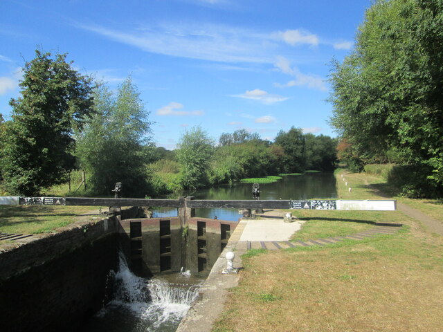
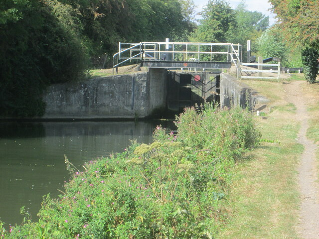
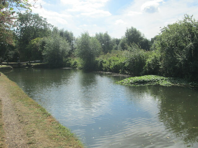
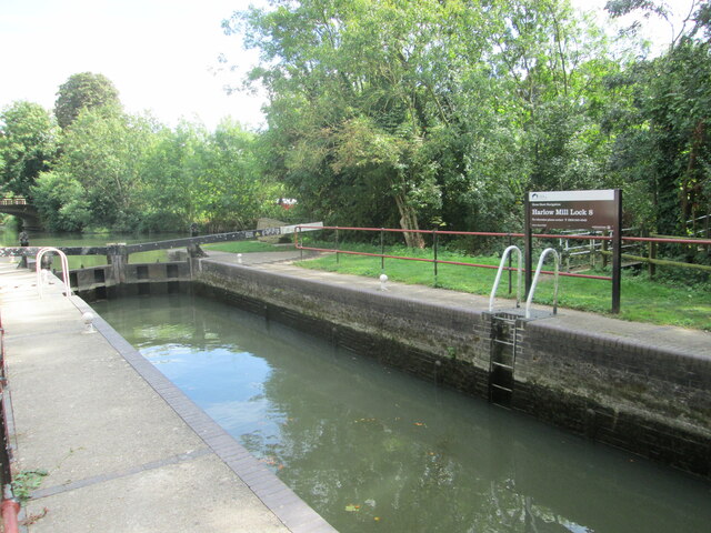
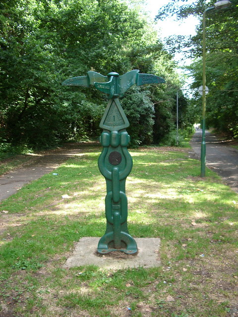
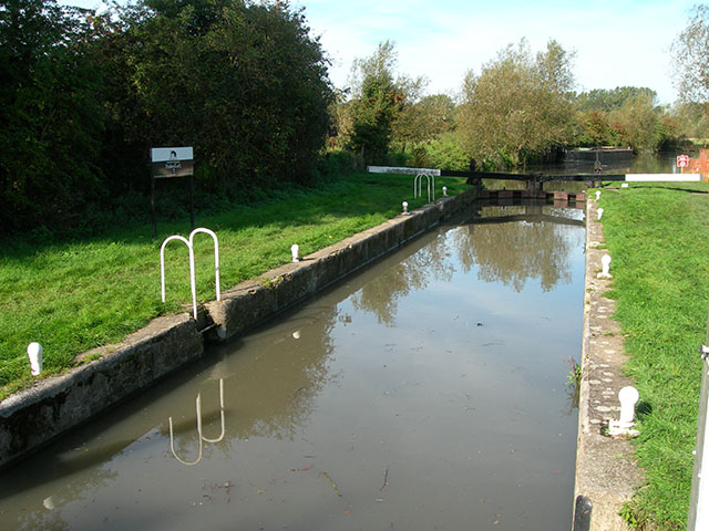
Campions Images

Images are sourced within 2km of 51.787088/0.14433285 or Grid Reference TL4812. Thanks to Geograph Open Source API. All images are credited.

Lee and Stort Navigation: Lock no 7 - Feakes Lock Feakes Lock is situated a kilometre to the east of Pishiobury Park. This is another pretty location with a remote feel about it despite being only about 200 metres from the railway line. There are nearby fields and hedgerows and this is a pleasant and peaceful place to stop on a warm summer's day. The lock is in a quieter stretch of the route between the built-up areas of Sawbridgeworth and Harlow Town.
Lee and Stort Navigation: Lock no 7 - Feakes Lock
Feakes Lock is situated a kilometre to the east of Pishiobury Park. This is another pretty location with a remote feel about it despite being only about 200 metres from the railway line. There are nearby fields and hedgerows and this is a pleasant and peaceful place to stop on a warm summer's day. The lock is in a quieter stretch of the route between the built-up areas of Sawbridgeworth and Harlow Town.
Downstream from Lee and Stort Navigation: Lock no 7 - Feakes Lock
Approaching Lee and Stort Navigation: Lock no 7 - Feakes Lock
Lee and Stort Navigation: Lock no 8 - Harlow Mill Lock
Gibberd Gardens
Gibberd Gardens
Gibberd Garden, Harlow This was the home and garden of Sir Frederick Gibberd from the 1950s until his death in 1984.  Gibberd, a renowned architect and town planner was responsible for Harlow New Town and many notable post-war developments such as Liverpool Metropolitan cathedral. He collected sculptures which he deployed to dramatic effect throughout his garden.
Gibberd Garden, Harlow
This was the home and garden of Sir Frederick Gibberd from the 1950s until his death in 1984. Gibberd, a renowned architect and town planner was responsible for Harlow New Town and many notable post-war developments such as Liverpool Metropolitan cathedral. He collected sculptures which he deployed to dramatic effect throughout his garden.
Norman Chapel, Harlowbury, Essex This small chapel consists of a Norman nave and chancel in one. It lies to the far east of Harlow New Town.
Norman Chapel, Harlowbury, Essex
This small chapel consists of a Norman nave and chancel in one. It lies to the far east of Harlow New Town.
'The Queen's Head' inn, Harlow, Essex This old timber-framed inn stands in the old part of Harlow, which is now known as Churchgate Street.
'The Queen's Head' inn, Harlow, Essex
This old timber-framed inn stands in the old part of Harlow, which is now known as Churchgate Street.
'The Green Man' inn, Old Harlow, Essex This old inn stands in an area of Old Harlow known as Mulberry Green. There is evidence that the inn has stood here since the 14th century and remains the oldest inn in Harlow.
'The Green Man' inn, Old Harlow, Essex
This old inn stands in an area of Old Harlow known as Mulberry Green. There is evidence that the inn has stood here since the 14th century and remains the oldest inn in Harlow.
Harlow Mill Restaurant This Beefeater Restaurant is alongside the River Stort, on the outskirts of Harlow.
Harlow Mill Restaurant
This Beefeater Restaurant is alongside the River Stort, on the outskirts of Harlow.
Milepost This is one of 1000 mileposts funded by the Royal Bank of Scotland to mark the creation of the National Cycle Network. This milepost is on National Cycle Route 1, which runs from Dover to London and then up the east coast to Edinburgh and on to John o'Groats, Orkney and Shetland. Post markings read as follows: South - Harlow Museum ½ Mile, East - Harlow Town Centre 1½ Miles & Hertford 14 Miles, North - Templefields, West - Old Harlow 1½ Miles & Chelmsford 21 Miles. <span class="nowrap"><a title="https://www.sustrans.org.uk" rel="nofollow ugc noopener" href="https://www.sustrans.org.uk">Link</a><img style="margin-left:2px;" alt="External link" title="External link - shift click to open in new window" src="https://s1.geograph.org.uk/img/external.png" width="10" height="10"/></span>
Milepost
This is one of 1000 mileposts funded by the Royal Bank of Scotland to mark the creation of the National Cycle Network. This milepost is on National Cycle Route 1, which runs from Dover to London and then up the east coast to Edinburgh and on to John o'Groats, Orkney and Shetland. Post markings read as follows: South - Harlow Museum ½ Mile, East - Harlow Town Centre 1½ Miles & Hertford 14 Miles, North - Templefields, West - Old Harlow 1½ Miles & Chelmsford 21 Miles. LinkExternal link
Harlow Mill, near Harlow, Essex This Beefeater restaurant lies just off the road to Sawbridgeworth from Harlow.
Harlow Mill, near Harlow, Essex
This Beefeater restaurant lies just off the road to Sawbridgeworth from Harlow.
'White Horse' public house, Harlowbury, Essex This pub stands on Old Road.
'White Horse' public house, Harlowbury, Essex
This pub stands on Old Road.
Thatched cottage close to Churchgate Street, Essex
Farmhouse at Franklins Farm
Harlow Mill Lock
Harlow Mill Lock
River Stort The last in a series of distinctive bends going east before the river swings round in a large arc to flow from the north
River Stort
The last in a series of distinctive bends going east before the river swings round in a large arc to flow from the north
Feakes Lock One of many on the River Stort between Bishop's Stortford and Harlow.
Feakes Lock
One of many on the River Stort between Bishop's Stortford and Harlow.
Show me another place!

Campions is located at Grid Ref: TL4812 (Lat: 51.787088, Lng: 0.14433285)

Administrative County: Essex

District: Epping Forest

Police Authority: Essex

What 3 Words

///pump.rarely.cooks. Near Old Harlow, Essex

Nearby Locations

Campions

Related Wikis

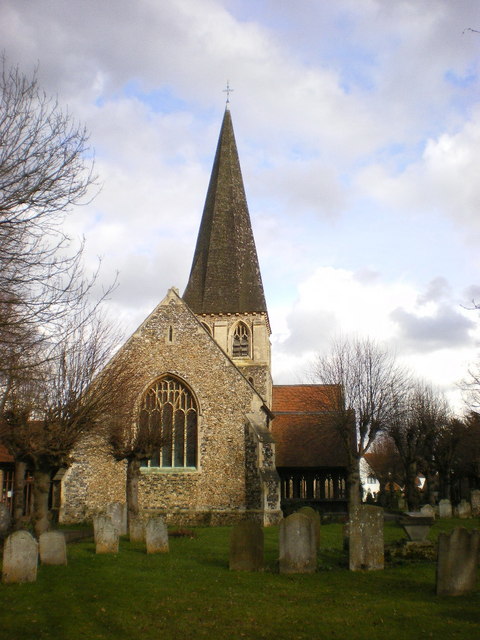
St Mary & St Hugh, Old Harlow

St Mary & St Hugh's Church is a Church of England parish church in Churchgate Street, Old Harlow in Essex, England. The church is of medieval origin and...
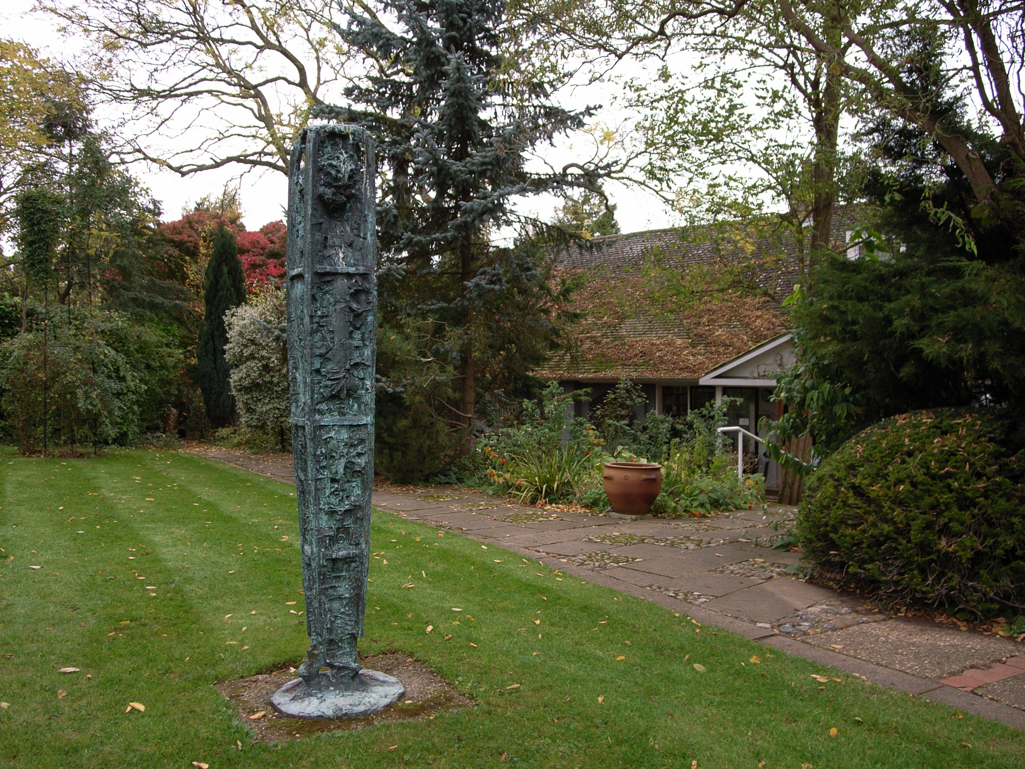
Gibberd Garden

Gibberd Garden is a garden in Harlow, Essex, England, which was created by Sir Frederick Gibberd (the planner of Harlow New Town) and his wife Patricia...

Old Harlow

Old Harlow is the old town area of Harlow, in Essex, England. It was the historical town centre prior to Harlow being designated a new town in 1947 during...

Harlow Mill railway station

Harlow Mill railway station is on the West Anglia Main Line serving the eastern part of Harlow in Essex, England. It is 24 miles 36 chains (39.3 km) down...

Nearby Amenities

Located within 500m of 51.787088,0.14433285
Traffic Signals
Traffic Signals: signal
Traffic Signals Direction: forward
Lat/Long: 51.7851739/0.1480371
Created By: YahooApplet 1.0
Lat/Long: 51.7844658/0.1487809
Created By: YahooApplet 1.0
Lat/Long: 51.7844193/0.142011
Created By: YahooApplet 1.0
Lat/Long: 51.7839149/0.1399189
Created By: YahooApplet 1.0
Lat/Long: 51.7847512/0.1401442
Created By: YahooApplet 1.0
Lat/Long: 51.7849835/0.140273
Created By: YahooApplet 1.0
Lat/Long: 51.785468/0.1404232
Created By: YahooApplet 1.0
Lat/Long: 51.7858396/0.1402837
Created By: YahooApplet 1.0
Lat/Long: 51.7840941/0.1390177
Mini Roundabout
Lat/Long: 51.7878812/0.138832
Created By: YahooApplet 1.0
Lat/Long: 51.7866958/0.1396936
Created By: YahooApplet 1.0
Lat/Long: 51.7868153/0.137977
Created By: YahooApplet 1.0
Lat/Long: 51.7869414/0.1377088
Created By: YahooApplet 1.0
Lat/Long: 51.7882289/0.1399296
Created By: YahooApplet 1.0
Lat/Long: 51.7883284/0.1387065
Created By: YahooApplet 1.0
Lat/Long: 51.7886536/0.13861
Created By: YahooApplet 1.0
Lat/Long: 51.7892177/0.1383418
Created By: YahooApplet 1.0
Lat/Long: 51.7893969/0.1392323
Created By: YahooApplet 1.0
Lat/Long: 51.7895362/0.1393932
Created By: YahooApplet 1.0
Lat/Long: 51.7897751/0.1390821
Created By: YahooApplet 1.0
Lat/Long: 51.7900008/0.1389533
Bus Stop
Oxleys
Bus: yes
Naptan AtcoCode: 150035007003
Naptan Bearing: NE
Naptan CommonName: Oxleys
Naptan Indicator: Adj
Naptan Landmark: Oxleys
Naptan NaptanCode: esxapjmj
Naptan PlusbusZoneRef: HRLWTWN
Naptan Street: Gilden Way
Naptan Verified: no
Public Transport: platform
Shelter: yes
Source: naptan_import
Lat/Long: 51.7840426/0.1450707
Bus Stop
Oxleys
Bus: yes
Naptan AtcoCode: 150035007004
Naptan Bearing: SW
Naptan CommonName: Oxleys
Naptan Indicator: Opp
Naptan Landmark: Oxleys
Naptan NaptanCode: esxapjmp
Naptan PlusbusZoneRef: HRLWTWN
Naptan Street: Gilden Way
Naptan Verified: no
Public Transport: platform
Shelter: yes
Source: naptan_import
Lat/Long: 51.7842451/0.1457696
Bus Stop
Pitten House
Bus: yes
Naptan AtcoCode: 150035008001
Naptan Bearing: N
Naptan CommonName: Pitten House
Naptan Crossing: Sheering Road
Naptan Indicator: o/s
Naptan Landmark: Pitten House
Naptan NaptanCode: esxapjmt
Naptan PlusbusZoneRef: HRLWTWN
Naptan Street: Gilden Way Spur
Naptan Verified: no
Public Transport: platform
Source: naptan_import
Lat/Long: 51.7843109/0.148677
Bus Stop
Pitten House
Bus: yes
Naptan AtcoCode: 150035008002
Naptan Bearing: S
Naptan CommonName: Pitten House
Naptan Crossing: Sheering Road
Naptan Indicator: Opp
Naptan Landmark: Pitten House
Naptan NaptanCode: esxapjmw
Naptan PlusbusZoneRef: HRLWTWN
Naptan Street: Gilden Way Spur
Naptan Verified: no
Public Transport: platform
Source: naptan_import
Lat/Long: 51.7842522/0.1488592
Bus Stop
St. John's Avenue
Bus: yes
Naptan AtcoCode: 150035010005
Naptan Bearing: NW
Naptan CommonName: St. John's Avenue
Naptan Crossing: St. John's Avenue
Naptan Indicator: Adj
Naptan Landmark: St. John's Avenue
Naptan NaptanCode: esxapjdp
Naptan PlusbusZoneRef: HRLWTWN
Naptan Street: Old Road
Naptan Verified: no
Public Transport: platform
Source: naptan_import
Lat/Long: 51.7864188/0.1398338
Bus Stop
The Green Man
Bus: yes
Naptan AtcoCode: 1500IM2607
Naptan Bearing: N
Naptan CommonName: The Green Man
Naptan Crossing: Mulberry Green
Naptan Indicator: N-bound
Naptan Landmark: The Green Man
Naptan NaptanCode: esxapjdw
Naptan PlusbusZoneRef: HRLWTWN
Naptan Street: Old Road
Naptan Verified: no
Public Transport: platform
Source: naptan_import
Lat/Long: 51.783783/0.1398831
Access: no
Barrier: fence
Lat/Long: 51.7907224/0.1465705
Power: pole
Lat/Long: 51.7906799/0.1464528
Barrier: swing_gate
Locked: yes
Lat/Long: 51.7879169/0.1390763
Building: yes
Lat/Long: 51.7882971/0.1396818
Power: substation
Substation: minor_distribution
Lat/Long: 51.7866773/0.1399013
Power: pole
Lat/Long: 51.7857795/0.1479551
Building: house
Lat/Long: 51.7852089/0.1406764
Building: house
Lat/Long: 51.7841279/0.1406229
Post Box
Lat/Long: 51.7878421/0.1389119
Barrier: lift_gate
Lat/Long: 51.7847755/0.1488227
Addr Housenumber: 1
Addr Street: Guilfords
Lat/Long: 51.7890863/0.1389091
Addr Housenumber: 4
Addr Street: Guilfords
Lat/Long: 51.7890391/0.1386395
Addr Housenumber: 5
Lat/Long: 51.7888051/0.1386878
Addr Housenumber: 8
Lat/Long: 51.7888582/0.1389829
Addr Housenumber: 15
Lat/Long: 51.7888898/0.139243
Addr Housenumber: 12
Lat/Long: 51.7889395/0.1395193
Addr Housenumber: 11
Lat/Long: 51.7891652/0.1393369
Addr Housenumber: 9
Lat/Long: 51.789127/0.1391438
Addr Housenumber: 27
Lat/Long: 51.7883529/0.1397071
Addr Housenumber: 26
Lat/Long: 51.7885039/0.1395649
Addr Housenumber: 16
Addr Street: Guilfords
Lat/Long: 51.7884717/0.1391652
Addr Housenumber: 19
Lat/Long: 51.7884202/0.1388783
Addr Housenumber: 29
Lat/Long: 51.7883877/0.1398815
Addr Housenumber: 28
Lat/Long: 51.7883678/0.1397956
Addr Housenumber: 20
Lat/Long: 51.788141/0.1389863
Addr Housenumber: 24
Lat/Long: 51.7882418/0.1393557
Addr Housenumber: 25
Lat/Long: 51.788484/0.1394656
Addr Housenumber: 23
Lat/Long: 51.7882252/0.1392725
Barrier: stile
Lat/Long: 51.7874982/0.1404359
Traffic Signals
Traffic Signals: signal
Traffic Signals Direction: forward
Lat/Long: 51.7853758/0.1479524
Traffic Signals
Traffic Signals: signal
Traffic Signals Direction: forward
Lat/Long: 51.7856195/0.1483762
Crossing
Crossing: marked
Crossing Island: no
Crossing Ref: pelican
Tactile Paving: yes
Traffic Signals: yes
Lat/Long: 51.7835563/0.144467
Addr City: Harlow
Addr Housenumber: 3
Addr Postcode: CM17 0HU
Addr Street: Guilfords
Lat/Long: 51.7890564/0.1387334
Addr City: Harlow
Addr Housenumber: 7
Addr Street: Guilfords
Lat/Long: 51.788842/0.1388963
Addr City: Harlow
Addr Housenumber: 6
Addr Street: Guilfords
Lat/Long: 51.7888204/0.1387844
Addr City: Harlow
Addr Housenumber: 2
Addr Street: Guilfords
Lat/Long: 51.7890705/0.1388132
Addr City: Harlow
Addr Housenumber: 10
Addr Street: Guilfords
Lat/Long: 51.7891468/0.139251
Addr City: Harlow
Addr Housenumber: 14
Addr Street: Guilfords
Lat/Long: 51.7889087/0.1393557
Addr City: Harlow
Addr Housenumber: 13
Addr Street: Guilfords
Lat/Long: 51.7889225/0.1394433
Addr City: Harlow
Addr Housenumber: 17
Addr Street: Guilfords
Lat/Long: 51.7884558/0.1390888
Addr City: Harlow
Addr Housenumber: 18
Addr Street: Guilfords
Lat/Long: 51.7884351/0.1389855
Addr City: Harlow
Addr Housenumber: 21
Addr Street: Guilfords
Lat/Long: 51.788158/0.1391089
Addr City: Harlow
Addr Housenumber: 22
Addr Street: Guilfords
Lat/Long: 51.7881696/0.1391987
Addr City: Harlow
Addr Housenumber: 31
Addr Street: Guilfords
Lat/Long: 51.7884824/0.1400101
Addr City: Harlow
Addr Housenumber: 30
Addr Street: Guilfords
Lat/Long: 51.7884658/0.139927
Addr City: Harlow
Addr Housenumber: 32
Addr Street: Guilfords
Lat/Long: 51.7885006/0.1400933
Addr City: Harlow
Addr Housenumber: 33
Addr Street: Guilfords
Lat/Long: 51.7885222/0.1401791
Barrier: motorcycle_barrier
Lat/Long: 51.7868305/0.1420824
Gilden Park
Place: suburb
Lat/Long: 51.7882461/0.148071
Direction: both
Traffic Calming: table
Lat/Long: 51.7897471/0.1468048
Crossing
Crossing: unmarked
Crossing Island: yes
Crossing Markings: no
Tactile Paving: yes
Lat/Long: 51.7856981/0.1481165
Crossing
Crossing: unmarked
Crossing Island: no
Crossing Markings: no
Tactile Paving: no
Lat/Long: 51.7878715/0.1474718
Crossing
Crossing: unmarked
Crossing Island: no
Crossing Markings: no
Tactile Paving: no
Lat/Long: 51.7884529/0.1473017
Crossing
Crossing: unmarked
Crossing Island: no
Crossing Markings: no
Tactile Paving: no
Lat/Long: 51.7892939/0.1467662
Crossing
Crossing: unmarked
Crossing Island: no
Crossing Markings: no
Tactile Paving: no
Traffic Calming: table
Lat/Long: 51.7882074/0.1471261
Crossing
Crossing: unmarked
Crossing Island: no
Crossing Markings: no
Tactile Paving: no
Lat/Long: 51.7884126/0.1470182
Crossing
Crossing: unmarked
Crossing Island: no
Crossing Markings: no
Tactile Paving: no
Lat/Long: 51.7885122/0.1480262
Crossing
Crossing: unmarked
Crossing Markings: no
Lat/Long: 51.7879391/0.1471976
Crossing
Crossing: unmarked
Crossing Island: no
Crossing Markings: no
Tactile Paving: yes
Lat/Long: 51.7882436/0.1501183
Crossing
Crossing: unmarked
Crossing Island: no
Crossing Markings: no
Tactile Paving: no
Lat/Long: 51.7863136/0.1478896
Barrier: bollard
Lat/Long: 51.7867733/0.1514812
Crossing
Lat/Long: 51.7857957/0.1442758
Direction: both
Traffic Calming: table
Lat/Long: 51.7894884/0.1496804
Barrier: motorcycle_barrier
Lat/Long: 51.7872124/0.1422105
Barrier: motorcycle_barrier
Lat/Long: 51.786844/0.1420388
Barrier: bollard
Lat/Long: 51.7860896/0.1401479
Direction: both
Traffic Calming: bump
Lat/Long: 51.7842183/0.1395884
Direction: both
Traffic Calming: bump
Lat/Long: 51.7841333/0.139198
Crossing
Crossing: unmarked
Crossing Island: yes
Crossing Markings: no
Tactile Paving: yes
Lat/Long: 51.7857255/0.1483159
Traffic Calming: island
Lat/Long: 51.7857036/0.1482138
Crossing
Crossing: unmarked
Crossing Island: no
Crossing Markings: no
Tactile Paving: no
Lat/Long: 51.7878959/0.1501925
Barrier: bollard
Lat/Long: 51.7891464/0.1452116
Parking Space
Capacity: 1
Lat/Long: 51.7878428/0.1475745
Crossing
Crossing: unmarked
Crossing Island: yes
Crossing Markings: no
Tactile Paving: yes
Lat/Long: 51.7833666/0.1439609
Noexit: yes
Lat/Long: 51.7836408/0.1402195
Playground: structure
Lat/Long: 51.7898316/0.1494723
Bench
Lat/Long: 51.7872278/0.1499469
Crossing
Crossing: unmarked
Crossing Island: no
Crossing Markings: no
Tactile Paving: yes
Lat/Long: 51.7834528/0.1435714
Crossing
Crossing: unmarked
Crossing Island: no
Crossing Markings: no
Tactile Paving: no
Lat/Long: 51.7895251/0.1496742
Noexit: yes
Lat/Long: 51.7835733/0.1443383
Man Made: street_cabinet
Lat/Long: 51.783588/0.144315
Traffic Signals
Traffic Signals: signal
Traffic Signals Direction: forward
Lat/Long: 51.7856778/0.1483891
Traffic Signals
Traffic Signals: signal
Traffic Signals Direction: forward
Lat/Long: 51.7855483/0.1486937
Traffic Signals
Traffic Signals: signal
Traffic Signals Direction: forward
Lat/Long: 51.7853632/0.1488496
Traffic Signals
Traffic Signals: signal
Traffic Signals Direction: forward
Lat/Long: 51.7855973/0.1488244
Traffic Signals
Traffic Signals: signal
Traffic Signals Direction: forward
Lat/Long: 51.7854965/0.1486775
Traffic Signals
Traffic Signals: signal
Traffic Signals Direction: forward
Lat/Long: 51.7853595/0.1489279
Traffic Signals
Traffic Signals: signal
Traffic Signals Direction: forward
Lat/Long: 51.7850167/0.1484756
Traffic Signals
Traffic Signals: signal
Traffic Signals Direction: forward
Lat/Long: 51.7850666/0.1484866
Bench
Backrest: yes
Material: wood
Lat/Long: 51.7884361/0.1482522
Bench
Backrest: yes
Material: wood
Lat/Long: 51.7884543/0.1483823
Bench
Backrest: yes
Material: wood
Lat/Long: 51.7884692/0.1485083
Bicycle Parking
Bicycle Parking: stands
Capacity: 4
Covered: no
Lat/Long: 51.7884424/0.1486411
Traffic Signals
Traffic Signals: signal
Traffic Signals Direction: forward
Lat/Long: 51.7854986/0.1480274
Traffic Signals
Traffic Signals: signal
Traffic Signals Direction: forward
Lat/Long: 51.785265/0.1478942
Traffic Signals
Traffic Signals: signal
Traffic Signals Direction: forward
Lat/Long: 51.7853451/0.1478445
Traffic Signals
Traffic Signals: signal
Traffic Signals Direction: forward
Lat/Long: 51.7851133/0.1479276
Crossing
Crossing: unmarked
Crossing Island: no
Crossing Markings: no
Tactile Paving: no
Lat/Long: 51.7885809/0.1487509
Artwork Type: sculpture
Tourism: artwork
Lat/Long: 51.7883399/0.1474607
Direction: both
Traffic Calming: cushion
Lat/Long: 51.7883351/0.1471109
Direction: both
Traffic Calming: cushion
Lat/Long: 51.7902413/0.146753
Direction: both
Traffic Calming: cushion
Lat/Long: 51.7892141/0.1469515
Traffic Signals
Traffic Signals: signal
Lat/Long: 51.7852562/0.1481082
Traffic Signals
Traffic Signals: signal
Traffic Signals Direction: forward
Lat/Long: 51.7854947/0.1488847
Barrier: bollard
Motor Vehicle: yes
Lat/Long: 51.7886524/0.1498856
Barrier: bollard
Motor Vehicle: yes
Lat/Long: 51.7882647/0.1499335
Direction: both
Traffic Calming: cushion
Lat/Long: 51.7872687/0.149607
Barrier: motorcycle_barrier
Lat/Long: 51.7873719/0.139327
Waste Basket
Lat/Long: 51.7872802/0.1499139
Direction: both
Traffic Calming: cushion
Lat/Long: 51.7871327/0.1486196
Direction: both
Traffic Calming: cushion
Lat/Long: 51.7877963/0.1501155
Bench
Backrest: yes
Lat/Long: 51.7882886/0.1475728
Bench
Backrest: yes
Lat/Long: 51.7883119/0.147727
Leisure: picnic_table
Lat/Long: 51.7882252/0.1476586
Waste Basket
Lat/Long: 51.7883019/0.1476211
Bicycle Parking
Bicycle Parking: stands
Capacity: 2
Covered: no
Lat/Long: 51.7882994/0.1479161
Bench
Backrest: yes
Material: wood
Lat/Long: 51.7884404/0.1482863
Bench
Backrest: yes
Material: wood
Lat/Long: 51.7884603/0.1484123
Bench
Backrest: yes
Material: wood
Lat/Long: 51.7884728/0.1485384
Leisure: picnic_table
Lat/Long: 51.7884487/0.1488938
Leisure: picnic_table
Lat/Long: 51.7883956/0.1489488
Leisure: picnic_table
Lat/Long: 51.7885151/0.1491593
Leisure: picnic_table
Lat/Long: 51.788501/0.149394
Waste Basket
Lat/Long: 51.7884919/0.1492639
Bench
Backrest: yes
Lat/Long: 51.7884703/0.149508
Waste Basket
Lat/Long: 51.7884985/0.1487516
Crossing
Crossing: unmarked
Crossing Island: no
Crossing Markings: no
Tactile Paving: no
Lat/Long: 51.7894804/0.1495853
Parking
Parking: street_side
Lat/Long: 51.7863896/0.1480176
Parking
Parking: street_side
Lat/Long: 51.7865737/0.1479264
Parking
Parking: street_side
Lat/Long: 51.7867778/0.1478164
Crossing
Crossing: unmarked
Crossing Island: no
Crossing Markings: no
Tactile Paving: no
Lat/Long: 51.787057/0.1476007
Crossing
Crossing: unmarked
Crossing Island: no
Crossing Markings: no
Tactile Paving: no
Lat/Long: 51.7868955/0.147684
Crossing
Crossing: unmarked
Crossing Island: no
Crossing Markings: no
Tactile Paving: no
Lat/Long: 51.7870277/0.1478202
Parking Space
Capacity: 1
Lat/Long: 51.7870682/0.1479183
Parking Space
Capacity: 1
Lat/Long: 51.7871329/0.148377
Parking Space
Capacity: 1
Lat/Long: 51.7871677/0.1485943
Parking Space
Capacity: 1
Lat/Long: 51.7872009/0.1488142
Parking Space
Capacity: 1
Lat/Long: 51.7872358/0.1490261
Parking Space
Capacity: 1
Lat/Long: 51.7874531/0.1498656
Parking
Parking: street_side
Lat/Long: 51.7880554/0.1499675
Parking
Parking: street_side
Lat/Long: 51.7880388/0.1501017
Crossing
Crossing: unmarked
Crossing Island: no
Crossing Markings: no
Tactile Paving: yes
Lat/Long: 51.7882838/0.1508956
Crossing
Crossing: unmarked
Crossing Island: no
Crossing Markings: no
Tactile Paving: yes
Lat/Long: 51.7881506/0.1499787
Entrance: yes
Lat/Long: 51.7858866/0.1486159
Entrance: yes
Lat/Long: 51.7859086/0.1490087
Crossing
Crossing: unmarked
Crossing Island: no
Crossing Markings: no
Tactile Paving: no
Lat/Long: 51.787417/0.1475316
Entrance: yes
Lat/Long: 51.7859685/0.1483954
Entrance: yes
Lat/Long: 51.7867535/0.1479119
Entrance: yes
Lat/Long: 51.7872457/0.1476635
Entrance: yes
Lat/Long: 51.7875981/0.1475105
Crossing
Crossing: unmarked
Crossing Island: no
Crossing Markings: no
Tactile Paving: no
Lat/Long: 51.7876782/0.1473028
Entrance: yes
Lat/Long: 51.7878729/0.1443808
Barrier: swing_gate
Locked: yes
Lat/Long: 51.7881097/0.1396486
Crossing
Crossing: unmarked
Crossing Island: no
Crossing Markings: no
Tactile Paving: yes
Lat/Long: 51.7879076/0.13893
Barrier: wicket_gate
Lat/Long: 51.7850612/0.1478733
Barrier: wicket_gate
Lat/Long: 51.7848084/0.1486009
Parking
Parking: street_side
Lat/Long: 51.7885037/0.147487
Parking
Parking: street_side
Lat/Long: 51.7884291/0.1474923
Parking
Parking: street_side
Lat/Long: 51.7885189/0.1485168
Parking
Parking: street_side
Lat/Long: 51.788595/0.1485062
Parking
Parking: street_side
Lat/Long: 51.7886613/0.1492197
Parking
Parking: street_side
Lat/Long: 51.7886829/0.1495067
Parking
Parking: street_side
Lat/Long: 51.7885842/0.1491908
Parking
Parking: street_side
Lat/Long: 51.7886247/0.149601
Parking
Parking: street_side
Lat/Long: 51.788741/0.1501102
Parking
Parking: street_side
Lat/Long: 51.7887791/0.1505152
Parking
Parking: street_side
Lat/Long: 51.7886748/0.150119
Parking
Parking: street_side
Lat/Long: 51.7887146/0.1505331
Parking
Parking: street_side
Lat/Long: 51.7887374/0.1507713
Noexit: yes
Lat/Long: 51.788993/0.1492568
Noexit: yes
Lat/Long: 51.7889933/0.1493163
Crossing
Crossing: unmarked
Crossing Markings: no
Lat/Long: 51.7897618/0.1469621
Crossing
Lat/Long: 51.7878565/0.144688
Crossing
Lat/Long: 51.7879415/0.1450087
Crossing
Lat/Long: 51.7881221/0.1456868
Crossing
Lat/Long: 51.7882129/0.1460251
Crossing
Lat/Long: 51.7885899/0.1481192
Crossing
Lat/Long: 51.7886562/0.1488683
Crossing
Lat/Long: 51.7887442/0.1498619
Crossing
Lat/Long: 51.7887833/0.1503035
Parking
Parking: street_side
Lat/Long: 51.7878374/0.1450271
Parking
Parking: street_side
Lat/Long: 51.7879228/0.1453758
Parking
Parking: street_side
Lat/Long: 51.788038/0.1457633
Parking
Parking: street_side
Lat/Long: 51.7881791/0.1462973
Parking
Parking: street_side
Lat/Long: 51.7882828/0.146383
Parking
Parking: street_side
Lat/Long: 51.7884089/0.1468497
Parking
Parking: street_side
Lat/Long: 51.788309/0.1467969
Parking Space
Capacity: 1
Lat/Long: 51.7871716/0.1491732
Parking Space
Capacity: 1
Lat/Long: 51.7872131/0.1494709
Parking Space
Capacity: 1
Lat/Long: 51.7870049/0.1479648
The data included in this document is from www.openstreetmap.org. The data is made available under ODbL.

Have you been to Campions?

Leave your review of Campions below (or comments, questions and feedback).